Understand the Problem
The question seems to relate to a geographic topic, likely asking about countries, borders, or features of the European map displayed in the image.
Answer
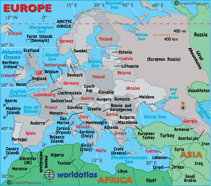
Political map of Europe.
This is a political map of Europe showing countries, major cities, and bodies of water.
Answer for screen readers
This is a political map of Europe showing countries, major cities, and bodies of water.
More Information
The map identifies countries, seas, islands, and shows Europe’s geographical boundaries with Asia and Africa.
AI-generated content may contain errors. Please verify critical information
Thank you for voting!