Podcast
Questions and Answers
What are the four major types of landforms mentioned in the text?
What are the four major types of landforms mentioned in the text?
- Mountains, rivers, lakes, and buttes
- Mountains, hills, plateaus, and plains (correct)
- Mountains, valleys, canyons, and basins
- Mountains, plateaus, rivers, and valleys
What natural processes are mentioned as responsible for creating landforms?
What natural processes are mentioned as responsible for creating landforms?
- Glacial movement, deposition, and sedimentation
- Tectonic plate movement, weathering, and erosion (correct)
- Human activities, deforestation, and urbanization
- Volcanic eruptions, earthquakes, and tsunamis
Which of the following is NOT considered a landform according to the text?
Which of the following is NOT considered a landform according to the text?
- Rivers
- Buttes
- Valleys
- Oceans (correct)
Which mountain range is mentioned as the largest in the United States?
Which mountain range is mentioned as the largest in the United States?
What cataclysmic event is mentioned as being able to create new landforms?
What cataclysmic event is mentioned as being able to create new landforms?
Which of the following is NOT mentioned as one of the most famous landforms within the U.S.?
Which of the following is NOT mentioned as one of the most famous landforms within the U.S.?
What U.S. organizations have created national parks and wilderness preserves to protect landforms?
What U.S. organizations have created national parks and wilderness preserves to protect landforms?
Which mountain range in the United States is the youngest of the three major ranges?
Which mountain range in the United States is the youngest of the three major ranges?
Which state is home to the hottest place on Earth?
Which state is home to the hottest place on Earth?
Which river serves as the source of 84% of the freshwater used in the United States?
Which river serves as the source of 84% of the freshwater used in the United States?
Which landform was formed by an ancient river less than 1 million years ago and shows evidence of human occupation 12,000 years ago?
Which landform was formed by an ancient river less than 1 million years ago and shows evidence of human occupation 12,000 years ago?
Which of the following is NOT one of the Great Lakes?
Which of the following is NOT one of the Great Lakes?
Which mountain range is located on the eastern side of the United States?
Which mountain range is located on the eastern side of the United States?
Which valley encompasses land from Canada south to Alabama and includes the Tennessee Valley and the Shenandoah Valley?
Which valley encompasses land from Canada south to Alabama and includes the Tennessee Valley and the Shenandoah Valley?
Which landform is designated as a national park and is 227 miles long, 18 miles wide, and a mile deep?
Which landform is designated as a national park and is 227 miles long, 18 miles wide, and a mile deep?
Which landform is the hottest place on Earth?
Which landform is the hottest place on Earth?
Which mountain range is the longest in the United States?
Which mountain range is the longest in the United States?
Which river is the most famous in the United States?
Which river is the most famous in the United States?
Which state park shows evidence of human occupation 12,000 years ago?
Which state park shows evidence of human occupation 12,000 years ago?
Which mountain range began its uplift 4 million years ago?
Which mountain range began its uplift 4 million years ago?
Which landform stretches from Canada south to Alabama?
Which landform stretches from Canada south to Alabama?
Which body of water provides valuable transportation routes and is connected to the Atlantic Ocean?
Which body of water provides valuable transportation routes and is connected to the Atlantic Ocean?
Which national park is 227 miles long, 18 miles wide, and a mile deep?
Which national park is 227 miles long, 18 miles wide, and a mile deep?
Flashcards are hidden until you start studying
Study Notes
Landforms of the United States
- The Rocky Mountains are the longest range in the United States and stretch across several states and into Canada, reaching heights of 14,440 feet.
- The Appalachian Mountains are located on the eastern side of the country, are smaller than the Rockies, and reach peaks of 6,664 feet.
- The Sierra Nevada mountains in California, the youngest of the three major US ranges, began its uplift 4 million years ago.
- Death Valley in southern California is the hottest place on Earth with summer temperatures often over 120 degrees.
- The Great Appalachian Valley encompasses land from Canada south to Alabama and includes the Tennessee Valley and the Shenandoah Valley.
- The Grand Canyon in Arizona, designated as a national park in 1926, is 227 miles long, 18 miles wide, and a mile deep.
- Palo Duro Canyon in Texas, designated as a state park, was formed by an ancient river less than 1 million years ago and shows evidence of human occupation 12,000 years ago.
- The Mississippi River, stretching 2,350 miles, is the most famous river in the United States and serves as the source of 84% of the freshwater used in the country.
- The Great Lakes, formed by melting glaciers around 14,000 years ago, are connected to the Atlantic Ocean and provide valuable transportation routes.
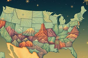
- The topographical map of the United States shows the location of major landforms, including the Sierra Nevada Mountains, Death Valley, Rocky Mountains, Mississippi River, Great Lakes, Great Appalachian Valley, and Appalachian Mountains.
- The North American Landforms Map shows the extension of the Rocky Mountains into Mexico and Canada, the boundary created by the Great Lakes between the United States and Canada, and the glaciers on the island of Greenland.
Studying That Suits You
Use AI to generate personalized quizzes and flashcards to suit your learning preferences.