Podcast
Questions and Answers
Which of the following scenarios would most likely result in significant gully erosion?
Which of the following scenarios would most likely result in significant gully erosion?
- A recently deforested hillside with loosely compacted soil during an intense rainstorm. (correct)
- A heavily forested area with a dense understory after a period of consistent rainfall.
- A gently sloping desert pavement with infrequent rainfall events.
- A flat, well-vegetated floodplain adjacent to a meandering river.
How does the process of 'saltation' contribute to both wind and water transport of sediment?
How does the process of 'saltation' contribute to both wind and water transport of sediment?
- By keeping fine particles suspended within the transport medium.
- By dissolving minerals and carrying them in a solution.
- By causing particles to bounce along the surface due to impacts. (correct)
- By rolling or sliding larger particles along the bed or surface.
Which drainage pattern is most likely to develop in an area with alternating bands of resistant and non-resistant bedrock that has been folded?
Which drainage pattern is most likely to develop in an area with alternating bands of resistant and non-resistant bedrock that has been folded?
- Trellis (correct)
- Radial
- Dendritic
- Rectangular
Which of the following scenarios best illustrates the role of 'hydrolysis' in chemical weathering?
Which of the following scenarios best illustrates the role of 'hydrolysis' in chemical weathering?
How does the construction of a large dam on a river most directly affect coastal deposition processes downstream?
How does the construction of a large dam on a river most directly affect coastal deposition processes downstream?
Which of the following landforms is LEAST likely to be directly formed by tectonic activity?
Which of the following landforms is LEAST likely to be directly formed by tectonic activity?
In the context of geomorphology, what is the primary difference between 'creep' and 'slump'?
In the context of geomorphology, what is the primary difference between 'creep' and 'slump'?
How do 'anticlines' and 'synclines' relate to compressional forces in tectonic geomorphology?
How do 'anticlines' and 'synclines' relate to compressional forces in tectonic geomorphology?
Which dating technique would be most appropriate for determining the age of a piece of wood found in a relatively young (less than 40,000 years old) archaeological site?
Which dating technique would be most appropriate for determining the age of a piece of wood found in a relatively young (less than 40,000 years old) archaeological site?
How does the presence of extensive desert pavements influence wind erosion in arid environments?
How does the presence of extensive desert pavements influence wind erosion in arid environments?
What role do plant roots play in biological weathering, and how might this relate to slope stability?
What role do plant roots play in biological weathering, and how might this relate to slope stability?
How does freeze-thaw weathering contribute to the formation of talus slopes at the base of mountains?
How does freeze-thaw weathering contribute to the formation of talus slopes at the base of mountains?
Which type of mass wasting event is most likely to occur in a recently burned forest on a steep slope during an intense rainstorm?
Which type of mass wasting event is most likely to occur in a recently burned forest on a steep slope during an intense rainstorm?
How does the development of urbanization typically impact the discharge characteristics of a local stream or river?
How does the development of urbanization typically impact the discharge characteristics of a local stream or river?
What is the primary difference between 'plucking' and 'abrasion' as glacial erosion processes?
What is the primary difference between 'plucking' and 'abrasion' as glacial erosion processes?
Flashcards
Geomorphology
Geomorphology
Study of Earth's surface features and the processes shaping them.
Landforms
Landforms
Natural features of the Earth's surface, such as mountains and valleys.
Geomorphic Processes
Geomorphic Processes
Physical, chemical, and biological actions modifying landforms.
Agents of Geomorphic Processes
Agents of Geomorphic Processes
Signup and view all the flashcards
Weathering
Weathering
Signup and view all the flashcards
Physical Weathering
Physical Weathering
Signup and view all the flashcards
Chemical Weathering
Chemical Weathering
Signup and view all the flashcards
Erosion
Erosion
Signup and view all the flashcards
Water Erosion
Water Erosion
Signup and view all the flashcards
Wind Erosion
Wind Erosion
Signup and view all the flashcards
Mass Wasting
Mass Wasting
Signup and view all the flashcards
Transportation (Geomorphology)
Transportation (Geomorphology)
Signup and view all the flashcards
Deposition
Deposition
Signup and view all the flashcards
Drainage Basin
Drainage Basin
Signup and view all the flashcards
Human Impact on Geomorphology
Human Impact on Geomorphology
Signup and view all the flashcards
Study Notes
- Geomorphology is the study of the Earth's surface features and the processes that shape them
- It focuses on landforms, their origin, evolution, and the forces that act upon them
Core Concepts
- Landforms: Natural features of the Earth's surface, such as mountains, valleys, plains, and coastlines
- Processes: Physical, chemical, and biological actions that modify landforms, including weathering, erosion, transportation, and deposition
- Agents: The forces responsible for geomorphic processes, such as water, wind, ice, gravity, and organisms
- Geologic Time: The framework for understanding the long-term evolution of landscapes
Weathering
- Breakdown of rocks, soils, and minerals through direct contact with the Earth's atmosphere
- Physical Weathering: Disintegration of rocks without chemical change
- Freeze-thaw: Water expands when it freezes, exerting pressure in cracks and causing rocks to break apart
- Exfoliation: Peeling of layers from exposed rocks due to pressure release
- Abrasion: Mechanical wearing down of rocks by friction
- Chemical Weathering: Decomposition of rocks through chemical reactions
- Dissolution: Dissolving of minerals by water or acids
- Oxidation: Reaction of minerals with oxygen
- Hydrolysis: Reaction of minerals with water
- Biological Weathering: Breakdown of rocks by living organisms
- Root wedging: Plant roots grow into cracks and exert pressure
- Burrowing: Animals dig into soil and rock
- Organic acids: Decomposition of organic matter releases acids that dissolve minerals
Erosion
- Removal and transport of weathered materials by natural agents
- Water Erosion: Erosion by the action of water
- Rain splash: Impact of raindrops dislodges soil particles
- Sheet erosion: Thin layer of soil is removed evenly
- Rill erosion: Small channels form on the surface
- Gully erosion: Larger, deeper channels develop
- Stream erosion: Erosion by flowing water in rivers and streams
- Wind Erosion: Erosion by the action of wind
- Deflation: Removal of loose particles from the surface
- Abrasion: Wearing down of rocks by windblown particles
- Glacial Erosion: Erosion by the action of glaciers
- Plucking: Glaciers freeze onto rocks and pull them away
- Abrasion: Rocks embedded in ice grind against the underlying surface
- Mass Wasting: Downslope movement of soil and rock under the influence of gravity
- Creep: Slow, gradual movement of soil and rock
- Landslides: Rapid movement of a mass of soil and rock
- Mudflows: Flow of water-saturated soil and debris
- Slumps: Downward rotational movement of a mass of soil and rock
Transportation
- Movement of eroded materials from one place to another
- Water Transport: Transport by flowing water
- Solution: Dissolved materials are carried in water
- Suspension: Fine particles are carried in the water column
- Saltation: Particles bounce along the bed
- Traction: Large particles roll or slide along the bed
- Wind Transport: Transport by wind
- Suspension: Fine particles are carried in the air
- Saltation: Particles bounce along the surface
- Creep: Large particles roll along the surface
- Glacial Transport: Transport by moving ice
- Debris is carried within the ice or on its surface
Deposition
- Settling and accumulation of transported materials
- Fluvial Deposition: Deposition by rivers and streams
- Alluvial fans: Fan-shaped deposits at the base of mountains
- Floodplains: Flat areas adjacent to rivers that are subject to flooding
- Deltas: Deposits at the mouth of a river
- Aeolian Deposition: Deposition by wind
- Dunes: Mounds of sand deposited by wind
- Loess: Fine-grained deposits of windblown silt
- Glacial Deposition: Deposition by glaciers
- Moraines: Ridges of sediment deposited at the edges of glaciers
- Eskers: Winding ridges of sand and gravel deposited by meltwater streams
- Drumlins: Elongated hills of glacial sediment
- Coastal Deposition: Deposition along coastlines
- Beaches: Accumulations of sand along shorelines
- Barrier islands: Long, narrow islands parallel to the coast
- Estuaries: Partially enclosed coastal bodies of water where freshwater mixes with saltwater
Drainage Basins
- Area of land drained by a river and its tributaries
- Drainage Divide: Boundary between adjacent drainage basins
- Drainage Patterns: Arrangement of streams in a drainage basin
- Dendritic: Tree-like pattern, common in areas with uniform geology
- Radial: Streams flow outward from a central high point
- Trellis: Streams flow parallel to each other in valleys
- Rectangular: Streams follow fractures in the rock
Landforms and Processes
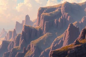
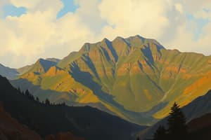
- Mountains: Elevated landforms shaped by tectonic activity, erosion, and glaciation
- Valleys: Depressions in the landscape formed by erosion or tectonic activity
- River valleys: Formed by the erosion of rivers and streams
- Glacial valleys: U-shaped valleys formed by glacial erosion
- Rift valleys: Formed by tectonic rifting
- Plains: Flat or gently sloping areas formed by deposition or erosion
- Alluvial plains: Formed by the deposition of sediment by rivers
- Coastal plains: Formed by the emergence of land from the sea
- Deserts: Arid regions shaped by wind erosion and deposition
- Sand dunes: Mounds of sand formed by wind
- Desert pavements: Surfaces covered with closely packed rocks
- Coasts: Dynamic environments shaped by waves, tides, and currents
- Beaches: Accumulations of sand along shorelines
- Cliffs: Steep rock faces formed by wave erosion
- Estuaries: Partially enclosed coastal bodies of water
Tectonic Geomorphology
- The influence of tectonic processes on landforms
- Plate Tectonics: The theory that the Earth's lithosphere is divided into plates that move and interact
- Faulting: Fractures in the Earth's crust where movement has occurred
- Normal faults: Tension forces cause one block to move down relative to the other
- Reverse faults: Compression forces cause one block to move up relative to the other
- Strike-slip faults: Blocks move horizontally past each other
- Folding: Bending of rock layers due to compression
- Anticlines: Upward folds
- Synclines: Downward folds
- Volcanism: Eruption of molten rock onto the Earth's surface
- Volcanoes: Conical mountains formed by the accumulation of lava and ash
- Lava flows: Sheets of molten rock that flow over the surface
- Calderas: Large volcanic craters formed by the collapse of a volcano
Climate and Geomorphology
- The influence of climate on geomorphic processes
- Humid Climates: High precipitation rates lead to increased weathering and erosion
- Arid Climates: Low precipitation rates lead to reduced weathering and erosion, but wind erosion is more significant
- Cold Climates: Freeze-thaw cycles and glacial activity are dominant processes
Human Impact on Geomorphology
- Human activities can significantly alter geomorphic processes
- Deforestation: Removal of trees increases erosion rates
- Agriculture: Tilling of soil increases erosion rates
- Urbanization: Construction of buildings and roads alters drainage patterns and increases runoff
- Mining: Extraction of minerals can lead to land subsidence and increased erosion
- Dam construction: Dams can trap sediment and alter downstream flow regimes
Dating Techniques
- Techniques used to determine the age of landforms and geomorphic events
- Radiometric Dating: Using the decay of radioactive isotopes to determine age
- Carbon-14 dating: Used for organic materials up to about 50,000 years old
- Uranium-lead dating: Used for rocks billions of years old
- Relative Dating: Determining the age of a landform relative to other landforms
- Superposition: Younger layers of sediment are deposited on top of older layers
- Cross-cutting relationships: A fault or intrusion is younger than the rocks it cuts across
- Cosmogenic Nuclide Dating: Measuring the concentration of rare isotopes produced by cosmic ray interactions
- Useful for dating surfaces exposed to the atmosphere
Applications of Geomorphology
- Natural Hazard Assessment: Identifying areas prone to landslides, floods, and other natural disasters
- Resource Management: Understanding the distribution of soil, water, and mineral resources
- Environmental Management: Assessing the impact of human activities on the environment
- Engineering: Designing structures that are stable and resistant to erosion
- Paleoclimate Reconstruction: Using landforms to reconstruct past climates
Studying That Suits You
Use AI to generate personalized quizzes and flashcards to suit your learning preferences.