Podcast
Questions and Answers
What are contours and what do they represent?
What are contours and what do they represent?
Contours are imaginary lines which join places having the same height above the mean sea level.
Define the term 'vertical interval' in the context of contouring.
Define the term 'vertical interval' in the context of contouring.
Vertical interval is the difference in height between two adjacent contour lines.
What kind of map would you refer to if you wanted detailed information on physical and man-made features of an area?
What kind of map would you refer to if you wanted detailed information on physical and man-made features of an area?
Topographical map.
Which organization publishes topographical maps in India?
Which organization publishes topographical maps in India?
What is the usual vertical interval on topographical maps of India?
What is the usual vertical interval on topographical maps of India?
Explain why vertical intervals are important on a topographical map.
Explain why vertical intervals are important on a topographical map.
Name three physical features and three man-made features that can be found on a topographical map.
Name three physical features and three man-made features that can be found on a topographical map.
Flashcards are hidden until you start studying
Study Notes
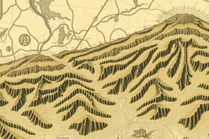
Contours
- Contours are imaginary lines that join places with the same height above the mean sea level.
- Contours are also called level lines.
- They are used to depict physical features related to landforms.
Contouring of a Relief Feature
- Contours are drawn at regular intervals, known as vertical intervals.
- Vertical intervals represent the difference in height between two adjacent contour lines.
- Vertical intervals are specified in the legend of a map.
Topographical Maps
- A topographical map is a large-scale map that shows detailed physical and man-made features of the Earth.
- Alternative names for topographical maps include topographical survey sheets and ordnance survey maps.
- Physical features on topographical maps include lakes, valleys, hills, plateaus, passes, mountains, and peaks.
- Man-made features on topographical maps include buildings, roads, villages, dams, railway lines, and temples.
- Topographical maps of India typically have a vertical interval of 20 meters.
- The vertical interval remains constant on a given map.
Studying That Suits You
Use AI to generate personalized quizzes and flashcards to suit your learning preferences.