Podcast
Questions and Answers
What technology is commonly used to scan the land and create detailed terrain models for accurate contour line generation?
What technology is commonly used to scan the land and create detailed terrain models for accurate contour line generation?
- Radar
- Drones
- LiDAR (Light Detection and Ranging) (correct)
- Satellite imaging
How do hikers use contour lines to estimate their vertical progress?
How do hikers use contour lines to estimate their vertical progress?
- By counting the total number of contour lines
- By measuring the distance between contour lines
- By checking altitude changes frequently
- By following contour lines horizontally (correct)
Why do city planners construct buildings along contour lines?
Why do city planners construct buildings along contour lines?
- To maximize sunlight exposure
- To avoid zoning regulations
- To minimize construction costs
- To prevent landslides and distribute weight evenly (correct)
What role do contour lines play in habitat restoration projects?
What role do contour lines play in habitat restoration projects?
How do geographers use data from ground surveys or digital elevation models to create contour maps?
How do geographers use data from ground surveys or digital elevation models to create contour maps?
How are GIS (Geographic Information System) software used in generating contours?
How are GIS (Geographic Information System) software used in generating contours?
What do contour lines represent?
What do contour lines represent?
How can contour lines assist in assessing potential areas affected by natural disasters?
How can contour lines assist in assessing potential areas affected by natural disasters?
What information can be derived by recognizing the distance between two consecutive contour lines?
What information can be derived by recognizing the distance between two consecutive contour lines?
In agriculture, how do contour lines influence irrigation needs for crops?
In agriculture, how do contour lines influence irrigation needs for crops?
What is the purpose of conservation tillage methods used by farmers in alignment with contour lines?
What is the purpose of conservation tillage methods used by farmers in alignment with contour lines?
Apart from mapping terrain features, what is another benefit of using contour lines in planning?
Apart from mapping terrain features, what is another benefit of using contour lines in planning?
Flashcards are hidden until you start studying
Study Notes
Contour Lines
Contour lines, also known as contours or isohyets, are important tools used by geographers, surveyors, hikers, and other professionals involved with mapping and understanding terrain features. They represent a line connecting points of equal elevation along the ground surface. This information can help assess potential areas affected by floods, landslides, or droughts based on rainfall patterns. In addition, they can assist in planning trails, predicting weather conditions, and identifying the best locations to build roads or houses.
Importance of Contour Lines
When looking at topographic maps, contour lines often convey vital information about the terrain's relief and the distribution of water across it. By following these lines horizontally, one can visualize the shape of hills, ridges, and valleys. Moreover, recognizing the distance between two consecutive contour lines helps determine the steepness of slopes and the degree of incline for navigation purposes.
In agriculture, contour lines play a crucial role in determining the irrigation needs for crops. For instance, if gaps exist between adjacent irrigated fields due to contour lines, then water flow can lead to soil erosion and nutrient loss. To address such challenges, farmers use conservation tillage methods that align with these gaps to minimize environmental impacts.
How Contour Lines Are Made
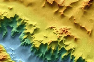
To create contour maps, geographers use data from ground surveys or digital elevation models derived from satellite imagery. These sources provide information about the shape and height of the Earth's surface, which are subsequently used to produce topographic representations based on specific scales. Advanced technologies like LiDAR (Light Detection and Ranging) scan the land using laser pulses and create detailed terrain models that allow for accurate contour line generation.
GIS (Geographic Information System) software has also made it easier to generate contours by interpolating between existing points and creating smooth curves along valleys and ridges. This approach helps maintain consistency across large areas while ensuring precision in representing irregularities in the landscape.
Using Contour Lines
Hikers often use contour lines to plan their routes and identify potential obstacles or difficulties during navigation. For example, if two contour lines are close together, it suggests steep terrain ahead. In contrast, a greater distance between them indicates more gradual slopes. Additionally, by following contour lines horizontally, hikers can estimate their vertical progress without needing to frequently check altitude changes.
Contour lines are also essential tools for emergency response teams during natural disasters. By analyzing floodplain maps created from contour lines, they can predict where flooding might occur and focus rescue efforts accordingly. Furthermore, understanding drainage patterns based on contour lines can help assess the risk of flash floods and landslides caused by heavy rainfall.
Conservation Efforts
Conservationists employ contour lines when planning habitat restoration projects. By studying the distribution of contour lines within a given area, they can identify important ecological features and ensure that any new plantings or modifications match the site's underlying topography. This approach helps preserve natural systems and promote biodiversity.
Urban Development & City Planning
City planners rely on contour lines to determine suitable locations for roads, buildings, and infrastructure development. For instance, constructing structures along contour lines could help prevent landslides and reduce the impact of earthquakes by evenly distributing weight across varying densities of soil layers. Moreover, understanding the topography represented by contour lines allows city planners to define zoning regulations that protect vulnerable areas from future urban expansion.
In summary, contour lines serve multiple purposes within various contexts, including mapping terrain features, assessing natural hazards related to rainfall patterns, and guiding decision-making processes such as urban development and conservation efforts. By understanding their importance and methods of generation, we can better appreciate how these seemingly simple graphics contribute to our daily lives and broader environmental stewardship initiatives.
Studying That Suits You
Use AI to generate personalized quizzes and flashcards to suit your learning preferences.