Podcast
Questions and Answers
What primary characteristic distinguishes trilateration from triangulation in surveying?
What primary characteristic distinguishes trilateration from triangulation in surveying?
- Trilateration computes angles based on measured distances, while triangulation measures angles directly. (correct)
- Trilateration uses electronic means, while triangulation relies on manual measurements.
- Trilateration is used for inaccessible points, while triangulation is for easily reachable points.
- Trilateration measures angles, while triangulation measures distances.
In surveying, what is the primary purpose of establishing control points?
In surveying, what is the primary purpose of establishing control points?
- To determine magnetic declination
- To create a consistent coordinate system for project layout and positioning (correct)
- To measure contour intervals accurately
- To establish the boundaries of a construction site
Under what conditions is the Two Distances Method most effectively used in surveying?
Under what conditions is the Two Distances Method most effectively used in surveying?
- When creating topographic maps with contour lines
- When direct traverse measurements are obstructed (correct)
- When high angular accuracy is required
- When measuring angles across inaccessible points
Which of the following best describes the function of contour lines on a topographic map?
Which of the following best describes the function of contour lines on a topographic map?
If a map shows elevations of 40 and 60, with 4 contour lines between them, what is the contour interval?
If a map shows elevations of 40 and 60, with 4 contour lines between them, what is the contour interval?
In what scenario is the magnetic meridian aligned with the true meridian, simplifying surveying compass corrections?
In what scenario is the magnetic meridian aligned with the true meridian, simplifying surveying compass corrections?
Which surveying method relies on a telescopic instrument with stadia hairs to determine distances?
Which surveying method relies on a telescopic instrument with stadia hairs to determine distances?
What type of map is MOST suitable for illustrating the steepness and gentleness of slopes within a particular area?
What type of map is MOST suitable for illustrating the steepness and gentleness of slopes within a particular area?
For linear construction projects like roads and canals, which surveying technique is particularly vital for determining ground shape and elevation perpendicular to the central alignment?
For linear construction projects like roads and canals, which surveying technique is particularly vital for determining ground shape and elevation perpendicular to the central alignment?
What is the primary assumption of the Transit Rule in surveying?
What is the primary assumption of the Transit Rule in surveying?
Flashcards
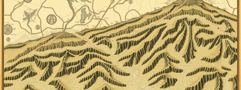
Topographic Map
Topographic Map
Detailed, accurate illustration of man-made and natural ground features.
Control Points
Control Points
Reference points with known coordinates for a consistent coordinate system.
Contour Lines
Contour Lines
Imaginary lines connecting points of equal elevation above sea level.
Contour Interval
Contour Interval
Signup and view all the flashcards
Contour Map
Contour Map
Signup and view all the flashcards
Relief Map
Relief Map
Signup and view all the flashcards
Strip Map
Strip Map
Signup and view all the flashcards
Open Traverse
Open Traverse
Signup and view all the flashcards
Closed Traverse
Closed Traverse
Signup and view all the flashcards
Compass Survey
Compass Survey
Signup and view all the flashcards
Signup and view all the flashcards
Study Notes
Mapping Terminology
- Topographic maps are detailed illustrations of man-made and natural ground features like roads, railways, power lines, contours, elevations, rivers, lakes, and geographical names.
- Control points are reference points with known coordinates that establish a consistent coordinate system for construction projects.
- Land surveyors use control points to accurately position elements on a jobsite, using digital plans or Building Information Modeling (BIM).
- Contour lines are imaginary lines on Earth's surface connecting points of equal height above sea level that illustrate the shape or relief of an area.
- Contour interval refers to the constant difference in height between contour lines, which simplifies height calculation.
- To calculate height use the contour interval, count the lines, and multiply by the interval.
- In a map with elevations 20 and 30, with 2 contour lines in between, the contour interval is 5.
- Contour maps use contour lines to depict valleys, hills, and the steepness or gentleness of slopes.
- Relief maps show the elevation, high points, and depressions, low points of a given area.
- Strip maps present a linear representation of a specific route for navigation or travel.
- Open traverse refers to a sequence of connected lines extending along a general direction without returning to the starting point.
- Closed traverse is a series of connected lines with measured lengths and bearings that enclose an area.
Surveying Methods
- Compass surveys determine the directions of surveying lines using a magnetic compass.
- Lengths of surveying lines are measured with a tape, chain, or laser range finder; compasses are used to run traverse lines.
- The Compass rule, also known as the Bowditch Rule, applies to traverses with similar angular and linear accuracy.
- The transit rule assumes course directions are measured with higher precision than distances.
- Stadia method is a surveying method for determining distances and elevation differences using a telescopic instrument with two horizontal lines.
- Optical readings are taken through a transit or theodolite.
- In stadia principle, the relationship between horizontal distances (H) and rod intercepts (V) is based on Similar Triangles.
- Triangulation is a surveying method that measures angles in a triangle formed by three survey control points.
- Trilateration is a surveying method where the lengths of a triangle's sides are measured, usually electronically, to compute angles.
- Trilateration estimates a mobile's position by measuring distances from reference points, also known as range measurement techniques.
- Triangulation locates a mobile by computing angles relative to different reference points.
- Trilateration and triangulation are considered more economical than the stadia method.
- Right-angle offset method determines the location of points using perpendicular distances from a survey baseline.
Other Terminology
- Electric currents in Earth's molten iron core are the primary source of Earth's magnetic field.
- The direction of the horizontal component of Earth's magnetic field defines the magnetic meridian.
- Grid meridians provide a consistent north-south reference aligned with a map's coordinate system in navigational systems.
- When magnetic declination is 0 degrees, magnetic and true meridians align, eliminating the need for compass corrections.
- The two-angle method locates a point by measuring two angles from two known control points.
- This method is suitable when the object is inaccessible, like across a river or highway.
- The Two distances method locates a point by measuring two distances from two known, fixed points.
- Best used when an outbuilding is obscured, preventing direct traverse measurements.
- Angle and distance method (azimuth-stadia) determines a point's position by measuring both the angle and the distance from a known point.
- Stadia two distances method, a stadia tacheometry technique, uses a telescope with stadia hairs to determine distances.
- Cross-sectioning determines the shape and elevation of the ground perpendicular to a central line and its essential for linear construction projects.
- Grid systems are most appropriate for determining elevations at regular intervals when creating area maps.
Studying That Suits You
Use AI to generate personalized quizzes and flashcards to suit your learning preferences.