Podcast
Questions and Answers
What is the purpose of a contour line on a map?
What is the purpose of a contour line on a map?
- To indicate the location of villages
- To connect places that have equal heights (correct)
- To show the direction of a river
- To represent transportation routes
What characteristic do contour lines exhibit regarding their crossing?
What characteristic do contour lines exhibit regarding their crossing?
- They cannot cross each other under any circumstances (correct)
- They can overlap to show areas of equal height
- They often intersect to represent different elevations
- They form regular patterns in flat terrain
How does the distance between contour lines relate to the steepness of the slope?
How does the distance between contour lines relate to the steepness of the slope?
- Closer lines indicate a flat landscape
- The distance is unrelated to slope steepness
- Closer spacing suggests a steeper slope (correct)
- Wider spacing indicates a steep slope
What would be indicated by the 50 meter contour line on a map?
What would be indicated by the 50 meter contour line on a map?
What is the effect of landforms on the shape of contour lines?
What is the effect of landforms on the shape of contour lines?
Flashcards
Contour Line
Contour Line
Connects points of equal elevation, showing height above a datum, like sea level.
Contour Line Crossing
Contour Line Crossing
Contour lines never intersect on a map because a single location cannot have two different elevations.
Contour Line Spacing
Contour Line Spacing
The closer the contour lines, the steeper the slope; widely spaced lines indicate a gentle slope.
50 Meter Contour Line
50 Meter Contour Line
Signup and view all the flashcards
Landforms and Contour Shape
Landforms and Contour Shape
Signup and view all the flashcards
Study Notes
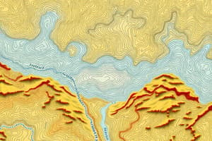
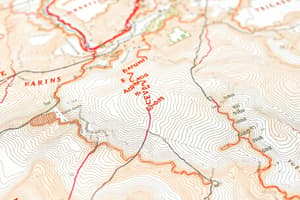
Contour Lines
- Contour lines represent areas of equal elevation on a map.
- The 50-meter contour line signifies that all points along this line are at an elevation of 50 meters.
Characteristics of Contour Lines
- Contour lines appear in irregular shapes, reflecting the underlying landforms.
- Contour lines do not intersect; each line maintains a distinct elevation.
Relationship with Landscape
- The spacing between contour lines indicates the steepness of the terrain.
- In steep landscapes, contour lines are more widely spaced, while gently sloping areas have contour lines closer together.
Studying That Suits You
Use AI to generate personalized quizzes and flashcards to suit your learning preferences.