Podcast
Questions and Answers
What is the main focus of hydrographic surveying?
What is the main focus of hydrographic surveying?
- Creating three-dimensional representations of objects
- Measuring and mapping land features
- Measuring and mapping the depth, shape, and features of water bodies (correct)
- Updating existing civil engineering project models
How did Electronic Distance Measurement (EDM) devices impact surveying?
How did Electronic Distance Measurement (EDM) devices impact surveying?
- Reduced the need for detailed data analysis
- Revolutionized large-scale mapping through aerial photography
- Enabled quicker distance measurements than manual techniques (correct)
- Improved the accuracy of land elevation measurements
What advantage do modern surveying methods offer over traditional techniques?
What advantage do modern surveying methods offer over traditional techniques?
- Enhanced accuracy and detail critical for construction fields (correct)
- Increased manual labor requirements
- Restricted data collection from hazardous areas
- Less time and cost efficiency
In what way do drones and 3D scanners contribute to surveying efficiency?
In what way do drones and 3D scanners contribute to surveying efficiency?
How are Artificial Intelligence (AI) and Machine Learning (ML) expected to impact surveying?
How are Artificial Intelligence (AI) and Machine Learning (ML) expected to impact surveying?
What is the primary purpose of topographic surveying in civil engineering?
What is the primary purpose of topographic surveying in civil engineering?
Which type of surveying is crucial for establishing a global coordinate system?
Which type of surveying is crucial for establishing a global coordinate system?
What aspect of the Earth does geodetic surveying primarily focus on mapping?
What aspect of the Earth does geodetic surveying primarily focus on mapping?
In civil engineering, what does construction surveying mainly help in setting out and verifying?
In civil engineering, what does construction surveying mainly help in setting out and verifying?
Which type of surveying involves measuring and mapping the contours of the land?
Which type of surveying involves measuring and mapping the contours of the land?
Study Notes
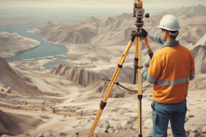
Surveying is a fundamental aspect of civil engineering and involves measuring and mapping the physical features of the Earth's surface. It is an essential discipline for constructing and maintaining infrastructure, such as highways, bridges, tunnels, pipelines, and buildings. The field of surveying has evolved significantly over time, incorporating various techniques and technologies to enhance accuracy, efficiency, and the scope of its applications.
There are several types of surveying, each with its specific purpose and methodology:
-
Topographic surveying: This process involves measuring and mapping the contours of the land, including the height and shape of natural and man-made features. Topographic surveying is crucial for civil engineering projects, as it helps determine the best route, assess environmental impacts, and analyze soil conditions.
-
Geodetic surveying: This type of surveying deals with mapping the shape and size of the Earth and its gravitational fields. Geodetic surveying helps establish a global coordinate system, which is the basis for all other types of surveying, and enables engineers to monitor changes in the Earth's crust, such as plate tectonics, volcanoes, and sea-level rise.
-
Construction surveying: This process is involved in setting out and verifying the positions of structures, such as foundations, beams, walls, and roofs. Construction surveying ensures the quality of civil engineering projects, controls the work of contractors, and helps engineers check and adjust the alignment, level, and elevation of structures.
-
Hydrographic surveying: This type of surveying focuses on measuring and mapping the depth, shape, and features of water bodies. Hydrographic surveying is essential for constructing civil engineering projects that involve water, such as ports, bridges, dams, and levees.
-
Photogrammetric surveying: This method requires mapping land or water features using photographs from aerial or satellite platforms. Photogrammetric surveying helps create large-scale models of civil engineering project sites and update existing models.
The evolution of surveying has been marked by the introduction of new technologies and techniques. For example, the development of Electronic Distance Measurement (EDM) devices in the mid-20th century allowed for more accurate and quicker distance measurements than manual techniques. The introduction of the Global Positioning System (GPS) in the 1970s revolutionized large-scale mapping and navigation. More recently, 3D scanning and drone technology have enabled surveyors to capture detailed three-dimensional representations of objects and terrains and cover large and inaccessible areas swiftly.
Modern surveying methods offer several advantages over traditional techniques. They provide enhanced accuracy and detail, which is critical for fields like construction. They are also more time and cost-efficient, as technologies like drones and 3D scanners significantly reduce the time needed for surveying operations and minimize the need for manual labor. Additionally, these methods allow surveyors to collect data from hazardous or inaccessible areas without risking their safety. They are also versatile, scalable, and invaluable in environmental and cultural conservation efforts.
As the field of surveying continues to evolve, advances in artificial intelligence (AI) and machine learning (ML) are expected to further enhance data analysis and decision-making processes. The integration of these technologies with existing surveying tools will enable smarter, more efficient processes. The burgeoning field of autonomous vehicles and robotics also holds promise for surveying, offering even greater efficiency and precision. Furthermore, as the demand for sustainable development grows, surveying technologies will play a crucial role in planning and implementing eco-friendly projects.
Studying That Suits You
Use AI to generate personalized quizzes and flashcards to suit your learning preferences.
Description
Explore the various types of surveying techniques in civil engineering, including topographic, geodetic, construction, hydrographic, and photogrammetric surveying. Learn about the importance of each method in infrastructure development and environmental conservation.


