Podcast
Questions and Answers
Land surveying primarily involves measuring and mapping underground structures.
Land surveying primarily involves measuring and mapping underground structures.
False (B)
CE 566 course covers the principles of land surveying related to coastal areas.
CE 566 course covers the principles of land surveying related to coastal areas.
False (B)
Coastal remote sensing technologies include the use of magnetic resonance imaging (MRI).
Coastal remote sensing technologies include the use of magnetic resonance imaging (MRI).
False (B)
Land surveying is not considered essential for construction projects.
Land surveying is not considered essential for construction projects.
CEM 263 covers the use of field surveying equipment and plane surveying methods.
CEM 263 covers the use of field surveying equipment and plane surveying methods.
Land surveying plays no role in coastal engineering and management.
Land surveying plays no role in coastal engineering and management.
Modern technologies such as least squares adjustments and geodesy are not part of land surveying.
Modern technologies such as least squares adjustments and geodesy are not part of land surveying.
CE 568, 'LEAST SQUARES ADJUSTMENTS,' mainly focuses on the principles of trigonometry.
CE 568, 'LEAST SQUARES ADJUSTMENTS,' mainly focuses on the principles of trigonometry.
Land surveying is not considered important in civil engineering and construction engineering management.
Land surveying is not considered important in civil engineering and construction engineering management.
CE 663, 'GEODESY,' covers only the geometrical aspects of terrestrial reference systems.
CE 663, 'GEODESY,' covers only the geometrical aspects of terrestrial reference systems.
Flashcards are hidden until you start studying
Study Notes
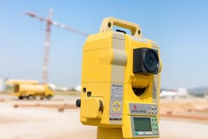
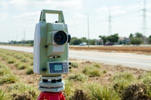
Land surveying is a crucial aspect of various engineering fields, particularly civil engineering. It involves the process of measuring and mapping the Earth's surface to determine the precise locations of points and the distances and angles between them. Land surveying is essential for a wide range of applications, including the creation of maps, construction projects, and the management of land use.
In the context of civil engineering, land surveying is a vital part of the educational preparation for the licensed profession. Students can pursue courses that specifically focus on land surveying techniques and technologies. One such course is CE 566, "3D LASER SCANNING AND IMAGING," which covers the fundamentals of lidar acquisition, registration, processing, modeling, analysis, and verification, as well as the use of sensor platforms for 3D acquisition and effective data management procedures.
Another important area of land surveying is coastal surveying, which is covered in CE 567, "COASTAL REMOTE SENSING." This course focuses on the application of remote sensing technologies, such as unmanned aircraft systems, multi- and hyperspectral imagery, high-resolution commercial satellite imagery, synthetic-aperture radar, and topographic and bathymetric lidar, to coastal mapping and charting, coastal engineering, and coastal zone management.
The principles of land surveying are also applied in construction engineering management. CEM 263, "PLANE SURVEYING," covers the use of field surveying equipment, error analysis, and plane surveying methods applied to construction, as well as plane coordinate computations and topographic mapping.
In addition to traditional surveying techniques, modern technologies such as least squares adjustments and geodesy play a significant role in land surveying. CE 568, "LEAST SQUARES ADJUSTMENTS," examines the theory of random error and statistical testing, propagation of error in indirect and direct observations, and the principles of least squares. CE 663, "GEODESY," covers the geometrical aspects of terrestrial and celestial reference systems and the physical geodesy of the geoid and heights, providing a solid background for other geospatial related studies.
These courses and their focus on various aspects of land surveying demonstrate the importance of this field in civil engineering and construction engineering management, ensuring that professionals are equipped with the necessary knowledge and skills to excel in their professions.
Studying That Suits You
Use AI to generate personalized quizzes and flashcards to suit your learning preferences.


