Podcast
Play an AI-generated podcast conversation about this lesson
Download our mobile app to listen on the go
Get App
Questions and Answers
What is a key characteristic of physical maps?
What is a key characteristic of physical maps?
- They focus on migration patterns.
- They highlight political boundaries.
- They show landforms and bodies of water. (correct)
- They illustrate statistical data.
Which type of map uses color shading to represent data density?
Which type of map uses color shading to represent data density?
- Political Map
- Physical Map
- Choropleth Map (correct)
- Flow Map
What primary function does a political map serve?
What primary function does a political map serve?
- Showing population statistics.
- Representing political boundaries and divisions. (correct)
- Illustrating natural landforms.
- Displaying climate variations.
What type of map would be most useful for visualizing migration patterns?
What type of map would be most useful for visualizing migration patterns?
Signup and view all the answers
Which of the following best describes thematic maps?
Which of the following best describes thematic maps?
Signup and view all the answers
Flashcards are hidden until you start studying
Study Notes
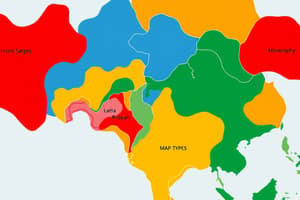
Types of Maps
Physical Maps
- Definition: Illustrate the natural features of the Earth.
- Key Features:
- Show landforms (mountains, valleys, plains).
- Include bodies of water (rivers, lakes, oceans).
- Use color gradients to represent elevation and terrain.
- Helpful for understanding topography and geography.
Thematic Maps
- Definition: Focus on specific themes or subjects.
- Key Features:
- Display statistical data related to a particular topic (e.g., population density, climate).
- Types include:
- Choropleth Maps: Use color shading to represent data density.
- Dot Distribution Maps: Use dots to show the presence of a feature.
- Flow Maps: Show movement (e.g., migration patterns).
- Useful for visualizing trends and making comparisons.
Political Maps
- Definition: Represent political boundaries and divisions.
- Key Features:
- Show countries, states, cities, and capitals.
- Highlight territorial boundaries.
- Use various colors to differentiate regions or political entities.
- Essential for understanding administrative divisions and geopolitical relationships.
Physical Maps
- Illustrate natural features of the Earth, emphasizing landforms such as mountains, valleys, and plains.
- Include water bodies like rivers, lakes, and oceans to depict hydrological features.
- Color gradients are utilized to represent elevation and terrain variations, enhancing topographical understanding.
- Serve as valuable tools for grasping geographical and environmental contexts.
Thematic Maps
- Concentrate on specific themes or subjects, presenting statistical data pertinent to a chosen topic.
- Include various types:
- Choropleth Maps: Utilize color shading to visually represent data density across different areas.
- Dot Distribution Maps: Employ dots to illustrate the presence and frequency of particular features or phenomena.
- Flow Maps: Depict movement patterns, such as migration flows or trade routes.
- Effective for visualizing trends and facilitating comparisons across different datasets.
Political Maps
- Represent political boundaries and administrative divisions, including countries, states, cities, and capitals.
- Highlight territorial boundaries to clarify jurisdictional limits and regional governance structures.
- Differentiation of regions or political entities is achieved through various color schemes.
- Crucial for understanding geopolitical relationships and the layout of political landscapes.
Studying That Suits You
Use AI to generate personalized quizzes and flashcards to suit your learning preferences.