Podcast
Questions and Answers
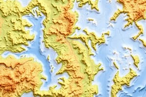
What type of information do topographic maps provide about the Earth's surface?
What type of information do topographic maps provide about the Earth's surface?
- Climate data
- Population density
- Relief, drainage patterns, climate zones, and vegetation (correct)
- Economic indicators
How can contour lines on a topographic map help in understanding the terrain?
How can contour lines on a topographic map help in understanding the terrain?
- By identifying rivers and lakes
- By analyzing elevation, slopes, and landforms (correct)
- By showing vegetation types
- By representing temperature patterns
What does interpreting symbols and colors on a topographic map related to vegetation help in understanding?
What does interpreting symbols and colors on a topographic map related to vegetation help in understanding?
- Historical events
- Climate zones (correct)
- Economic activities
- Political boundaries
How can a geographer use topographic maps to apply knowledge of atmospheric processes?
How can a geographer use topographic maps to apply knowledge of atmospheric processes?
Which feature on a topographic map can help identify underlying geology?
Which feature on a topographic map can help identify underlying geology?
In what way can a geographer use topographic maps to understand local climate zones?
In what way can a geographer use topographic maps to understand local climate zones?
What is the primary purpose of interpreting relief symbols on a topographic map?
What is the primary purpose of interpreting relief symbols on a topographic map?
How do topographic maps aid in identifying geomorphological features?
How do topographic maps aid in identifying geomorphological features?
What is the significance of identifying rivers and streams on a topographic map?
What is the significance of identifying rivers and streams on a topographic map?
How does understanding drainage patterns contribute to interpreting a topographic map?
How does understanding drainage patterns contribute to interpreting a topographic map?
What is a key aspect to consider when analyzing rivers and drainage patterns?
What is a key aspect to consider when analyzing rivers and drainage patterns?
How can contour lines be utilized in slope analysis?
How can contour lines be utilized in slope analysis?
What does drainage density assessment help determine?
What does drainage density assessment help determine?
How can stream order calculation contribute to understanding river systems?
How can stream order calculation contribute to understanding river systems?
What is the significance of identifying structural landforms like escarpments and ridges?
What is the significance of identifying structural landforms like escarpments and ridges?
How does integrating climate knowledge with geomorphology help in mapwork?
How does integrating climate knowledge with geomorphology help in mapwork?
What is a primary focus when conducting mapwork exercises involving topographic maps?
What is a primary focus when conducting mapwork exercises involving topographic maps?
How does understanding stream orders and drainage density help in geomorphological analysis?
How does understanding stream orders and drainage density help in geomorphological analysis?
What is a key aspect of identifying meandering rivers on a topographic map?
What is a key aspect of identifying meandering rivers on a topographic map?
How can analyzing slope elements like aspect, gradient, and shape contribute to land assessment?
How can analyzing slope elements like aspect, gradient, and shape contribute to land assessment?
What does interpreting climate data on a topographic map help geographers achieve?
What does interpreting climate data on a topographic map help geographers achieve?
Why is the identification of structural landforms like basins and ridges important in geomorphological analysis?
Why is the identification of structural landforms like basins and ridges important in geomorphological analysis?
What role does analyzing maps play in understanding human-environment interactions?
What role does analyzing maps play in understanding human-environment interactions?
How does interpreting rainfall data contribute to identifying climate zones on a topographic map?
How does interpreting rainfall data contribute to identifying climate zones on a topographic map?
What is the significance of relating temperature data to rainfall patterns on a topographic map?
What is the significance of relating temperature data to rainfall patterns on a topographic map?
How can identification of different types of rivers like braided and straight contribute to geomorphological analysis?
How can identification of different types of rivers like braided and straight contribute to geomorphological analysis?
Why is analyzing contour lines essential for slope assessment on a topographic map?
Why is analyzing contour lines essential for slope assessment on a topographic map?
How can a geographer interpret local climate zones using a 1:50,000 topographic map?
How can a geographer interpret local climate zones using a 1:50,000 topographic map?
When analyzing a 1:50,000 topographic map for geomorphological features, what should a geographer focus on?
When analyzing a 1:50,000 topographic map for geomorphological features, what should a geographer focus on?
How does interpreting drainage patterns contribute to understanding topographic maps?
How does interpreting drainage patterns contribute to understanding topographic maps?
What information can be derived from analyzing contour lines on a 1:50,000 topographic map?
What information can be derived from analyzing contour lines on a 1:50,000 topographic map?
In what way do climate data such as temperature and rainfall patterns help geographers when using topographic maps?
In what way do climate data such as temperature and rainfall patterns help geographers when using topographic maps?
How can identifying rivers, streams, and lakes patterns on a topographic map contribute to a geographer's analysis?
How can identifying rivers, streams, and lakes patterns on a topographic map contribute to a geographer's analysis?
When interpreting symbols and colors representing vegetation on a topographic map, what aspect does this primarily help geographers understand?
When interpreting symbols and colors representing vegetation on a topographic map, what aspect does this primarily help geographers understand?
What role do contour lines play in aiding geographers to understand the terrain on a 1:50,000 topographic map?
What role do contour lines play in aiding geographers to understand the terrain on a 1:50,000 topographic map?
What is the primary significance of identifying structural landforms like mountains, valleys, and plateaus on a topographic map?
What is the primary significance of identifying structural landforms like mountains, valleys, and plateaus on a topographic map?
How do rivers, streams, and lakes patterns assist geographers in interpreting a 1:50,000 topographic map?
How do rivers, streams, and lakes patterns assist geographers in interpreting a 1:50,000 topographic map?
What key information can be derived from interpreting symbols and colors representing vegetation on a topographic map?
What key information can be derived from interpreting symbols and colors representing vegetation on a topographic map?
How do contour lines on a 1:50,000 topographic map assist in understanding terrain features?
How do contour lines on a 1:50,000 topographic map assist in understanding terrain features?
What role do rivers, streams, and lakes patterns play in interpreting a 1:50,000 topographic map?
What role do rivers, streams, and lakes patterns play in interpreting a 1:50,000 topographic map?
How does the identification of meandering rivers contribute to geomorphological analysis on a topographic map?
How does the identification of meandering rivers contribute to geomorphological analysis on a topographic map?
Why is understanding drainage patterns essential in interpreting a topographic map?
Why is understanding drainage patterns essential in interpreting a topographic map?
In what way can analyzing slope elements like aspect, gradient, and shape contribute to land assessment using topographic maps?
In what way can analyzing slope elements like aspect, gradient, and shape contribute to land assessment using topographic maps?
How can stream order calculation contribute to a deeper understanding of river systems on a topographic map?
How can stream order calculation contribute to a deeper understanding of river systems on a topographic map?
Which aspect is most crucial when conducting mapwork exercises involving topographic maps?
Which aspect is most crucial when conducting mapwork exercises involving topographic maps?
What is the primary significance of identifying structural landforms like mountains, valleys, and plateaus on a topographic map?
What is the primary significance of identifying structural landforms like mountains, valleys, and plateaus on a topographic map?
How does integrating climate knowledge with geomorphology contribute to interpreting mapwork involving topographic maps?
How does integrating climate knowledge with geomorphology contribute to interpreting mapwork involving topographic maps?
How does analyzing stream orders contribute to understanding river systems?
How does analyzing stream orders contribute to understanding river systems?
Why is interpreting slope elements crucial in geomorphological analysis?
Why is interpreting slope elements crucial in geomorphological analysis?
What is the primary purpose of calculating drainage density in a landscape?
What is the primary purpose of calculating drainage density in a landscape?
Why is identifying structural landforms like escarpments and basins significant in geomorphological analysis?
Why is identifying structural landforms like escarpments and basins significant in geomorphological analysis?
How can analyzing contour lines contribute to assessing potential landslide risk?
How can analyzing contour lines contribute to assessing potential landslide risk?
In geomorphology, what does interpreting local climate data on maps aid in understanding?
In geomorphology, what does interpreting local climate data on maps aid in understanding?
Why is relating temperature and rainfall data crucial in identifying different climate zones?
Why is relating temperature and rainfall data crucial in identifying different climate zones?
How does understanding drainage patterns contribute to interpreting a landscape's geological characteristics?
How does understanding drainage patterns contribute to interpreting a landscape's geological characteristics?
What can analyzing map data related to climate help geographers identify?
What can analyzing map data related to climate help geographers identify?
Why is interpreting rivers' drainage patterns essential for understanding landscape evolution?
Why is interpreting rivers' drainage patterns essential for understanding landscape evolution?
How can analyzing stream orders and drainage density assist in landscape evaluation?
How can analyzing stream orders and drainage density assist in landscape evaluation?
Why is interpreting slope elements like aspect, gradient, and shape crucial when evaluating land stability?
Why is interpreting slope elements like aspect, gradient, and shape crucial when evaluating land stability?
How does understanding the formation of structural landforms contribute to interpreting landscapes?
How does understanding the formation of structural landforms contribute to interpreting landscapes?
What role do geomorphological features like escarpments and ridges play in landscape analysis?
What role do geomorphological features like escarpments and ridges play in landscape analysis?
How can relating temperature and rainfall data on a topographic map aid in identifying climate zones?
How can relating temperature and rainfall data on a topographic map aid in identifying climate zones?
In what way does analyzing maps related to climate help geographers solve geographic problems?
In what way does analyzing maps related to climate help geographers solve geographic problems?
What information can be derived from interpreting contour lines on a topographic map?
What information can be derived from interpreting contour lines on a topographic map?
How does identifying different types of rivers like meandering and straight contribute to geomorphological analysis?
How does identifying different types of rivers like meandering and straight contribute to geomorphological analysis?
What is the primary purpose of calculating drainage density in a landscape?
What is the primary purpose of calculating drainage density in a landscape?
Why is it important to analyze slopes using contour lines on topographic maps?
Why is it important to analyze slopes using contour lines on topographic maps?
How can geographers use topographic maps to interpret climate and weather information?
How can geographers use topographic maps to interpret climate and weather information?
What is the primary focus when interpreting relief symbols on a 1:50,000 topographic map?
What is the primary focus when interpreting relief symbols on a 1:50,000 topographic map?
How does understanding stream orders contribute to geomorphological analysis using topographic maps?
How does understanding stream orders contribute to geomorphological analysis using topographic maps?
Why is identifying mountains, valleys, and plains significant when analyzing a 1:50,000 topographic map?
Why is identifying mountains, valleys, and plains significant when analyzing a 1:50,000 topographic map?
How can the interpretation of symbols and colors representing vegetation on a topographic map contribute to a geographer's analysis?
How can the interpretation of symbols and colors representing vegetation on a topographic map contribute to a geographer's analysis?
What role do drainage patterns play in interpreting a 1:50,000 topographic map?
What role do drainage patterns play in interpreting a 1:50,000 topographic map?
How can relating temperature and rainfall data aid in identifying local climate zones using a 1:50,000 topographic map?
How can relating temperature and rainfall data aid in identifying local climate zones using a 1:50,000 topographic map?