Podcast
Questions and Answers
Which of the following practices is LEAST likely to be enhanced by understanding soil spatial variability in a farm field?
Which of the following practices is LEAST likely to be enhanced by understanding soil spatial variability in a farm field?
- Uniform planting density across the entire field. (correct)
- Adjusting tillage practices to manage soil compaction.
- Variable rate irrigation to address moisture stress.
- Targeted fertilizer application based on nutrient deficiencies.
Which soil property is LEAST useful for visually distinguishing soil horizons in a soil pit?
Which soil property is LEAST useful for visually distinguishing soil horizons in a soil pit?
- Soil texture.
- Soil structure.
- Soil pH. (correct)
- Soil color.
What is the primary purpose of delineating soil boundaries during a soil survey?
What is the primary purpose of delineating soil boundaries during a soil survey?
- To measure the soil's precise chemical composition.
- To calculate the average rainfall in the region.
- To determine the exact age of the soil.
- To identify where different soil units occur in the landscape. (correct)
What does a soil survey primarily aim to provide?
What does a soil survey primarily aim to provide?
How does understanding soil formation contribute to effective soil mapping?
How does understanding soil formation contribute to effective soil mapping?
In the context of soil science, what does the term 'catena' refer to?
In the context of soil science, what does the term 'catena' refer to?
How have GPS technology and precision farming changed the approach to soil management?
How have GPS technology and precision farming changed the approach to soil management?
Which factor is LEAST considered when evaluating a soil's suitability for a specific land use?
Which factor is LEAST considered when evaluating a soil's suitability for a specific land use?
Which of the following describes the role of parent material in understanding soil spatial variability?
Which of the following describes the role of parent material in understanding soil spatial variability?
Upon what basis is soil classification within the Soil Taxonomy system primarily based?
Upon what basis is soil classification within the Soil Taxonomy system primarily based?
When classifying soils, why is it essential to understand the environment in which the soil profile is located?
When classifying soils, why is it essential to understand the environment in which the soil profile is located?
What's a primary difference between Oxisols and Ultisols concerning weathering?
What's a primary difference between Oxisols and Ultisols concerning weathering?
How are soils typically defined during a soil survey?
How are soils typically defined during a soil survey?
According to the information provided, which one is NOT true about soil
According to the information provided, which one is NOT true about soil
Which of the following is not classified using properties of soil?
Which of the following is not classified using properties of soil?
What is the FIRST step in mapping soils?
What is the FIRST step in mapping soils?
At a very large scale(region,country,etc.),soil patterns are principally the results of which of the following?
At a very large scale(region,country,etc.),soil patterns are principally the results of which of the following?
Understanding spatial variation of soils is often useful. For which of these would this be MOST useful?
Understanding spatial variation of soils is often useful. For which of these would this be MOST useful?
What type of soil has limited alteration of parent material with subsurface illuviation of carbonates?
What type of soil has limited alteration of parent material with subsurface illuviation of carbonates?
What is the main feature of the mollisol soil order?
What is the main feature of the mollisol soil order?
Which of the soil orders has a permafrost within 100 cm of the soil surface?
Which of the soil orders has a permafrost within 100 cm of the soil surface?
Which soil order is typically found in grassland soils with a dark, humus-rich surface?
Which soil order is typically found in grassland soils with a dark, humus-rich surface?
In which soil order would you expect to find soils with high concentrations of iron and aluminum oxides due to extensive weathering?
In which soil order would you expect to find soils with high concentrations of iron and aluminum oxides due to extensive weathering?
Which soil order is described as having limited development and often inherits properties directly from the parent material?
Which soil order is described as having limited development and often inherits properties directly from the parent material?
Which soil-forming factor is MOST directly responsible for the unique characteristics of Andisols?
Which soil-forming factor is MOST directly responsible for the unique characteristics of Andisols?
How does the presence of permafrost influence the characteristics of Gelisols?
How does the presence of permafrost influence the characteristics of Gelisols?
What is common about Ultisols and Alfisols?
What is common about Ultisols and Alfisols?
Diagnostic horizons are critical for determining soil classification. What is the name given to the diagnostic horizon that forms on the surface?
Diagnostic horizons are critical for determining soil classification. What is the name given to the diagnostic horizon that forms on the surface?
Diagnostic horizons are critical for determining soil classification. Illuvial horizons are located where, relatively speaking?
Diagnostic horizons are critical for determining soil classification. Illuvial horizons are located where, relatively speaking?
Which of the following is NOT a characteristic that defines soil subclasses?
Which of the following is NOT a characteristic that defines soil subclasses?
The soil description process involves a series of steps. Which of the phrases is NOT a step in the soil description process?
The soil description process involves a series of steps. Which of the phrases is NOT a step in the soil description process?
Loess is the prevalent ground cover in the northern Idaho Palouse region. Predict the soil order most likely be observed in this region.
Loess is the prevalent ground cover in the northern Idaho Palouse region. Predict the soil order most likely be observed in this region.
There is a patch of pine forest in central Vancouver that has a distinct type of soil. There is very little humus or clay in the A horizon; however there is acid accumulation in the soil. What soil type is likely to be observed in this region
There is a patch of pine forest in central Vancouver that has a distinct type of soil. There is very little humus or clay in the A horizon; however there is acid accumulation in the soil. What soil type is likely to be observed in this region
A location on the Texas coast has a large amount of commercial sorghum crop planted. The soil is a dark color. What soil type is likely to be observed in this region
A location on the Texas coast has a large amount of commercial sorghum crop planted. The soil is a dark color. What soil type is likely to be observed in this region
The tundra is green in the brief summer season on Spitsbergen Island, as the active layer thaws. Which of the soil types would be assigned to this region?
The tundra is green in the brief summer season on Spitsbergen Island, as the active layer thaws. Which of the soil types would be assigned to this region?
Which best describes the soil in coastal Maine near Popham Beach State Park?
Which best describes the soil in coastal Maine near Popham Beach State Park?
What is "a sequence of soils that develop on a landscape, while a toposequence is a composite of soil series that occur in a topographic pattern" called?
What is "a sequence of soils that develop on a landscape, while a toposequence is a composite of soil series that occur in a topographic pattern" called?
Flashcards
Soil classification
Soil classification
A means of organizing knowledge about soils based on physical, chemical, and biological properties
Soil mantle
Soil mantle
AFES defines it as a three-dimensional soil body.
Pedon
Pedon
USDA Soil Taxonomy classifies this as a soil profile from the surface to the parent material.
Soil Taxonomy
Soil Taxonomy
Signup and view all the flashcards
Diagnostic horizons
Diagnostic horizons
Signup and view all the flashcards
Epipedon
Epipedon
Signup and view all the flashcards
Endopedon
Endopedon
Signup and view all the flashcards
Spodic horizon
Spodic horizon
Signup and view all the flashcards
Argillic horizon
Argillic horizon
Signup and view all the flashcards
Diagnostic properties
Diagnostic properties
Signup and view all the flashcards
Oxisols
Oxisols
Signup and view all the flashcards
Aridisols
Aridisols
Signup and view all the flashcards
Mollisols
Mollisols
Signup and view all the flashcards
Alfisols
Alfisols
Signup and view all the flashcards
Entisols
Entisols
Signup and view all the flashcards
Oxisols
Oxisols
Signup and view all the flashcards
Aridisols
Aridisols
Signup and view all the flashcards
Mollisols
Mollisols
Signup and view all the flashcards
Entisols
Entisols
Signup and view all the flashcards
Gelisols
Gelisols
Signup and view all the flashcards
Vertisols
Vertisols
Signup and view all the flashcards
Soil Survey
Soil Survey
Signup and view all the flashcards
Soil Survey
Soil Survey
Signup and view all the flashcards
Soil Maps
Soil Maps
Signup and view all the flashcards
Soil spatial variability
Soil spatial variability
Signup and view all the flashcards
Small- scale Soil Variability
Small- scale Soil Variability
Signup and view all the flashcards
Medium- Scale Soil Variability
Medium- Scale Soil Variability
Signup and view all the flashcards
Catena
Catena
Signup and view all the flashcards
Large Soil Variability
Large Soil Variability
Signup and view all the flashcards
Soil Description
Soil Description
Signup and view all the flashcards
Soil Mapping
Soil Mapping
Signup and view all the flashcards
Study Notes
Soil Classification
- Creating a system to classify objects helps humans order the world, thus making it easier to understand.
- This supports better communication, remembering, and knowledge development.
How Soils are Classified
- A way to organize information regarding soils makes soil classification much more useful.
- Because there are so many different soils, each having unique biological, chemical, and physical traits, a hierarchical system is frequently employed when classifying soils.
Soil Classification Objects
- When talking about soil classification, it is important to know exactly what is being classified.
- A soil mantle, as defined by AFES in 1998, constitutes a three-dimensional soil body.
- A pedon is classified under the USDA Soil Taxonomy (Soil Survey Staff, 2003).
- WRB (2007) defines any material within 2 m of the Earth's surface with a horizontal area ranging from 1–10 m2.
Lecture Outcomes
- Understanding the reasons for soil classification.
- Naming the soil orders associated with Soil Taxonomy.
- Identifying the general traits which characterize the soil orders.
- Elaborating how soil orders are distributed at the global level.
Soil Taxonomy
- A system of soil classification known as soil taxonomy places emphasis on the physical and chemical characteristics of the soil profile.
Diagnostic Horizons
- Soil horizons define soil types and taxonomic units.
- Diagnostic horizons are features which are quantitatively defined and are used to differentiate between taxa.
- Horizon symbols point to the likely direction of pedogenesis.
- Diagnostic horizons show the extent of that expression.
Epipedons
- An epipedon is a horizon that develops close to the surface where most of the rock structure has been broken down.
- They are distinguished by the amount of plant nutrients in addition to their color, texture, and structure.
Endopedons
- Soil layers known as endopedons are located below the epipedon; their texture, structure, and color are among their distinguishing characteristics.
Examples of Illuvial Horizons
- Spodic: pH ≤ 5.9 and SOC ≥ 0.6%, accumulation of organic carbon and aluminum with or without iron.
- Appears redder or blacker than the overlying horizon or both colors are present.
- Argillic: Illuvial accumulation of clay, the amount of clay increase depends upon texture, minimum 3% or 1.2 x clay of the overlying layer
- Cambic: Evidence of soil development in the form of changes in color or structure derived from parent material.
- Does not meet the requirements for other types of endopedons.
Soil Orders
- Alfisols: These soils commonly form in forests and have moderate weathering, are typically fertile and temperature and moisture affect productivity.
- Andisols: Associated with areas of volcanic activity, especially those associated with the Pacific Rim. Weathering is important, notably the presence of volcanic glass, high CEC, and they are generally fertile.
- Aridisols: Containing significant amounts of salt, these desert soils make up around 19% of the land on Earth. Salinization occurs where the potential evapotranspiration is greater than actual evapotranspiration.
- Entisols: Exhibit limited development and have properties derived from parent material and lack of a B layer, irrespective of climate.
- Gelisols: These soils are associated with high latitudes and have permafrost within 100cm of the surface.
- Histosols: Organic soils that occur in areas that are wet
- Inceptisols: Display weak development and only a few diagnostic features, and are common in humid regions
- Mollisols: These soils are extremely fertile grassland soils. The largest single soil order in the US, they remain soft even when left to dry.
- Oxisols: Containing deeply-developed Fe/Al oxides, these tropical soils are known for their moisture.
- Spodosols: The formation of soil occurs within sandy parent materials in forested portions of the humid continental mild-summer climates which are seen across N. America and Europe.
- Ultisols: Often found in subtropical forest environments, with highly weathered forest soils. The Southeast United States are a great example of where they are commonplace.
- Vertisols: These contain more than 30% swelling clays that swell significantly when they absorb water. The black color of vertisols is because of specific mineral content, rather than organics.
Soil Classification
- Review the location of the soil profile
- Describe the soil profile/pedon
- Discover which diagnostic features are present
- Determine soil moisture and temperature patterns
- Decide on the soil class
Soil Survey and Mapping
- Soil characteristics are crucial to make sure utilization and management are appropriate.
- Assessing location and scope of different types of soil for land use, development, and planning is important
- Examples such as: construction, irrigation, and cropping projects
- The inventory is called a soil survey.
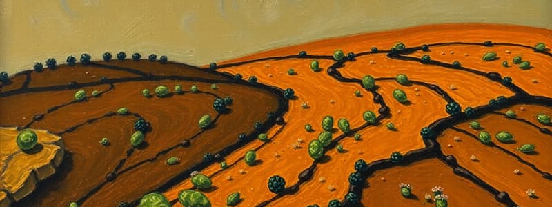
Soil Spatial Variability
- Using the influence of these five conditions: climate, parent material, organisms, topography, and time, is useful in understanding spatial variations in soils.
- Understanding the variables in soil formations is helpful in creating a mental model which predicts which soils are more prone to form certain areas of the landscape.
Small Scale Variability
- Within a single soil, properties of soil are subject to abrupt and noticeable change across short distances within a farm field.
- Variations most often occur in small changes in topography and thickness of parent material.
- Measuring small-scale variability and casual observation can be difficult
- Soil fertility variability typically reflects previous methods in soil profile management
Creating Soil Maps
- A book of soil data that describes and categories certain uses, is often used with soil maps
- Soil maps help to pinpoint the spatial variability of soil at that specific point in measurement
- Following the survey of a soil, it is then grouped in its correct classifications
- Each soil helps evaluate reasonable uses and environmental management
Other Processes
- A soil scientist must choose a representative location for study
- A pit should be dug to expose the soil profile for observation
- Soil horizons should be differentiated and labeled based on color, texture, and structure variation
- Horizon boundaries are recorded for their distinctness on a vertical face.
- Different soil samples are gathered and studied in the laboratory for analysis
- Determine and categorize soil type based on development and material
- Record the amount of soil depth and patterns of different horizons
- Any essential characteristics like root channels should also be recorded
Soil Boundaries
- To determine existing soil boundaries, soil scientists can dig pits within the landscape.
- Small holes are to bring up soil samples for analysis.
- The texture, color, and attributes are compared with established soil regions
- Soil scientist use bore holes that aren't entirely random.
Studying That Suits You
Use AI to generate personalized quizzes and flashcards to suit your learning preferences.


