Scale Maps

AccomplishedBixbite avatar
AccomplishedBixbite
·
·
Download

Start Quiz

Study Flashcards

20 Questions

What is the purpose of using scale maps?

The purpose of using scale maps is to make ratio information more readable or understandable to an audience and to communicate statistics clearly.

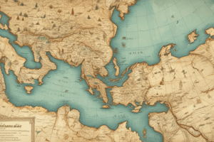
What is the importance of scale maps?

Scale maps are important because they allow us to relate what we see on a map to the real world it is portraying.

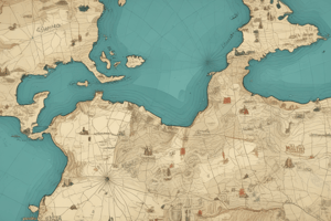
What is a scale map?

A scale map is a map that includes a scale, which is a ratio of two numbers, and it helps us understand the relationship between the map and the real world.

How did the carpenter's feet affect the size of the bed?

The carpenter's feet were larger than the princess' feet, so when he used his own feet to measure the bed, it ended up being much bigger than the princess wanted.

What subjects did Elizabeth teach at the college level?

Elizabeth taught college level Physical Science and Biology.

What degrees does Elizabeth hold?

Elizabeth has a Master's in Zoology, one in GIS, and a Bachelor's in Biology.

What is the purpose of a bar scale on a map?

To show a scaled distance on the map and indicate how far a certain distance is.

What is the difference between a bar scale and a ratio scale?

A bar scale shows a scaled distance on the map, while a ratio scale is a ratio that indicates how many of something on the map equals the actual distance in the real world.

How does a ratio scale on a map work?

A ratio scale indicates how many of something on the map equals the actual distance in the real world.

What is the rule when using a scale map?

You have to stick with the same unit of measure throughout and cannot change halfway through or change the size of the measurement unit.

What are the steps involved in creating a scale map?

Find or make a map, obtain accurate ground measurements for the distance between two points, measure the distance between those same two points on the map, calculate the ratio by dividing the actual ground distance by the measured distance on the map, place the ratio on the map to indicate the scale.

Why is it usually easier to use conventional measurements like feet or miles when creating a scale map?

Using conventional measurements like feet or miles is more practical and easier to understand than using unconventional measurements like spoons or pinecones.

Explain the concept of scale maps and how they are used.

Scale maps employ a ratio of two numbers to represent the relationship between a distance on the map and a distance in real life. The ratio tells you how many units of measurement on the map relate to the same distance in real life. It can be any unit of measurement as long as it is consistent. To create a scale map, you need to find the actual ground distance between two points, find the map distance between the same two points, and then divide the former by the latter to get your ratio.

What does a ratio of 1:87,000 mean in the context of a scale map?

A ratio of 1:87,000 means that for every 1 unit of measurement on the map, you would need 87,000 of the same unit in real life to cover the same distance on the ground.

What does the term 'unit-less ratio' mean in the context of scale maps?

A unit-less ratio means that the ratio does not refer to any specific unit of measurement. It is simply a relationship between the two numbers in the ratio.

How can scale maps be used to measure distances on the ground?

By using the ratio on a scale map, you can determine how many units of measurement in real life would be needed to cover a certain distance on the ground. As long as the same unit of measurement is used consistently, you can measure distances using scale maps.

What is the process for creating a scale map?

To create a scale map, you need to find a map, determine the actual ground distance between two points, measure the map distance between the same two points, and then divide the ground distance by the map distance to obtain the ratio.

What are some examples of units of measurement that can be used on scale maps?

Examples of units of measurement that can be used on scale maps include inches, thumbs, feet, pens, staplers, or any other consistent unit of measurement.

What is the advantage of using a unit-less ratio on a scale map?

The advantage of using a unit-less ratio is that it allows you to measure distances with any unit of measurement you prefer, both on paper and on the ground. This flexibility makes scale maps adaptable to different measurement systems.

What is the benefit of using Study.com for learning?

Study.com offers a comprehensive platform for learning and studying. It provides valuable resources, such as practice quizzes and test questions, that are similar to actual exams. It is recommended by many users for its effectiveness in helping them pass exams and improve their understanding of various subjects.

Test your knowledge on scale maps and how they can be used to communicate statistics clearly. Learn about the benefits of using scale maps and how they make ratio information more readable and understandable to an audience.

Make Your Own Quizzes and Flashcards

Convert your notes into interactive study material.

Get started for free

More Quizzes Like This

Scale Maps
10 questions

Scale Maps

AccomplishedBixbite avatar
AccomplishedBixbite
Scale Maps Quiz
10 questions

Scale Maps Quiz

AccomplishedBixbite avatar
AccomplishedBixbite
Mapas - verdadero/falso
7 questions

Mapas - verdadero/falso

MarvelousConsciousness avatar
MarvelousConsciousness
Use Quizgecko on...
Browser
Browser