Podcast
Questions and Answers
Which of the following factors primarily dictates a river's ability to erode, transport, and deposit materials?
Which of the following factors primarily dictates a river's ability to erode, transport, and deposit materials?
- Width of the river channel
- Depth of the river channel
- Velocity of the river (correct)
- Volume of the river
How does the balance between a river's energy and its load influence its behavior?
How does the balance between a river's energy and its load influence its behavior?
- If a river has excess energy beyond what is needed to transport its load, it will deposit material.
- If a river has sufficient energy to transport its load, any extra energy can be used for additional erosion. (correct)
- A river's load has no correlation with its energy.
- A river will erode more if its energy is less than needed to transport its load.
What is the primary reason for the formation of V-shaped valleys in the upper reaches of a river?
What is the primary reason for the formation of V-shaped valleys in the upper reaches of a river?
- High sediment load in the river
- Extensive meander bend formation
- Surplus of energy for downward erosion (correct)
- Dominance of deposition over erosion
Which factor contributes to the formation of deltas in the lower reaches of a river?
Which factor contributes to the formation of deltas in the lower reaches of a river?
How does isostatic rebound affect the potential energy of rivers?
How does isostatic rebound affect the potential energy of rivers?
What effect does urbanization have on the infiltration capacity of the ground and the likelihood of flooding?
What effect does urbanization have on the infiltration capacity of the ground and the likelihood of flooding?
How do Hadley cells contribute to the formation of deserts?
How do Hadley cells contribute to the formation of deserts?
What is the primary process responsible for the formation of glacier ice?
What is the primary process responsible for the formation of glacier ice?
Why are most of the world's glaciers and large ice sheets shrinking?
Why are most of the world's glaciers and large ice sheets shrinking?
How does internal flow contribute to glacial movement?
How does internal flow contribute to glacial movement?
What is the significance of stomata in plant leaves?
What is the significance of stomata in plant leaves?
Which process refers to the water loss from a plant to the atmosphere through open stomata?
Which process refers to the water loss from a plant to the atmosphere through open stomata?
How does the 10% rule affect ecosystem structure?
How does the 10% rule affect ecosystem structure?
How do forests, fires, and plantlife affect one another in the Australian mountain ash forest biome?
How do forests, fires, and plantlife affect one another in the Australian mountain ash forest biome?
What are the general characteristics of mid-latitude broadleaf and mixed forests?
What are the general characteristics of mid-latitude broadleaf and mixed forests?
What role does erosion play in the dynamics of tectonic activity and land height?
What role does erosion play in the dynamics of tectonic activity and land height?
What happens to the landscape in areas with differential erosion?
What happens to the landscape in areas with differential erosion?
Over time, the Mississippi River has been greatly affected by channels and levees building up sediment, but what has changed in more recent years?
Over time, the Mississippi River has been greatly affected by channels and levees building up sediment, but what has changed in more recent years?
How does a drainage divide impact the flow of water within a landscape?
How does a drainage divide impact the flow of water within a landscape?
What is a critical factor to consider when analyzing the Freshwater Change planetary boundary?
What is a critical factor to consider when analyzing the Freshwater Change planetary boundary?
Flashcards
What is a river?
What is a river?
A body of water flowing downslope in a physically distinct channel.
Infiltration capacity
Infiltration capacity
The rate at which water soaks into the ground; affects river channel formation and flooding.
How do rivers sculpt landscapes?
How do rivers sculpt landscapes?
Rivers sculpt landscapes through erosion, transportation, and deposition, using kinetic energy.
First Law of Thermodynamics
First Law of Thermodynamics
Signup and view all the flashcards
Eustatic Sea Level Changes
Eustatic Sea Level Changes
Signup and view all the flashcards
Isostatic Sea Level Changes
Isostatic Sea Level Changes
Signup and view all the flashcards
Drainage patterns
Drainage patterns
Signup and view all the flashcards
Dendritic
Dendritic
Signup and view all the flashcards
River discharge
River discharge
Signup and view all the flashcards
Overland flow (surface runoff)
Overland flow (surface runoff)
Signup and view all the flashcards
Storm hydrograph
Storm hydrograph
Signup and view all the flashcards
Impact of Urbanization on Rivers
Impact of Urbanization on Rivers
Signup and view all the flashcards
Dead zone
Dead zone
Signup and view all the flashcards
The 10% Rule
The 10% Rule
Signup and view all the flashcards
Biomes
Biomes
Signup and view all the flashcards
Barriers to plant/animal spread
Barriers to plant/animal spread
Signup and view all the flashcards
Precipitation
Precipitation
Signup and view all the flashcards
Climate of rainforests
Climate of rainforests
Signup and view all the flashcards
Ecosystem
Ecosystem
Signup and view all the flashcards
Study Notes
River Energy
-
Rivers are landscape formation agents that contribute to the hydrosphere via weathering and erosion.
-
A river is a body of water flowing downslope within a physically distinct channel.
-
River water comes from rainfall, springs, or melting snow/ice.
-
Slopes are a product of volcanic or tectonic processes. Orogenesis is the term given to describe these processes.
-
Channels are formed by the erosive action of overland flow when rainfall exceeds the surface's infiltration capacity.
-
Infiltration capacity is the rate at which the ground soaks up water, affecting channel formation and flooding.
- A high infiltration capacity means water is soaked up easily.
- A low infiltration capacity means water absorption is difficult.
-
Rivers sculpt landscapes by erosion, transportation, and deposition, using kinetic energy (energy of motion).
-
Rivers get kinetic energy from potential energy, which evaporation provides
- Potential energy is measured by mass x acceleration due to gravity x height above base level.
- Base level is commonly sea level, but can vary; for example, the Great Salt Lake is the base level in northern Utah at over 4000 feet above sea level.
-
The total amount of energy in the universe remains constant.
- Rivers have kinetic energy due to potential energy.
- Potential energy arises from solar energy evaporating water that falls as rain/snow on high ground.
- Ultimately, rivers are powered by energy from the Sun.
-
Changes in height above base level are caused by changes in either the land's height or the base water level.
Changes in land and sea levels
- Changes in the height of the land occur via orogenesis/tectonic activity, or due to erosion.
- The Grand Canyon formed as the Colorado Plateau uplifted slowly, allowing the Colorado River to cut through.
- Uplift increases a river's potential energy, leading to higher kinetic energy and increased erosion, which ultimately stems from the Earth's interior.
- Eustatic sea level changes are due to changes in the amount of water in the oceans.
- During the last glacial period (Ice Age, peaked 18,000 years ago), large ice sheets formed on land, decreasing sea level and increasing river potential energy and erosion.
- The reverse happens when ice melts, raising sea levels again.
- Isostatic sea level changes occur when the land level changes relative to the sea.
- The weight of large ice sheets can push the crust down into the mantle (isostatic depression).
- When ice melts, the crust rebounds (isostatic rebound), altering potential energy.
- Rivers have less potential energy and erode less during isostatic depression.
- Rivers have more potential energy and erode more during isostatic rebound.
River Landscapes
- Drainage divides define drainage basins, following high ground around a stream channel, directing water towards that channel.
- Drainage basins are fractal, displaying similar shapes/patterns at various scales.
- The US has continental divides separating drainage basins; the Rocky Mountains divide the Pacific drainage from the Gulf/Atlantic drainage.
- Some rivers form closed basins (internal drainages) without reaching the sea, such as the Great Basin with the Great Salt Lake.
- A river flowing through a desert is known as an exotic stream.
- Drainage patterns are formed by rivers in a drainage basin and are controlled by underlying geology.
- A dendritic pattern is a very common, default pattern. Example: Causey Reservoir, Utah.
- A radial pattern occurs when streams flow outwards from a central peak or dome. Example: Mt. Rainier.
- A parallel pattern is when streams flow in one direction on steep slopes or slopes with surface runoff, common in deserts. Example: Truth or Consequences, New Mexico.
- A trellis pattern features long main channels with shorter channels joining at right angles, typical in areas with folded rock. Example: Shenandoah River basin, Virginia.
River characteristics and erosion
- Velocity is the primary indicator of a river's energy and ability to erode, transport, and deposit (kinetic energy = ½ mass x velocity squared.)
- Slope angle, river discharge, and channel shape influence the conversion of potential to kinetic energy,
- Rivers erode when flowing fast; slow rivers transport particles; even slower rivers deposit particles.
- Larger particle sizes require higher velocities for erosion, transportation, or deposition.
- Erosion happens via three processes:
- Hydraulic action: the physical force of river water hitting the bed and banks, mostly at waterfalls, forming plunge pools.
- Abrasion: particles carried by the river grind away at the bed and banks.
- Solution: rivers dissolve bed and banks with chemicals, effectively acting as chemical weathering.
- Transportation also has multiple processes:
- Traction: large particles roll along the river bed.
- Saltation: smaller particles hop along the river bed.
- Suspension: small material is transported while completely suspended in the river water.
- Dissolved material travels in solution.
- A river's load is the total material carried like bed load (traction and saltation) + suspended load (suspension) + dissolved load (solution).
- River behaviour depends on the balance between its load and energy; extra energy is used for erosion.
- A river with insufficient energy to transport its load deposits material and becomes braided.
River landforms
- Rivers typically have concave long profiles that are steeper at the top, gradually becoming less steep downstream.
- Landforms along a river's course reflect the changing balance between energy and sediment load.
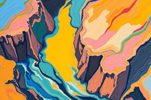
- Upper reaches have a surplus of energy and are dominated by erosion, including V-shaped valleys and waterfalls.
- Middle reaches have less energy and transport more sediment, evidenced by energy-conserving meander bends.
- Meander bends have distinctive features:
- The fastest water is thrown to the outside of the bend creating external erosion and internal deposition,
- The channel is deeper outside and shallower inside, forming an asymmetric cross-section,
- A cut bank on the outside bend, and a point bar on the inside bend.
- An oxbow lake is formed when meander bends erode and merge, cutting off the bend.
- Flood plains can also form on either side of a meandering river.
- Rejuvenation occurs when rivers gain additional potential energy, creating alluvial terraces or entrenched meanders.
- Lower reaches form deltas where rivers slow and deposit material, appearing as braided streams with sediment overload.
- Delta types include:
- Arcuate delta: Nile delta.
- Bird's-foot delta: Mississippi delta.
- Sediment accumulation on the Mississippi delta causes land subsidence, but flooding used to replenish sediment.
- Channels and levees prevent flooding, so new sediment is now carried further out to sea.
- The delta area is still sinking, as sediment is carried out to sea.
Rivers and Humans
-
River discharge (Q = av or Q = wdv) measures volume per time, typically cubic meters/feet per second.
- River velocity varies across the cross-section due to friction, with fastest water in the middle near the surface.
-
Rivers are part of a drainage basin system where actions in one area greatly affect another. Water enters river channels through:
- Direct precipitation like rain or snow.
- Rainfall infiltrating the ground and flowing as throughflow. It is a slow mode of entering the channel.
- Rainfall infiltrating and percolating into groundwater flow. It is a very slow mode of entering the channel.
- Rainfall becoming overland flow or surface runoff that rapidly enters the channel.
-
The storm hydrograph shows a river's response to rainstorms.
- Basins with primarily overland flow have rapid responses with short lag times (e.g., Capitol Reef National Park).
- Natural changes like forest fires reduce interception and infiltration, increasing flood risk.
- Frozen ground reduces infiltration, increasing surface runoff and flood potential (e.g., Nebraska floods of March 2019).
- Urbanization increases impermeable surfaces, forcing overland flow and raising flood risk.
-
Flood risks disproportionately affect flood-prone area residents, like Black populations in New Orleans during Hurricane Katrina and Black/Hispanic communities in Houston after Hurricane Harvey.
US Water issues and Deserts
-
The Western US faces water scarcity.
- The Colorado River is overallocated and dwindling due to climate change, rarely reaching the sea.
- Great Salt Lake is shrinking from water diverted for agriculture, creating dust storms.
- The Aral Sea shrank due to cotton irrigation diversions and serves as an example of freshwater change.
-
Globally, freshwater change exceeds the safe operating space, though not as severe as other planetary boundaries.
- Planetary boundary assessments reflect global conditions, not just a few critical areas.
- The conditions at the global level are considered ok.
-
Arid landscapes cover 26% and semi-arid/arid landscapes 35% of Earth's land.
-
Dry climates come from several factors:
- Hadley cells descend around 20-30 degrees latitude. An example is the Sahara desert. The rising air causes rainforests around the equator.
- Rain shadow deserts occur in the lee of mountain ranges (e.g., eastern Washington).
- Continental interiors are far from oceans (e.g., Taklimakan and Gobi deserts).
- Southern Utah dryness is influenced by all three factors.
-
Wind is a notable agent in deserts because water is scarce.
- Wind erosion, transport, and deposition are similar to riverine processes.
- Transportation includes: surface creep (large particles), saltation (medium particles) and suspension (small particles).
- Erosion includes: deflation (creating desert pavements) and abrasion (forming ventifacts/yardangs).
- Deposition forms sand ripples and dunes that migrate downwind.
- Dune types include crescentic (barchan), linear, and star dunes.
- Ergs (sand seas) are large sand accumulations that form when wind slows down, such as the Great Sand Dunes National Park, Colorado.
Differential Erosion
- Differential erosion in southwestern US deserts (including southern Utah) forms interesting landforms.
- Weaker materials erode faster, undercutting stronger layers and creating balanced rocks or hoodoos.
- Examples of this landform include Arches National Park, Bryce Canyon National Park and Goblin Valley State Park in Utah.
Glaciers and glacial landforms
-
Glacier ice is formed by compacting snow, squeezing out air, and gradually becoming ice over time.
-
It only forms above the permanent snowline, where snow lasts through summer each year allowing ice to form.
-
The permanent snowline's height varies with climate, being higher near the equator and dropping to sea level near the poles, and can therefore be in high altitude and high latitude locations.
-
Glacier types include continental glaciers (large ice sheets like Greenland/Antarctica) and alpine (mountain) glaciers.
-
Alpine glaciers consist of cirque glaciers and valley glaciers; the cirque glaciers form in high mountain basins, that then feed the valley glaciers.
-
Alpine glaciers have ablation and accumulation zones, where the dominant process over the year is either mass loss by melting/other process or mass gain.
-
These zones are separated by the equilibrium line.
- Ablation starts high and gets lesser moving upwards.
- Accumulation starts low and increases upwards, and this is because it is warmer lower down, and colder higher up.
-
Glacier mass balance= mass gain - mass loss from ablation.
-
Climate change causes most glaciers/ice sheets to have negative mass balance due to increasing temperatures.
-
Glaciers move through internal flow and basal slip.
- Internal flow states that closer substances are to their melting point, the easier they flow.
- Ice can get closer to its melting point by increasing its temperature, or putting it under pressure.
- This pressure causes ice to deform plastically. Ice at the surface has no pressure and is a brittle zone, whereas at the base has greater pressure and is a plastic zone.
- This plastic deformation of ice crystals will slide them over each other downslope under gravity.
- Basal slip allows a glacier to slide downslope with gravity, by using a lubricating layer of meltwater at the glacier's base.
- Internal flow states that closer substances are to their melting point, the easier they flow.
-
Crevasse formation occurs because ice near the surface is not under enough pressure to deform plastically, therefore it cracks.
- They're known to form when glacier's surface stresses exceed its ability to deform, like when it drops over a step and creates icefalls.
-
Glacial erosion occurs through abrasion and plucking.
- Abrasion works with particles scratching the glacier's bed.
- Plucking involves melting ice on the side of obstacles due to increased pressure and then refreezing to be plucked out as the glacier moves, known as ice regelation.
- Roche moutonnee is a landform produced by ice regelation where there is a smooth side up-glacier, and rough side down-glacier.
-
Alpine glaciation creates landforms, like U-shaped valleys, horns, arêtes, cirques, truncated spurs, hanging valleys, and hanging waterfalls. Examples include Yosemite Valley, and Little Cottonwood Canyon.
-
Glacial deposition includes moraines (terminal, lateral) and the outwash, as well as pro-glacial lakes.
-
Outwash is material deposited by meltwater away from the glacier, forming braided streams with heavy sediment load.
-
Glacial US features existing despite today's lack of glaciers in certain locations, indicates different climate during the last glacial maximum ~18,000 BP.
-
During this time, the Laurentide Ice Sheet extended.
-
Lake Bonneville and western US paleolakes began forming.
-
Fluctuations like this have been happening for earth's history.
-
Variation in Earth's orbit can trigger these glacial/interglacial cycles.
Ecosystems
-
An ecosystem consists of living plants and animals interacting with each other, as well as a non-living environment.
-
Components of an ecosystem are biotic (living) and abiotic (non living).
-
Biotic components: the sun being their fuel source, they include producers, consumers and decomposers.
-
Energy flows from producers (autotrophs) through primary (herbivores), secondary (carnivores) consumers in a food chain, with each of these being a tropic level.
-
Abiotic components are nutrients and gases for plant/animal survival. Example: Animal waste.
-
All earth's life works upon this pattern, but deep ocean life doesn't use sunlight, instead using energy through chemosynthesis.
-
Green plants are important to almost all life on earth.
-
Basic processes depend on gas exchanges within plants, facilitated by stomata. Key processes include:
- Transpiration: stomata openings draw in carbon dioxide, releasing oxygen, and causes water loss.
- Photosynthesis: creates sugars from combining water and carbon dioxide using chlorophyll, using light from the sun.
- Respiration: where plants use the food made from Photosynthesis to grow, burning sugars in the process, also happens in animals.
-
Any food that remains is stored as starches, which helps the plants grow bigger.
- Food left is measured through net photosynthesis.
- Net primary production is measured for an entire ecosystem.
-
The mass of a tree is made from carbon dioxide.
-
Equatorial regions have the earth's most productive ecosystems, mostly through tropical rainforest.
- As the ecosystem travels to colder and drier conditions, productivity will often drop.
- Other examples are; swamps/coral reefs.
-
Climate greatly impacts ecosystem productivity. Controls include: light, warmth/heat, water, nutrients.
-
Climatic control gives the ecosystem types based on precipitation, temperature influences the type of desert, grassland, or forest.
-
The relationship between climate/vegetation helped Wladimir Koppen create climate classification based on vegetation.
-
He can determine the climate through plants in given location with no records of temperature/precipitation.
-
Vegetation matches climate closely, but soil is also important for nutrient availability.
-
Close matches creates atitudinal/latitudinal zonation.
-
Too much/many of the list above can also cause problems for plants/ecosystems.
-
The 'dead zone' shows this, in the Gulf of Mexico
-
In different plannts/animals species can thrive at different levels of the list, where some of these can become limiting factors.
-
A plant may not live in certain place because it's too cold; temperature becomes the limiting factor.
-
Coastal red wood: is tolerant of wide temperature conditions, but sensitive to moisture; thrives in climate conditions of Pacific Northwest.
-
Micro scale can differentiate type of vegeatation; north-facing is cooler, moisture to retain more vegetation, Alaska is to temperature/limited to being opposite.
-
Biotic ecosystem components function at 10% percentage, where only 10% of food chain is available. - Herbivores need a amount of to grape, and tend to spread out accordingly. - Number of small animals tend to drop as you work way food chain because food decreases. - All these ideas support the argument for banning feeding grain to cattle. - Food chains create bioaccumulation, metals/pesticides become concentrated from higher trophic levels.
-
Important relationships: so important: consider food webs some inport species important, like krell in Antarctic marine web.
-
So species can be disperportaily. E.g. krill in Antarctic marine; if anything happens to krill, the whole ecosystem crash.
-
Succession happens from ecosystem disterd by something.
- Primary succession starts from scratch on bare rock
- Secondary succession starts where soil is already.
-
Complexities shown trough trophic cascades of pant: animals.
- Introduce wolves to Yellowstone. - Before; elk eat trees the banks, erosion, not good fish. - After; elk numbers lower; riverside for less in liver; improving habitat for fish: attracting to beavers.
Biomes and Forest Biomes
- Biomes; scaled ecosystems defined vegetation, forests: Savannah, grassland, Shrub land, desert, and tundra.
- Barriers in distribution; mountains: ranges, deserts and oceans; borders in maps or regions:Wallace's lie is change to show influenced of primairy.
- Dependence an climante; temperature, percipitation; rain: biomes types, forests, grossland, deserts, temperture with the type forests, etc.
- Varies atitudinal, atitude; also highitude, forest biomes, adaptations climantic, features; shows adaptaditions in features.
- Forest characteristis Hot: plenty sunlights seasonsl. Also dense. Competion. Vertictial. Main is gettiing high. In the form tree for ever greens and low fertily. Real problem to do. Mostly land for catl: Mostly land for cattle.
- Conditions coolder: seasoal cold darker witiners. Less spread out less stuct. Changes with seasons in winter.
- Cold: darker winters high altitude to reach the trees. Little spread sprooce: light for evergreeen, leave suface protect from waxy coat to wash acids.
- More in secondary; contrast applacia;
- Show change see sunlight, etc.
- Australia, show fire. Understory tree not germ. Fire destroys ash germ, trees survives and ash.
- fires species: not killed re produce fire grassdslands
- Mainmals maintain grasslannds; drouht andmals leave big reverse the chain. Maintain biospehere.
Studying That Suits You
Use AI to generate personalized quizzes and flashcards to suit your learning preferences.