Podcast
Questions and Answers
What is the name of the long mountain range in South America?
What is the name of the long mountain range in South America?
Andes Mountains
How many rivers are in South America?
How many rivers are in South America?
6
What is the longest river in South America?
What is the longest river in South America?
Amazon
What is the name of the highest mountain in South America?
What is the name of the highest mountain in South America?
What is the elevation of Mount Aconcagua?
What is the elevation of Mount Aconcagua?
Which oceans border South America?
Which oceans border South America?
Which sea borders South America?
Which sea borders South America?
Is Patagonia a desert, grassland, or forest area?
Is Patagonia a desert, grassland, or forest area?
Which two areas in South America are considered grasslands?
Which two areas in South America are considered grasslands?
What is another name for a group of islands?
What is another name for a group of islands?
Where are the Galapagos Islands located?
Where are the Galapagos Islands located?
What is the Gran Chaco?
What is the Gran Chaco?
Where is the Gran Chaco located?
Where is the Gran Chaco located?
What is the term for land drained by a river?
What is the term for land drained by a river?
What is a point of land that extends into a sea or ocean called?
What is a point of land that extends into a sea or ocean called?
What is the term for height above sea level?
What is the term for height above sea level?
What is a chain of mountains called?
What is a chain of mountains called?
What are natural landforms and waterways on Earth's surface called?
What are natural landforms and waterways on Earth's surface called?
What is a map that shows natural landforms and waterways on Earth's surface called?
What is a map that shows natural landforms and waterways on Earth's surface called?
What is a dense, tropical forest where a lot of rain falls called?
What is a dense, tropical forest where a lot of rain falls called?
What is a body of salt water that is part of an ocean, yet is partially enclosed by land?
What is a body of salt water that is part of an ocean, yet is partially enclosed by land?
What is a narrow channel connecting two bodies of water called?
What is a narrow channel connecting two bodies of water called?
Flashcards are hidden until you start studying
Study Notes
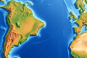
South America Geography Overview
- Andes Mountains: The longest mountain range in South America, running along the western coast of the continent.
- Amazon River: Recognized as the longest river in South America, crucial for biodiversity and ecosystems.
- Mount Aconcagua: The highest peak in South America, reaching an elevation of 22,831 feet.
- Geographic Borders: South America is bordered by the Atlantic Ocean to the east, the Southern Ocean to the south, and the Pacific Ocean to the west.
- Caribbean Sea: The sea that lies to the north of South America.
Natural Regions
- Patagonia: Characterized as a desert region, known for its arid climate and unique landscapes.
- Grasslands: Llanos and Pampas are the main grassland regions, offering fertile soil and vast open spaces.
Landforms and Definitions
- Archipelago: A term used to describe a group of islands like the Galapagos Islands, located west of the South American continent in the Pacific Ocean.
- Gran Chaco: A hardwood scrub forest area situated in central South America, providing a diverse habitat.
- Basin: The region of land that is drained by a river, playing a critical role in hydrology.
- Cape: A geographical term for a point of land extending into a sea or ocean.
Physical Geography Concepts
- Elevation: Refers to the height of land above sea level, an important factor in climate and vegetation diversity.
- Mountain Range: A chain of mountains, such as the Andes, that influences weather patterns and ecosystems.
- Physical Features: Encompasses natural landforms and waterways, essential for understanding geography.
- Physical Map: A type of map designed to illustrate natural landforms and waterways, providing insights into geological features.
Ecosystems
- Rainforest: Dense tropical forests with high rainfall, crucial for sustaining diverse wildlife and plant species.
Water Geography
- Sea: Defined as a body of saltwater that forms part of an ocean but is partially surrounded by land.
- Strait: A narrow channel connecting two larger bodies of water, important for navigation and marine life.
Studying That Suits You
Use AI to generate personalized quizzes and flashcards to suit your learning preferences.