Podcast
Questions and Answers
What geographical features provide the Ganges River with freshwater?
What geographical features provide the Ganges River with freshwater?
The Himalayas
What role does the Ganges River play in supporting life in the Gangetic Plain?
What role does the Ganges River play in supporting life in the Gangetic Plain?
It fosters a diverse ecosystem and provides a source of spiritual significance.
What is the cultural significance of the Ganges River for millions of Indians?
What is the cultural significance of the Ganges River for millions of Indians?
It is considered a holy river and has healing and purifying properties.
How do the Himalayas influence India's climate and weather patterns?
How do the Himalayas influence India's climate and weather patterns?
What physical feature supports a vast, fertile region known as the Gangetic Plain?
What physical feature supports a vast, fertile region known as the Gangetic Plain?
What is the economic significance of the Ganges River for the region?
What is the economic significance of the Ganges River for the region?
What are the three parallel mountain chains that make up the Himalayas?
What are the three parallel mountain chains that make up the Himalayas?
Name two of the highest peaks in the Himalayas.
Name two of the highest peaks in the Himalayas.
What lies to the north of the Great Himalayas?
What lies to the north of the Great Himalayas?
What lies to the south of the Great Himalayas?
What lies to the south of the Great Himalayas?
What are some of the resources provided by the Himalayas?
What are some of the resources provided by the Himalayas?
What is the Ganges River also known as?
What is the Ganges River also known as?
Flashcards are hidden until you start studying
Study Notes
Physical Features of India: The Himalayas and Ganges River
In the vast expanse of India, two natural wonders have played a defining role in shaping the country's landscape, geography, and culture: the Himalayas and the Ganges River.
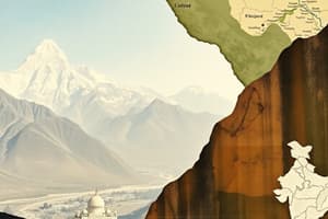
The Himalayas
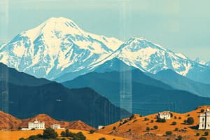
Stretching across northern India, the Himalayas are the world's highest mountain range, forming a natural and imposing barrier between India and its neighboring countries. The range is approximately 2,400 kilometers long and includes some of the highest peaks on the planet, such as Mount Everest, K2, and Kangchenjunga.
The Himalayas are made up of three parallel mountain chains: the Great Himalayas, the Middle Himalayas, and the Outer Himalayas. The Great Himalayas, often referred to as the "Himalaya Proper," are home to the tallest peaks, including Everest and Kangchenjunga, reaching heights of over 8,000 meters. To the north of the Great Himalayas lies the Tibetan Plateau, and to the south lies the Gangetic Plain, which we will discuss later.
The Himalayas are not only a symbol of India's natural beauty but also a source of freshwater, glaciers, and fertile soils. The range is also home to several unique ecosystems, from alpine meadows to coniferous forests. The Himalayas have shaped the lives of the people living in the region, including the Sherpas, Tibetans, and many others.
The Ganges River
The Ganges River, also known as the Ganga, is one of the world's longest and most sacred rivers. Flowing through India and Bangladesh, the Ganges nourishes the fertile plains of north and eastern India, including the states of Uttar Pradesh, Bihar, Jharkhand, and West Bengal.
Originating in the Himalayas, the Ganges flows through the states of Uttarakhand and Himachal Pradesh before entering the Gangetic Plain. The Ganges and its tributaries, such as the Yamuna and the Kosi, form a vast, intricate network of rivers and wetlands that support diverse flora and fauna.
The Ganges is considered a holy river and is a source of spiritual and cultural significance for millions of Indians. Throughout history, the river has been the center of religious rituals, and its waters are believed to have healing and purifying properties. The Ganges is also an important source of water for irrigation, hydroelectric power, and industry.
The Gangetic Plain
The Gangetic Plain, also known as the North Indian Plain, is a vast, fertile region that stretches across the northern parts of India and Bangladesh. The Ganges River and its tributaries flow through the plain, depositing fertile soils and maintaining a rich ecosystem.
The Gangetic Plain is home to more than half of India's population and is a center of agriculture, industry, and commerce. The region supports a wide variety of crops, including rice, wheat, and sugarcane, and its fertile soils have been cultivated for centuries.
The area is also home to several important cities, such as Delhi, Mumbai, Kolkata, and Chennai, as well as historical sites like the ancient city of Harappa, the ruins of the Nanda and Mauryan empires, and the Taj Mahal.
The Interplay Between the Himalayas and the Ganges River
The Himalayas and the Ganges River are interconnected in several ways. The Himalayas provide the Ganges with freshwater, feed the fertile soils of the Gangetic Plain, and create a natural barrier that influences India's climate and weather patterns.
The Ganges, in turn, plays a crucial role in supporting life in the Gangetic Plain, fostering a diverse ecosystem, and providing a source of spiritual significance for millions of Indians. The Ganges has also shaped India's history, culture, and economy throughout centuries.
The Himalayas and the Ganges River represent the natural beauty and cultural significance of India, and they continue to influence the country's development and growth. Understanding these two physical features is essential for understanding the rich and diverse landscape of India.
Studying That Suits You
Use AI to generate personalized quizzes and flashcards to suit your learning preferences.