Podcast
Questions and Answers
What was a significant factor that influenced the migration of the Indo-Aryan people around 2000 BCE?
What was a significant factor that influenced the migration of the Indo-Aryan people around 2000 BCE?
- The discovery of agriculture
- The rise of urban civilizations
- The northern Hindu Kush mountains (correct)
- The expansion of trade routes
Which empire controlled a significant area around the Ganges River around 400 BCE?
Which empire controlled a significant area around the Ganges River around 400 BCE?
- Chola Empire
- Mauryan Empire
- Mughal Empire
- Gupta Empire (correct)
How did the geography of ancient India affect its agricultural practices?
How did the geography of ancient India affect its agricultural practices?
- Fertile plains facilitated agriculture. (correct)
- High altitudes increased crop yields.
- The presence of deserts limited farming activities.
- Mountains obstructed trade routes.
What percentage of India's population is estimated to follow a vegetarian lifestyle?
What percentage of India's population is estimated to follow a vegetarian lifestyle?
What environmental challenge does the monsoon season present in ancient India?
What environmental challenge does the monsoon season present in ancient India?
What geographical feature forms a natural boundary between India and Pakistan?
What geographical feature forms a natural boundary between India and Pakistan?
Which mountain range is known as the highest in the world and is located in northern India?
Which mountain range is known as the highest in the world and is located in northern India?
What significant agricultural products were grown by the Indus Valley Civilization?
What significant agricultural products were grown by the Indus Valley Civilization?
How did the monsoon season affect the geography of the region?
How did the monsoon season affect the geography of the region?
Which river is considered the 'heartbeat of India'?
Which river is considered the 'heartbeat of India'?
What characterized the settlements of the Indus Valley Civilization?
What characterized the settlements of the Indus Valley Civilization?
When did the Indus Valley Civilization flourish?
When did the Indus Valley Civilization flourish?
Which plateau covers most of South Central India?
Which plateau covers most of South Central India?
Flashcards
Where are the Himalayas located?
Where are the Himalayas located?
The Himalayas, the highest mountain range in the world, are located in northern India.
What lies south of the Himalayas?
What lies south of the Himalayas?
The Himalayas descend southward into a large fertile plain that covers much of North India.
Where is the Indus River situated?
Where is the Indus River situated?
Three mountain ranges surround the Indus River in the Northwest.
Where does the Indus River flow?
Where does the Indus River flow?
Signup and view all the flashcards
What desert lies south of the Indus River?
What desert lies south of the Indus River?
Signup and view all the flashcards
What covers most of South Central India?
What covers most of South Central India?
Signup and view all the flashcards
What borders the Deccan Plateau?
What borders the Deccan Plateau?
Signup and view all the flashcards
What is the most significant river in India?
What is the most significant river in India?
Signup and view all the flashcards
Indo-Aryan Migration
Indo-Aryan Migration
Signup and view all the flashcards
Mauryan Empire
Mauryan Empire
Signup and view all the flashcards
Gupta Empire
Gupta Empire
Signup and view all the flashcards
Geography of Ancient India
Geography of Ancient India
Signup and view all the flashcards
Vegetarianism in India
Vegetarianism in India
Signup and view all the flashcards
Study Notes
Introduction
- India is the seventh largest country globally, covering 1,269,219 square miles.
- It is roughly one-third the size of the United States.
- India's physical environment significantly shaped its economy and culture.
India's Physical Geography
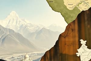
- The Himalayas, the world's highest mountain range, are located in northern India.
- The Himalayas descend into a fertile northern plain, spanning much of North India.
- Three mountain ranges encircle the Indus River in the northwest.
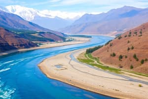
- The Indus River originates in the Himalayan mountains, flowing towards the Arabian Sea, also passing through parts of Pakistan, Northwest India, and Afghanistan.
- The Indus River is one of the longest globally, approximately 2,000 miles in length.
- The Thar Desert, or the Great Indian Desert, lies south of the Indus River.
- The Thar Desert, the 18th largest globally, covers 77,000 square miles and acts as a natural border between India and Pakistan.
- The Deccan Plateau dominates south-central India.
- The Eastern and Western Ghats, mountain ranges sloping to coastal plains, flank the Deccan Plateau.
- Numerous rivers drain the land, with the Ganges River being a critical global river and the "heartbeat of India."
The Indus Valley Civilization
- The Indus Valley Civilization, or Harappan civilization, was named after the Indus River.
- The rich Indus River soil facilitated irrigation and crop cultivation.
- Cultivated crops included wheat, barley, peas, and lentils.
- The region experiences monsoonal rainfall.
- The monsoon's climate shift involves hot air travelling over the Indian Ocean, forming rain clouds and releasing rain on the cooler landmass, frequently resulting in floods.
- Settlements were built on elevated grounds with defensive brick walls to safeguard against floods and contamination.
- The Indus Valley Civilization flourished from approximately 2600 BCE to 1900 BCE, then abruptly vanished.
Ancient Indian Civilizations & Migrations
- Following the Indus Valley Civilization's collapse, ancient Indian civilizations experienced periods of growth and decline, similar to an accordion.
- Indo-Aryans migrated through the Hindu Kush mountains around 2000 BCE, settling in the Indus River Valley and expanding to the Ganges Plain.
- The Mauryan Empire (around 324 BCE) expanded across much of modern India.
- The Gupta Empire (approximately 400 BCE), centered around the Ganges River south of the Himalayas, held significant power.
Geography and Impact on Lives
- Ancient India's geography profoundly shaped its inhabitants' lives and culture.
- The fertile plains were ideal for agricultural pursuits.
- The Indus River and its tributaries facilitated irrigation and trade.
- Monsoon rains were a vital water source, yet also presented a flood risk.
Vegetarianism in India
- India has a sizable vegetarian population, estimated at approximately 25% of the total.
- Chicken and mutton are the most commonly consumed meats amongst meat-eaters within India.
Studying That Suits You
Use AI to generate personalized quizzes and flashcards to suit your learning preferences.


