Podcast
Questions and Answers
What is the approximate east-west stretch of India?
What is the approximate east-west stretch of India?
- 3,000 kilometers (correct)
- 5,000 kilometers
- 10,000 kilometers
- 1,000 kilometers
Which of the following is the southernmost tip of India?
Which of the following is the southernmost tip of India?
- Kanyakumari
- Lakshadweep Island
- Indira Point (correct)
- Pondicherry
India lies entirely in which hemispheres?
India lies entirely in which hemispheres?
- Southern and Eastern
- Northern and Western
- Southern and Western
- Northern and Eastern (correct)
What landmass was the Indian subcontinent a part of before breaking away?
What landmass was the Indian subcontinent a part of before breaking away?
Which line of latitude divides India into almost two equal parts?
Which line of latitude divides India into almost two equal parts?
Which country does not share a border with India along its northeastern side?
Which country does not share a border with India along its northeastern side?
Which mountain range is located to the north of the Himalayas?
Which mountain range is located to the north of the Himalayas?
What is the average height of Greater Himalayas?
What is the average height of Greater Himalayas?
What is the meaning of 'Himalaya' in Sanskrit?
What is the meaning of 'Himalaya' in Sanskrit?
Which of the following rivers does not contribute to the formation of the Northern Plains?
Which of the following rivers does not contribute to the formation of the Northern Plains?
Which range is known as the Outer Himalayas?
Which range is known as the Outer Himalayas?
What is the approximate length of the Northern Plains?
What is the approximate length of the Northern Plains?
What is the name given to the valleys lying between the Sivaliks and the Lesser Himalayas?
What is the name given to the valleys lying between the Sivaliks and the Lesser Himalayas?
What is the Brahmaputra River called in Tibet?
What is the Brahmaputra River called in Tibet?
The Ganga Plain extends between which two rivers?
The Ganga Plain extends between which two rivers?
What is the black soil area in the Deccan Plateau known as?
What is the black soil area in the Deccan Plateau known as?
Which hills connect the Western and Eastern Ghats?
Which hills connect the Western and Eastern Ghats?
Which desert lies to the north-west of the Aravalli Hills?
Which desert lies to the north-west of the Aravalli Hills?
Which of the following rivers does NOT form a delta on the eastern coast?
Which of the following rivers does NOT form a delta on the eastern coast?
Which is the largest among the Lakshadweep Islands?
Which is the largest among the Lakshadweep Islands?
Which of the following best explains the temperature difference between Kerala and Kashmir?
Which of the following best explains the temperature difference between Kerala and Kashmir?
Why does Kashmir experience a greater difference in the duration of day and night compared to Kanyakumari?
Why does Kashmir experience a greater difference in the duration of day and night compared to Kanyakumari?
If a traveler moves from west to east across India, what would they notice about the timing of sunrise?
If a traveler moves from west to east across India, what would they notice about the timing of sunrise?
What is the significance of the 82°30'E longitude in determining India's Standard Time?
What is the significance of the 82°30'E longitude in determining India's Standard Time?
Which of these statements best describes the latitudinal position of mainland India?
Which of these statements best describes the latitudinal position of mainland India?
What is a key reason for the economic and social significance of the Northern Plains?
What is a key reason for the economic and social significance of the Northern Plains?
Which geological feature primarily divides the Deccan Plateau from the Chhota Nagpur Plateau?
Which geological feature primarily divides the Deccan Plateau from the Chhota Nagpur Plateau?
How does the nature of the Eastern Ghats differ from that of the Western Ghats?
How does the nature of the Eastern Ghats differ from that of the Western Ghats?
What is the primary reason for classifying the eastern coastal plain as an 'emergent' coastal plain?
What is the primary reason for classifying the eastern coastal plain as an 'emergent' coastal plain?
What is the significance of the 'Ten Degree Channel' in the context of Indian geography?
What is the significance of the 'Ten Degree Channel' in the context of Indian geography?
What is the characteristic of the rivers in the western coast?
What is the characteristic of the rivers in the western coast?
If you were traveling eastward across the Central Highlands, which of the following hill ranges would you encounter as its eastern extension?
If you were traveling eastward across the Central Highlands, which of the following hill ranges would you encounter as its eastern extension?
Which of the following statements best describes the formation of the Northern Plains?
Which of the following statements best describes the formation of the Northern Plains?
How does the width of the Himalayan mountain range change from west to east?
How does the width of the Himalayan mountain range change from west to east?
Which of the following options accurately describes the location of the Purvanchal Range?
Which of the following options accurately describes the location of the Purvanchal Range?
What is the significance of the term 'Duns' in the context of the Himalayan ranges?
What is the significance of the term 'Duns' in the context of the Himalayan ranges?
Which of the following statements accurately describes the Greater Himalayas (Himadri)?
Which of the following statements accurately describes the Greater Himalayas (Himadri)?
How do the Himalayas influence the monsoon patterns in India?
How do the Himalayas influence the monsoon patterns in India?
Which of the following best describes the Terai region?
Which of the following best describes the Terai region?
Besides the Himalayas, what other significant mountain range is located to the north of India, extending across parts of Pakistan, China, and Afghanistan?
Besides the Himalayas, what other significant mountain range is located to the north of India, extending across parts of Pakistan, China, and Afghanistan?
Considering the geographical context of the Himalayan ranges, which of the following factors would most significantly influence the local climate and biodiversity of a specific region within the Lesser Himalayas (Himachal)?
Considering the geographical context of the Himalayan ranges, which of the following factors would most significantly influence the local climate and biodiversity of a specific region within the Lesser Himalayas (Himachal)?
How would the disappearance of the Himalayan range most likely affect the monsoon season in India?
How would the disappearance of the Himalayan range most likely affect the monsoon season in India?
Based on the geological composition and formation processes of the Northern Plains, which resource extraction activity would LEAST likely have a detrimental long-term effect on the region's ecological balance?
Based on the geological composition and formation processes of the Northern Plains, which resource extraction activity would LEAST likely have a detrimental long-term effect on the region's ecological balance?
Considering the geological history of the Indian subcontinent, what was the primary force driving its separation from Gondwanaland and subsequent collision with the Eurasian plate?
Considering the geological history of the Indian subcontinent, what was the primary force driving its separation from Gondwanaland and subsequent collision with the Eurasian plate?
Given that India's Standard Meridian is 82°30'E and passes through Prayagraj, Uttar Pradesh, what specific criteria were likely prioritized when selecting this longitude as the national standard, considering India's vast longitudinal extent?
Given that India's Standard Meridian is 82°30'E and passes through Prayagraj, Uttar Pradesh, what specific criteria were likely prioritized when selecting this longitude as the national standard, considering India's vast longitudinal extent?
Considering the geographical positioning of India's neighboring countries, which of the following scenarios would have the MOST significant impact on India's geopolitical strategy and border security?
Considering the geographical positioning of India's neighboring countries, which of the following scenarios would have the MOST significant impact on India's geopolitical strategy and border security?
How would a significant increase in tectonic activity in the Himalayan region MOST likely affect the flow and characteristics of the rivers originating there?
How would a significant increase in tectonic activity in the Himalayan region MOST likely affect the flow and characteristics of the rivers originating there?
How does the latitudinal extent of India influence regional climate patterns, considering the interaction between the Tropic of Cancer and the country's diverse topography?
How does the latitudinal extent of India influence regional climate patterns, considering the interaction between the Tropic of Cancer and the country's diverse topography?
Considering the location of Kanyakumari and Kashmir relative to the Equator, which of the following factors MOST contributes to the significant difference in day and night duration between these two regions?
Considering the location of Kanyakumari and Kashmir relative to the Equator, which of the following factors MOST contributes to the significant difference in day and night duration between these two regions?
If a researcher aims to study the impact of India's latitudinal and longitudinal extent on regional biodiversity, which approach would provide the MOST comprehensive understanding?
If a researcher aims to study the impact of India's latitudinal and longitudinal extent on regional biodiversity, which approach would provide the MOST comprehensive understanding?
India was once part of a large landmass called Gondwanaland.
India was once part of a large landmass called Gondwanaland.
India is currently the fifth largest country in the world.
India is currently the fifth largest country in the world.
The Tropic of Capricorn divides India into two equal parts.
The Tropic of Capricorn divides India into two equal parts.
The longitudinal extent causes a time lag of approximately four hours between the eastern and western ends of India.
The longitudinal extent causes a time lag of approximately four hours between the eastern and western ends of India.
India shares its boundaries with Myanmar and Bangladesh in the north-west.
India shares its boundaries with Myanmar and Bangladesh in the north-west.
Nepal is not a north-eastern neighbor of India.
Nepal is not a north-eastern neighbor of India.
The Chinese border only passes along the states of Himachal Pradesh and Uttarakhand.
The Chinese border only passes along the states of Himachal Pradesh and Uttarakhand.
Bangladesh is located to the west of India.
Bangladesh is located to the west of India.
The Palk Strait and the Gulf of Mannar separate Sri Lanka from India.
The Palk Strait and the Gulf of Mannar separate Sri Lanka from India.
India has 29 states and 7 union territories.
India has 29 states and 7 union territories.
The Himalayas are the shortest mountain range in the world.
The Himalayas are the shortest mountain range in the world.
The Sivaliks are the innermost range of the Himalayas.
The Sivaliks are the innermost range of the Himalayas.
The Northern Plains are located north of the Himalayas.
The Northern Plains are located north of the Himalayas.
The Brahmaputra River is known as the Tsangpo in Bhutan.
The Brahmaputra River is known as the Tsangpo in Bhutan.
The Ganga and Brahmaputra rivers merge in Bangladesh to form the world's largest delta.
The Ganga and Brahmaputra rivers merge in Bangladesh to form the world's largest delta.
The Peninsular Plateau is the newest geological formation in India.
The Peninsular Plateau is the newest geological formation in India.
The Central Highlands are bounded by the Aravallis in the east.
The Central Highlands are bounded by the Aravallis in the east.
The Deccan Trap region is known for its fertile black soil, ideal for cotton cultivation.
The Deccan Trap region is known for its fertile black soil, ideal for cotton cultivation.
The Eastern Ghats are continuous and can only be crossed through passes.
The Eastern Ghats are continuous and can only be crossed through passes.
The Lakshadweep Islands are formed by volcanic activity.
The Lakshadweep Islands are formed by volcanic activity.
India's longitudinal extent primarily influences the variations in climate experienced across the country.
India's longitudinal extent primarily influences the variations in climate experienced across the country.
The Standard Meridian of India, which determines the country's standard time, passes through Bengaluru.
The Standard Meridian of India, which determines the country's standard time, passes through Bengaluru.
Due to its proximity to the Equator, Kanyakumari experiences significantly more variation in day and night duration compared to Kashmir.
Due to its proximity to the Equator, Kanyakumari experiences significantly more variation in day and night duration compared to Kashmir.
India lies entirely in the Southern and Western Hemisphere.
India lies entirely in the Southern and Western Hemisphere.
India rifted from Gondwanaland approximately 50 million years ago, leading to the formation of the Himalayas through a collision with the Eurasian plate.
India rifted from Gondwanaland approximately 50 million years ago, leading to the formation of the Himalayas through a collision with the Eurasian plate.
The Himalayas' width consistently increases from west to east, reaching approximately 550 kilometers in Arunachal Pradesh.
The Himalayas' width consistently increases from west to east, reaching approximately 550 kilometers in Arunachal Pradesh.
The 'Duns,' such as Dehradun, are valleys located between the Himadri and Himachal ranges.
The 'Duns,' such as Dehradun, are valleys located between the Himadri and Himachal ranges.
The average elevation of the Himachal range, also known as the Lesser Himalayas, is approximately 7,000 meters.
The average elevation of the Himachal range, also known as the Lesser Himalayas, is approximately 7,000 meters.
The Purvanchal Range, situated along the India-Myanmar border, is characterized by elevations generally exceeding 5,000 meters.
The Purvanchal Range, situated along the India-Myanmar border, is characterized by elevations generally exceeding 5,000 meters.
The Ganga-Brahmaputra Plain is primarily formed by the alluvial deposits of the Indus River and its tributaries.
The Ganga-Brahmaputra Plain is primarily formed by the alluvial deposits of the Indus River and its tributaries.
The Karakoram range, located exclusively within India, boasts numerous peaks surpassing 9,000 meters in height.
The Karakoram range, located exclusively within India, boasts numerous peaks surpassing 9,000 meters in height.
The Sivalik Range, the innermost range of the Himalayas, is renowned for its continuous and unbroken mountain chains.
The Sivalik Range, the innermost range of the Himalayas, is renowned for its continuous and unbroken mountain chains.
The Northern Plains, known for their fertile alluvial soil, are sparsely populated due to the arid climate and limited water resources.
The Northern Plains, known for their fertile alluvial soil, are sparsely populated due to the arid climate and limited water resources.
The Brahmaputra River, known as the Tsangpo in Tibet, initially flows eastward before sharply turning southward and then predominantly westward as it courses through Assam.
The Brahmaputra River, known as the Tsangpo in Tibet, initially flows eastward before sharply turning southward and then predominantly westward as it courses through Assam.
The Deccan Plateau is directly adjacent to the Chota Nagpur Plateau, separated only by a narrow geological fault line.
The Deccan Plateau is directly adjacent to the Chota Nagpur Plateau, separated only by a narrow geological fault line.
The Western Ghats, a continuous mountain range parallel to India's western coast, can only be traversed at specific points such as the Dave Ghat, Bhor Ghat and Pal Ghat.
The Western Ghats, a continuous mountain range parallel to India's western coast, can only be traversed at specific points such as the Dave Ghat, Bhor Ghat and Pal Ghat.
The Eastern Coastal Plain is characterized by a landscape featuring fewer ports and harbors because it is an emergent coastal plain; this contrasts with the Western Coastal Plain.
The Eastern Coastal Plain is characterized by a landscape featuring fewer ports and harbors because it is an emergent coastal plain; this contrasts with the Western Coastal Plain.
The northern plains of India owe much of their agricultural richness to their flat terrain, the consistent flow of water from perennial rivers, and conducive climatic conditions, bolstering the area's economic and infrastructural development.
The northern plains of India owe much of their agricultural richness to their flat terrain, the consistent flow of water from perennial rivers, and conducive climatic conditions, bolstering the area's economic and infrastructural development.
While the Thar Desert is known for its arid climate and minimal rainfall, the Sambhar Lake distinguishes itself as the region's only significant saltwater lake, sustained by consistent riverine inputs.
While the Thar Desert is known for its arid climate and minimal rainfall, the Sambhar Lake distinguishes itself as the region's only significant saltwater lake, sustained by consistent riverine inputs.
The Andaman Islands and the Lakshadweep Islands, despite being geographically distant and differing in formation, both consist primarily of coral-based structures and feature similar biodiversity.
The Andaman Islands and the Lakshadweep Islands, despite being geographically distant and differing in formation, both consist primarily of coral-based structures and feature similar biodiversity.
The Himalayas' width remains consistently at 400 kilometers throughout its entire stretch from west to east.
The Himalayas' width remains consistently at 400 kilometers throughout its entire stretch from west to east.
The Alps are young fold mountains primarily composed of metamorphic rocks.
The Alps are young fold mountains primarily composed of metamorphic rocks.
India's longitudinal extent results in an approximate time difference of five hours between its easternmost and westernmost points.
India's longitudinal extent results in an approximate time difference of five hours between its easternmost and westernmost points.
The Standard Meridian of India, which determines India's standard time, runs exactly along 83°0' East longitude.
The Standard Meridian of India, which determines India's standard time, runs exactly along 83°0' East longitude.
The average height of the Greater Himalayas is 8,000 meters and its peaks are only seasonally covered with snow.
The average height of the Greater Himalayas is 8,000 meters and its peaks are only seasonally covered with snow.
The valleys lying between the Sivaliks and the Lesser Himalayas are called 'Terai'.
The valleys lying between the Sivaliks and the Lesser Himalayas are called 'Terai'.
Due to its proximity to the Equator, Kashmir experiences a minimal difference of approximately 1 hour in the duration of day and night.
Due to its proximity to the Equator, Kashmir experiences a minimal difference of approximately 1 hour in the duration of day and night.
Prior to its collision with the Tibetan landmass, the Indian subcontinent was a part of the ancient supercontinent known as Pangea.
Prior to its collision with the Tibetan landmass, the Indian subcontinent was a part of the ancient supercontinent known as Pangea.
The Himalayas prevent cold winds from Siberia from entering India, influencing the climate in the north of Australia.
The Himalayas prevent cold winds from Siberia from entering India, influencing the climate in the north of Australia.
The southernmost tip of India, known as Indira Point, is situated at 6°45'S latitude.
The southernmost tip of India, known as Indira Point, is situated at 6°45'S latitude.
India was once part of an ancient landmass called ______.
India was once part of an ancient landmass called ______.
The ______ divides India into almost two equal parts.
The ______ divides India into almost two equal parts.
India is located entirely in the Northern and Eastern ______.
India is located entirely in the Northern and Eastern ______.
The southernmost tip of India is ______ in Andaman and Nicobar Islands.
The southernmost tip of India is ______ in Andaman and Nicobar Islands.
India's standard time is based on the longitude 82°30' East, which passes through ______ in Uttar Pradesh.
India's standard time is based on the longitude 82°30' East, which passes through ______ in Uttar Pradesh.
The Brahmaputra River is known as the ______ in Tibet.
The Brahmaputra River is known as the ______ in Tibet.
The Ganga Plain extends between the Ghaggar and ______ rivers.
The Ganga Plain extends between the Ghaggar and ______ rivers.
The Peninsular Plateau is a part of an ancient landmass called ______.
The Peninsular Plateau is a part of an ancient landmass called ______.
The Central Highlands are bounded by the Aravallis in the ______.
The Central Highlands are bounded by the Aravallis in the ______.
The black soil area in the Deccan Plateau is known as the ______ Region.
The black soil area in the Deccan Plateau is known as the ______ Region.
The Western Ghats are also known as ______.
The Western Ghats are also known as ______.
The Great Indian Desert is also known as the ______ Desert.
The Great Indian Desert is also known as the ______ Desert.
The Himalayas are also known as the '______' of snow.
The Himalayas are also known as the '______' of snow.
The northern plains are formed by the alluvial deposits brought by the rivers Indus, Ganga, and ______.
The northern plains are formed by the alluvial deposits brought by the rivers Indus, Ganga, and ______.
The Purvanchal Range is located along the border of India and ______ in the east.
The Purvanchal Range is located along the border of India and ______ in the east.
The Sivaliks is the ______ range of the Himalayas.
The Sivaliks is the ______ range of the Himalayas.
The valleys lying between the Sivaliks and the Lesser Himalayas are called '______'.
The valleys lying between the Sivaliks and the Lesser Himalayas are called '______'.
The Greater Himalayas are also known as ______.
The Greater Himalayas are also known as ______.
Mt. Everest is located in ______.
Mt. Everest is located in ______.
The Northern Plains are located south of the Himalayas and north of the ______ Plateau.
The Northern Plains are located south of the Himalayas and north of the ______ Plateau.
India was once part of an ancient landmass called ______, before its continental drift.
India was once part of an ancient landmass called ______, before its continental drift.
The ______ of Cancer divides India into approximately two equal parts, influencing its climate zones.
The ______ of Cancer divides India into approximately two equal parts, influencing its climate zones.
The time difference of two hours between the eastern and western ends of India is due to its ______ stretch.
The time difference of two hours between the eastern and western ends of India is due to its ______ stretch.
India's standard time is based on the longitude that passes through Prayagraj in Uttar Pradesh, which is ______ degrees East.
India's standard time is based on the longitude that passes through Prayagraj in Uttar Pradesh, which is ______ degrees East.
The variations in the duration of day and night are minimal in Kanyakumari but maximal in Kashmir due to their respective distances from the ______.
The variations in the duration of day and night are minimal in Kanyakumari but maximal in Kashmir due to their respective distances from the ______.
The eastern extension of the Central Highlands consists of the ______ hills.
The eastern extension of the Central Highlands consists of the ______ hills.
The ______ Plateau is separated from the Chhota Nagpur Plateau by a geological fault and is known for its black soil.
The ______ Plateau is separated from the Chhota Nagpur Plateau by a geological fault and is known for its black soil.
The Western Ghats, also known as ______, are continuous mountain ranges that run parallel to the western coast of India.
The Western Ghats, also known as ______, are continuous mountain ranges that run parallel to the western coast of India.
The ______ connect the Western and Eastern Ghats in the southern part of India.
The ______ connect the Western and Eastern Ghats in the southern part of India.
The Northern Plains are also referred to as the ______ Plains, due to the significant river system that flows through it.
The Northern Plains are also referred to as the ______ Plains, due to the significant river system that flows through it.
The ______ is the only large river that flows through the Great Indian Desert.
The ______ is the only large river that flows through the Great Indian Desert.
The Brahmaputra River, known as ______ in Tibet, significantly contributes to forming the world's largest delta as it meets the Ganga.
The Brahmaputra River, known as ______ in Tibet, significantly contributes to forming the world's largest delta as it meets the Ganga.
The Himalayas are young ______ mountains primarily composed of sedimentary rocks, formed by the collision of tectonic plates.
The Himalayas are young ______ mountains primarily composed of sedimentary rocks, formed by the collision of tectonic plates.
The ______ Strait and the Gulf of Mannar create a narrow channel that separates Sri Lanka from India.
The ______ Strait and the Gulf of Mannar create a narrow channel that separates Sri Lanka from India.
The ______ Islands are coral-formed and located in the Arabian Sea, near the Malabar Coast of Kerala.
The ______ Islands are coral-formed and located in the Arabian Sea, near the Malabar Coast of Kerala.
The valleys lying between the Sivaliks and the Lesser Himalayas are called '______,' exemplified by locations such as Dehradun.
The valleys lying between the Sivaliks and the Lesser Himalayas are called '______,' exemplified by locations such as Dehradun.
The Northern Mountains protect India from cold north-eastern trade winds originating from ______, influencing India's climate.
The Northern Mountains protect India from cold north-eastern trade winds originating from ______, influencing India's climate.
The Western Plain is formed by the Indus and its five tributaries: Jhelum, Chenab, Ravi, Beas and ______.
The Western Plain is formed by the Indus and its five tributaries: Jhelum, Chenab, Ravi, Beas and ______.
The Himalayas are known as the '______ of snow' in Sanskrit, reflective of their perennial snow cover.
The Himalayas are known as the '______ of snow' in Sanskrit, reflective of their perennial snow cover.
The ______ range, located along the India-Myanmar border, includes the Patkai Bum, Naga Hills, and Lushai Hills.
The ______ range, located along the India-Myanmar border, includes the Patkai Bum, Naga Hills, and Lushai Hills.
The Chinese border extends from Ladakh to Arunachal Pradesh, passing through Himachal Pradesh, Uttarakhand, and ______.
The Chinese border extends from Ladakh to Arunachal Pradesh, passing through Himachal Pradesh, Uttarakhand, and ______.
Sri Lanka is separated from India by the Palk Strait and the Gulf of ______.
Sri Lanka is separated from India by the Palk Strait and the Gulf of ______.
The Himalayas are also known as young ______ mountains, consisting mainly of sedimentary rocks.
The Himalayas are also known as young ______ mountains, consisting mainly of sedimentary rocks.
The valleys between the Sivaliks and the Lesser Himalayas are known as '______' such as Dehradun, Kotlidun and Patlidun.
The valleys between the Sivaliks and the Lesser Himalayas are known as '______' such as Dehradun, Kotlidun and Patlidun.
The convergence of the Indian subcontinent with the Tibetan landmass approximately 50 million years ago resulted in the formation of the ______, showcasing the dynamic geological processes shaping the region.
The convergence of the Indian subcontinent with the Tibetan landmass approximately 50 million years ago resulted in the formation of the ______, showcasing the dynamic geological processes shaping the region.
The latitudinal extent of India significantly influences the country's climate, with the southern part experiencing warm, tropical conditions due to its proximity to the ______ and the northern part exhibiting more extreme temperature variations.
The latitudinal extent of India significantly influences the country's climate, with the southern part experiencing warm, tropical conditions due to its proximity to the ______ and the northern part exhibiting more extreme temperature variations.
The ______ meridian of India, passing through Prayagraj in Uttar Pradesh, serves as the reference point for determining the country's standard time, helping to synchronize activities across its vast longitudinal expanse.
The ______ meridian of India, passing through Prayagraj in Uttar Pradesh, serves as the reference point for determining the country's standard time, helping to synchronize activities across its vast longitudinal expanse.
Before its collision with the Tibetan landmass, the Indian subcontinent was a part of the ancient supercontinent called ______, reflecting its deep-rooted geological history and the subsequent drift that shaped its current position.
Before its collision with the Tibetan landmass, the Indian subcontinent was a part of the ancient supercontinent called ______, reflecting its deep-rooted geological history and the subsequent drift that shaped its current position.
The significant difference in the duration of days and nights between Kanyakumari and Kashmir is primarily attributed to their varying distances from the ______; Kanyakumari experiences nearly equal day and night durations, whereas Kashmir witnesses a substantial difference, particularly during specific times of the year.
The significant difference in the duration of days and nights between Kanyakumari and Kashmir is primarily attributed to their varying distances from the ______; Kanyakumari experiences nearly equal day and night durations, whereas Kashmir witnesses a substantial difference, particularly during specific times of the year.
What is the southernmost tip of India called?
What is the southernmost tip of India called?
Which old landmass was the Indian subcontinent a part of?
Which old landmass was the Indian subcontinent a part of?
Approximately what is the longitudinal extent of India?
Approximately what is the longitudinal extent of India?
India is located in which two hemispheres?
India is located in which two hemispheres?
Which countries share boundaries with India towards the north-west?
Which countries share boundaries with India towards the north-west?
Which countries are considered India's north-eastern neighbors?
Which countries are considered India's north-eastern neighbors?
Name the narrow channel that separates Sri Lanka from India.
Name the narrow channel that separates Sri Lanka from India.
What are the young fold mountains bounding India on the northern and north-eastern side called?
What are the young fold mountains bounding India on the northern and north-eastern side called?
How many states and union territories does India have?
How many states and union territories does India have?
Name the three parallel ranges in the Himalayas.
Name the three parallel ranges in the Himalayas.
What is another name for the Northern Plains?
What is another name for the Northern Plains?
Name two of the major rivers that form the Northern Plains.
Name two of the major rivers that form the Northern Plains.
Where does the Brahmaputra River originate?
Where does the Brahmaputra River originate?
What is the Great Indian Desert also known as?
What is the Great Indian Desert also known as?
What two rivers form the world's largest delta?
What two rivers form the world's largest delta?
What are the two main divisions of the Peninsular Plateau?
What are the two main divisions of the Peninsular Plateau?
What is the name of the mountain range that lies parallel to the western coast of India?
What is the name of the mountain range that lies parallel to the western coast of India?
What is the name of active volcano in the Andaman Islands?
What is the name of active volcano in the Andaman Islands?
Explain how India's latitudinal extent influences its climate and the duration of day and night.
Explain how India's latitudinal extent influences its climate and the duration of day and night.
Describe India's location in terms of hemispheres and its latitudinal and longitudinal extent.
Describe India's location in terms of hemispheres and its latitudinal and longitudinal extent.
How does the longitudinal stretch of India impact the local time across the country?
How does the longitudinal stretch of India impact the local time across the country?
Outline the major geological events that led to the formation of the Indian subcontinent as it exists today.
Outline the major geological events that led to the formation of the Indian subcontinent as it exists today.
Which countries share land boundaries with India towards its northwest?
Which countries share land boundaries with India towards its northwest?
How do the geographical features of the Northern Plains contribute to its agricultural importance?
How do the geographical features of the Northern Plains contribute to its agricultural importance?
Contrast the river systems of the Western and Eastern Coastal Plains in terms of delta formation. Why do they differ?
Contrast the river systems of the Western and Eastern Coastal Plains in terms of delta formation. Why do they differ?
Explain the significance of the Deccan Trap region's soil composition for agriculture.
Explain the significance of the Deccan Trap region's soil composition for agriculture.
How does the location of the Lakshadweep Islands influence their formation and biodiversity?
How does the location of the Lakshadweep Islands influence their formation and biodiversity?
What are the economic and social implications of the extensive road and railway network in the Northern Plains?
What are the economic and social implications of the extensive road and railway network in the Northern Plains?
In what ways do the Western Ghats influence the climate and hydrology of the Peninsular Plateau?
In what ways do the Western Ghats influence the climate and hydrology of the Peninsular Plateau?
Describe how the Brahmaputra River's journey from Tibet to Bangladesh affects the geography and ecology of the regions it traverses.
Describe how the Brahmaputra River's journey from Tibet to Bangladesh affects the geography and ecology of the regions it traverses.
How do the Himalayas influence the monsoon patterns in India, and what is the geographical reason behind this?
How do the Himalayas influence the monsoon patterns in India, and what is the geographical reason behind this?
Explain how the varying widths of the Himalayan range, being wider in the west and narrower in the east, impact the region's accessibility and biodiversity.
Explain how the varying widths of the Himalayan range, being wider in the west and narrower in the east, impact the region's accessibility and biodiversity.
Describe the formation of 'Duns' and state their significance in terms of land use and human settlement.
Describe the formation of 'Duns' and state their significance in terms of land use and human settlement.
How do the geographical locations of the Greater Himalayas (Himadri) and the Sivaliks contribute differently to the ecological balance and water resources of the Northern Plains?
How do the geographical locations of the Greater Himalayas (Himadri) and the Sivaliks contribute differently to the ecological balance and water resources of the Northern Plains?
Contrast the formation processes of the Western Plains and the Ganga-Brahmaputra Plain, highlighting the contributions of different river systems.
Contrast the formation processes of the Western Plains and the Ganga-Brahmaputra Plain, highlighting the contributions of different river systems.
In what ways does the Purvanchal Range differ from the main Himalayan ranges in terms of altitude, local names, and their impact on regional connectivity?
In what ways does the Purvanchal Range differ from the main Himalayan ranges in terms of altitude, local names, and their impact on regional connectivity?
What agricultural and economic activities are primarily supported by the Northern Plains
What agricultural and economic activities are primarily supported by the Northern Plains
How does the Karakoram range's location relative to the Himalayas influence the distribution of glacial ice and the flow of rivers in the northern part of the Indian subcontinent?
How does the Karakoram range's location relative to the Himalayas influence the distribution of glacial ice and the flow of rivers in the northern part of the Indian subcontinent?
Explain how the Himalayas influence India's climate and, consequently, its agricultural practices.
Explain how the Himalayas influence India's climate and, consequently, its agricultural practices.
Critically evaluate the statement: 'The Purvanchal Range is merely an eastern extension of the Himalayan range with little regional significance'.
Critically evaluate the statement: 'The Purvanchal Range is merely an eastern extension of the Himalayan range with little regional significance'.
Analyze the potential impact on the Ganga-Brahmaputra Plain if deforestation in the Himalayan foothills continues unchecked.
Analyze the potential impact on the Ganga-Brahmaputra Plain if deforestation in the Himalayan foothills continues unchecked.
Compare and contrast the economic significance of the Greater Himalayas (Himadri) and the Lesser Himalayas (Himachal) for India.
Compare and contrast the economic significance of the Greater Himalayas (Himadri) and the Lesser Himalayas (Himachal) for India.
India's Standard Meridian passes through 82°30'E. What are the implications of selecting this particular longitude as the standard time and how does it affect daily life across the country?
India's Standard Meridian passes through 82°30'E. What are the implications of selecting this particular longitude as the standard time and how does it affect daily life across the country?
Describe Gondwanaland and explain how the Indian subcontinent's separation and collision with the Eurasian plate shaped the present-day geological structure of India.
Describe Gondwanaland and explain how the Indian subcontinent's separation and collision with the Eurasian plate shaped the present-day geological structure of India.
How might geopolitical tensions in the Karakoram region impact India's access to resources and trade routes?
How might geopolitical tensions in the Karakoram region impact India's access to resources and trade routes?
Analyze the strategic importance of Indira Point's location at 6°45'N latitude. What are the implications of this southernmost point for India's maritime boundaries and strategic interests in the Indian Ocean?
Analyze the strategic importance of Indira Point's location at 6°45'N latitude. What are the implications of this southernmost point for India's maritime boundaries and strategic interests in the Indian Ocean?
Explain why the latitudinal extent of Kashmir results in a significant difference in day and night duration compared to Kanyakumari.
Explain why the latitudinal extent of Kashmir results in a significant difference in day and night duration compared to Kanyakumari.
Flashcards
Gondwanaland
Gondwanaland
Ancient supercontinent that included India.
India's Hemispheres
India's Hemispheres
Northern and Eastern Hemispheres.
Southernmost Tip of India
Southernmost Tip of India
6°45'N latitude.
Standard Meridian of India
Standard Meridian of India
Signup and view all the flashcards
North-west Boundaries of India
North-west Boundaries of India
Signup and view all the flashcards
Brahmaputra River
Brahmaputra River
Signup and view all the flashcards
Ganga Plain
Ganga Plain
Signup and view all the flashcards
Peninsular Plateau
Peninsular Plateau
Signup and view all the flashcards
Central Highlands
Central Highlands
Signup and view all the flashcards
Deccan Trap
Deccan Trap
Signup and view all the flashcards
Western Ghats
Western Ghats
Signup and view all the flashcards
Great Indian Desert
Great Indian Desert
Signup and view all the flashcards
India's North-Eastern Neighbors
India's North-Eastern Neighbors
Signup and view all the flashcards
Himalayas
Himalayas
Signup and view all the flashcards
Greater Himalayas (Himadri)
Greater Himalayas (Himadri)
Signup and view all the flashcards
Himalayan passes
Himalayan passes
Signup and view all the flashcards
Lesser Himalayas (Himachal)
Lesser Himalayas (Himachal)
Signup and view all the flashcards
Outer Himalayas (Sivaliks)
Outer Himalayas (Sivaliks)
Signup and view all the flashcards
Duns
Duns
Signup and view all the flashcards
Northern Plains
Northern Plains
Signup and view all the flashcards
3,000 Kilometers
3,000 Kilometers
Signup and view all the flashcards
Tropic of Cancer
Tropic of Cancer
Signup and view all the flashcards
Day & Night Duration
Day & Night Duration
Signup and view all the flashcards
Standard Meridian
Standard Meridian
Signup and view all the flashcards
Rajmahal Hills
Rajmahal Hills
Signup and view all the flashcards
Brahmaputra Plain
Brahmaputra Plain
Signup and view all the flashcards
Northern Plains Importance
Northern Plains Importance
Signup and view all the flashcards
Central Highlands location
Central Highlands location
Signup and view all the flashcards
Nilgiri Hills
Nilgiri Hills
Signup and view all the flashcards
Coastal Plains
Coastal Plains
Signup and view all the flashcards
Barren Volcano
Barren Volcano
Signup and view all the flashcards
Palk Strait & Gulf of Mannar
Palk Strait & Gulf of Mannar
Signup and view all the flashcards
Terai Region
Terai Region
Signup and view all the flashcards
Purvanchal Range
Purvanchal Range
Signup and view all the flashcards
Karakoram Range
Karakoram Range
Signup and view all the flashcards
Western Plain
Western Plain
Signup and view all the flashcards
Doabs
Doabs
Signup and view all the flashcards
Ganga-Brahmaputra Plain
Ganga-Brahmaputra Plain
Signup and view all the flashcards
Importance of Himalayas
Importance of Himalayas
Signup and view all the flashcards
India & Gondwanaland
India & Gondwanaland
Signup and view all the flashcards
Himalayan Formation
Himalayan Formation
Signup and view all the flashcards
Indira Point Latitude
Indira Point Latitude
Signup and view all the flashcards
Latitude of Tropic of Cancer
Latitude of Tropic of Cancer
Signup and view all the flashcards
India's NW Neighbors
India's NW Neighbors
Signup and view all the flashcards
India's political divisions
India's political divisions
Signup and view all the flashcards
India's Physiographic Divisions
India's Physiographic Divisions
Signup and view all the flashcards
Formation of Northern Plains
Formation of Northern Plains
Signup and view all the flashcards
Tributaries of the Indus
Tributaries of the Indus
Signup and view all the flashcards
India's World Rank (Area)
India's World Rank (Area)
Signup and view all the flashcards
India's East-West Time Lag
India's East-West Time Lag
Signup and view all the flashcards
India's Climatic Zones
India's Climatic Zones
Signup and view all the flashcards
Latitude & Day/Night Duration
Latitude & Day/Night Duration
Signup and view all the flashcards
India's Break From Gondwanaland
India's Break From Gondwanaland
Signup and view all the flashcards
Himadri Height
Himadri Height
Signup and view all the flashcards
Himalayan Mountains
Himalayan Mountains
Signup and view all the flashcards
Himachal Location
Himachal Location
Signup and view all the flashcards
Sivaliks Altitude
Sivaliks Altitude
Signup and view all the flashcards
Northern Plains Rivers
Northern Plains Rivers
Signup and view all the flashcards
Purvanchal Local Names
Purvanchal Local Names
Signup and view all the flashcards
Himalayan Benefits
Himalayan Benefits
Signup and view all the flashcards
Northern Plains Density
Northern Plains Density
Signup and view all the flashcards
Brahmaputra in Bangladesh
Brahmaputra in Bangladesh
Signup and view all the flashcards
Peninsular Plateau Shape
Peninsular Plateau Shape
Signup and view all the flashcards
Geological Fault
Geological Fault
Signup and view all the flashcards
Western Ghats Location
Western Ghats Location
Signup and view all the flashcards
Thar Desert Rainfall
Thar Desert Rainfall
Signup and view all the flashcards
Western Coastal Plain's Sections
Western Coastal Plain's Sections
Signup and view all the flashcards
India's Latitudinal Extent
India's Latitudinal Extent
Signup and view all the flashcards
India's Longitudinal Extent
India's Longitudinal Extent
Signup and view all the flashcards
Tropic of Cancer's Impact
Tropic of Cancer's Impact
Signup and view all the flashcards
India's East-West Time Difference
India's East-West Time Difference
Signup and view all the flashcards
Latitude's Effect on Day Length
Latitude's Effect on Day Length
Signup and view all the flashcards
India-Sri Lanka Strait
India-Sri Lanka Strait
Signup and view all the flashcards
Himalayan Ranges
Himalayan Ranges
Signup and view all the flashcards
Himadri Meaning
Himadri Meaning
Signup and view all the flashcards
Gangetic Plains
Gangetic Plains
Signup and view all the flashcards
Alluvial Deposits
Alluvial Deposits
Signup and view all the flashcards
Punjab-Haryana Flow
Punjab-Haryana Flow
Signup and view all the flashcards
Ganga Tributaries
Ganga Tributaries
Signup and view all the flashcards
Brahmaputra River's Course
Brahmaputra River's Course
Signup and view all the flashcards
Central Highland Boundaries
Central Highland Boundaries
Signup and view all the flashcards
Deccan Trap Region
Deccan Trap Region
Signup and view all the flashcards
Western Ghats Passes
Western Ghats Passes
Signup and view all the flashcards
Eastern Ghats Features
Eastern Ghats Features
Signup and view all the flashcards
Thar Desert Features
Thar Desert Features
Signup and view all the flashcards
Western Coastal Plain Divisions
Western Coastal Plain Divisions
Signup and view all the flashcards
Gondwanaland Origin
Gondwanaland Origin
Signup and view all the flashcards
India's Hemispheric Location
India's Hemispheric Location
Signup and view all the flashcards
India's NW Boundaries
India's NW Boundaries
Signup and view all the flashcards
India's Northern Mountains
India's Northern Mountains
Signup and view all the flashcards
Western Plain Formation
Western Plain Formation
Signup and view all the flashcards
Purvanchal Range Location
Purvanchal Range Location
Signup and view all the flashcards
Northern Plains Characteristics
Northern Plains Characteristics
Signup and view all the flashcards
Karakoram Range Location
Karakoram Range Location
Signup and view all the flashcards
What is Gondwanaland?
What is Gondwanaland?
Signup and view all the flashcards
What are Northern & Eastern?
What are Northern & Eastern?
Signup and view all the flashcards
What is Indira Point?
What is Indira Point?
Signup and view all the flashcards
What is 82°30' East?
What is 82°30' East?
Signup and view all the flashcards
Who are Afghanistan & Pakistan?
Who are Afghanistan & Pakistan?
Signup and view all the flashcards
Himalayas Extent
Himalayas Extent
Signup and view all the flashcards
Himalayan Geology
Himalayan Geology
Signup and view all the flashcards
Greater Himalayas Features
Greater Himalayas Features
Signup and view all the flashcards
Himachal Features
Himachal Features
Signup and view all the flashcards
Duns definition
Duns definition
Signup and view all the flashcards
Himalayas Importance
Himalayas Importance
Signup and view all the flashcards
Ganga-Brahmaputra Delta
Ganga-Brahmaputra Delta
Signup and view all the flashcards
Chhota Nagpur Plateau
Chhota Nagpur Plateau
Signup and view all the flashcards
Thar Desert Climate
Thar Desert Climate
Signup and view all the flashcards
Western Coastal Plain
Western Coastal Plain
Signup and view all the flashcards
Lakshadweep Islands
Lakshadweep Islands
Signup and view all the flashcards
What are the Northern & Eastern Hemispheres?
What are the Northern & Eastern Hemispheres?
Signup and view all the flashcards
What is 6°45'N?
What is 6°45'N?
Signup and view all the flashcards
Formation of Himalayas
Formation of Himalayas
Signup and view all the flashcards
Tropic of Cancer Location
Tropic of Cancer Location
Signup and view all the flashcards
Latitude's Day/Night effect
Latitude's Day/Night effect
Signup and view all the flashcards
Tropical climate zone (India)
Tropical climate zone (India)
Signup and view all the flashcards
Palk Strait location
Palk Strait location
Signup and view all the flashcards
Northern Plains Location
Northern Plains Location
Signup and view all the flashcards
Eastern Neighbors
Eastern Neighbors
Signup and view all the flashcards
India's Extent
India's Extent
Signup and view all the flashcards
Latitude's Effect
Latitude's Effect
Signup and view all the flashcards
Himadri Location
Himadri Location
Signup and view all the flashcards
Himachal Characteristics
Himachal Characteristics
Signup and view all the flashcards
Sivaliks Location
Sivaliks Location
Signup and view all the flashcards
Purvanchal Breakdown
Purvanchal Breakdown
Signup and view all the flashcards
Ganga Plain Boundaries
Ganga Plain Boundaries
Signup and view all the flashcards
Narmada River
Narmada River
Signup and view all the flashcards
Importance of Western Ghats
Importance of Western Ghats
Signup and view all the flashcards
Thar Desert Characteristics
Thar Desert Characteristics
Signup and view all the flashcards
Andaman & Nicobar Islands
Andaman & Nicobar Islands
Signup and view all the flashcards
Northern and Eastern
Northern and Eastern
Signup and view all the flashcards
Himadri Range
Himadri Range
Signup and view all the flashcards
Himachal Range
Himachal Range
Signup and view all the flashcards
Sivalik Range
Sivalik Range
Signup and view all the flashcards
Duns Valleys
Duns Valleys
Signup and view all the flashcards
Brahmaputra's Course
Brahmaputra's Course
Signup and view all the flashcards
Padma River
Padma River
Signup and view all the flashcards
Western Ghats chain
Western Ghats chain
Signup and view all the flashcards
Thar Desert dry
Thar Desert dry
Signup and view all the flashcards
Coastal Plains Location
Coastal Plains Location
Signup and view all the flashcards
India's Continental Drift
India's Continental Drift
Signup and view all the flashcards
India's Latitudinal Span
India's Latitudinal Span
Signup and view all the flashcards
India's Longitudinal Span
India's Longitudinal Span
Signup and view all the flashcards
Latitude & Day Length
Latitude & Day Length
Signup and view all the flashcards
Sivaliks
Sivaliks
Signup and view all the flashcards
Study Notes
- India's geological history is unique because it originated as part of Gondwanaland.
- About 50 million years ago, the Indian Subcontinent separated from Gondwanaland and collided with the Tibetan landmass, forming the Himalayas.
- India is currently the seventh largest country in the world.
Location and Extent of India
- India is located entirely in the Northern and Eastern Hemispheres.
- Mainland India extends from 8°4'N to 37°6'N latitude and from 68°7'E to 97°25′E longitude.
- Indira Point, the southernmost tip of India, is located in the Andaman and Nicobar Islands at 6°45'N latitude.
- The Tropic of Cancer (23°30'N) divides the country into two nearly equal parts.
- India's east-west and north-south stretches both measure approximately 3,000 kilometers.
- The longitudinal extent causes a two-hour time lag between the eastern and western ends of the country.
- 82°30' East longitude is India's Standard Meridian.
- The Standard Meridian passes through Prayagraj in Uttar Pradesh.
- The latitudinal stretch impacts the length of days and nights.
Implications of Latitudinal Extensions
- India's southern half is in the tropical zone, characterized by a warm climate and indistinct winters.
- The northern half is within the subtropical zone, exhibiting a more extreme climate.
- Temperature decreases as latitude increases.
- Day and night duration varies significantly from north to south.
- Kanyakumari, near the Equator, experiences nearly equal day and night duration.
- Kashmir experiences a significant difference (almost 5 hours) between day and night durations.
- Regions further from the Equator have more uneven day and night durations as they receive less direct sunlight for a fixed period.
Boundaries of India
- Afghanistan and Pakistan border India to the northwest.
- China, Bhutan, and Nepal are India's northern neighbors.
- The Chinese border stretches from Ladakh to Arunachal Pradesh, passing through Himachal Pradesh, Uttarakhand, and Sikkim.
- Bangladesh lies to the east, with Myanmar to the far east.
- The Palk Strait and the Gulf of Mannar separate Sri Lanka from India.
- Maldives is an island neighbor to the southwest.
- The Himalayas border India on its northern and northeastern sides.
- There are 28 states and 8 union territories in India.
Political Divisions
-
India's states and territories are organized into zones based on location.
- North-western India: Chandigarh, Haryana, Himachal Pradesh, Jammu and Kashmir, Ladakh and Punjab
- Northern India: Delhi, Uttar Pradesh and Uttarakhand
- Western India: Dadra and Nagar Haveli and Daman and Diu, Gujarat, Maharashtra and Rajasthan
- Central India: Madhya Pradesh and Chhattisgarh
- Eastern India: Bihar, Jharkhand, Odisha, Sikkim and West Bengal
- North-eastern India: Arunachal Pradesh, Assam, Manipur, Meghalaya, Mizoram, Nagaland and Tripura
- Southern India: Andhra Pradesh, Telangana, Goa, Karnataka, Kerala, Puducherry and Tamil Nadu
-
State Capitals:
- Andhra Pradesh: Amaravati
- Arunachal Pradesh: Itanagar
- Assam: Dispur
- Bihar: Patna
- Chhattisgarh: Raipur
- Goa: Panaji
- Gujarat: Gandhinagar
- Haryana: Chandigarh
- Himachal Pradesh: Shimla
- Jharkhand: Ranchi
- Karnataka: Bengaluru
- Kerala: Thiruvananthapuram
- Madhya Pradesh: Bhopal
- Maharashtra: Mumbai
- Manipur: Imphal
- Meghalaya: Shillong
- Mizoram: Aizawl
- Nagaland: Kohima
- Odisha: Bhubaneswar
- Punjab: Chandigarh
- Rajasthan: Jaipur
- Sikkim: Gangtok
- Tamil Nadu: Chennai
- Telangana: Hyderabad
- Tripura: Agartala
- Uttarakhand: Dehradun
- Uttar Pradesh: Lucknow
- West Bengal: Kolkata
-
Union Territories:
- Andaman and Nicobar Islands: Port Blair
- Chandigarh: Chandigarh
- Dadra and Nagar Haveli and Daman and Diu: Daman
- Jammu and Kashmir: Srinagar, Jammu
- Ladakh: Leh
- Lakshadweep: Kavaratti
- Puducherry: Puducherry
- National Capital Territory of Delhi: Delhi
Physiographic Features of India
- India is divided into six divisions based on physical features:
- Northern Mountains
- Northern Plains
- Peninsular Plateau
- Great Indian Desert
- Coastal Plains
- Islands
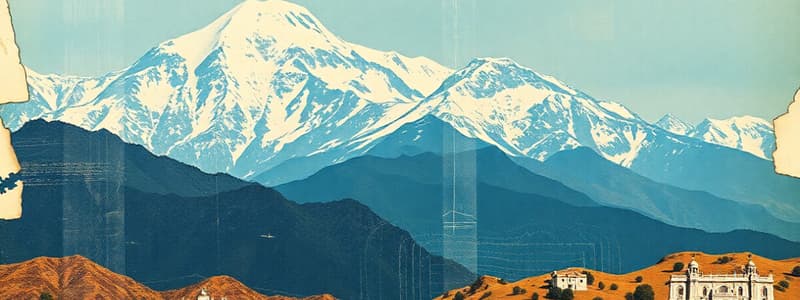
Northern Mountains
- The Northern Mountains encompass the Himalayas
- 'Himalaya' means 'abode of snow' in Sanskrit.
- The Himalayas stretch 2,500 km from the Pamir Knot in the west to Purvanchal in the east.
- Himalayan width varies from 400 km in the west to 150 km in the east.
- The Himalayas are young mountains composed of sedimentary rocks.
- There are three parallel Himalayan ranges: Himadri, Himachal, and Sivalik.
Greater Himalayas or Himadri
- The Greater Himalayas are the northernmost ranges.
- It has an average height of 6,000 meters.
- It has a width between 120 km and 190 km.
- Peaks in this region include:
- Mt Everest (Nepal)
- Kanchenjunga
- Makalu
- Dhaulagiri
- Nanga Parbat.
- These peaks exceeding 8,000 meters are mostly on the country's borders.
- The peaks of this range are perennially covered with snow.
- High passes include:
- Rohtang
- Bara-lacha La
- Shipki La
- Zoji La pass.
Lesser Himalayas or Himachal
- Himachal lies south of the Greater Himalayas.
- These regions have an altitude of 1,000 - 4,500 metres
- It has an average width of 50 km.
- Prominent ranges include:
- Pir Panjal
- Dhaula Dhar
- Mahabharata ranges.
- Popular hill stations include:
- Manali
- Kullu
- Dalhousie
- Mussoorie
- Shimla
- Nainital
- Darjeeling.
- These hill stations are popular among tourists as they are easily accessible.
Outer Himalayas or the Sivaliks
- The Sivaliks comprise the outermost Himalayan range
- It has an altitude of 900 - 1,100 metres
- It has a width between 10 km and 50 km.
- The hills within this range are narrow, discontinuous, and merge with other ranges.
- Valleys between the Sivaliks and Himachal are called 'Duns' such as:
- Dehradun
- Kotlidun
- Patlidun.
- The terai, a densely forested and marshy region, lies at the foothills of the Sivaliks.
Purvanchal Range
- The Purvanchal Range runs along the India-Myanmar border to the east
- It has an average altitude of less than 3,000 metres.
- Different local names depending on location include:
- Patkai Bum and Naga Hills in the north
- the Lushai Hills and Mizo Hills in the south
- the Garo Hills
- Khasi Hills
- Jaintia Hills in Meghalaya.
- The Karakoram range is north of the Himalayas along the border of India, Pakistan and China.
- The Karakoram extends to Afghanistan and Tajikistan
- Most of the peaks in the Karakoram range that cross 8,000 metres are not within India.
Importance of the Himalayas
- Protection from cold north-eastern trade winds from Tibet
- Direction of monsoon winds
- Storehouse of resources
- Source of biodiversity and tourist attraction
- Source of many important rivers
Northern Plains
- The Northern Plains, also called the Gangetic Plains, lie south of the Himalayas and north of the Peninsular Plateau.
- These plains are formed by the alluvial deposits from the rivers Indus, Ganga, and Brahmaputra.
- The plains are about 2,400 kilometers in length.
- This is the most densely populated area of the country.
- The plains are fertile due to alluvial sediment and good for crops:
- wheat
- rice
- sugarcane
- pulses
- oilseeds
- jute.
- The Northern Plains are broadly divided into the Western Plain and the Ganga-Brahmaputra Plain.
Western Plain
- The Western Plain is formed by the Indus and its tributaries:
- Jhelum
- Chenab
- Ravi
- Beas
- Sutlej.
- The Jhelum and Chenab flow through Jammu and Kashmir.
- The Ravi, Beas, and Sutlej flow through the Punjab-Haryana plains.
- A major portion of this plain is in Pakistan.
- Doabs are found in the plains of Punjab.
Ganga-Brahmaputra Plain
- The Ganga-Brahmapurta plain is formed by the deposition of sediments brought by the two main river systems-the Ganga and the Brahmaputra.
- The Yamuna is Ganga's most important tributary.
- Both the Yamuna and the Ganga originate in the Himalayas.
- The Brahmaputra originates in Tibet, where it is known as Tsangpo.
- It flows east and turns south, flowing westwards through Assam.
- The Ganga Plain extends between the Ghaggar and Teesta rivers.
- The Brahmaputra Plain forms the eastern part of the northern plains.
- The Brahmaputra meets the Ganga in Bangladesh as Padma, forming the world's largest delta.
Importance of the Northern Plains
- Fertile soil and water resources.
- The plains are rich agricultural lands making them the granaries of India
- Flat surface, slow rivers and suitable climate.
- A good network of roads and railways has led to industrialisation and assisted the economy.
Peninsular Plateau
- The Peninsular Plateau is the largest and oldest hard rock formation.
- It is a triangular-shaped tableland part of Gondwanaland.
- The Peninsular Plateau is divided into the Central Highlands and Deccan Plateau.
Central Highlands
- The Central Highlands extend from the Narmada River to the Northern Plains.
- It is bounded by the Aravallis to the west and the Satpura range to the south.
- The eastern extension of the Central Highlands consists of the Rajmahal hills.
- The Malwa and Chhota Nagpur Plateaus are part of the Central Highlands.
- Betwa, Chambal and Ken are rivers that flow in the Malwa Plateau.
- Mahadeo, Kaimur and Maikal are hills of the Chhota Nagpur Plateau.
Deccan Plateau
- The Deccan Plateau is separated from the Chhota Nagpur Plateau by a geological fault.
- The black soil area in the Deccan Plateau is known as the Deccan Trap Region.
- The Deccan Trap Region is formed by volcanic eruptions.
- This soil is suitable for cotton and sugarcane crops.
- The Deccan Plateau is divided into the Western Ghats and the Eastern Ghats.
Western Ghats
- The Western Ghats are a mountain range running parallel to the western coast.
- It is also known as Sahyadri Ghats.
- The Western Ghats are continuous and can be crossed through passes (Thal Ghat, Bhor Ghat, Pal Ghat).
- The highest peak in this region is Anamudi (2,695 metres).
- Famous waterfalls here include:
- Jog Falls on the Sharavati River
- Shivasamudram Falls on the Kaveri River.
Eastern Ghats
- The Eastern Ghats consist of discontinuous low mountains.
- They run parallel to the eastern coast from the south of Mahanadi Valley to the Nilgiri Hills.
- The highest peak in this region is Mahendragiri (1,501 metres).
- The Mahanadi, Godavari, Krishna, and Kaveri river systems drain this area.
- The Nilgiri Hills connect the Western and Eastern Ghats in the south.
The Great Indian Desert
- The Great Indian Desert, also known as the Thar Desert, lies to the north-west of the Aravalli Hills.
- This region gets very little annual rainfall (less than 150 millimetres).
- It has a very dry climate.
- It has a region of inland drainage.
- The Luni is the only large river that flows through this region.
- The Sambhar Lake is the largest of several salt lakes.
- Crescent-shaped dunes (barchans) can be found in this area.
Coastal Plains
- The Coastal Plains in India run parallel to the Arabian Sea and the Bay of Bengal.
- On the basis of location, they are divided into the western and eastern coastal plains.
Western Coastal Plain
- The western coastal plain extends from Rann of Kutch in Gujarat to Kanyakumari in Tamil Nadu.
- It has four divisions:
- Kutch and Kathiawar Coast in Gujarat
- Konkan Coast in Maharashtra
- Goan Coast in Goa and Karnataka
- Malabar Coast in Kerala
- The western coast is narrow in the middle and gets broader towards the north and south.
- The rivers in the western coast do not form a delta.
Eastern Coastal Plain
- The eastern coastal plain extends along the Bay of Bengal.
- It is broader than its western counterpart.
- It is an emergent coastal plain.
- It has fewer ports and harbours in comparison to the western coast
- The eastern coast has well-developed deltas formed by the rivers:
- Mahanadi
- Godavari
- Krishna
- Kaveri.
Islands
- There are two major island groups in India:
- the Andaman and Nicobar Islands in the Bay of Bengal
- the Lakshadweep Islands in the Arabian Sea.
Andaman and Nicobar Islands
- The Andaman and Nicobar Islands are found within the Bay of Bengal and consist of 204 islands.
- The two islet groups:
- Ritchie's Archipelago
- Labyrinth Islands.
- An active volcano called Barren Volcano is located on Barren Island in the Andaman Islands.
- The Andaman Islands are separated from the Nicobar Islands by the Ten Degree Channel.
Lakshadweep Islands
- The Lakshadweep Islands are located in the Arabian Sea and include 43 islands.
- They are located near the Malabar Coast of Kerala.
- These islands were formed by corals.
- Minicoy is the largest amongst the Lakshadweep Islands.
- The eastern Deccan Plateau, called Telangana, is made of vast sheets of massive granite rock, which effectively traps rainwater.
Studying That Suits You
Use AI to generate personalized quizzes and flashcards to suit your learning preferences.


