Podcast
Questions and Answers
What is the approximate length of the Nico Ditch?
What is the approximate length of the Nico Ditch?
- 20 kilometers
- 9.7 kilometers (correct)
- 5 kilometers
- 15 kilometers
In which English region is the Nico Ditch located?
In which English region is the Nico Ditch located?
- Yorkshire
- Merseyside
- Lancashire
- Greater Manchester (correct)
What was a possible original purpose of the Nico Ditch?
What was a possible original purpose of the Nico Ditch?
- Transportation route
- Defensive fortification (correct)
- Irrigation canal
- Agricultural boundary
During which period was the Nico Ditch likely constructed?
During which period was the Nico Ditch likely constructed?
What is the meaning of 'magnum fossatum'?
What is the meaning of 'magnum fossatum'?
What is the suspected origin of the name 'Nico'?
What is the suspected origin of the name 'Nico'?
Through which of these locations does the Nico Ditch pass?
Through which of these locations does the Nico Ditch pass?
The Nico Ditch coincides with boundaries between which boroughs?
The Nico Ditch coincides with boundaries between which boroughs?
What event could the Nico Ditch have been built to defend against, according to legend?
What event could the Nico Ditch have been built to defend against, according to legend?
What gave the towns of Gorton and Reddish their names, according to popular 19th century folklore?
What gave the towns of Gorton and Reddish their names, according to popular 19th century folklore?
What shape is the Nico Ditch?
What shape is the Nico Ditch?
What does the U-shape of the Nico Ditch suggest?
What does the U-shape of the Nico Ditch suggest?
In which park is a well-preserved section of the Nico Ditch located?
In which park is a well-preserved section of the Nico Ditch located?
What designation protects a segment of the Nico Ditch in Platt Fields?
What designation protects a segment of the Nico Ditch in Platt Fields?
What is the width of the Nico Ditch?
What is the width of the Nico Ditch?
Why might the section that was north of the bank be of 20th century origin?
Why might the section that was north of the bank be of 20th century origin?
What is Mykelldiche?
What is Mykelldiche?
What does the name Gorton translate to?
What does the name Gorton translate to?
What does the name Reddish translate to?
What does the name Reddish translate to?
Flashcards
Nico Ditch
Nico Ditch
A 6-mile long linear earthwork in Greater Manchester, England, likely built as a defensive fortification or boundary marker.
Nico Ditch construction period
Nico Ditch construction period
From 5th to 11th century, between the end of Roman rule and the Norman conquest.
Nico Ditch dimensions
Nico Ditch dimensions
The ditch is 4–5 yards wide and up to 5 feet deep where it has survived.
Possible origin of 'Nico'
Possible origin of 'Nico'
Signup and view all the flashcards
Nico Ditch course
Nico Ditch course
Signup and view all the flashcards
Nico Ditch purpose
Nico Ditch purpose
Signup and view all the flashcards
Historical event linked by legend
Historical event linked by legend
Signup and view all the flashcards
Origins of Gorton and Reddish names
Origins of Gorton and Reddish names
Signup and view all the flashcards
Modern interpretation of Nico Ditch
Modern interpretation of Nico Ditch
Signup and view all the flashcards
Best preserved Nico Ditch remains
Best preserved Nico Ditch remains
Signup and view all the flashcards
Protected section of Nico Ditch
Protected section of Nico Ditch
Signup and view all the flashcards
Study Notes
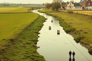
- Nico Ditch is a 6 mi (9.7 km) linear earthwork in Greater Manchester, England, stretching between Ashton-under-Lyne and Stretford.
- Dating from the 5th to 11th century, it may have served as a defensive fortification or boundary marker.
- Surviving sections measure 4–5 yards (3.7–4.6 m) wide and up to 5 ft (1.5 m) deep.
- A portion of Nico Ditch is protected as a Scheduled Ancient Monument.
Etymology
- The earliest reference to the ditch appears in a charter from 1190–1212, granting land in Audenshaw to Kersal Cell monks, calling it "Mykelldiche" and magnum fossatum ("large ditch" in Latin).
- The name Nico, or Nikker, emerged in the 19th and 20th centuries.
- Nico may come from the Anglo-Saxon Hnickar, a water spirit, but likely evolved from Mykelldiche, where micel means "big".
- Another possible origin for Nico is the Anglo-Saxon verb nǽcan, meaning "kill".
Course
- Nico Ditch covers the area between Ashton Moss in Ashton-under-Lyne and Hough Moss, east of Stretford.
- It traverses through Denton, Reddish, Gorton, Levenshulme, Burnage, Rusholme, Platt Fields Park, Withington, and Chorlton-cum-Hardy.
- The ditch crosses four metropolitan boroughs in Greater Manchester.
- It aligns with parts of boundaries between Stockport and Manchester, and Tameside and Manchester.
- The ditch extends up to Denton Golf Course, with a section lying beneath the Audenshaw Reservoirs.
- It may have stretched west beyond Stretford to Urmston.
History
- The earthwork was built between the 5th and 11th centuries, after Roman rule and before the Norman conquest.
- Its original purpose is debated but may be defensive or to mark an administrative border.
- It may have defined a 7th-century boundary for Anglo-Saxon expansion, or a boundary in the 8th or 9th century between Mercia and Northumbria.
- During the early medieval period, Northumbria, Mercia, and Wessex competed for control of North West England, alongside Britons and Danes.
- The ditch has served as a boundary since at least the Middle Ages.
- According to legend, the inhabitants of Manchester constructed Nico Ditch in a single night for protection against Viking invaders in 869–870.
- It was rumored that the nearby towns Gorton and Reddish got their names from a battle at the ditch – "Gore Town" and "Red-Ditch" – but historians dismiss this. The names actually mean "dirty farmstead" and "reedy ditch".
- Historians and antiquarians have studied the ditch since the 19th century, but much of it has been built over.
- From 1990 to 1997, the University of Manchester Archaeological Unit excavated parts of the ditch to find its age and purpose.
- Investigations showed the bank north of the ditch originated in the 20th century.
- The U-shaped ditch profile suggests that it marked a territorial boundary rather than serving as a military defense.
- The project concluded that the ditch was likely a boundary marker.
Preservation
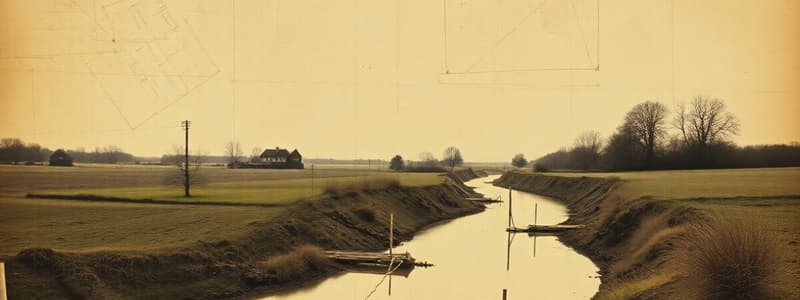
- Despite weathering, short sections of the ditch remain visible, measuring 4–5 yards (3.7–4.6 m) wide and up to 5 feet (1.5 m) deep.
- A 330-yard (300 m) stretch in Denton Golf Course and a section in Platt Fields Park are the best-preserved parts.
- In 1997, a 150-yard (140 m) segment in Platt Fields was protected as a Scheduled Ancient Monument, but the rest is unprotected.
Studying That Suits You
Use AI to generate personalized quizzes and flashcards to suit your learning preferences.