Podcast
Questions and Answers
What is described as physical features such as mountains and valleys with contour lines that show height on a map?
What is described as physical features such as mountains and valleys with contour lines that show height on a map?
- Physical Map
- Political Map
- Topographical Map (correct)
- Thematic Map
What does the Equator represent in terms of geographic classification?
What does the Equator represent in terms of geographic classification?
- Prime Meridian
- Tropic of Cancer
- Line of Latitude (correct)
- Line of Longitude
If a map scale indicates that 1 cm represents 100 miles and a distance measures 3 cm on the map, what is the actual distance?
If a map scale indicates that 1 cm represents 100 miles and a distance measures 3 cm on the map, what is the actual distance?
- 100 miles
- 150 miles
- 200 miles
- 300 miles (correct)
Which line divides the Earth into the Eastern and Western Hemispheres?
Which line divides the Earth into the Eastern and Western Hemispheres?
Lines of latitude and longitude are described as what type of lines?
Lines of latitude and longitude are described as what type of lines?
What is the main purpose of a key/legend on a map?
What is the main purpose of a key/legend on a map?
Which of the following statements is true about an atlas?
Which of the following statements is true about an atlas?
How many continents are there in the world?
How many continents are there in the world?
What feature of a map helps determine how big the things shown are and the real distances?
What feature of a map helps determine how big the things shown are and the real distances?
Which of the following is NOT a feature or element of a map?
Which of the following is NOT a feature or element of a map?
In a physical map, what type of features does it document?
In a physical map, what type of features does it document?
If you are located at the library on a community map, which statement is most likely true?
If you are located at the library on a community map, which statement is most likely true?
What is the correct definition of a cartographer?
What is the correct definition of a cartographer?
Flashcards are hidden until you start studying
Study Notes
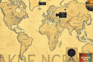
Map Quiz Study Notes
-
Cartographer: A person who produces or draws maps.
-
Atlas: A collection of maps compiled in a book format.
-
Flat Maps vs. Globe: World maps depict a globe's representation when it is flattened out.
-
Map Features:
- Title: Indicates the subject of the map.
- Legend (Key): Explains symbols used on the map.
- Direction: Often indicated by a compass rose.
- Scale: Shows the relationship between map distance and real-world distance.
-
Legend/Key: It represents symbols corresponding to real-world objects on a map, aiding in navigation and understanding.
-
Community Map Analysis:
- Number of food places can be determined by the community map.
- Location of key places, like libraries and post offices, can be inferred from the map.
-
Continents: There are seven (7) continents globally.
-
Physical Map: Represents landscape features such as mountains, rivers, and valleys.
-
Smallest Continent: Asia is not the smallest continent; Australia holds that title.
-
Map Scale Importance: A scale helps determine the real distances between locations depicted on the map.
-
Geographical Neighbors: Afghanistan is a neighboring country of Pakistan.
-
Imaginary Lines: Latitude runs east to west (not north to south), while lines of latitude and longitude are imaginary tools used for navigation.
-
Topographical Maps: Show detailed physical features, including elevations and contours of terrain.
-
Prime Meridian: Divides the Earth into eastern and western hemispheres.
-
Map Measurement Example: If the scale indicates that 1 cm equals 100 miles, a distance of 3 cm on a map represents 300 miles in reality.
-
Equator: A line of latitude, it divides the Earth into northern and southern hemispheres.
Studying That Suits You
Use AI to generate personalized quizzes and flashcards to suit your learning preferences.