Podcast
Questions and Answers
What type of map specifically indicates national and state boundaries, as well as capital cities?
What type of map specifically indicates national and state boundaries, as well as capital cities?
- Topographic maps
- Physical maps
- Political maps (correct)
- Thematic maps
What term is used to describe the relationship between distances on the map and actual distances on Earth?
What term is used to describe the relationship between distances on the map and actual distances on Earth?
- Projection
- Key
- Scale (correct)
- Contouring
Which color is typically used on maps to represent water?
Which color is typically used on maps to represent water?
- Brown
- Green
- Yellow
- Blue (correct)
What does a contour interval represent on a map?
What does a contour interval represent on a map?
What is the role of the grid pattern found on most maps?
What is the role of the grid pattern found on most maps?
What is the primary purpose of a Stop Order in construction?
What is the primary purpose of a Stop Order in construction?
Under what circumstances can a person appeal to the Minister regarding a Development Order?
Under what circumstances can a person appeal to the Minister regarding a Development Order?
What is the statutory time limit for applying an Enforcement Notice?
What is the statutory time limit for applying an Enforcement Notice?
How long does a person have to appeal after being served an Enforcement Notice?
How long does a person have to appeal after being served an Enforcement Notice?
What is the role of the Minister regarding appeals on Enforcement Notices?
What is the role of the Minister regarding appeals on Enforcement Notices?
What is the definition of 'development' according to the Town and Country Planning Act?
What is the definition of 'development' according to the Town and Country Planning Act?
Which of the following is NOT a role of the local government?
Which of the following is NOT a role of the local government?
What is the operational date of the Town and Country Planning Act?
What is the operational date of the Town and Country Planning Act?
Which of the following municipalities is located in the Cornwall region?
Which of the following municipalities is located in the Cornwall region?
The Local Improvements Act governs which of the following?
The Local Improvements Act governs which of the following?
What is a primary goal of the Town and Country Planning Act?
What is a primary goal of the Town and Country Planning Act?
Which of the following is a responsibility of municipal corporations?
Which of the following is a responsibility of municipal corporations?
Which of the following statements is true regarding the roles of local governments?
Which of the following statements is true regarding the roles of local governments?
What is the primary reason for conducting pre-consultation in the development process?
What is the primary reason for conducting pre-consultation in the development process?
Which of the following is NOT one of the key professional organizations involved in team selection?
Which of the following is NOT one of the key professional organizations involved in team selection?
What action can NEPA take if the stipulated conditions of a permit are not upheld?
What action can NEPA take if the stipulated conditions of a permit are not upheld?
What is an essential component of the decision-making process for planning permission applications?
What is an essential component of the decision-making process for planning permission applications?
What does post permit monitoring by NEPA involve?
What does post permit monitoring by NEPA involve?
What is one purpose of the drafting and finalizing plans stage?
What is one purpose of the drafting and finalizing plans stage?
Which is a reason for facilities to undertake self-monitoring?
Which is a reason for facilities to undertake self-monitoring?
Which of the following stages is NOT part of the development process?
Which of the following stages is NOT part of the development process?
What is the main goal of the COP 21 commitment regarding climate change?
What is the main goal of the COP 21 commitment regarding climate change?
Which of the following is a major risk for the Caribbean due to climate change?
Which of the following is a major risk for the Caribbean due to climate change?
What is considered a key investment priority in climate-smart real estate?
What is considered a key investment priority in climate-smart real estate?
Which building feature is associated with traditional sustainability in architecture?
Which building feature is associated with traditional sustainability in architecture?
What type of building is the Courtyard Marriott Kingston certified for?
What type of building is the Courtyard Marriott Kingston certified for?
What issue is directly linked to rising temperatures in the Caribbean?
What issue is directly linked to rising temperatures in the Caribbean?
Which of the following building practices is aimed at waste reduction?
Which of the following building practices is aimed at waste reduction?
What does the phrase 'Do the best you can until you know better' emphasize?
What does the phrase 'Do the best you can until you know better' emphasize?
Flashcards are hidden until you start studying
Study Notes
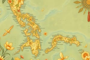
Map Features
- Maps are scale models of reality, showing the relationship between map distances and actual distances on Earth.
- Scale can be represented graphically, verbally, or as a representative fraction.
- Symbols represent geographic features, using colors, lines, and shapes.
- Maps usually include a legend, or key, to explain symbols and the map's scale.
- Contour lines connect points of equal elevation above sea level.
- Contour intervals indicate the difference in elevation between lines, typically 5 meters for 1:25,000 scale maps.
- Widely spaced lines indicate a gentle slope, while closely spaced lines indicate a steep slope.
- Grid patterns, often using latitude and longitude lines, help locate places on the map.
- Latitude lines run east-west, parallel to the equator.
- Longitude lines run north-south, from pole to pole.
- Coordinates, the intersection of latitude and longitude lines, identify exact locations.
Town and Country Planning Act
- Aims for the orderly and progressive development of land and cities, preserving and improving amenities.
- Became operational on February 1, 1958, and was last amended on January 1, 1999.
Local Improvements Act
- Governs land subdivision island-wide, outlining requirements for subdivision, map submissions, approval, and appeals.
- Requires permits and licenses, subject to National Environment and Planning Agency (NEPA) review.
Local Government
- Local government responsibilities include:
- Developing, managing, and maintaining infrastructure like roads, water supplies, parks, and markets.
- Regulating building and planning approvals, licensing businesses, and street parking.
- Coordinating inter-agency collaboration among organizations involved in local services and development.
- Supporting national policies and development programs locally.
- Leading parish-specific plans and initiatives.
Municipal Corporations
- Cornwall includes:
- St. James
- Westmoreland
- Hanover
- St. Elizabeth
- Trelawny
- Middlesex includes:
- Kingston and St. Andrew
- St. Ann
- St. Catherine
- St. Mary
- Clarendon
- Surrey includes:
- Portland
- St. Thomas
- Portmore is a separate municipality.
Development Process
- Stages of the development process:
- Pre-consultation
- Team selection
- Drafting
- Finalizing plans
- Decision-making
- Appeals
- Construction
- Monitoring and enforcement.
Pre-Consultation
- Recommended to save time and money, ensure design alignment with available facilities, achieve acceptable design standards, and consider current and future land use.
Team Selection
- Involves professional organizations such as:
- Jamaica Institute of Architects (JIA)
- Jamaica Institute of Planners (JIP)
- Jamaica Institution of Engineers (JIE)
- Land Surveyors Association of Jamaica
- Association of Land Economy and Valuation Surveyors (ALEVS).
- Additionally, includes construction team specialists, project management, legal and financial advisors, and social and environmental advisors.
Drafting and Finalizing Plans
- Involves:
- Enquiries or applications
- Team management
- Revisions based on feedback
- Submissions according to requirements
- Payment of fees
- Confirmation of receipt
- Presentation and response to queries.
Decision-making
- Applications for planning permission are made to the local planning authority with necessary drawings.
- The authority may grant permission with or without conditions, refuse the application, or subject it to National Resources Conservation Authority (NRCA) review for environmental considerations.
- Development Orders provide guidance on permission categories and types.
Construction, Monitoring, and Enforcement
- Construction implements approved development plans.
- Approving bodies monitor permits and licenses.
- A Stop Order is issued when development breaches approved conditions, lacks permission, or poses a public hazard.
- An Enforcement Notice is issued when development occurs without permission, or contradicts approved conditions, after a Development Order is in place.
Appeals Process
- Appeals to the Minister, under the Town and Country Planning Act (TCPA), cover:
- Development of land, including refusals, approvals with conditions, delays in response, or outline applications requiring additional information.
- Serving of Enforcement Notices, related to unauthorized use changes, illegal building construction, and condition non-compliance.
- An Enforcement Notice can be appealed within 14 days.
- The Minister may hear the appeal, appoint a panel, and provide a report within 21 days.
- Further appeal to the Court of Appeal is available if dissatisfied with the Minister's decision.
#1point5toStayAlive – Small Island Developing States (SIDS)
- Global commitments aim to achieve net-zero emissions by 2050, limiting warming to 1.5°C above pre-industrial levels.
- Policies impacting the real estate sector include carbon pricing, building efficiency standards, and renewable energy mandates.
- COP27 focused on loss and damage due to climate change.
Our Caribbean Situation
- 70% of Caribbean people live in coastal settlements at or near sea level.
- The region faces tropical storms and hurricanes for 50% of the year.
- Climate events could impact 10% of Caribbean economies (US$22 Billion) by 2050.
Climate-Driven Property Risk
- Flood insurance is affected by sea level rise and coastal and inland flooding.
- Fire insurance increases due to the risk of bushfires.
- Rising temperatures and air quality degradation lead to increased energy costs.
- Investments in high-risk locations raise concerns.
Climate Smart Real Estate
- Climate resilience is emphasized as an investment priority.
- Examples include:
- Courtyard Marriott Kingston's LEED Silver certification for new construction in 2017.
- Net-Zero Energy Building at the University of the West Indies (UWI) and a home in Antigua.
- Conservation and management of potable water.
- Building Life Cycle Waste Reduction (Circular Economies).
Traditional Sustainability
- Heat-reducing verandas, sunlight filters, rainwater collection, elevated structures cross ventilation, airflow louvers, and wind-resistant roofs promote traditional sustainability.
- "Do the best you can until you know better. Then when you know better, do better." - Maya Angelou.
Studying That Suits You
Use AI to generate personalized quizzes and flashcards to suit your learning preferences.