Podcast
Questions and Answers
What is the main purpose of using WGS-84?
What is the main purpose of using WGS-84?
- To confuse global positioning systems.
- To define a unified standard for geographic information. (correct)
- To calculate the distance between great circles.
- To describe the shape of the Earth accurately.
How does a great circle differ from a loxodrome in navigation?
How does a great circle differ from a loxodrome in navigation?
- A great circle represents the shortest distance between two points, unlike a loxodrome. (correct)
- A great circle cuts all meridians at the same angle while a loxodrome does not.
- A great circle is a path of constant angle while a loxodrome involves variable angles.
- A loxodrome is the path of the fastest route, while a great circle is the slowest.
What describes the shape of the Earth's geoid?
What describes the shape of the Earth's geoid?
- It is an exact sphere with no deviations.
- It represents only the highest elevations of the Earth.
- It is a flat surface with no curvature.
- It has slight undulations and does not perfectly match a sphere. (correct)
What happens to the bearing when traveling along a great circle?
What happens to the bearing when traveling along a great circle?
In which projection are loxodromic lines represented as straight?
In which projection are loxodromic lines represented as straight?
What does the term 'Graticule' refer to in map projections?
What does the term 'Graticule' refer to in map projections?
Which of the following describes a Conical Projection?
Which of the following describes a Conical Projection?
What is the purpose of the Standard Parallel in map projections?
What is the purpose of the Standard Parallel in map projections?
How is the Constant of Cone mathematically expressed?
How is the Constant of Cone mathematically expressed?
What does the Scale Factor indicate?
What does the Scale Factor indicate?
Which of the following is true about a Radial Scale Factor (RSF)?
Which of the following is true about a Radial Scale Factor (RSF)?
What does the term 'Datum' represent in mapping?
What does the term 'Datum' represent in mapping?
Which of the following best describes a Generating Globe?
Which of the following best describes a Generating Globe?
Flashcards are hidden until you start studying
Study Notes
Map Projection Fundamentals
-
Map Projection: A method to represent the curved surface of the Earth onto a flat surface.
-
Graticule: A network of parallels (lines of latitude) and meridians (lines of longitude) displayed on a map, representing the Earth's grid system.
-
Generating Globe: A model of the Earth used as a reference for creating projections. It's often a wire or glass globe.
-
Developable Surface: A geometric shape onto which the Earth's surface is projected. Common surfaces include cones and cylinders.
-
Cone Projection Examples:
- Conical Projection with one standard parallel
- Conical Projection with two standard parallels
- Bonne's Projection
- Polyconic Projection
-
Cylindrical Projection Examples:
- Cylindrical Equal Area Projection
- Cylindrical Equi-Distant Projection
- Mercator's Projection
-
Standard Parallel: The parallel of latitude where the developable surface touches the generating globe. The scale is most accurate along this parallel.
-
Central Meridian: The central meridian on which the radial scale (scaling in a straight line outward from the central meridian) is accurate. Distortion increases further from the central meridian.
-
Constant of Cone: This value relates the angle at the vertex of a cone to the angle of the pole on the generating globe, and it helps define the conical projection. The formula is: Constant of Cone (n) = α/360, where α is the angle of the cone's vertex.
-
Scale Factor: The ratio between the map's scale and the real-world scale, or the ratio of a distance on the map to the actual distance on the ground.
Types of Scale Factors
-
Tangential Scale Factor (TSF): Compares the length of a parallel of latitude on the globe to the length of the same parallel on the map.
-
Radial Scale Factor (RSF): Compares the length of a meridian on the globe to the length of the same meridian on the map.
Datum & Geoid
-
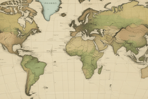
Datum: A reference surface that defines the position of points on the Earth. The most common datum is the World Geodetic System 1984 (WGS-84), which is based on the mean sea level.
-
Geoid: The actual shape of the Earth, which is an irregular, slightly flattened sphere.
Orthodrome & Loxodrome (Great Circle & Rhumb Line)
-
Great Circle (Orthodrome): The shortest distance between two points on the surface of the Earth. On a great circle, the compass bearing changes constantly.
-
Rhumb Line (Loxodrome): A line that intersects all meridians at a constant angle. On a rhumb line, the compass bearing remains the same. Loxodromes appear as straight lines on Mercator's Projection.
Studying That Suits You
Use AI to generate personalized quizzes and flashcards to suit your learning preferences.