Podcast
Questions and Answers
What is a significant distortion issue present in the Robinson projection?
What is a significant distortion issue present in the Robinson projection?
- Antarctica appears very large compared to its actual size. (correct)
- All continents appear larger than they are.
- Ocean sizes are exaggerated.
- Greenland appears flattened from north to south. (correct)
Which type of map projection is known for accurately representing true area?
Which type of map projection is known for accurately representing true area?
- Sinusoidal projection (correct)
- Robinson projection
- Conic projection
- Mercator projection
What is a limitation of the Lambert's Conic projection?
What is a limitation of the Lambert's Conic projection?
- It accurately shows true direction.
- It can display the entire world on a flat surface.
- It requires less map distortion than other projections.
- It distorts size and shape and can only show half of the world. (correct)
What is a defining feature of the Mercator projection?
What is a defining feature of the Mercator projection?
Which map projection is best known for combining various map benefits yet inevitably distorts some spatial relationships?
Which map projection is best known for combining various map benefits yet inevitably distorts some spatial relationships?
What is a primary strength of the Mercator projection?
What is a primary strength of the Mercator projection?
What type of projection is Lambert's map considered?
What type of projection is Lambert's map considered?
In what way does the Peters projection primarily aim to represent spatial information?
In what way does the Peters projection primarily aim to represent spatial information?
Which of the following projections distorts shapes significantly, especially near the poles?
Which of the following projections distorts shapes significantly, especially near the poles?
Which projection is best suited for general use in mid-latitude countries?
Which projection is best suited for general use in mid-latitude countries?
What is the main distortion characteristic of conic projections?
What is the main distortion characteristic of conic projections?
How does the cylindrical projection relate to creating a map?
How does the cylindrical projection relate to creating a map?
What is an essential limitation of all map projections?
What is an essential limitation of all map projections?
What is the latitude of the Equator?
What is the latitude of the Equator?
Which line of latitude is the longest?
Which line of latitude is the longest?
What is the significance of the Prime Meridian?
What is the significance of the Prime Meridian?
How far apart are time zones, based on longitude?
How far apart are time zones, based on longitude?
Which of the following best describes absolute location?
Which of the following best describes absolute location?
Which example best demonstrates relative location?
Which example best demonstrates relative location?
Why do lines of latitude not converge like meridians do?
Why do lines of latitude not converge like meridians do?
What is relative distance?
What is relative distance?
What is emphasized in the spatial organization of human society according to political, historical, cultural, and economic factors?
What is emphasized in the spatial organization of human society according to political, historical, cultural, and economic factors?
Which of the following best describes the impact of spatial perspectives in geography?
Which of the following best describes the impact of spatial perspectives in geography?
Which skill involves analyzing quantitative geographic data represented in various forms?
Which skill involves analyzing quantitative geographic data represented in various forms?
What major geographic concept helps illustrate spatial relationships?
What major geographic concept helps illustrate spatial relationships?
What will understanding scales of analysis reveal in geographic studies?
What will understanding scales of analysis reveal in geographic studies?
What aspect does the concept of 'impacts and interactions' emphasize in geography?
What aspect does the concept of 'impacts and interactions' emphasize in geography?
Which of the following is a characteristic of qualitative geographic analysis?
Which of the following is a characteristic of qualitative geographic analysis?
How do geographers typically define regions?
How do geographers typically define regions?
Which type of scale refers to a map that covers the entire planet?
Which type of scale refers to a map that covers the entire planet?
What distinguishing feature does 'small scale' refer to in terms of fractions?
What distinguishing feature does 'small scale' refer to in terms of fractions?
Which phenomenon is more likely to be reflected in a clustered pattern on a map?
Which phenomenon is more likely to be reflected in a clustered pattern on a map?
What might affect the conclusion drawn about unemployment rates based on geographical scale?
What might affect the conclusion drawn about unemployment rates based on geographical scale?
What is the difference between absolute distance and relative distance on a map?
What is the difference between absolute distance and relative distance on a map?
When comparing two maps of the same area with different data scales, what type of conclusions might change?
When comparing two maps of the same area with different data scales, what type of conclusions might change?
What does the term 'dispersal' refer to in map representation?
What does the term 'dispersal' refer to in map representation?
Which of the following best describes the term 'clustering' as related to map patterns?
Which of the following best describes the term 'clustering' as related to map patterns?
What do thematic maps primarily illustrate?
What do thematic maps primarily illustrate?
What is the main function of the map key in a graduated symbol map?
What is the main function of the map key in a graduated symbol map?
How do cartograms differ from traditional maps?
How do cartograms differ from traditional maps?
Which option best defines 'graduated' in the context of graduated symbol maps?
Which option best defines 'graduated' in the context of graduated symbol maps?
What is an important advantage of using a cartogram?
What is an important advantage of using a cartogram?
What should you do first when breaking down a multiple choice question?
What should you do first when breaking down a multiple choice question?
Which of the following describes reference maps accurately?
Which of the following describes reference maps accurately?
What role does prior knowledge play when approaching multiple choice questions?
What role does prior knowledge play when approaching multiple choice questions?
Flashcards
Spatial Organization
Spatial Organization
Geographic patterns, such as population density, are organized based on factors like political boundaries, historical events, cultural practices, and economic activities.
Impacts and Interactions
Impacts and Interactions
Interactions between humans, their environment, and past actions influence present-day situations.
Spatial Process & Societal Change
Spatial Process & Societal Change
Viewing the spatial relationships between different phenomena helps understand human organization and its environmental consequences.
Types of Maps
Types of Maps
Signup and view all the flashcards
Methods of Geographic Data Collection
Methods of Geographic Data Collection
Signup and view all the flashcards
Geographic Effects of Decisions
Geographic Effects of Decisions
Signup and view all the flashcards
Major Geographic Concepts
Major Geographic Concepts
Signup and view all the flashcards
Scales of Analysis
Scales of Analysis
Signup and view all the flashcards
Thematic Maps
Thematic Maps
Signup and view all the flashcards
Graduated Symbol Maps
Graduated Symbol Maps
Signup and view all the flashcards
Cartograms
Cartograms
Signup and view all the flashcards
Reference Maps
Reference Maps
Signup and view all the flashcards
Comprehend the Question
Comprehend the Question
Signup and view all the flashcards
Establish Prior Knowledge
Establish Prior Knowledge
Signup and view all the flashcards
Read Your Answer Options
Read Your Answer Options
Signup and view all the flashcards
Analyze Stimuli and Connect to Question
Analyze Stimuli and Connect to Question
Signup and view all the flashcards
Equator
Equator
Signup and view all the flashcards
Lines of Latitude
Lines of Latitude
Signup and view all the flashcards
What is the longest line of latitude?
What is the longest line of latitude?
Signup and view all the flashcards
Lines of Longitude
Lines of Longitude
Signup and view all the flashcards
Prime Meridian
Prime Meridian
Signup and view all the flashcards
International Date Line
International Date Line
Signup and view all the flashcards
Absolute Location
Absolute Location
Signup and view all the flashcards
Relative Location
Relative Location
Signup and view all the flashcards
Geographic Scale
Geographic Scale
Signup and view all the flashcards
Clustering
Clustering
Signup and view all the flashcards
Dispersal
Dispersal
Signup and view all the flashcards
Absolute Distance
Absolute Distance
Signup and view all the flashcards
Relative Distance
Relative Distance
Signup and view all the flashcards
Absolute Direction
Absolute Direction
Signup and view all the flashcards
Relative Direction
Relative Direction
Signup and view all the flashcards
Elevation
Elevation
Signup and view all the flashcards
Cylindrical Projection
Cylindrical Projection
Signup and view all the flashcards
Mercator Projection
Mercator Projection
Signup and view all the flashcards
Peters Projection
Peters Projection
Signup and view all the flashcards
Conic Projection
Conic Projection
Signup and view all the flashcards
Conic Map
Conic Map
Signup and view all the flashcards
Lambert's Map
Lambert's Map
Signup and view all the flashcards
Planar (Azimuthal) Projection
Planar (Azimuthal) Projection
Signup and view all the flashcards
Gnomonic Projection
Gnomonic Projection
Signup and view all the flashcards
Compromise Projection
Compromise Projection
Signup and view all the flashcards
Cylindrical Projection (e.g., Mercator)
Cylindrical Projection (e.g., Mercator)
Signup and view all the flashcards
Sinusoidal Projection (e.g., Goode's)
Sinusoidal Projection (e.g., Goode's)
Signup and view all the flashcards
Conic Projection (e.g., Lambert's)
Conic Projection (e.g., Lambert's)
Signup and view all the flashcards
Azimuthal (Planar) Projection
Azimuthal (Planar) Projection
Signup and view all the flashcards
Study Notes
AP Human Geography Big Ideas
-
Big Idea 1: Patterns and Spatial Organization (PSO): Spatial patterns and organization of human society are arranged according to political, historical, cultural, and economic factors.
-
Big Idea 2: Impacts and Interactions (IMP): Complex relationships of cause and effect exist among people, their environments, and historical and contemporary actions.
-
Big Idea 3: Spatial Process and Societal Change (SPS): A spatial perspective allows for a focus on the ways phenomena are related to one another in particular places, which in turn allows for the examination of human organization and its environmental consequences.
AP Human Geography Course Skills
-
Concepts and Processes (1.A - 1.E): Analyze geographic theories, approaches, concepts, processes, or models in theoretical and applied contexts.
-
Spatial Relationships (2.A - 2.E): Analyze geographic patterns, relationships, and outcomes in applied contexts.
-
Data Analysis (3.A - 3.F): Analyze and interpret quantitative geographic data represented in maps, tables, charts, graphs, satellite images, and infographics.
-
Source Analysis (4.A - 4.F): Analyze and interpret qualitative geographic information represented in maps, images (i.e., satellite, photographs, cartoons), and landscapes.
-
Scale Analysis (5.A - 5.D): Analyze geographic theories, approaches, concepts, processes, and models across geographic scales to explain spatial relationships.
Unit I Learning Requirements
-
Topic 1.1: Identify types of maps, the types of information presented in maps, and different kinds of spatial patterns and relationships portrayed in maps.
-
Topic 1.2: Identify different methods of geographic data collection.
-
Topic 1.3: Explain the geographical effects of decisions made using geographical information.
-
Topic 1.4: Define major geographic concepts that illustrate spatial relationships.
-
Topic 1.5: Explain how major geographic concepts illustrate spatial relationships.
-
Topic 1.6: Define scales of analysis used by geographers and explain what scales of analysis reveal.
-
Topic 1.7: Describe different ways that geographers define regions.
Topic 1.1 Introduction to Maps
-
Geography is the why of where.
-
Subfields:
-
Physical geography studies the physical natural environment
-
Human geography studies human and human societies.
-
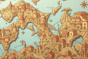
Types of Maps:
-
Reference maps for general information about places (political and physical)
-
Thematic maps for spatial aspects of information or a phenomenon (choropleth, dot-density, isoline, graduated symbol, and cartogram).
-
Spatial Patterns: Absolute location (latitude, longitude, addresses), relative location (relation to other things), distance, direction, clustering, dispersal, and elevation.
-
Maps and Scale: Maps are reductions of the actual land, and scale is the ratio between the size of things in real world and the size on the map. Cartographic scale, geographic scale, and data scale.
-
Map Projections: Map projections inevitably distort spatial relationships (shape, area, distance, and direction). Understanding several types of map projection is essential including: Cylindrical (Mercator), Azimuthal/planar, Conic, Peters, Goode-Homolosine, Winkel Tripel, Robinson.
-
Distortions: Shape, area, distance, and direction. Each type of projection affects these, and thus, compromises must be made to develop the best map.
Studying That Suits You
Use AI to generate personalized quizzes and flashcards to suit your learning preferences.