Podcast
Questions and Answers
Which is the most accurate way to show the geography of the planet?
Which is the most accurate way to show the geography of the planet?
- A satellite image
- A globe (correct)
- A map
- A compass
What are the cardinal directions?
What are the cardinal directions?
- North, South, East, and West (correct)
- Front, Back, Left, and Right
- Up, Down, Left, and Right
- Northeast, Northwest, Southeast, and Southwest
What are intermediate directions?
What are intermediate directions?
- Directions that are in between the Cardinal directions (correct)
- Directions that are opposite of the Cardinal directions
- Directions that are difficult to understand
- Directions that are used in advanced navigation
What do maps often use to pinpoint your location on the globe?
What do maps often use to pinpoint your location on the globe?
What would dividing the planet right down the middle horizontally be called?
What would dividing the planet right down the middle horizontally be called?
Flashcards
Globe
Globe
A three-dimensional model of the Earth that accurately reflects the Earth's shape and size.
Cardinal Directions
Cardinal Directions
The four main directions: North, South, East, and West.
Intermediate Directions
Intermediate Directions
Directions that are in between the Cardinal directions, such as Northeast, Northwest, Southeast, and Southwest.
Latitude
Latitude
Signup and view all the flashcards
Longitude
Longitude
Signup and view all the flashcards
Study Notes
Geography Representation
- The most accurate way to show the geography of the planet is through a globe, which provides a three-dimensional representation of Earth's surface.
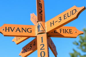
Cardinal Directions
- Cardinal directions are the four main points of a compass: North, South, East, and West.
- These directions are essential for navigation and geographic orientation.
Intermediate Directions
- Intermediate directions are the directions that fall between the cardinal directions: Northeast, Southeast, Northwest, and Southwest.
- They help provide a more precise location and enhance navigation.
Pinpointing Location
- Maps often use a coordinate system, consisting of latitude and longitude, to pinpoint your location on the globe.
- Latitude lines run parallel to the equator, while longitude lines run from pole to pole.
Dividing the Planet
- Dividing the planet horizontally down the middle is called the Equator.
- The Equator separates the Earth into the Northern Hemisphere and the Southern Hemisphere.
Studying That Suits You
Use AI to generate personalized quizzes and flashcards to suit your learning preferences.