Podcast
Questions and Answers
What does a scale on a map help you determine?
What does a scale on a map help you determine?
- The political boundaries of a region
- The elevation of the terrain
- The distance between points on the map (correct)
- The history of the area represented
Which of the following best describes what a political map displays?
Which of the following best describes what a political map displays?
- Elevation levels across landscapes
- Natural features like mountains and rivers
- Human-made boundaries and countries (correct)
- Population density in a region
When referring to cardinal directions, what are the primary directions?
When referring to cardinal directions, what are the primary directions?
- North, East, South, West (correct)
- North, West, East, South, Down
- North, South, East, West, Up
- North, Northeast, South, Southwest
What is the significance of the Prime Meridian in geography?
What is the significance of the Prime Meridian in geography?
How do you interpret latitude and longitude coordinates?
How do you interpret latitude and longitude coordinates?
Flashcards are hidden until you start studying
Study Notes
Geography and Mapping Study Guide
- Geography: The study of the Earth’s landscapes, environments, and the relationships between people and their environments.
- Legend/Key: A guide on a map that explains symbols and colors used for features such as roads, parks, and boundaries.
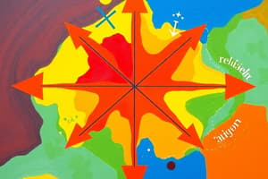
- Compass Rose: A figure on a map displaying the cardinal directions (North, South, East, West) and often intermediate directions (NE, NW, SE, SW).
- Equator: The imaginary line at 0° latitude that divides the Earth into the Northern and Southern Hemispheres.
- Prime Meridian: The line at 0° longitude that divides the Earth into the Eastern and Western Hemispheres.
- Physical Map: A map that uses color and relief to show natural features such as mountains, rivers, and vegetation.
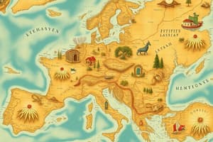
- Political Map: A map that displays governmental boundaries, such as countries, states, and cities.
- Elevation Map: A map indicating the terrain and height of the land, usually represented with contour lines or color shading.
- Historical Map: A map that depicts geographical conditions at a particular time in history, often used to show change over time.
- Cardinal Directions: The four main directions: North, South, East, West.
- Intermediate Directions: Directions that fall between the cardinal points: Northeast (NE), Northwest (NW), Southeast (SE), Southwest (SW).
Memory Aids and Measurement
- Mnemonic for Cardinal Directions: "Never Eat Soggy Waffles" helps recall North, East, South, West.
- Intermediate Directions: Northeast, Northwest, Southeast, Southwest.
- Funny Name for Latitude: Often referred to as "ladder" to help remember it measures the distance north and south of the Equator.
- Labels for Latitude and Longitude: Latitude lines are labeled in degrees north or south of the Equator; longitude lines are labeled in degrees east or west of the Prime Meridian.
- Measure Order of Latitude and Longitude: Start with latitude before longitude when describing a location.
Hemispheres and Map Features
- Hemispheres: Four hemispheres exist: Northern, Southern, Eastern, Western.
- Star on a Map: Indicates the location of a city, often denoting important or capital cities.
- Scale on a Map: A tool used to measure distances; it shows the ratio between distances on the map and actual ground distances.
Studying That Suits You
Use AI to generate personalized quizzes and flashcards to suit your learning preferences.


