Podcast
Questions and Answers
Which mountain range forms a natural barrier between India and Tibet?
Which mountain range forms a natural barrier between India and Tibet?
- Deccan Plateau
- Eastern Ghats
- Western Ghats
- Himalayan Mountain Range (correct)
What primarily characterizes the Indo-Gangetic Plain?
What primarily characterizes the Indo-Gangetic Plain?
- High elevation mountainous area
- Rich alluvial soil supporting agriculture (correct)
- Sandy terrain with sparse vegetation
- Ancient volcanic rocks
Which desert region is recognized as one of the driest in India?
Which desert region is recognized as one of the driest in India?
- Himalayan foothills
- Chota Nagpur Plateau
- Thar Desert (correct)
- Deccan Plateau
What is the primary material that composes the Deccan Plateau?
What is the primary material that composes the Deccan Plateau?
Which of the following statements is true about the Western Ghats?
Which of the following statements is true about the Western Ghats?
What is a key feature of the Andaman and Nicobar Islands?
What is a key feature of the Andaman and Nicobar Islands?
What geological process led to the uplift of the Himalayas?
What geological process led to the uplift of the Himalayas?
Which river is NOT considered one of the major rivers shaping India's landscape?
Which river is NOT considered one of the major rivers shaping India's landscape?
Flashcards are hidden until you start studying
Study Notes
Landforms of India
-
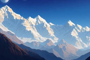
Himalayan Mountain Range
- Extends across northern India; includes some of the world's highest peaks (e.g., Mount Everest).
- Composed of several parallel ranges: Greater Himalayas, Lesser Himalayas, and Outer Himalayas.
- Forms a natural barrier between India and Tibet, influencing climate and weather patterns.
-
Indo-Gangetic Plain
- A vast, fertile plain created by the sediment from the Indus, Ganges, and Brahmaputra rivers.
- Extends from Punjab in the northwest to West Bengal in the east.
- Supports agriculture due to rich alluvial soil.
-
Desert Regions
- Thar Desert: Located in Rajasthan, characterized by sandy terrain and sparse vegetation.
- Experiences extreme temperatures; rainfall is minimal, making it one of the driest regions in India.
-
Plateaus
- Deccan Plateau: A large plateau in south-central India; bounded by the Western and Eastern Ghats.
- Composed of ancient volcanic rocks; rich in minerals and diverse ecosystems.
- Chota Nagpur Plateau: Located in eastern India; known for its mineral resources and dense forests.
-
Western and Eastern Ghats
- Western Ghats: Mountain range running parallel to the western coast; recognized for its biodiversity and endemic species.
- Eastern Ghats: A discontinuous range along the eastern coast; less continuous than the Western Ghats and lower in elevation.
-
Coastal Regions
- India has a long coastline of about 7,517 kilometers, featuring diverse coastal landforms.
- Includes sandy beaches, rocky coastlines, and mangrove forests, particularly in the Sundarbans.
-
Islands
- Andaman and Nicobar Islands: An archipelago in the Bay of Bengal; known for tropical rainforests and coral reefs.
- Lakshadweep Islands: A group of islands off the southwestern coast; known for stunning beaches and marine biodiversity.
-
Plate Tectonics
- The Indian subcontinent is a result of the collision of the Indian Plate with the Eurasian Plate, leading to the uplift of the Himalayas.
- Ongoing tectonic activity contributes to earthquakes and volcanic activity in certain regions.
-
Rivers
- Major rivers include the Ganges, Yamuna, Brahmaputra, Indus, and Godavari.
- These rivers play a crucial role in shaping the landscape, creating valleys and plains, and supporting agriculture.
Himalayan Mountain Range
- Extends across northern India, hosting some of the world’s highest peaks, including Mount Everest.
- Comprises three parallel ranges: Greater Himalayas, Lesser Himalayas, and Outer Himalayas.
- Acts as a natural barrier between India and Tibet, significantly influencing the region's climate and weather patterns.
Indo-Gangetic Plain
- A vast and fertile plain formed by sediment from the Indus, Ganges, and Brahmaputra rivers.
- Stretches from Punjab in the northwest to West Bengal in the east.
- Features rich alluvial soil, making it highly conducive for agriculture.
Desert Regions
- Thar Desert: Located in Rajasthan; known for sandy terrain and minimal vegetation.
- Experiences extreme temperature variations and is one of India's driest areas, with very little rainfall.
Plateaus
- Deccan Plateau: A large plateau in south-central India, bordered by the Western and Eastern Ghats.
- Comprised of ancient volcanic rocks; known for its mineral wealth and biological diversity.
- Chota Nagpur Plateau: Situated in eastern India; recognized for abundant mineral resources and dense forests.
Western and Eastern Ghats
- Western Ghats: Mountain range along the western coast of India, noted for its rich biodiversity and unique endemic species.
- Eastern Ghats: A discontinuous mountain range along the east coast, lower in elevation compared to the Western Ghats and less continuous.
Coastal Regions
- India’s coastline measures approximately 7,517 kilometers, exhibiting a variety of coastal landforms.
- Features include sandy beaches, rocky coastlines, and notable mangrove forests, especially in the Sundarbans region.
Islands
- Andaman and Nicobar Islands: An archipelago in the Bay of Bengal, famous for its tropical rainforests and coral reefs.
- Lakshadweep Islands: Located off the southwestern coast, known for beautiful beaches and rich marine biodiversity.
Plate Tectonics
- The Indian subcontinent formed due to the collision of the Indian Plate with the Eurasian Plate, resulting in the uplift of the Himalayas.
- Ongoing tectonic activity in the region leads to earthquakes and volcanic phenomena.
Rivers
- Major rivers include the Ganges, Yamuna, Brahmaputra, Indus, and Godavari.
- These rivers are crucial in shaping the geographic landscape, forming valleys and plains, and providing vital irrigation for agriculture.
Studying That Suits You
Use AI to generate personalized quizzes and flashcards to suit your learning preferences.


