Podcast
Questions and Answers
What is the approximate daily water usage from the Great Lakes in the United States?
What is the approximate daily water usage from the Great Lakes in the United States?
- 60 billion gallons
- 40 billion gallons (correct)
- 30 billion gallons
- 50 billion gallons
Which body of water directly borders the city of Chicago?
Which body of water directly borders the city of Chicago?
- Lake Michigan (correct)
- Lake Ontario
- Lake Erie
- Lake Superior
Which geographic feature is most likely to provide freshwater to the United States?
Which geographic feature is most likely to provide freshwater to the United States?
- Ocean
- Desert
- Mountain Range
- Great Lakes (correct)
Which of the following statements is true regarding water usage in the United States?
Which of the following statements is true regarding water usage in the United States?
How does the water usage from the Great Lakes compare to overall water consumption in the United States?
How does the water usage from the Great Lakes compare to overall water consumption in the United States?
Which of the following lakes is NOT part of the Great Lakes?
Which of the following lakes is NOT part of the Great Lakes?
What is a primary factor for Chicago’s location by Lake Michigan?
What is a primary factor for Chicago’s location by Lake Michigan?
Which of the following is NOT a significant use of the Great Lakes water?
Which of the following is NOT a significant use of the Great Lakes water?
Which statement about the Great Lakes' water distribution in the U.S. is correct?
Which statement about the Great Lakes' water distribution in the U.S. is correct?
What geographical feature is primarily associated with Ontario as indicated in the information provided?
What geographical feature is primarily associated with Ontario as indicated in the information provided?
Which city is suggested to be near the mentioned geographical feature within Ontario?
Which city is suggested to be near the mentioned geographical feature within Ontario?
What unusual characters are used before the mention of Ontario in the content?
What unusual characters are used before the mention of Ontario in the content?
What is the primary challenge presented by the formatting in the provided content?
What is the primary challenge presented by the formatting in the provided content?
Which of the following is least relevant to the context of the provided geographical information?
Which of the following is least relevant to the context of the provided geographical information?
Which of the following statements accurately describes Mexico's area compared to Canada and the United States?
Which of the following statements accurately describes Mexico's area compared to Canada and the United States?
Which country has the highest population among the three largest countries in North America?
Which country has the highest population among the three largest countries in North America?
What is the primary reason for the population distribution in Canada?
What is the primary reason for the population distribution in Canada?
How many states does the United States have?
How many states does the United States have?
In how many regions are the 50 states of the United States often grouped?
In how many regions are the 50 states of the United States often grouped?
Which factor contributes to Mexico's higher population relative to Canada despite its smaller area?
Which factor contributes to Mexico's higher population relative to Canada despite its smaller area?
What does the population figure for Canada indicate regarding its density?
What does the population figure for Canada indicate regarding its density?
What geographic characteristic is shared among the three largest countries in North America?
What geographic characteristic is shared among the three largest countries in North America?
In comparison to Mexico, how does the United States rank in terms of population?
In comparison to Mexico, how does the United States rank in terms of population?
What is a significant factor contributing to fewer people living in northern Canada?
What is a significant factor contributing to fewer people living in northern Canada?
What is one primary benefit of grouping landform regions?
What is one primary benefit of grouping landform regions?
In which decade did Robert Louis Stevenson arrive in New York City, according to the photograph mentioned?
In which decade did Robert Louis Stevenson arrive in New York City, according to the photograph mentioned?
Which body of water is directly associated with New York Harbor?
Which body of water is directly associated with New York Harbor?
What aspect of landform regions allows for easier geographic analysis?
What aspect of landform regions allows for easier geographic analysis?
In the context of U.S. geography, what is a significant characteristic of landform regions?
In the context of U.S. geography, what is a significant characteristic of landform regions?
What historical significance does New York Harbor hold in the context of United States development?
What historical significance does New York Harbor hold in the context of United States development?
Which factor does NOT contribute to the differences between landform regions?
Which factor does NOT contribute to the differences between landform regions?
How can landform regions impact urban development?
How can landform regions impact urban development?
Flashcards are hidden until you start studying
Study Notes
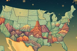
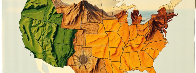
Landform Regions in the United States
- Landform regions facilitate comparison and contrast of different areas within the country.
- Various landform regions exist in the United States, influencing population distribution and settlement patterns.
Comparison of North America Countries
- Canada has a land area of 3,855,100 square miles with a population of 33,212,696.
- The United States covers 3,718,700 square miles and has a population of 303,824,646.
- Mexico, with an area of 761,600 square miles, has a higher population of 109,955,400 than Canada.
- Canada’s population is concentrated near its southern border, unlike the more spread-out population in Mexico.
Urban Areas and Resources
- New York Harbor in the 1890s marked significant historical arrival points, including that of Robert Louis Stevenson.
- Chicago, located on the shore of Lake Michigan, is a major American city utilizing over 40 billion gallons of water from the Great Lakes daily.
Geographic Relationships
- The three largest countries in North America are Canada, the United States, and Mexico.
- Each of the 50 states in the United States is grouped into five distinct regions, providing insights into their similarities and differences.
Studying That Suits You
Use AI to generate personalized quizzes and flashcards to suit your learning preferences.