Podcast
Questions and Answers
Which of the following correctly describes how a cartographer aims to represent reality in a map?
Which of the following correctly describes how a cartographer aims to represent reality in a map?
- By stylizing and abstracting features without careful consideration of the map's interpretability.
- By including all visible and invisible phenomena regardless of their relevance to the map's purpose.
- By selecting features and adding invisible phenomena that are essential to fulfill the map's purpose and suitable for its scale. (correct)
- By focusing solely on static situations, ignoring the dynamic changes in geographic regions over time.
How does 'map interpretation' build upon 'map analysis', according to the presented framework?
How does 'map interpretation' build upon 'map analysis', according to the presented framework?
- Map interpretation is limited to understanding spatial patterns, while map analysis includes insight, prediction, and decision.
- Map interpretation aims to explain patterns noticed during map analysis to derive insights, predictions, and inform decision-making. (correct)
- Map interpretation focuses solely on identifying locations and features, while map analysis explains potential decisions without understanding patterns .
- Map interpretation involves the objective determination of what the map maker has depicted, while map analysis focuses on insight, predication and decision.
Which of the following scenarios best exemplifies how overlaying multiple maps can reveal inter-relationships?
Which of the following scenarios best exemplifies how overlaying multiple maps can reveal inter-relationships?
- Analyzing the correlation between a map of air pollution levels and a map of respiratory disease prevalence in a city. (correct)
- Using a satellite image to identify different land cover types, such as forests, water bodies, and urban areas.
- Presenting a single thematic map showing population density to understand local population distribution.
- Displaying a map of a city's streets and buildings without additional layers or data.
What is the most significant limitation of relying solely on a table of texts and numbers when analyzing global population distribution, compared to using a map?
What is the most significant limitation of relying solely on a table of texts and numbers when analyzing global population distribution, compared to using a map?
A researcher aims to map the spread of an invasive plant species in a national park over a 5-year period. Which map characteristic is MOST crucial for their study?
A researcher aims to map the spread of an invasive plant species in a national park over a 5-year period. Which map characteristic is MOST crucial for their study?
Which of the following questions about a region would likely require using maps to 'observe' and 'infer,' rather than directly measure the answer?
Which of the following questions about a region would likely require using maps to 'observe' and 'infer,' rather than directly measure the answer?
A city planner wants to analyze the impact of a new highway on local business revenue. Which mapping approach is be MOST suitable?
A city planner wants to analyze the impact of a new highway on local business revenue. Which mapping approach is be MOST suitable?
A remote sensing analyst is tasked with mapping deforestation rates in the Amazon rainforest. What type of geographic data would be MOST appropriate and why?
A remote sensing analyst is tasked with mapping deforestation rates in the Amazon rainforest. What type of geographic data would be MOST appropriate and why?
Which of the scenarios describes the MOST appropriate use of a vector data model?
Which of the scenarios describes the MOST appropriate use of a vector data model?
If a map inaccurately represents spatial relationships, what consequences could arise?
If a map inaccurately represents spatial relationships, what consequences could arise?
In GIS, what is the primary function of the 'attribute table' and how does it enhance the utility of spatial data?
In GIS, what is the primary function of the 'attribute table' and how does it enhance the utility of spatial data?
What is the key difference between quantitative and qualitative data attributes in the context of geographic information systems (GIS)?
What is the key difference between quantitative and qualitative data attributes in the context of geographic information systems (GIS)?
When a GIS analyst uses historical maps and spatial data to recreate the Imperial Japanese occupation of Hong Kong from December 8 to December 25, 1941, which characteristic of spatial data is this use case primarily emphasizing?
When a GIS analyst uses historical maps and spatial data to recreate the Imperial Japanese occupation of Hong Kong from December 8 to December 25, 1941, which characteristic of spatial data is this use case primarily emphasizing?
In the context of GIS and mapping, if a dataset is described as 'Secondary Data', what does this imply about its origin and characteristics?
In the context of GIS and mapping, if a dataset is described as 'Secondary Data', what does this imply about its origin and characteristics?
What action should a user take if they do not have an ArcGIS Pro account?
What action should a user take if they do not have an ArcGIS Pro account?
How does the International Cartographic Association (ICA) define a map, and what key elements does their definition emphasize?
How does the International Cartographic Association (ICA) define a map, and what key elements does their definition emphasize?
According to M.J. Kraak & F.J. Ormeling, what fundamental characteristic distinguishes a map from a simple graphic representation?
According to M.J. Kraak & F.J. Ormeling, what fundamental characteristic distinguishes a map from a simple graphic representation?
Which of the following best explains the relationship between the points, lines, and areas on a map, and how they relate to the real world?
Which of the following best explains the relationship between the points, lines, and areas on a map, and how they relate to the real world?
A researcher is examining a map displaying noise pollution in New York City. Which of the following BEST describes the type of data being represented by the noise contours on the map?
A researcher is examining a map displaying noise pollution in New York City. Which of the following BEST describes the type of data being represented by the noise contours on the map?
Why is cartographic generalization an important step in the map-making process?
Why is cartographic generalization an important step in the map-making process?
Flashcards
What is a map?
What is a map?
A reduced representation of the world using points, lines, and areas in a coordinate system.
What is map reading?
What is map reading?
The process of figuring out what the map maker depicted, including the 'where' and 'what'.
What is map analysis?
What is map analysis?
The process of recognizing and studying patterns presented on the map.
What is map interpretation?
What is map interpretation?
Signup and view all the flashcards
What is a globe?
What is a globe?
Signup and view all the flashcards
Map Readability
Map Readability
Signup and view all the flashcards
Map Symbols and Elements
Map Symbols and Elements
Signup and view all the flashcards
Purposes of Maps
Purposes of Maps
Signup and view all the flashcards
What is spatial data?
What is spatial data?
Signup and view all the flashcards
Geographic Data
Geographic Data
Signup and view all the flashcards
Definition of Spatial Data
Definition of Spatial Data
Signup and view all the flashcards
Vector data model
Vector data model
Signup and view all the flashcards
Raster data model
Raster data model
Signup and view all the flashcards
Characteristics of Spatial Data
Characteristics of Spatial Data
Signup and view all the flashcards
Geographic Position
Geographic Position
Signup and view all the flashcards
Data Attributes
Data Attributes
Signup and view all the flashcards
Spatial Relationship
Spatial Relationship
Signup and view all the flashcards
Source of Geographic Data
Source of Geographic Data
Signup and view all the flashcards
Historical data
Historical data
Signup and view all the flashcards
Study Notes
Introduction to Maps
- A map reduces the world to points, lines, and areas.
- These elements are defined by their positions within a coordinate system.
- Maps employ visual aids like size, value, texture, color, orientation, and shape for representation.
- Maps are often stylized, generalized, or abstracted.
- Careful interpretation is needed.
- Maps usually show only a static situation or a "time slice."
- Maps specify how objects are located in space relative to each other.
Map Definitions
- The International Cartographic Association says a map is a graphic representation on a flat medium, typically to scale.
- The representation contains a selection of material or abstract features on or related to the Earth's surface.
- M.J. Kraak & F.J. Ormeling define a map as a spatial information system placing spatial data, (location-based data about objects or phenomena), in correct relation to each other.
How Maps Represent Reality
- Cartographers select features or add invisible phenomenon based on the map's purpose and scale.
Map Use: Reading, Analysis, and Interpretation
- Map reading is determining what the map maker depicted, including identifying location or attribute.
- Map analysis detects spatial patterns on the map, noting any trends or directions.
- Map interpretation involves explaining these patterns to gain insights and make predictions or decisions.
What Maps Can Offer
- Maps can help answer questions about migration causes, visibility range, event locations, efficient routes, and disease outbreaks.
Medium of Display
- Maps can be displayed in various formats, including:
- Globes, which are 3D spheres and representations of the Earth
- Printed paper
- Desktop browsers
- Mobile phone screens
- Satellite imagery.
- Car navigation systems.
- 3D printers, which can produce topographic maps.
Map Elements and Symbols
- Due to the impossibility of labeling every feature, maps use map symbols and elements.
- These elements include titles, inset maps, symbols, scale bars, source information, north arrows, neat lines, and legends.
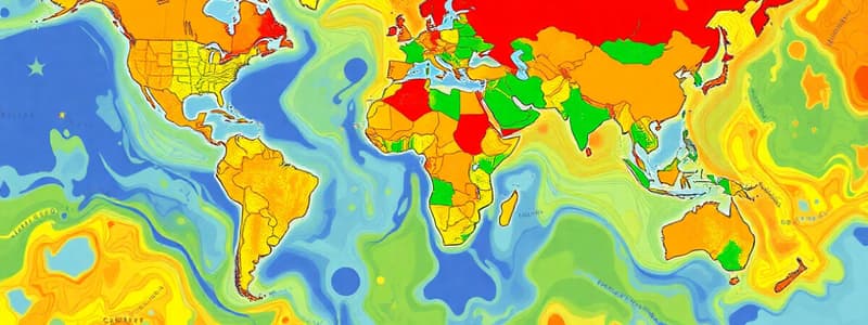
Maps are Useful for Answering Questions
- Maps can answer questions like "What is there?", "How big is it?", "How do I get there?", and "How does a disease spread?"
- Overlapping multiple layers on a map can reveal inter-relationships between spatial events
"Observe" and "Infer"
- Maps allow one to "observe" and "infer,"
- Processes by observing patterns through visualization.
Overlaying Maps
- Overlaying maps reveals spatial relationships and can provide insights or answers to questions.
Purposes of Maps
- Maps store geographical data/information
- Maps serve as mobility and navigation aids
- Maps visualize the invisible, (boundaries of countries and temperature)
- Maps recognize spatial distributions and potential relationships and help visualize processes.
- Maps summarize statistical data to detect patterns and trends for forecasting and decision-making.
- Maps stimulate spatial thinking about the placement of resources, climate, farming technology, natural disasters, and how they relate to each other
GIS Software
- Mapping or Geographic Information System (GIS) software (e.g., ArcGIS Pro and QGIS) provides tools for mapping and design.
- Cartographic rules are needed to make a map that can communicate with general users.
- A map's appearance and readability determine its usefulness.
Spatial Data
- Spatial data is recorded and displayed on a map
- Spatial data translates into a graphic representation that visually displays the location, distribution, and spatial relationship
- It includes spatial geographic features, invisible features, and phenomena.
What Spatial Data Is
- Geographic Data, Spatial Data, Geospatial data, and location data are often used interactively,
- Refer to any information about the location, shape, and relationships among geographic features.
Types of Spatial Data Models
- There are two types; Vector and Raster
- Vector data models use coordinates to store the shape of spatial data objects, like topographic maps or road networks.
- Raster data models use individual cells in a matrix or grid format to represent real-world entities, like satellite imagery, aerial photos, or scanned maps.
Vector Data Model Characteristics
- Features are represented by points, lines, or areas (polygons) defined by x-y coordinates.
- It organizes geometric objects and their spatial relationships into digital data files for computer access, interpretation, and processing.
Raster Data Model Characteristics
- Each location is represented by a cell (or pixel) organized into a matrix with rows and columns (a grid).
- The value may be a measurement like light intensity, numerical data (elevation, temperature), or a class of category (land use code or soil type).
Characteristics of Spatial Data
- Spatial data has:
- Geographic position (e.g., coordinates).
- Attributes (descriptive information).
- Spatial relationships (how objects are located in space relative to each other).
- Time (how the locations are changing over time).
Geographic Position
- Geographic position include geographic reference systems such as absolute position (coordinates) and relative position (location relative to another place).
Data Attributes
- Data describes characteristics of the spatial features with quantitative data (width, length, traffic volume)
- Data has qualitative data (road name, direction, categories)
- Attributes connect with the spatial feature, which is referred to as geometry
Spatial Relationship
- This illustrates how an object is located in space in relation to another object based on computed coordinates of spatial features
Time
- Historical data is used for time series analysis, like tracking population density changes.
- Historical maps and spatial data animate historical events, like the Imperial Japanese occupation of Hong Kong.
Sources of Geographic Data
- GIS data originates from digital resources classified as primary or secondary.
- Primary data comes from direct measurement (e.g., GPS).
- Secondary data is derived from existing sources, (e.g., old paper maps)
Open Data Sources
- Maps in Hong Kong are supplied by the Lands Department, HKSAR.
- Hong Kong Common Spatial Data Infrastructure, which provides free spatial data
- Data.gov.hk with data from different departments of Hong Kong Government
- Open Geo-Spatial Data in HK
- Esri China (Hong Kong) Limited,
- USGS (US-based datahub)
Studying That Suits You
Use AI to generate personalized quizzes and flashcards to suit your learning preferences.