Podcast
Questions and Answers
Quel type de schéma géologique montre l'arrangement vertical des couches géologiques sur une zone spécifique ?
Quel type de schéma géologique montre l'arrangement vertical des couches géologiques sur une zone spécifique ?
Que représente une carte de contours structurels en géologie ?
Que représente une carte de contours structurels en géologie ?
Un plissement indique quel type de contrainte dans la croûte terrestre ?
Un plissement indique quel type de contrainte dans la croûte terrestre ?
Les intrusions en géologie font référence à quoi ?
Les intrusions en géologie font référence à quoi ?
Signup and view all the answers
Qu'est-ce qu'une discontinuité en géologie ?
Qu'est-ce qu'une discontinuité en géologie ?
Signup and view all the answers
Quelles informations peuvent être représentées par une colonne stratigraphique ?
Quelles informations peuvent être représentées par une colonne stratigraphique ?
Signup and view all the answers
Les contacts entre différentes unités rocheuses peuvent être :
Les contacts entre différentes unités rocheuses peuvent être :
Signup and view all the answers
Quels éléments sont souvent représentés sur une carte géologique ?
Quels éléments sont souvent représentés sur une carte géologique ?
Signup and view all the answers
Quel est l'un des principaux avantages des schémas géologiques?
Quel est l'un des principaux avantages des schémas géologiques?
Signup and view all the answers
Quel processus géologique peut être mieux compris grâce aux schémas géologiques?
Quel processus géologique peut être mieux compris grâce aux schémas géologiques?
Signup and view all the answers
Pourquoi est-il important de maintenir une échelle appropriée dans les schémas géologiques?
Pourquoi est-il important de maintenir une échelle appropriée dans les schémas géologiques?
Signup and view all the answers
Quel type de données est essentiel pour la construction des schémas géologiques?
Quel type de données est essentiel pour la construction des schémas géologiques?
Signup and view all the answers
Comment les schémas géologiques aident-ils à explorer les ressources naturelles?
Comment les schémas géologiques aident-ils à explorer les ressources naturelles?
Signup and view all the answers
Quel est le rôle principal des conventions géologiques dans les schémas?
Quel est le rôle principal des conventions géologiques dans les schémas?
Signup and view all the answers
Quel outil est crucial pour atténuer les risques géologiques dans les projets d'ingénierie?
Quel outil est crucial pour atténuer les risques géologiques dans les projets d'ingénierie?
Signup and view all the answers
Quel symbole est utilisé dans les schémas géologiques pour représenter des caractéristiques géologiques spécifiques?
Quel symbole est utilisé dans les schémas géologiques pour représenter des caractéristiques géologiques spécifiques?
Signup and view all the answers
Flashcards
Symboles géologiques
Symboles géologiques
Des symboles normalisés représentent différentes caractéristiques géologiques, ce qui rend les schémas plus faciles à interpréter.
Visualisation de structures géologiques
Visualisation de structures géologiques
Ils permettent aux géologues de visualiser des structures 3D complexes dans un format 2D simplifié.
Compréhension des processus géologiques
Compréhension des processus géologiques
Ils aident à comprendre les processus qui ont façonné la géologie d'une région, comme la tectonique des plaques, la sédimentation et l'érosion.
Identification des ressources
Identification des ressources
Signup and view all the flashcards
Relations structurelles
Relations structurelles
Signup and view all the flashcards
Modélisation géologique
Modélisation géologique
Signup and view all the flashcards
Collecte des données
Collecte des données
Signup and view all the flashcards
Interprétation des données
Interprétation des données
Signup and view all the flashcards
Schémas géologiques
Schémas géologiques
Signup and view all the flashcards
Sections géologiques
Sections géologiques
Signup and view all the flashcards
Cartes géologiques
Cartes géologiques
Signup and view all the flashcards
Diagrammes en blocs
Diagrammes en blocs
Signup and view all the flashcards
Cartes de structure
Cartes de structure
Signup and view all the flashcards
Colonnes stratigraphiques
Colonnes stratigraphiques
Signup and view all the flashcards
Failles
Failles
Signup and view all the flashcards
Plis
Plis
Signup and view all the flashcards
Study Notes
Introduction to Geological Schemas
- Geological schemas are graphical representations of geological structures and processes.
- They visually illustrate the arrangement of rocks, folds, faults, and other geological features.
- These schemas allow for a simplified representation of complex 3D geological structures on a 2D plane.
Types of Geological Schemas
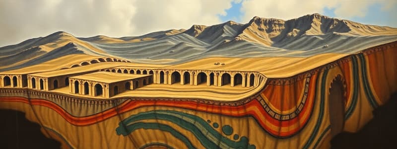
- Geological cross-sections: These diagrams show the vertical arrangement of geological layers across a specific area. They are crucial for understanding the stratigraphy and structural features of a region.
- Geological maps: These maps depict the surface distribution of different rock units, formations, and structures. Key features include symbols representing rock types, faults, folds, and contacts.
- Block diagrams: These schematic representations provide a perspective view showing three-dimensional relationships between geological features such as faults, folds, and unconformities. They provide insights into the overall shape and structure of an area.
- Structural contour maps: These maps illustrate the elevation of a particular geological surface. Contour lines connect points of equal elevation, helping to visualize subsurface structure.
- Stratigraphic columns: These diagrams illustrate the vertical sequence of rock layers within a specific area or borehole. They portray the order in which rock units were deposited, and assist in establishing relative age relationships.
Key Elements in Geological Schemas
- Rock units: Different rock types are represented by various patterns, colors, or symbols, depicting their composition and age.
- Contacts: These delineate the boundaries between different rock units. They can be conformable (smooth transitions) or unconformable (with breaks or gaps in the rock record).
- Faults: Representations of fractures in the Earth's crust, accompanied by displacement of rock blocks. Faults can be normal, reverse, or strike-slip.
- Folds: Bent rock layers, indicating compressional stresses in the Earth's crust. These can be anticlines (upward folds) or synclines (downward folds).
- Unconformities: Surfaces where part of the rock record is missing due to erosion or non-deposition indicating a gap in time. These highlight significant events in geological history.
- Bedding planes: Show the layering within sedimentary rocks.
- Intrusions: Represent igneous rocks that solidified within the surrounding host rocks (e.g., dikes, sills).
- Symbols: Standardized symbols represent different geological features, making the schemas more easily interpreted.
Purpose and Applications of Geological Schemas
- Visualizing geological structures: They allow geologists to visualize complex 3D structures in a simplified 2D format.
- Understanding geological processes: They support understanding of the processes that shaped a region's geology, such as plate tectonics, sedimentation, and erosion.
- Identifying resources: Geological schemas are used in prospecting for mineral deposits, oil and gas reserves, and groundwater sources.
- Determining structural relationships: They help to discern the relative ages of rock units and the relationships between different geological features.
- Facilitating geological modeling: They are essential tools in building more complex geological models for various applications.
Geological Schema Construction
- Data collection: Geological mapping, drilling data, and fieldwork are used to acquire data.
- Data interpretation: Geological data is interpreted by considering the relationships between different geological formations.
- Representation: Accurate and systematic representation of features using standardized symbols and scales are employed.
- Scale: Maintaining appropriate scale is crucial for accurate representation and interpretation.
- Conventions: Applying consistent geological conventions, such as colors, patterns, and symbols, ensures a clear understanding.
Importance of Geological Schemas
- Communication tool: Geological schemas effectively communicate geological information to different audiences.
- Essential for geological studies: They are fundamental components of geological research.
- Critical for resource exploration: They provide critical insights to locate and evaluate the distribution of natural resources.
- Crucial for engineering projects: They assist in mitigating geological hazards and optimizing engineering designs for projects aligned with geological conditions.
Studying That Suits You
Use AI to generate personalized quizzes and flashcards to suit your learning preferences.
Description
Ce quiz explore les schémas géologiques, qui sont des représentations graphiques des structures et processus géologiques. Vous apprendrez à identifier les différents types de schémas, tels que les coupes géologiques, les cartes géologiques et les diagrammes en bloc, et leur importance pour comprendre la géologie d'une région.


