Podcast
Questions and Answers
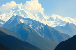
What explains the presence of tropical evergreen forests in the Western Ghats and not in the Eastern Ghats?
What explains the presence of tropical evergreen forests in the Western Ghats and not in the Eastern Ghats?
- The Western Ghats have a greater variety of soil types, enhancing biodiversity and supporting tropical evergreen forests, unlike the Eastern Ghats.
- The Western Ghats are positioned to receive more orographic rainfall from the southwest monsoon than The Eastern Ghats. (correct)
- The Eastern Ghats experience higher rates of deforestation and soil erosion compared to the Western Ghats.
- The Eastern Ghats have a higher average elevation, resulting in lower temperatures unsuitable for tropical evergreen forests compared to the Western Ghats.
What would be the most ecologically sound approach to managing frequent flooding in the Kosi River basin?
What would be the most ecologically sound approach to managing frequent flooding in the Kosi River basin?
- Straightening and deepening the river channel to increase the river's discharge capacity and reduce overflow.
- Establishing a network of embankments and levees along the riverbanks to confine the river within its channel.
- Constructing a series of large dams and reservoirs along the Kosi River to regulate water flow.
- Implementing comprehensive afforestation programs in the upper catchment areas to reduce soil erosion and increase water retention. (correct)
What explains the paradox of India having a long coastline yet experiencing water scarcity in many regions?
What explains the paradox of India having a long coastline yet experiencing water scarcity in many regions?
- The presence of strong offshore currents prevents the inflow of freshwater, intensifying water scarcity issues.
- Inefficient water management practices and over-extraction of groundwater resources lead to depletion, despite coastal proximity. (correct)
- High levels of industrial pollution along the coastline contaminate water sources, rendering them unusable for consumption.
- The majority of the coastline consists of rocky terrain unsuitable for groundwater recharge, exacerbating water scarcity.
What is the primary reason for the formation of black soil in the Deccan Plateau?
What is the primary reason for the formation of black soil in the Deccan Plateau?
Which factor most significantly contributes to the formation of rain shadows in the leeward side of the Western Ghats?
Which factor most significantly contributes to the formation of rain shadows in the leeward side of the Western Ghats?
Flashcards
What is a subcontinent?
What is a subcontinent?
A large landmass that is geographically separated from the rest of a continent.
What are the Himalayas?
What are the Himalayas?
The mountain range that forms India's northern border.
What are the Indus and Ganges?
What are the Indus and Ganges?
The two major river systems that originate in the Himalayas and flow through India.
What is a monsoon?
What is a monsoon?
Signup and view all the flashcards
What is the Thar Desert?
What is the Thar Desert?
Signup and view all the flashcards
Study Notes
- India is located in South Asia and is the seventh-largest country in the world by land area.
- It is the second-most populous country, with over 1.3 billion people.
- India is bounded by the Indian Ocean on the south, the Arabian Sea on the southwest, and the Bay of Bengal on the southeast.
- It shares land borders with Pakistan to the west; China, Nepal, and Bhutan to the northeast; and Bangladesh and Myanmar to the east.
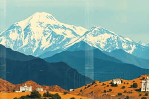
Major Physical Divisions
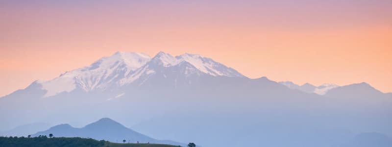
- The Himalayas: These are young fold mountains and the highest mountain range in the world.
- The Himalayas extend from the Indus River to the Brahmaputra River.
- They are divided into three parallel ranges: the Greater Himalayas (Himadri), the Lesser Himalayas (Himachal), and the Outer Himalayas (Shiwaliks).
- The Northern Plains: These plains are formed by the alluvial deposits of the Indus, Ganga, and Brahmaputra rivers.
- They are one of the most fertile and densely populated regions of the world.
- The Peninsular Plateau: This is the oldest landform of India, composed of igneous and metamorphic rocks.
- It is divided into two broad divisions: the Central Highlands and the Deccan Plateau.
- The Indian Desert: Located to the west of the Aravali Hills, it is characterized by low rainfall and sandy terrain.
- Coastal Plains: These plains are located on either side of the Peninsular Plateau, along the Arabian Sea and the Bay of Bengal.
- The Western Coastal Plains are narrow and include the Konkan, Kannada, and Malabar coasts.
- The Eastern Coastal Plains are broader and known as the Coromandel and Northern Circars.
- Islands: India has two main groups of islands: Lakshadweep in the Arabian Sea and the Andaman and Nicobar Islands in the Bay of Bengal.
Climate
- India's climate is influenced by the Himalayas and the Thar Desert.
- The Himalayas prevent cold winds from Central Asia from entering India.
- The Thar Desert attracts moisture-laden southwest monsoon winds.
- India experiences a monsoon climate, characterized by seasonal changes in wind direction.
Seasons
- Cold Weather Season (Winter): From November to January, temperatures are low, especially in northern India.
- Hot Weather Season (Summer): From March to May, temperatures are high across the country.
- Southwest Monsoon Season (Rainy): From June to September, India receives the majority of its rainfall from the southwest monsoon winds.
- Retreating Monsoon Season (Autumn): October and November mark the transition period between the monsoon and winter seasons.
Drainage Systems
- The drainage systems of India are mainly divided into the Himalayan rivers and the Peninsular rivers.
- Himalayan Rivers: These rivers are perennial, fed by both rainfall and snowmelt from the Himalayas.
- Major Himalayan rivers include the Indus, Ganga, and Brahmaputra.
- Peninsular Rivers: These rivers are seasonal, dependent on rainfall.
- Major Peninsular rivers include the Narmada, Tapi, Godavari, Krishna, and Kaveri.
- The Ganga River is considered the most sacred river in India.
- The Brahmaputra River enters India through Arunachal Pradesh.
Soil Types
- Alluvial Soils: These are the most fertile soils, found in the Northern Plains and river valleys.
- Black Soils: These are suitable for cotton cultivation and are found in the Deccan Plateau.
- Red and Yellow Soils: These are found in areas of low rainfall and are less fertile.
- Laterite Soils: These are found in areas of high rainfall and are prone to leaching.
- Arid Soils: These are found in the desert regions and are sandy in texture.
- Forest Soils: These are found in forested areas and are rich in humus.
Natural Vegetation
- Tropical Evergreen Forests: Found in areas with heavy rainfall, like the Western Ghats and Northeast India.
- Deciduous Forests: These are the most widespread forests in India, found in areas with moderate rainfall.
- Thorn Forests and Scrubs: Found in arid regions like Rajasthan, Punjab and Gujarat.
- Montane Forests: Found in the Himalayan region, with vegetation varying according to altitude.
- Mangrove Forests: Found in coastal areas, especially in the deltas of rivers.
Population
- India is the second-most populous country in the world.
- The population is unevenly distributed due to variations in climate, soil, and availability of resources.
- The most densely populated areas are the Northern Plains and coastal regions.
- States like Uttar Pradesh, Maharashtra, and Bihar have the highest population.
Natural Resources
- India is rich in mineral resources like iron ore, coal, and petroleum.
- Coal is mainly found in Jharkhand, Odisha and West Bengal.
- Petroleum reserves are located in Mumbai High, Assam, and Gujarat.
- Iron ore is mainly found in Odisha, Chhattisgarh, and Karnataka.
Agriculture
- Agriculture is a major occupation in India, employing a large percentage of the population.
- Major crops include rice, wheat, cotton, tea, and sugarcane.
- Rice is the staple food crop in India.
- Wheat is mainly grown in the northern states.
- Cotton is an important cash crop grown in the black soil regions.
States and Union Territories
- India is a union of states and union territories.
- Each state has its own government and legislative assembly.
- Union territories are administered by the central government.
- New Delhi is the capital of India.
Studying That Suits You
Use AI to generate personalized quizzes and flashcards to suit your learning preferences.