Podcast
Questions and Answers
North, South, East, and West are called ____________________.
North, South, East, and West are called ____________________.
cardinal directions
Parts of the world that share similar characteristics, but don’t necessarily have fixed boundaries are called _____________________.
Parts of the world that share similar characteristics, but don’t necessarily have fixed boundaries are called _____________________.
regions
Northwest, Northeast, Southwest, and Southeast are examples of _______________________.
Northwest, Northeast, Southwest, and Southeast are examples of _______________________.
intermediate directions
The method that geographers use to transfer the latitude and longitude of the spherical Earth on a flat surface is called _____________________.
The method that geographers use to transfer the latitude and longitude of the spherical Earth on a flat surface is called _____________________.
A network of evenly spaced horizontal and vertical lines used to identify locations on a map.
A network of evenly spaced horizontal and vertical lines used to identify locations on a map.
Lines on a map that go North to South.
Lines on a map that go North to South.
Lines on a map that go East to West.
Lines on a map that go East to West.
The 0° line that runs from east to west through the middle of the Earth:
The 0° line that runs from east to west through the middle of the Earth:
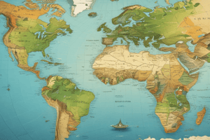
A detailed representation on a map of the natural and artificial features of an area.
A detailed representation on a map of the natural and artificial features of an area.
A location on earth relative to another location.
A location on earth relative to another location.
Distance on the map that corresponds to real distance on earth is called
Distance on the map that corresponds to real distance on earth is called
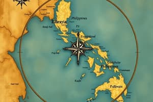
A tool on a map used to show the cardinal directions and the intermediate directions.
A tool on a map used to show the cardinal directions and the intermediate directions.
Half of the earth is called a ______________________.
Half of the earth is called a ______________________.
An exact place on Earth, often given in terms of latitude and longitude or an address. _________________________.
An exact place on Earth, often given in terms of latitude and longitude or an address. _________________________.
How people interact with the world, and the world interacts with people is called
How people interact with the world, and the world interacts with people is called
Also known as a “key,” this part of a map tells us what symbols on a map represent.
Also known as a “key,” this part of a map tells us what symbols on a map represent.
It is impossible to put a sphere onto a flat surface, therefore all maps have some sort of
It is impossible to put a sphere onto a flat surface, therefore all maps have some sort of
The 0° line that runs from North to South through the middle of the Earth:
The 0° line that runs from North to South through the middle of the Earth:
Flashcards
Cardinal Directions
Cardinal Directions
North, South, East, and West.
Regions
Regions
Areas with similar characteristics, not fixed boundaries.
Intermediate Directions
Intermediate Directions
Northwest, Northeast, Southwest, Southeast.
Map Projection
Map Projection
Signup and view all the flashcards
Grid
Grid
Signup and view all the flashcards
Longitude
Longitude
Signup and view all the flashcards
Latitude
Latitude
Signup and view all the flashcards
Equator
Equator
Signup and view all the flashcards
Topography
Topography
Signup and view all the flashcards
Relative Location
Relative Location
Signup and view all the flashcards
Scale (on a map)
Scale (on a map)
Signup and view all the flashcards
Compass Rose
Compass Rose
Signup and view all the flashcards
Hemisphere
Hemisphere
Signup and view all the flashcards
Absolute Location
Absolute Location
Signup and view all the flashcards
Study Notes
Geography Terminology
- North, South, East, and West are referred to as cardinal directions.
- Regions of the world that share common characteristics but lack fixed boundaries are called cultural regions.
- Northwest, Northeast, Southwest, and Southeast represent intermediate directions.
- The technique used by geographers to project latitude and longitude from a spherical Earth onto a flat surface is called map projection.
Map Features
- A grid network consists of evenly spaced horizontal and vertical lines that assist in pinpointing locations on a map.
- Lines that run from North to South are known as meridians.
- Lines that run from East to West are called parallels.
- The 0° line that extends from east to west through the Earth's center is known as the Equator.
Map Representation and Location
- A topographic map provides a detailed portrayal of both natural and artificial features in an area.
- Relative location denotes a place on Earth in relation to another location.
- The scale indicates the distance on a map that correlates with actual distance on Earth.
Map Elements
- A compass rose is a map tool that illustrates cardinal and intermediate directions.
- A hemisphere refers to half of the Earth, divided into Northern and Southern or Eastern and Western halves.
- An absolute location specifies an exact point on Earth, typically described by coordinates or an address.
Human-Environment Interaction
- Human geography studies how people interact with their environment and vice versa.
- A map legend, also known as a key, explains the significance of symbols used on the map.
- Due to the challenge of representing a sphere on a flat surface, all maps experience some distortion.
- The 0° line that extends from North to South is known as the Prime Meridian.
Studying That Suits You
Use AI to generate personalized quizzes and flashcards to suit your learning preferences.