Podcast
Questions and Answers
What are the three key attributes that define any map?
What are the three key attributes that define any map?
- Title, Scale, Projection (correct)
- Title, Legend, Grid System
- Scale, Orientation, Legend
- Projection, Legend, Color Scale
Which type of map would best display population density?
Which type of map would best display population density?
- Thematic Map (correct)
- General Purpose Map
- Topographic Map
- Physical Map
Which of the following grid systems is most commonly used in Military maps?
Which of the following grid systems is most commonly used in Military maps?
- Universal Grid
- Latitude-Longitude Grid
- Alphanumeric Grid
- Military Grid (correct)
What is the baseline for measuring longitude?
What is the baseline for measuring longitude?
What is the significance of the Golden Rule in Military/Grid Maps?
What is the significance of the Golden Rule in Military/Grid Maps?
Why are time zones generally 15° wide?
Why are time zones generally 15° wide?
Which compass direction is located between North and East?
Which compass direction is located between North and East?
What is an example of a Point feature on a map?
What is an example of a Point feature on a map?
Flashcards
Map Attributes
Map Attributes
The three key characteristics that define any map: Title, Legend, and Scale.
Map Scale
Map Scale
Shows the relationship between distances on a map and distances on the Earth's surface.
Map Grid Systems
Map Grid Systems
Systems of lines used to locate places on a map, including alphanumeric and lat/long.
Geographic Grid
Geographic Grid
Signup and view all the flashcards
Time Zones
Time Zones
Signup and view all the flashcards
Time Zones and Earth rotation
Time Zones and Earth rotation
Signup and view all the flashcards
Compass Bearings
Compass Bearings
Signup and view all the flashcards
Map Types
Map Types
Signup and view all the flashcards
Study Notes
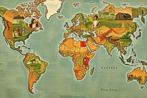
Maps and Map Elements
- Maps have three key defining attributes
- Six basic features of all maps
- Distinguishing small, medium, and large-scale maps using direct statements, representative fractions, and line scales
- Identifying point, line, and area features/symbols on maps
- Using a legend to interpret maps and map features
Map Types & Grid Systems
- Distinguishing between general-purpose, thematic, and topographic maps
- Identifying and describing three types of grid systems (alphanumeric, latitude-longitude, military grid)
- Understanding general-purpose, general-purpose latitude-longitude, and military grid maps
- Knowing the golden rule, eastings/northings, and differences between 4 and 6-digit reference numbers
Geographic Reference Systems
- Knowing the five major lines of latitude and two major lines of longitude, major parallels and polar/temperate/tropical zones
- Understanding relative locations, labeling/identifying alpha-numeric grids on maps, and latitude/longitude coordinates
- Definitions and examples of baseline, equator, prime meridian, sea level, and GMT (Greenwich Mean Time)
Geo-referencing
- Calculating 16 compass points and bearings on a compass rose
- Identifying cardinal (primary), ordinal (secondary), and other (tertiary) points/bearings on a compass rose
- Calculating complex bearings
- Geo-referencing using relative location
Time Zones
- Identifying and locating the 5+1 time zones in Canada and GMT on maps
- Comparing standard time (ST) and universal time (UTC or GMT)
- Understanding the rationale behind time zones (reasoning)
- Explaining why time zones are generally 15 degrees wide
- Explaining why time zones in the real world aren't precisely 15 degrees wide and how adjustments are made
- Calculating times within Canada, between Canada and GMT, and globally, using time zone maps.
- Calculating departure/arrival scenarios within Canada's time zones and from/to Canada to GMT considering world time zone maps
Studying That Suits You
Use AI to generate personalized quizzes and flashcards to suit your learning preferences.