Podcast
Questions and Answers
What is a significant characteristic of the Mexican Plateau's elevation?
What is a significant characteristic of the Mexican Plateau's elevation?
- It varies but never exceeds 2,000 meters.
- It has no variations in elevation.
- It is entirely below 1,500 meters.
- It generally exceeds 1,500 meters. (correct)
Which mountain ranges define the approximate geographical boundaries of the Mexican Plateau?
Which mountain ranges define the approximate geographical boundaries of the Mexican Plateau?
- Appalachians and Himalayas.
- Andes and Rockies.
- Alps and Urals.
- Sierra Madre Oriental and Sierra Madre Occidental. (correct)
How do varying elevations on the Mexican Plateau impact climate?
How do varying elevations on the Mexican Plateau impact climate?
- Higher elevations are always wetter.
- There are no significant climatic changes with elevation.
- The climate is uniformly tropical across the plateau.
- Temperature differences are substantial based on elevation. (correct)
What type of ecosystems are supported by the diverse elevations on the Mexican Plateau?
What type of ecosystems are supported by the diverse elevations on the Mexican Plateau?
In which areas of the Mexican Plateau is agriculture primarily important?
In which areas of the Mexican Plateau is agriculture primarily important?
Which statement best describes the river systems of the Mexican Plateau?
Which statement best describes the river systems of the Mexican Plateau?
What human activities are influenced by the resources available on the Mexican Plateau?
What human activities are influenced by the resources available on the Mexican Plateau?
How does the topography of the Mexican Plateau influence its ecosystems?
How does the topography of the Mexican Plateau influence its ecosystems?
Flashcards
Mexican Plateau
Mexican Plateau
A large, elevated area in central Mexico spanning a vast portion of the country, characterized by high altitude above 1,500 meters (4,921 feet).
What defines the boundary of the Mexican Plateau?
What defines the boundary of the Mexican Plateau?
The Mexican Plateau is bordered by mountain ranges that define its approximate limits.
How does elevation affect the Mexican Plateau?
How does elevation affect the Mexican Plateau?
The plateau exhibits a range of elevations, leading to different climates in its various sections.
Describe the topography of the Mexican Plateau
Describe the topography of the Mexican Plateau
Signup and view all the flashcards
How do precipitation patterns vary across the Mexican Plateau?
How do precipitation patterns vary across the Mexican Plateau?
Signup and view all the flashcards
Explain how elevation and precipitation influence the rivers of the Mexican Plateau.
Explain how elevation and precipitation influence the rivers of the Mexican Plateau.
Signup and view all the flashcards
How does the Mexican Plateau's geography affect human activities?
How does the Mexican Plateau's geography affect human activities?
Signup and view all the flashcards
What is the ecological importance of the Mexican Plateau?
What is the ecological importance of the Mexican Plateau?
Signup and view all the flashcards
Study Notes
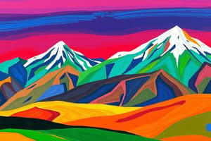
Geographic Overview
- The Mexican Plateau is a large, high-altitude region in central Mexico.
- It's a significant geographic feature spanning a considerable portion of the country.
- It's characterized by high elevation, generally found above 1,500 meters (4,921 feet).
- Its geographical boundaries are approximate, often defined by the Sierra Madre Oriental and Sierra Madre Occidental mountain ranges.
- The plateau is divided into different subregions, each characterized by distinct climatic and topographic features.
Elevation and Topography
- The plateau displays various elevations across its extent.
- The higher elevations create distinct climatic conditions from the lower regions.
- The plateau's varying topography includes wide plains and elevated plateaus.
- The topography influences regional climate and vegetation.
- The variations in elevation and terrain foster a range of ecosystems.
Climatic Zones
- The climate on the plateau varies significantly with elevation.
- Temperature differences are substantial between higher and lower parts.
- The climate is generally dry and semi-arid in some locales.
- Rainfall patterns and moisture levels vary significantly across the plateau's regions.
- Temperatures can vary drastically depending on elevation and proximity to mountains.
Drainage and Rivers
- The region's river systems are influenced by the plateau's elevation and topography.
- Major rivers often originate within the plateau's ranges and flow into surrounding basins.
- Some rivers are ephemeral, meaning they flow only at certain times of the year.
- The amount of water in the rivers can shift depending on precipitation.
- The drainage patterns in the region affect local agriculture and water resources.
Impact on Human Settlement and Activities
- The plateau's resources, whether agricultural or mineral, have influenced population patterns.
- Agriculture is important in the plateau's regions that have sufficient rainfall.
- The high-altitude regions see grazing and livestock farming.
- Mineral extraction can be an important activity in the region too.
- Large populations concentrate in more fertile and accessible zones of the plateau.
Ecological Considerations
- The diverse elevations on the plateau support a wealth of distinct ecosystems.
- Different elevations and microclimates lead to varied flora and fauna.
- Several unique plant and animal species are found within the plateau's region.
- Conservation efforts are necessary due to the varied ecosystems of the region.
- The biodiversity of the region depends on maintaining a balance within the plateau's many diverse ecosystems.
Geological History
- The Mexican Plateau represents layers of geological developments.
- Features indicate volcanic activity and tectonic movements over time.
- The varied geological history of the plateau has a role in shaping the landscapes we see today.
- Insights into this geological history help us understand the processes that shaped the plateau into what it is.
- Many factors, including erosion, deposition, and geological shifts have contributed to the formation of the current plateau landscape.
Studying That Suits You
Use AI to generate personalized quizzes and flashcards to suit your learning preferences.