Podcast
Questions and Answers
What are the Andes Mountains?
What are the Andes Mountains?
- A mountain range extending about 4500 miles in W South America (correct)
- A famous river in Brazil
- A desert in South America
- A type of plateau
What is the highest peak of the Andes Mountains?
What is the highest peak of the Andes Mountains?
Aconcagua
What is the Mexican Plateau?
What is the Mexican Plateau?
A large arid-to-semiarid plateau that occupies much of northern and central Mexico.
Define Cordilleras.
Define Cordilleras.
What is the Altiplano?
What is the Altiplano?
Describe the Mato Grosso Plateau.
Describe the Mato Grosso Plateau.
What are the Brazilian Highlands?
What are the Brazilian Highlands?
What is an escarpment?
What is an escarpment?
Define llanos.
Define llanos.
What are the Pampas?
What are the Pampas?
What is hydroelectric power?
What is hydroelectric power?
Flashcards are hidden until you start studying
Study Notes
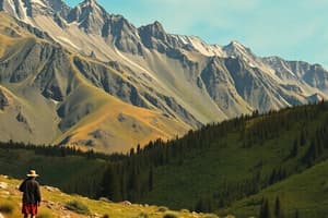
Andes Mountains
- Mountain range in western South America, stretching approximately 4,500 miles (7,250 km) from northern Colombia and Venezuela to Cape Horn.
- Highest peak is Aconcagua, reaching 22,834 feet (6,960 meters).
Mexican Plateau
- A large arid-to-semiarid plateau covering northern and central Mexico.
- Average elevation is 1,825 meters (5,988 feet) above sea level.
- Extends from the US border to the Trans-Mexican Volcanic Belt, flanked by Sierra Madre Occidental and Sierra Madre Oriental.
Cordilleras
- System of parallel mountain ranges along with intervening plateaus and other geological features.
- Prominent in regions like the Andes and the Rockies.
Altiplano
- High tableland located in central South America, characterized by elevated terrain.
Mato Grosso Plateau
- Located in central Brazil, it primarily occupies the state of Mato Grosso.
- Features savanna and woodland, and represents an ancient erosional plateau.
- Extends to the Parecis plateau near the Bolivian border and transitions into the Pantanal floodplains to the south.
Brazilian Highlands
- Extensive geographical region covering eastern, southern, and central Brazil, about half of the country's land area.
- Encompasses approximately 4.5 million km² (1,930,511 sq mi).
- Home to the majority of Brazil's population, approximately 190.8 million (as of 2010).
Escarpment
- Characterized as a long, steep slope found at the edge of plateaus or separating areas of differing elevations.
Llanos
- Vast treeless grassy plains located in South America, offering unique ecological and hydrological characteristics.
Pampas
- Fertile lowlands in South America, encompassing over 750,000 km² (289,577 sq mi).
- Covers provinces such as Buenos Aires, La Pampa, Santa Fe, Entre Ríos, Córdoba in Argentina, most of Uruguay, and parts of southern Brazil.
- The region is largely plain, interrupted only by low hills with heights of 1,300 m (4,265 ft) and 500 m (1,640 ft).
Hydroelectric Power
- Refers to electricity produced from hydropower using the gravitational force of falling or flowing water.
- Most widely employed renewable energy, contributing to 16% of global electricity generation.
- In 2010, hydroelectricity production amounted to 3,427 terawatt-hours, with a projected annual growth of 3.1% for the next 25 years.
Studying That Suits You
Use AI to generate personalized quizzes and flashcards to suit your learning preferences.


