Podcast
Questions and Answers
What is the elevation range of the Shiwalik Range?
What is the elevation range of the Shiwalik Range?
- 1200 to 1800 meters
- 1000 to 1500 meters
- 800 to 900 meters
- 900 to 1100 meters (correct)
Which river does the Dhauladhar Range end at?
Which river does the Dhauladhar Range end at?
- Hanuman Tibba (correct)
- Teesta River
- Gandak River
- Ravi River
Which of the following names is NOT associated with the Shiwalik Range?
Which of the following names is NOT associated with the Shiwalik Range?
- Churia Ghat Hills
- Jammu Hills
- Himalayan Foothills (correct)
- Dhang Range
What contributes to the discontinuity of the Shiwalik hills beyond the Teesta River?
What contributes to the discontinuity of the Shiwalik hills beyond the Teesta River?
What are Duns primarily characterized as?
What are Duns primarily characterized as?
Which feature describes the southern slopes of the Shiwalik Range in Punjab?
Which feature describes the southern slopes of the Shiwalik Range in Punjab?
Where does the Shiwalik Range have its highest width?
Where does the Shiwalik Range have its highest width?
How do the forest covers change from east to west in the Shiwalik Range?
How do the forest covers change from east to west in the Shiwalik Range?
What is the primary reason climbers often choose the southern slopes from Nepal?
What is the primary reason climbers often choose the southern slopes from Nepal?
Which of the following accurately describes the syntaxial bends of the Himalayas?
Which of the following accurately describes the syntaxial bends of the Himalayas?
What is the average elevation of the Trans-Himalayas above mean sea level?
What is the average elevation of the Trans-Himalayas above mean sea level?
Which of these ranges is NOT part of the Trans-Himalayas?
Which of these ranges is NOT part of the Trans-Himalayas?
What is the height of K2, the prominent peak in the Karakoram Range?
What is the height of K2, the prominent peak in the Karakoram Range?
Which of the following statements about the Zanskar Range is correct?
Which of the following statements about the Zanskar Range is correct?
Which region is situated immediately north of the Great Himalayan range?
Which region is situated immediately north of the Great Himalayan range?
What is a notable geographical feature of the Karakoram Range?
What is a notable geographical feature of the Karakoram Range?
Which of the following ranges is NOT part of the Kashmir Himalayas?
Which of the following ranges is NOT part of the Kashmir Himalayas?
What is the significance of the Baltoro and Siachen glaciers?
What is the significance of the Baltoro and Siachen glaciers?
Which lake is a saltwater lake located in the Kashmir Himalayas?
Which lake is a saltwater lake located in the Kashmir Himalayas?
Himachal Himalayas are drained by which two major river systems?
Himachal Himalayas are drained by which two major river systems?
What has predominantly contributed to the formation of the Indo-Gangetic-Brahmaputra Plain in recent times?
What has predominantly contributed to the formation of the Indo-Gangetic-Brahmaputra Plain in recent times?
Which classification describes the easternmost hills of the Himalayan Ranges?
Which classification describes the easternmost hills of the Himalayan Ranges?
Which of the following hill stations was established by the British colonial administration in the Himachal Himalayas?
Which of the following hill stations was established by the British colonial administration in the Himachal Himalayas?
Which range represents the Outer Himalaya in the Himachal Himalayas?
Which range represents the Outer Himalaya in the Himachal Himalayas?
What characterizes the slopes of the folds in the Himalayan Ranges?
What characterizes the slopes of the folds in the Himalayan Ranges?
What is a prominent feature of the northeastern part of the Kashmir Himalayas, known as Aksai Chin?
What is a prominent feature of the northeastern part of the Kashmir Himalayas, known as Aksai Chin?
How do the three parallel ranges of the Himalayas orient themselves geographically?
How do the three parallel ranges of the Himalayas orient themselves geographically?
Which river is NOT mentioned as draining the Kashmir Himalayas?
Which river is NOT mentioned as draining the Kashmir Himalayas?
What is the extent of the distance covered by the Himalayas?
What is the extent of the distance covered by the Himalayas?
Which direction does the northwest part of India align regarding the Himalayan Ranges?
Which direction does the northwest part of India align regarding the Himalayan Ranges?
Which of the following statements about Mount Everest's northern side is correct?
Which of the following statements about Mount Everest's northern side is correct?
Which of these geographical features is associated with the Himalayas' valleys and hills?
Which of these geographical features is associated with the Himalayas' valleys and hills?
Which of the following nomadic groups inhabit the valleys of the Greater Himalayan range?
Which of the following nomadic groups inhabit the valleys of the Greater Himalayan range?
What are 'Bugyals' in the context of the Greater Himalayan region?
What are 'Bugyals' in the context of the Greater Himalayan region?
Which mountain range is situated south of the Mussoorie range?
Which mountain range is situated south of the Mussoorie range?
What distinguishes the Central Himalayas in terms of geography?
What distinguishes the Central Himalayas in terms of geography?
In the Eastern Himalayas, what is a characteristic of the southern slopes?
In the Eastern Himalayas, what is a characteristic of the southern slopes?
Which river marks the eastern boundary of the Eastern Himalayas?
Which river marks the eastern boundary of the Eastern Himalayas?
What is a key feature of the Lesser Himalayas in the Eastern Himalayas region?
What is a key feature of the Lesser Himalayas in the Eastern Himalayas region?
Which peak is notable in the Sikkim Himalayas?
Which peak is notable in the Sikkim Himalayas?
Which of the following characteristics indicates that the Himalayas are young fold mountains?
Which of the following characteristics indicates that the Himalayas are young fold mountains?
The Himalayan Ranges are characterized by old, stable geological structures.
The Himalayan Ranges are characterized by old, stable geological structures.
What geological event primarily led to the formation of the Himalayan Ranges?
What geological event primarily led to the formation of the Himalayan Ranges?
The presence of __________ valleys and __________ indicate the youthful stage of the Himalayan geography.
The presence of __________ valleys and __________ indicate the youthful stage of the Himalayan geography.
Which of the following regions do the Himalayan Ranges NOT extend into?
Which of the following regions do the Himalayan Ranges NOT extend into?
Match the features of the Himalayas with their descriptions:
Match the features of the Himalayas with their descriptions:
Which of the following statements best describes the geological stability of the Himalayas?
Which of the following statements best describes the geological stability of the Himalayas?
Fast-flowing rivers contribute to the widening of valleys in the Himalayas.
Fast-flowing rivers contribute to the widening of valleys in the Himalayas.
Which of the following rivers is NOT mentioned as having a high hydroelectric power potential in the Arunachal Himalayas?
Which of the following rivers is NOT mentioned as having a high hydroelectric power potential in the Arunachal Himalayas?
The southern part of the Darjeeling Himalayas is primarily inhabited by the Lepcha tribes.
The southern part of the Darjeeling Himalayas is primarily inhabited by the Lepcha tribes.
Name one prominent peak located in the Arunachal Himalayas.
Name one prominent peak located in the Arunachal Himalayas.
The British introduced tea plantations in this region due to its _______ slopes and well-distributed rainfall.
The British introduced tea plantations in this region due to its _______ slopes and well-distributed rainfall.
Match the following ethnic communities to their corresponding characteristic:
Match the following ethnic communities to their corresponding characteristic:
What geological process contributed to the formation of the Himalayas?
What geological process contributed to the formation of the Himalayas?
Young fold mountains like the Himalayas have experienced significant erosion over time.
Young fold mountains like the Himalayas have experienced significant erosion over time.
What ocean surrounded the supercontinent Pangea?
What ocean surrounded the supercontinent Pangea?
The long, narrow sea created between Laurasia and Gondwanaland was called the ______.
The long, narrow sea created between Laurasia and Gondwanaland was called the ______.
Match the following geological features with their descriptions:
Match the following geological features with their descriptions:
Which of the following is a consequence of the ongoing rise of the Himalayas?
Which of the following is a consequence of the ongoing rise of the Himalayas?
The Indo-Gangetic-Brahmaputra Plain formed due to the rising of the Himalayas and subsequent sediment deposition.
The Indo-Gangetic-Brahmaputra Plain formed due to the rising of the Himalayas and subsequent sediment deposition.
What was the Indian Plate's geological history before colliding with the Eurasian Plate?
What was the Indian Plate's geological history before colliding with the Eurasian Plate?
The geological feature formed by the subduction of the Indian Plate beneath the Eurasian Plate is known as the ______.
The geological feature formed by the subduction of the Indian Plate beneath the Eurasian Plate is known as the ______.
How long ago did the Indian Plate begin its northward movement?
How long ago did the Indian Plate begin its northward movement?
What is the elevation range of the Middle Himalayas?
What is the elevation range of the Middle Himalayas?
The Northern slopes of the Middle Himalayas are primarily barren and steep.
The Northern slopes of the Middle Himalayas are primarily barren and steep.
Name one range that represents the Middle Himalayas in Uttarakhand.
Name one range that represents the Middle Himalayas in Uttarakhand.
The southern slopes of the Middle Himalayas prevent ______ formation due to their steepness.
The southern slopes of the Middle Himalayas prevent ______ formation due to their steepness.
Match the regions with their respective significant ranges in the Lesser Himalayas:
Match the regions with their respective significant ranges in the Lesser Himalayas:
Which of the following valleys is NOT associated with the Middle Himalayas?
Which of the following valleys is NOT associated with the Middle Himalayas?
The Pir Panjal Range is primarily composed of volcanic rocks.
The Pir Panjal Range is primarily composed of volcanic rocks.
What is the approximate length of the Pir Panjal Range?
What is the approximate length of the Pir Panjal Range?
The ______ and Chenab rivers cut through the Pir Panjal Range.
The ______ and Chenab rivers cut through the Pir Panjal Range.
Which regional name is associated with Mount Everest in Nepal?
Which regional name is associated with Mount Everest in Nepal?
Which hills form the watershed between India and Myanmar?
Which hills form the watershed between India and Myanmar?
The highest point in the Mizo Hills is Blue Mountain, which has an elevation of 2,157 meters.
The highest point in the Mizo Hills is Blue Mountain, which has an elevation of 2,157 meters.
What is the elevation range of the Patkai Bum hills?
What is the elevation range of the Patkai Bum hills?
The Barail Range separates the _____ Hills from the Naga Hills.
The Barail Range separates the _____ Hills from the Naga Hills.
Match the following states with their highest peaks:
Match the following states with their highest peaks:
What separates the Naga Hills from the Manipur Hills?
What separates the Naga Hills from the Manipur Hills?
Himachal Pradesh is one of the states included in the Western Himalayas.
Himachal Pradesh is one of the states included in the Western Himalayas.
Which is the highest peak in Nagaland?
Which is the highest peak in Nagaland?
The _____ Himalayas span a distance of 880 km from the Indus to the Kali River.
The _____ Himalayas span a distance of 880 km from the Indus to the Kali River.
Which of these ranges is NOT part of the Western Himalayas?
Which of these ranges is NOT part of the Western Himalayas?
Flashcards are hidden until you start studying
Study Notes
Formation of Indo-Gangetic-Brahmaputra Plain
- The plain formed due to depositional activity of alluvium in a depression that was once filled by the Tethys Sea.
- The Himalayan rivers, specifically the Indus, Ganga, and Brahmaputra, have contributed to the formation of the plain in recent times.
Himalayan Ranges
- Classified into five major ranges: Trans-Himalayas, Great Himalayas, Lesser Himalayas, Shiwaliks, and Eastern Hills.
- The three parallel ranges, Great Himalayas, Lesser Himalayas, and Shiwaliks, extend for 2400 km forming an arc.
- The width of these ranges varies from 400 km in Kashmir to 150 km in Arunachal Pradesh.
- The Himalayas curve convexly to the south.
- Variations in altitude are greater in the eastern half compared to the western half.
- The ranges exhibit an asymmetrical fold structure, with valleys within synclines and hills within anticlines or anti-synclines.
- This creates a topography with steep southern slopes and gentle northern slopes, known as hogback topography.
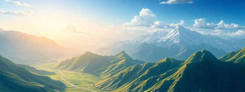
Trans-Himalayas
- Located north of the Great Himalayas, mainly in Tibet, also known as Tibetan Himalayas.
- Average elevation is 3000 meters above sea level, stretching approximately 1,000 km in the east-west direction.
- Found only in the western Himalayas (Ladakh, J&K, and Himachal Pradesh).
- Average width is about 40 km at its extremities and widens to around 225 km in the central part.
- Major ranges include Karakoram, Ladakh, Zanskar, and Kailas.
Karakoram Range
- Northernmost Trans-Himalayan range in India, extending 800 km eastwards from the Pamirs of Pakistan.
- Home to lofty peaks, including K2 (8611 m), the second highest peak globally and the highest in India.
Ladakh Range
- Located south of the Karakoram Range and north of the Zanskar Range, running parallel to it.
- Only a few peaks in this range exceed a height of 6,000 meters.
Zanskar Range
- Situated south of the Ladakh Range with an average height of 6,000 m.
- It houses Nanga Parbat, standing at 8126 m.
Kailas Range
- An offshoot of the Ladakh Range in western Tibet.
Dhauladhar Range
- The Pir Panjal continues as the Dhauladhar Range, extending from southwest of the Ravi River through Dalhousie and Dharamshala, ending at Hanuman Tibba near Manali.
Shiwalik Range
- Also known as Outer Himalayas, situated between the Great Plains and Lesser Himalayas.
- Its width varies from 50 km in Himachal Pradesh to less than 15 km in Arunachal Pradesh.
- With altitudes ranging from 900 to 1100 meters, it spans 2,400 km from the Potwar Plateau in the west to the Brahmaputra Valley in the east.
- It primarily runs as a continuous chain of low hills for over 1200 km from northwest India to the Gandak River.
- Beyond the Gandak and Teesta Rivers, it becomes discontinuous, highly dissected by streams and rivers.
- The Shivalik hills are discontinuous or non-existent in many locations due to the numerous streams and rivers and high annual rainfall.
- The Shiwalik Range, extending from North-East India to Nepal, is covered with thick forests.
- The forest cover decreases towards the west of Nepal due to a decrease in rainfall from east to west.
- The southern slopes are steep, while the northern slopes are gentle.
- The southern slopes in Punjab and Himachal Pradesh lack significant forest cover and are highly dissected by seasonal streams known as Chos.
Shiwalik Names by Region
- Jammu Hills: Jammu Region
- Shivalik Hills: Himachal Pradesh
- The Dhang Range and Dundwa Range: Uttarakhand
- Churia Ghat Hills: Nepal
Duns
- Longitudinal valleys situated between the Lesser Himalayas and Shiwaliks.
- Formerly part of the floodplains of the rivers flowing in the region.
Kashmir Himalayas
- Comprises a series of ranges including the Karakoram, Ladakh, Zanskar, and Pir Panjal.
- Important glaciers of South Asia, such as the Baltoro and Siachen, are found in this region.
- The northeastern part (Aksai Chin) is a cold desert.
- The valley of Kashmir and the Dal Lake lie between the Great Himalayas and the Pir Panjal range.
- Important passes include Zoji La on the Zanskar Range, Banihal on the Pir Panjal, Photu (Fotu) La on the Zaskar, and Khardung La on the Ladakh Range.
- Famous lakes include Dal, Wular (freshwater) and Pangong Tso and Tso Moriri (saltwater).
- The region is drained by the Indus River and its tributaries, such as the Jhelum and the Chenab.
- Srinagar is situated on the banks of the Jhelum River.
- Important pilgrimage sites include Vaishno Devi, Amamath Cave, and Charar-e-Sharif.
Himachal Himalayas
- Extends between the Ravi in the west and the Kali (Sharda River) in the east.
- Drained by two major river systems of India: the Indus and Ganga.
- Indus tributaries include the Ravi, the Beas, and the Sutlej.
- Ganga tributaries flowing through the region include the Yamuna and the Ghaghara.
- All three Himalayan ranges are prominent in this section: Pir Panjal and Dhauladhar (HP) ranges represent the Lesser Himalayas, and the Shiwalik range represents the Outer Himalayas.
- The southern slopes are rugged, steep, and forested, while the northern slopes are bare and gentle.
- The northernmost part of the Himachal Himalayas is an extension of the Ladakh cold desert in the Spiti subdivision of district Lahul and Spiti.
- Important hill stations established by the British include Dharamshala, Mussoorie, Shimla, Kaosani.
- Cantonment towns and health resorts include Shimla, Mussoorie, Kasauli, Almora, Lansdowne, and Ranikhet.
Kumaon Himalayas
- Situated in Uttarakhand, extending from the Sutlej to the Kali River.
- The valleys in the Greater Himalayan range are inhabited by the Bhotias (nomadic groups), who migrate to 'Bugyals' (summer grasslands in the higher reaches) during summer and return to the valleys during winter.
- The Lesser Himalayas are represented by the Mussoorie and Nag Tibba ranges in this region.
- The Shiwalik range in this region runs south of the Mussoorie range, situated between the Ganga and Yamuna rivers.
- Distinguishing features of the Himachal and Kumaon Himalayas are the ‘Shiwalik’ and ‘Dun formations’ — flat valleys between the Lesser Himalaya and the Shiwalik range. E.g. Dehra Dun.
Central Himalayas
- Covers an 800 km region between the Kali River in the west and the Teesta River in the east.
- The Great Himalaya range reaches its maximum height with famous peaks such as Mt.Everest, Kanchenjunga, Makalu, Annapurna, Gosainthan, and Dhaulagiri.
- The Lesser Himalayas are referred to as Mahabharat Lekh in this region.
- Rivers like Ghaghara, Gandak, Kosi traverse the range.
- Between the Great and Lesser Himalayas lie the Kathmandu and Pokhara valleys, which were once lakes.
- The Shiwalik range comes close to the Lesser Himalayas towards the east and becomes discontinuous beyond Narayani (Gandak).
Eastern Himalayas
- Also known as the Assam Himalayas, situated between the Teesta River in the west and the Brahmaputra River in the east, covering a distance of approximately 720 km.
- The mountains exhibit a marked dominance of fluvial erosion due to heavy rainfall.
- The elevation is notably lower compared to the Nepal Himalayas.
- The southern slopes are steep, while the northern slopes are more gentle.
- The Lesser Himalayas are narrow and situated close to the Greater Himalayas.
- The Shiwalik range becomes almost non-existent.
- After the Dihang Gorge, the Himalayas abruptly turn southward as the Purvanchal.
Sikkim Himalayas
- Known for its fast-flowing rivers, such as Teesta.
- Characterized by high mountain peaks like Kanchenjunga and deep valleys.
Himalayan Ranges
- The Himalayan Ranges are a series of parallel and converging mountain ranges formed by continental-continental convergence.
- Includes the Himalayas, Purvanchal, Arakan Yoma, and the Andaman and Nicobar Islands.
- Located primarily in India, Nepal, and Bhutan, with northern slopes extending into Tibet and western extremities reaching Pakistan, Afghanistan, and Central Asia.
- Known for their young, weak, and flexible geological structure, thus making them the most unstable landmass in India.
- Experience ongoing tectonic movements such as faulting, folding, and thrusting, as a result of internal and external forces.
- Deeply dissected by fast-flowing rivers in their youthful stage of development.
- Characterized by gorges, V-shaped valleys, rapids, and waterfalls.
- Evidence of their youthfulness:
- Deep gorges: rapid upliftment doesn't allow rivers enough time to widen valleys, resulting in deep, narrow gorges.
- U-turn rivers: evidence of past glaciation in the form of U-shaped valleys and rivers that take U-turns.
- Parallel ranges: caused by folding and compression of rock layers due to tectonic movement, a characteristic of young fold mountains.
- Steep gradients causing land-sliding: steep slopes and unstable terrain make them prone to landslides, further contributing to their young appearance.
Formation of the Himalayas
- Around 250 million years ago, the supercontinent Pangaea, surrounded by the superocean Panthalassa, existed.
- Around 150 million years ago, Pangaea broke into:
- Laurasia or Angaraland (present-day North America, Europe, and Asia)
- Gondwanaland (present-day South America, Africa, South India, Australia, and Antarctica)
- The breaking of Pangaea led to the creation of the Tethys Sea, a narrow sea between Angaraland and Gondwanaland.
- Rivers deposited large amounts of sediment into the Tethys Sea.
- The Indian Plate, once part of Gondwanaland, began moving northward around 150 million years ago, eventually colliding with the Eurasian Plate.
- This collision resulted in the formation of the Himalayas and the Indo-Gangetic-Brahmaputra trough to the south.
- The subduction of the Indian Plate beneath the Eurasian Plate gave rise to features such as the Indus-Tsangpo Suture Zone and the Main Central Thrust.
Formation of the Indo-Gangetic-Brahmaputra Plain
- The upliftment of the Himalayas and the subsequent formation of glaciers led to the formation of many new rivers.
- These rivers carried large amounts of alluvium, which filled the depression, creating the Indo-Gangetic-Brahmaputra plain.
Mount Everest
- Regional names:
- Sagarmatha (The Goddess of the Sky) - Nepal
- Qomolangma (Mother of the World) - China (Tibet)
Lesser Himalayas (Middle Himalayas)
- Located between the Greater Himalayas (north) and the Shiwaliks (south).
- Approx 50 km wide and 2400 km long, with elevations from 3500 to 4500 meters.
- Many peaks exceed 5050 meters and remain snow-covered throughout the year.
- Characterized by steep, barren southern slopes and gentler, forested northern slopes.
- Important ranges:
- Mussoorie and Nag Tibba ranges (Uttarakhand)
- Mahabharat Lekh (southern Nepal, continuation of the Mussoorie Range)
- Sapta Kosi, Sikkim, Bhutan, Miri, Abor, and Mishmi hills (east of the Kosi River)
- More accessible for human interaction, home to many Himalayan hill resorts:
- Shimla, Mussoorie, Ranikhet, Nainital, Almora, and Darjeeling.
- Includes famous valleys:
- Kashmir, Kangra, Kullu, Katmandu, and Pokhara.
Important Ranges in the Lesser Himalayas
- Jammu and Kashmir and HP - The Pir Panjal Range
- Himachal Pradesh - The Dhauladhar Range
- Uttarakhand - The Mussoorie Range and The Nag Tibba Range
- Nepal - Mahabharat Lekh
- Arunachal Pradesh - Dafla, Miri, Abor, and Mishmi
The Pir Panjal Range
- The most significant range of the Lesser Himalayas, stretching over 300 km.
- Located between the Jhelum River and the upper Beas River (near Manali).
- Rivers Kishanganga, Jhelum, and Chenab cut through this range.
- Reaches heights of 5,000 meters and consists primarily of volcanic rocks.
Regional Hills of the Purvanchal
- Low hills separated by numerous small rivers, inhabited by numerous tribal groups practicing Jhum cultivation.
Patkai Bum and Naga Hills
- The Patkai Bum hills, composed of strong sandstone, have elevations ranging from 2,000 to 3,000 meters.
- Merge into the Naga Hills, where Saramati (3,826 m) is the highest peak.
- Form the watershed between India and Myanmar.
Manipur Hills
- Located south of the Naga Hills, with elevations below 2,500 meters.
- The Barail Range separates the Naga Hills from the Manipur Hills.
Mizo (Lushai) Hills
- Located south of the Manipur Hills, with elevations less than 1,500 meters.
- The highest point is Blue Mountain (2,157 m) in the south.
Highest Peaks in the Purvanchal
- Arunachal Pradesh - Kangto
- Nagaland - Saramati (3,841 m)
- Manipur - Mt. Tempu (Esii/ISO)
- Mizoram - Blue Mountain (2,157 m)
- Tripura - Betling Sib (Betlingchip)
Regional Division of Himalayas
- Western Himalayas:
- From the Indus River in the west to the Kali River (Sharda River) in the east (880 km).
- Spans three states:
- Jammu and Kashmir and Ladakh (Punjab Himalayas)
- Himachal Pradesh (Himachal Himalayas)
- Uttarakhand (Kumaon/Uttarakhand Himalayas)
Punjab Himalayas
- Located between the Indus and Sutlej rivers (560 km long).
- Predominantly located in Jammu and Kashmir and Himachal Pradesh.
- Known as the Kashmir and Himachal Himalayas.
- Major ranges: Karakoram, Ladakh, Pir Panjal (J&K and HP), Zaskar, and Dhauladhar (HP).
- General elevation falls westwards, and all major rivers of the Indus River system flow westwards.
- Inhabited by Lepcha tribes in the higher reaches and a mixed population of Nepalis, Bengalis, and tribals from Central India in the south.
Arunachal Himalayas
- Extend east of the Bhutan Himalayas to the Diphu (Dipher) Pass.
- Important mountain peaks: Kangtu and Namcha Barwa.
- Dissected by fast-flowing rivers from north to south, forming deep gorges.
- Brahmaputra flows through a deep gorge after crossing Namcha Barwa.
- Rugged topography results in minimal inter-valley transportation linkages, most interactions occur through the duar region along the Arunachal-Assam border.
- Important rivers: Kameng, Subansiri, Dihang, Dibang, and Lohit.
- High hydroelectric potential due to perennial rivers with a high rate of fall.
- Inhabited by numerous ethnic tribal communities: Monpa, Daffla, Abor, Mishmi, Nishi, and the Nagas.
- Most communities practice Jhumming (shifting or slash-and-burn cultivation).
- Rich in biodiversity preserved by indigenous communities.
- British introduced tea plantations due to suitable physical conditions: moderate slopes, thick soil cover with high organic content, well-distributed rainfall, and mild winters.
Studying That Suits You
Use AI to generate personalized quizzes and flashcards to suit your learning preferences.


