Podcast
Questions and Answers
Why is map projection important in cartography?
Why is map projection important in cartography?
- It is designed to present data on a map in a geographically sensible manner.
- It ensures all maps are drawn to the same scale.
- It simplifies complex geographical areas for easier understanding.
- It is used for finding areas with places. (correct)
What is the primary function of thematic maps?
What is the primary function of thematic maps?
- To show political boundaries.
- To present data on a map in a way that makes geographic sense. (correct)
- To display general reference information.
- To provide equal area projections.
Which type of map uses colors to represent different quantities or values?
Which type of map uses colors to represent different quantities or values?
- Reference Map
- Chloropleth Map (correct)
- Isoline Map
- Dot Density Map
What distinguishes absolute direction from relative direction?
What distinguishes absolute direction from relative direction?
Which of the following is true of absolute location?
Which of the following is true of absolute location?
How does relative distance differ from absolute distance?
How does relative distance differ from absolute distance?
Which of the following best describes the concept of relative location?
Which of the following best describes the concept of relative location?
What is GIS primarily used for in the context of data analysis and collection?
What is GIS primarily used for in the context of data analysis and collection?
Which data collection method is capable of collecting data without directly being present in the area of study?
Which data collection method is capable of collecting data without directly being present in the area of study?
What is an advantage of using satellite navigation for data collection?
What is an advantage of using satellite navigation for data collection?
Which data collection method involves gathering information through individuals or media?
Which data collection method involves gathering information through individuals or media?
In data collection, what role do travel narratives play?
In data collection, what role do travel narratives play?
Which method of data collection directly engages with individuals to gather information?
Which method of data collection directly engages with individuals to gather information?
If a researcher wants to gather firsthand insights about a community's lifestyle, which data collection method would be most suitable?
If a researcher wants to gather firsthand insights about a community's lifestyle, which data collection method would be most suitable?
A researcher aims to understand public perception of a new environmental policy. Which data collecting approach would be most effective?
A researcher aims to understand public perception of a new environmental policy. Which data collecting approach would be most effective?
A researcher needs to gather real-time atmospheric data over a remote area. Which method would be most appropriate?
A researcher needs to gather real-time atmospheric data over a remote area. Which method would be most appropriate?
For documenting the biodiversity of a forest, which data collection method is most effective?
For documenting the biodiversity of a forest, which data collection method is most effective?
How might a historical geographer utilize travel narratives in their research?
How might a historical geographer utilize travel narratives in their research?
What kind of insight can media reports provide in geographic studies?
What kind of insight can media reports provide in geographic studies?
Which data collection method is best suited for understanding community perspectives after a natural disaster?
Which data collection method is best suited for understanding community perspectives after a natural disaster?
Flashcards
Reference Map
Reference Map
Used for finding areas with places
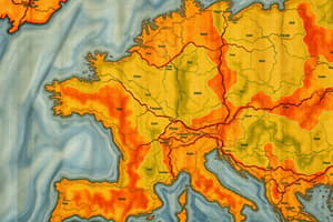
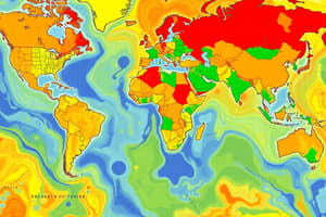
Thematic Map
Thematic Map
Puts data on a map in a geographic area that makes sense.
Chloropleth
Chloropleth
Uses colors
Absolute Direction
Absolute Direction
Signup and view all the flashcards
Absolute Distance
Absolute Distance
Signup and view all the flashcards
Absolute Location
Absolute Location
Signup and view all the flashcards
Relative Direction
Relative Direction
Signup and view all the flashcards
Relative Distance
Relative Distance
Signup and view all the flashcards
Relative Location
Relative Location
Signup and view all the flashcards
GIS
GIS
Signup and view all the flashcards
Satellite Navigation
Satellite Navigation
Signup and view all the flashcards
Remote Sensing
Remote Sensing
Signup and view all the flashcards
Telling of Data
Telling of Data
Signup and view all the flashcards
Travel Narrative/Media Reports/Field Observation/Personal Interviews
Travel Narrative/Media Reports/Field Observation/Personal Interviews
Signup and view all the flashcards
Study Notes
Chapter 1
- Definition of a reference map: Used to find areas with places
- Thematic maps puts data on a map in a geographic area that makes sense
- Chlorapleth maps utilizes colors
- Dot density
Absolute
- Direction is an exact direction
- Distance is the exact measurement between two places
- Location is the exact spot where something is located
Relative
- Direction depends on the surrounding area
- Distance is an approximate measurement between two places
- Location is a description using surrounding features
Chapter 2
- Data analysis and collecting data
- GIS allows for seeing data all at once
- Satellite navigation allows for more accurate data of an area
- Remote sensing: collecting data without being present
- Telling of data happens through people/media
- Travel narratives, media reports, field observations, and personal interviews are all ways of collecting data
Studying That Suits You
Use AI to generate personalized quizzes and flashcards to suit your learning preferences.