Podcast
Questions and Answers
What is the primary purpose of a thematic map?
What is the primary purpose of a thematic map?
- To illustrate trade patterns and the spread of disease
- To depict detailed physical features of a geographic area
- To provide directions and simple location information
- To explain spatial patterns and trends related to a specific concept (correct)
What is cartography?
What is cartography?
- The process of analyzing statistical data
- The art of creating topographic maps
- The act of mapmaking (correct)
- The study of geographical features
What distinguishes thematic maps from traditional reference maps?
What distinguishes thematic maps from traditional reference maps?
- Thematic maps explain spatial patterns and trends, while reference maps provide simple location information (correct)
- Thematic maps display detailed topography, while reference maps illustrate trade patterns
- Thematic maps focus on physical features, while reference maps depict statistical data
- Thematic maps are used for navigation, while reference maps are for research purposes
What process turns statistical data into geospatial data?
What process turns statistical data into geospatial data?
What is an example of a thematic map's subject matter?
What is an example of a thematic map's subject matter?
What is a disadvantage of a heat map?
What is a disadvantage of a heat map?
What is a disadvantage of a dot distribution map?
What is a disadvantage of a dot distribution map?
What is a disadvantage of a flow-line map?
What is a disadvantage of a flow-line map?
What is the purpose of a thematic map?
What is the purpose of a thematic map?
What does a darker color on a thematic map typically represent?
What does a darker color on a thematic map typically represent?
Which type of thematic map uses continuous lines to delineate data of the same value, such as elevation and weather maps?
Which type of thematic map uses continuous lines to delineate data of the same value, such as elevation and weather maps?
What is a limitation of choropleth maps?
What is a limitation of choropleth maps?
What is the advantage of graduated symbol maps?
What is the advantage of graduated symbol maps?
Which type of thematic map distorts geographical areas to represent data, for example, by making countries with higher populations appear larger on the map?
Which type of thematic map distorts geographical areas to represent data, for example, by making countries with higher populations appear larger on the map?
What can thematic maps be used to visualize, according to the text?
What can thematic maps be used to visualize, according to the text?
Flashcards
Thematic Map Purpose
Thematic Map Purpose
To show spatial patterns and trends related to a specific idea.
Cartography
Cartography
The art and science of mapmaking.
Thematic Map vs. Reference Map
Thematic Map vs. Reference Map
Thematic maps focus on patterns; reference maps show locations.
Geospatial Data Creation
Geospatial Data Creation
Signup and view all the flashcards
Thematic Map Subject Matter Example
Thematic Map Subject Matter Example
Signup and view all the flashcards
Heat Map Disadvantage
Heat Map Disadvantage
Signup and view all the flashcards
Dot Distribution Map Disadvantage
Dot Distribution Map Disadvantage
Signup and view all the flashcards
Flow-Line Map Disadvantage
Flow-Line Map Disadvantage
Signup and view all the flashcards
Thematic Map Purpose (alt)
Thematic Map Purpose (alt)
Signup and view all the flashcards
Darker Color on Thematic Map
Darker Color on Thematic Map
Signup and view all the flashcards
Isoline Map
Isoline Map
Signup and view all the flashcards
Choropleth Map Limitation
Choropleth Map Limitation
Signup and view all the flashcards
Graduated Symbol Map Advantage
Graduated Symbol Map Advantage
Signup and view all the flashcards
Cartogram Map
Cartogram Map
Signup and view all the flashcards
Thematic Map Visualizations
Thematic Map Visualizations
Signup and view all the flashcards
Study Notes
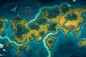
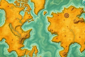
Thematic Maps: Types and Definitions
- Thematic maps can be used to understand correlations and patterns in data, including world population distribution.
- Choropleth maps, one of the most common types of thematic maps, use colors to highlight patterns and can display two variables at once.
- Isoline maps use continuous lines to delineate data of the same value, such as elevation and weather maps.
- Cartogram maps distort geographical areas to represent data, for example, by making countries with higher populations appear larger on the map.
- Graduated symbol maps use size and shape to indicate the amount of data at a specific location, making it easier to understand the map.
- Thematic maps have different purposes and pros and cons, and they include isoline maps, cartogram maps, choropleth maps, graduated symbol maps, heat maps, dot-density maps, and flow-line definition maps.
- Isoline maps are beneficial for interpreting gradual changes in data but can be challenging to make and read.
- Choropleth maps are visually effective and easy to read but assume that the areas shaded have the same value, limiting specificity.
- Cartogram maps effectively exhibit numbers but distort geographical areas.
- A graduated symbol map's advantage lies in its effective classification of symbols to represent data.
- Thematic maps can be used to visualize various data, such as world population, atmospheric pressure, gas prices, and hospital locations.
- Thematic maps serve different purposes and are useful for understanding spatial data and patterns in a visually effective way.
Studying That Suits You
Use AI to generate personalized quizzes and flashcards to suit your learning preferences.