Podcast
Questions and Answers
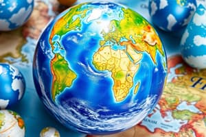
What is the primary purpose of using a map instead of a globe?
What is the primary purpose of using a map instead of a globe?
- To study the Earth's shape as a whole
- To understand the difference between maps and sketches
- To study the Earth horizontally as a part (correct)
- To locate specific houses in a town
Which type of map would be most useful for showing the location of continents and oceans?
Which type of map would be most useful for showing the location of continents and oceans?
- Thematic map
- Physical map
- Political map (correct)
- Sketch
Why did Mrudula fail to reach Sathwika’s house with the help of the sketch?
Why did Mrudula fail to reach Sathwika’s house with the help of the sketch?
- The sketch did not show the location of Tirupati
- The sketch did not include a scale
- The sketch did not indicate the direction to Sathwika’s house (correct)
- The sketch did not have symbols and colors
What is a limitation of using a globe for studying the Earth?
What is a limitation of using a globe for studying the Earth?
Which components are essential for a map to be effective in providing guidance?
Which components are essential for a map to be effective in providing guidance?
What is the main focus of this chapter?
What is the main focus of this chapter?
What is the main difference between a sketch and a map?
What is the main difference between a sketch and a map?
Why do all maps contain a North arrow with the letter 'N' at the top right-hand corner?
Why do all maps contain a North arrow with the letter 'N' at the top right-hand corner?
What is the purpose of a scale on a map?
What is the purpose of a scale on a map?
What do symbols on a map help with?
What do symbols on a map help with?
In thematic maps, what is used instead of colours to represent different intensities?
In thematic maps, what is used instead of colours to represent different intensities?
What does a political map primarily show?
What does a political map primarily show?
What type of map shows physical features such as Mountains, Plateaus, Plains, Oceans and Rivers?
What type of map shows physical features such as Mountains, Plateaus, Plains, Oceans and Rivers?
What is the primary purpose of thematic maps?
What is the primary purpose of thematic maps?
'Large-scale' maps represent which type of areas?
'Large-scale' maps represent which type of areas?
'Small-scale' maps represent which type of areas?
'Small-scale' maps represent which type of areas?
What is the main purpose of Wall maps?
What is the main purpose of Wall maps?
What do Cartographers do?
What do Cartographers do?
What is the purpose of GPS technology?
What is the purpose of GPS technology?
Why are aerial and satellite views provided in web-based map services?
Why are aerial and satellite views provided in web-based map services?
What is the purpose of using symbols in preparing maps?
What is the purpose of using symbols in preparing maps?
Why is the actual distance on the ground reduced on a map?
Why is the actual distance on the ground reduced on a map?
What makes political maps different from physical maps?
What makes political maps different from physical maps?
What is the importance of thematic maps?
What is the importance of thematic maps?
Which component of a map is a drawing based on memory and spot observation, not to scale?
Which component of a map is a drawing based on memory and spot observation, not to scale?
What is the ratio between the actual distance on the ground and the distance shown on the map with the help of scale called?
What is the ratio between the actual distance on the ground and the distance shown on the map with the help of scale called?