Podcast
Questions and Answers
What type of map is crucial for hikers, campers, and outdoor enthusiasts?
What type of map is crucial for hikers, campers, and outdoor enthusiasts?
- Cartograms
- Thematic Maps
- Road Maps
- Topographic Maps (correct)
Which type of map distorts the shapes of geographical areas to emphasize certain characteristics?
Which type of map distorts the shapes of geographical areas to emphasize certain characteristics?
- Topographic Maps
- Road Maps
- Thematic Maps
- Cartograms (correct)
What do scales determine in maps?
What do scales determine in maps?
- The level of detail shown (correct)
- The cardinal points
- The legends
- The types of maps
Which type of map provides specific information about a particular subject or location?
Which type of map provides specific information about a particular subject or location?
When used by explorers or when detailed maps are unavailable, what type of map is typically employed for a general understanding of an area?
When used by explorers or when detailed maps are unavailable, what type of map is typically employed for a general understanding of an area?
What does a map's scale ratio of 1:50,000 signify?
What does a map's scale ratio of 1:50,000 signify?
Which map component provides information about symbols and abbreviations used?
Which map component provides information about symbols and abbreviations used?
What are the four primary cardinal points used on maps?
What are the four primary cardinal points used on maps?
Which map type is a hand-drawn outline used when detailed maps are unavailable?
Which map type is a hand-drawn outline used when detailed maps are unavailable?
What is the purpose of a scale bar on a map?
What is the purpose of a scale bar on a map?
Flashcards are hidden until you start studying
Study Notes
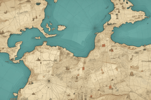
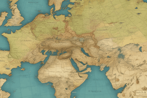
Mapping: A Comprehensive Guide to Understanding Our World
Maps are intricate visual representations of our planet, essential for navigation, exploration, and understanding our surroundings. They encompass a range of types, scales, and components that help us make sense of complex geographical features. Let's delve into each of these aspects.
Types of Maps
Maps come in various forms to cater to different purposes.
- Topographic Maps: These show relief, or the three-dimensional characteristics of land, such as mountains, valleys, and elevations. They are crucial for hikers, campers, and outdoor enthusiasts.
- Road Maps: Primarily designed for drivers and travelers, these maps display highways, major roads, and other transportation routes.
- Thematic Maps: Also known as reference maps, these convey specific information about a particular subject or location, such as a forest cover map, population density map, or climate map.
- Cartograms: These maps distort the shapes of geographical areas to emphasize certain characteristics, such as population density or economic activity.
- Sketch Maps: Quick and simple drawings, sketch maps show the general layout of an area to provide a basic understanding of its features, often used by explorers or when detailed maps are unavailable.
Scales
Scales are essential aspects of maps, as they determine the level of detail shown. A map's scale is represented by a ratio, such as 1:50,000, which signifies that 1 centimeter on the map represents 50,000 centimeters in the real world.
Components of Maps
Maps consist of several essential elements that help convey information and aid in understanding the spatial relationships between features.
- Cartographic Symbols: These are the standardized graphic representations used to depict map features, such as roads, rivers, and vegetation.
- Legends: These are important key elements that explain the symbols and abbreviations used on the map.
- Insets: These are smaller maps inserted into a larger map to provide additional detail or to show a specific area in greater detail.
- Grid Lines: These are lines overlaid on a map to help better locate positions, measure distances, and identify cardinal directions.
- Titles: These provide the map's name and location being depicted.
- Scale Bar: These are horizontal or vertical bars drawn on the map that show the relationship between distances on the map and their actual counterparts in the real world.
Cardinal Points
Cardinal points are the four primary directions used on maps: north, south, east, and west. Other terms used to describe intermediate directions include north-east, south-west, and so on.
Sketch Maps
Sketch maps are hand-drawn, simple outlines of an area, often used by explorers or when detailed maps are unavailable. They provide a general understanding of the area's features, such as roads, rivers, mountains, and other significant landmarks.
In summary, maps encompass a variety of types, scales, components, and cardinal points that help us understand our surroundings. Sketch maps are simple outlines that provide a general understanding of an area. These elements work together to make maps a powerful tool for navigation, exploration, and comprehending our world.
Studying That Suits You
Use AI to generate personalized quizzes and flashcards to suit your learning preferences.