Podcast
Questions and Answers
What does physical geography primarily focus on?
What does physical geography primarily focus on?
- Human societies and their relationships
- Cultural landscapes
- Natural features of the Earth (correct)
- Mapping spatial data
Human geography includes the study of biogeography.
Human geography includes the study of biogeography.
False (B)
What is the term for the exact coordinates used to define location?
What is the term for the exact coordinates used to define location?
absolute location
Geographical Information Systems (GIS) are important tools for _______.
Geographical Information Systems (GIS) are important tools for _______.
Match the following themes in geography with their descriptions:
Match the following themes in geography with their descriptions:
Which of the following is NOT a key concept in geography?
Which of the following is NOT a key concept in geography?
Remote sensing is a method used for direct field measurement.
Remote sensing is a method used for direct field measurement.
What are some applications of GIS?
What are some applications of GIS?
The study of population distribution and demographics is a topic within _______.
The study of population distribution and demographics is a topic within _______.
What is the focus of human geography?
What is the focus of human geography?
Which type of map focuses specifically on themes like population density?
Which type of map focuses specifically on themes like population density?
Road maps are primarily used for representing political boundaries.
Road maps are primarily used for representing political boundaries.
What does the term 'legend' refer to in cartography?
What does the term 'legend' refer to in cartography?
The _____ projection preserves angles and is useful for navigation despite distorting areas near the poles.
The _____ projection preserves angles and is useful for navigation despite distorting areas near the poles.
Match the following map types with their definitions:
Match the following map types with their definitions:
Which map element is used to indicate cardinal directions?
Which map element is used to indicate cardinal directions?
Medieval cartography placed a strong emphasis on accuracy in mapping.
Medieval cartography placed a strong emphasis on accuracy in mapping.
What is the primary use of GIS in modern cartography?
What is the primary use of GIS in modern cartography?
The use of colors to differentiate features on a map is known as _____ coding.
The use of colors to differentiate features on a map is known as _____ coding.
What projection minimizes both area and shape distortion in maps?
What projection minimizes both area and shape distortion in maps?
What is the primary purpose of a political map?
What is the primary purpose of a political map?
The Robinson projection is known for distorting both size and shape equally.
The Robinson projection is known for distorting both size and shape equally.
What does GIS stand for?
What does GIS stand for?
The _______ is a map feature that explains the symbols and colors used on a map.
The _______ is a map feature that explains the symbols and colors used on a map.
Match the following types of maps with their descriptions:
Match the following types of maps with their descriptions:
Which cartographic projection emphasizes area accuracy but distorts shape?
Which cartographic projection emphasizes area accuracy but distorts shape?
Digital cartography involves traditional map-making techniques without the use of technology.
Digital cartography involves traditional map-making techniques without the use of technology.
What does a compass rose indicate on a map?
What does a compass rose indicate on a map?
Cartography combines traditional techniques with _______ for precision and usability.
Cartography combines traditional techniques with _______ for precision and usability.
What is the scale on a map used for?
What is the scale on a map used for?
Flashcards are hidden until you start studying
Study Notes
Definition of Geography
- Study of the Earth's landscapes, environments, and the relationships between people and their environments.
Branches of Geography
-
Physical Geography
- Focuses on natural features: landforms, climate, vegetation, and ecosystems.
- Key topics include:
- Landforms (mountains, plains, valleys)
- Climate and weather patterns
- Biogeography (distribution of species)
-
Human Geography
- Examines human societies and their relationship with the environment.
- Key topics include:
- Population distribution and demographics
- Urbanization and city planning
- Cultural landscapes and globalization
-
Geographical Information Systems (GIS)
- Tools for mapping and analyzing spatial data.
- Applications in urban planning, environmental management, and resource allocation.
Key Concepts in Geography
-
Location
- Absolute: exact coordinates (latitude and longitude).
- Relative: position in relation to other locations.
-
Place
- Characteristics that define a location: physical and human attributes.
-
Region
- Areas defined by common features: physical (landforms, climate) and cultural (language, history).
-
Movement
- How people, goods, and ideas move from one place to another.
- Includes migration, trade, and communication networks.
-
Human-Environment Interaction
- How humans adapt to and modify their environment.
- Key issues: sustainability, climate change, and resource management.
Tools and Techniques
-
Maps
- Visual representation of geographical areas.
- Types: topographic, political, thematic.
-
Remote Sensing
- Acquisition of information about the Earth's surface using satellites and aerial imagery.
-
Fieldwork
- Collection of data through observation and measurement in natural environments.
Important Themes in Geography
-
Globalization
- Increasing interconnectedness of economies, cultures, and populations.
-
Environmental Sustainability
- Balancing human needs with the health of the planet.
-
Cultural Diversity
- Variety of cultural practices and beliefs across different regions.
-
Urbanization
- Growth of urban areas as people move from rural to urban settings.
Applications of Geography
- Urban planning and development
- Environmental conservation and management
- Disaster response and risk assessment
- Transportation and logistics planning
Geographic Skills
- Map reading and interpretation
- Data analysis and spatial reasoning
- Critical thinking about spatial relationships and patterns
Definition of Geography
- Involves studying Earth's landscapes, environments, and human-environment interactions.
Branches of Geography
-
Physical Geography
- Analyzes natural features such as landforms, climate, vegetation, and ecosystems.
- Key areas include:
- Landforms like mountains, plains, and valleys
- Climate and its weather patterns
- Biogeography, focusing on species distribution
-
Human Geography
- Investigates human societies and their connections with the natural environment.
- Key areas include:
- Population distribution and demographic trends
- Urbanization and the complexities of city planning
- Cultural landscapes influenced by globalization
-
Geographical Information Systems (GIS)
- Employs tools for mapping and spatial data analysis.
- Utilized in urban planning, environmental management, and resource allocation.
Key Concepts in Geography
-
Location
- Absolute location refers to precise coordinates (latitude and longitude).
- Relative location is determined by its position relative to other places.
-
Place
- Considers specific characteristics that define a location, encompassing both physical and human attributes.
-
Region
- Represents areas with shared features, whether physical (like landforms and climate) or cultural (including language and history).
-
Movement
- Explores how people, goods, and ideas transition between locations, involving migration, trade, and communication networks.
-
Human-Environment Interaction
- Examines how humans adapt to and modify their surroundings.
- Key issues include sustainability, climate change, and resource management.
Tools and Techniques
-
Maps
- Serve as visual representations of geographic areas and come in various types, including topographic, political, and thematic maps.
-
Remote Sensing
- Involves obtaining information about Earth's surface via satellites and aerial imagery.
-
Fieldwork
- Entails data collection through direct observation and measurement in natural environments.
Important Themes in Geography
-
Globalization
- Highlights the growing interconnectedness of economies, cultures, and populations around the world.
-
Environmental Sustainability
- Focuses on balancing human needs with environmental health and stability.
-
Cultural Diversity
- Represents the rich variety of cultural practices and beliefs found across different regions.
-
Urbanization
- Describes the trend of increasing urban area growth as populations shift from rural to urban environments.
Applications of Geography
- Plays a crucial role in urban planning and the development of cities.
- Essential for environmental conservation and natural resource management.
- Important for disaster response and risk assessment strategies.
- Vital for planning transportation systems and logistics.
Geographic Skills
- Proficiency in map reading and interpretation is essential for geographers.
- Data analysis and spatial reasoning skills enable better understanding of geographic patterns.
- Critical thinking is necessary for assessing spatial relationships and geographical phenomena.
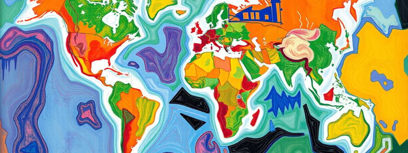
Cartography Overview
- Cartography combines science and art, focusing on the creation of maps to visually represent geographical information.
Types of Maps
- Thematic Maps target specific data (e.g., population density, climate variations).
- Topographic Maps illustrate terrain relief and elevation using contour lines for detailed landscape representation.
- Political Maps delineate boundaries, cities, and political features, making them essential for understanding geopolitical landscapes.
- Physical Maps emphasize natural features such as mountains, rivers, and lakes, highlighting the Earth’s physical characteristics.
- Road Maps are practical for navigation, detailing roads, highways, and points of interest for travelers.
Map Elements
- Scale indicates the ratio of map distance to actual ground distance, facilitating accurate distance interpretation (e.g., 1:50,000).
- Legend/Key clarifies the symbols and colors utilized on the map, ensuring users can interpret the data effectively.
- Compass Rose displays cardinal directions (North, South, East, West), aiding in navigation and orientation.
- Grid System employs latitude and longitude for precise location identification on maps.
Map Projections
- Mercator Projection maintains angle accuracy, making it useful for navigation but distorts areas, particularly near the poles.
- Robinson Projection attempts to balance size and shape distortions, offering visually pleasing world maps.
- Goode's Homolosine Projection minimizes area and shape distortion with an interrupted format, ideal for representing global data.
Historical Development
- Ancient Maps were created by early civilizations like the Babylonians and Greeks, based on careful observations and explorations.
- Medieval Cartography prioritized religious and mythological representations, often sacrificing accuracy for narrative.
- Modern Cartography integrates advanced technology, including Geographic Information Systems (GIS) and satellite imagery, for precise and detailed mapping.
Cartographic Techniques
- Symbolization involves using various symbols to denote features (e.g., dots for cities, lines for transportation routes).
- Color Coding effectively distinguishes features by category (e.g., blue for water bodies, green for forests).
- Data Visualization incorporates graphs and charts alongside maps, enhancing the communication of information.
Importance of Cartography
- Cartography is crucial for navigation, urban planning, resource management, and environmental monitoring, providing essential tools for a variety of fields.
- It enhances understanding of geographical relationships and patterns, aiding in informed decision-making within government, business, and scientific contexts.
Cartography Overview
- Cartography combines art and science, focusing on creating maps that represent geographic knowledge accurately on a two-dimensional surface.
Types of Maps
- Physical Maps: Depict natural geographic features like mountains and rivers to illustrate terrain.
- Political Maps: Highlight governmental boundaries and significant human-made structures, such as cities.
- Thematic Maps: Present data related to specific themes, such as population density and climate patterns.
- Topographic Maps: Include contour lines to represent elevation changes and landform details.
Map Components
- Scale: Indicates the relationship between map distance and real-world distance, for example, a scale of 1:50,000.
- Legend/Key: Provides explanations of the symbols and colors used within the map.
- Compass Rose: Shows cardinal directions—North, South, East, and West.
- Projection: Refers to methods that translate the Earth's curved surface onto a flat map, influencing various properties like area and shape.
Cartographic Projections
- Mercator Projection: Maintains angle accuracy for navigation but distorts size, particularly at high latitudes.
- Robinson Projection: Strives to minimize distortion in size and shape, making it suitable for world maps.
- Peters Projection: Focuses on accurate area representation but compromises on shape fidelity.
Technological Advances
- GIS (Geographic Information Systems): Facilitates spatial data analysis and visualization, transforming how maps are created and understood.
- Remote Sensing: Involves the use of satellite and aerial imagery for data collection, enhancing map production capabilities.
- Digital Cartography: Features the creation and digital storage of maps, boosting accessibility and interactive use.
Historical Development
- Early maps predominantly included symbolic or artistic representations, heavily influenced by religious or mythological contexts.
- The Age of Exploration marked significant improvements in navigation, leading to practical and accurate mapping techniques.
- Contemporary cartography merges traditional methods with cutting-edge technology, ensuring high precision and user-friendliness.
Ethical Considerations
- Maps can shape perceptions and influence behaviors, with ethical cartographers prioritizing both accuracy and fairness in representation.
- The depiction of political boundaries often reflects underlying biases, emphasizing the need for critical evaluation of map content.
Applications of Cartography
- Utilized in urban planning, environmental monitoring, and disaster management for resource allocation.
- Supports navigation and travel planning through the integration of GPS technology.
- Serves as an educational resource in geography and social sciences to enhance understanding of spatial relations and world geography.
Studying That Suits You
Use AI to generate personalized quizzes and flashcards to suit your learning preferences.