Podcast
Questions and Answers
What is the primary purpose of a geographic coordinate system?
What is the primary purpose of a geographic coordinate system?
- To measure distances between cities
- To create maps
- To have a common language for exact location on Earth (correct)
- To analyze landmass shapes
Meridians measure distance north to south of the prime meridian.
Meridians measure distance north to south of the prime meridian.
False (B)
What shape is the Earth generally considered to be?
What shape is the Earth generally considered to be?
approximately spherical
The _______ system is crucial for effective data sharing and communication in geography.
The _______ system is crucial for effective data sharing and communication in geography.
Match the following terms with their definitions:
Match the following terms with their definitions:
Which factor is not considered when determining distances between landmasses?
Which factor is not considered when determining distances between landmasses?
Standardization in mapping only affects cartography.
Standardization in mapping only affects cartography.
What is the effect of having a common geographic coordinate system?
What is the effect of having a common geographic coordinate system?
What is a common characteristic of all map projections?
What is a common characteristic of all map projections?
The equator is an area where all map projections maintain perfect accuracy.
The equator is an area where all map projections maintain perfect accuracy.
What is the main consequence of the projection process on maps?
What is the main consequence of the projection process on maps?
All projections distort something, but none can perfectly represent the __________ of the Earth.
All projections distort something, but none can perfectly represent the __________ of the Earth.
Match the following projections with their characteristics:
Match the following projections with their characteristics:
Which projection type primarily focuses on preserving area?
Which projection type primarily focuses on preserving area?
Conformal projections are known for maintaining the shape of geographic features accurately.
Conformal projections are known for maintaining the shape of geographic features accurately.
What is the point where the map projection's distortion is greatest?
What is the point where the map projection's distortion is greatest?
Flashcards are hidden until you start studying
Study Notes
Importance of Geographic Coordinate Systems
- Geographic coordinates are used to accurately locate places on Earth.
- A standard system is crucial for effective data sharing, communication, and consistency.
Understanding the Coordinate System
- Latitude and longitude are used to represent points on Earth's surface.
- Latitude measures distance north or south from the equator.
- Longitude measures distance east or west from the Prime Meridian.
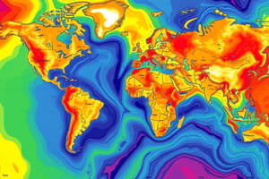
Shape of Earth
- Earth is approximately spherical, but its shape is not perfectly round.
Distortion in Mapping
- It is impossible to represent a spherical Earth on a flat map without some distortion.
- All projections distort some aspect of Earth, such as distance, area, or shape.
- Projections are techniques used to represent the curved surface of the Earth on a flat map.
- There are different types of projections, each with advantages and limitations.
Key Types of Projections
- Equal Area Projections: Preserve area but distort shapes.
- Conformal Projections: Preserve angles and shapes but distort area.
- Compromise Projections: Attempt to balance distortions in area, shape, and distance.
Importance of the Prime Meridian
- The Prime Meridian is a line of longitude that runs from the North Pole to the South Pole.
- It's used as a reference point for measuring longitude.
- It does not pass through the North and South Poles.
- The equator is a line of zero degrees latitude and is the only line of latitude unaffected by distortion in projections.
Understanding Distortion
- Distortion is introduced during the projection process, which is the transformation of a spherical shape into a flat map.
- Projections can be chosen based on the specific needs of a map, such as showing accurate shapes, distances, or areas.
Studying That Suits You
Use AI to generate personalized quizzes and flashcards to suit your learning preferences.