Podcast
Questions and Answers
What is the main purpose of a reference map?
What is the main purpose of a reference map?
- To classify data into quantitative ranges
- To demonstrate particular features or concepts
- To emphasize the location of spatial phenomena (correct)
- To visualize population density specifically
Which type of map uses shading or patterns in relation to the quantitative value of features?
Which type of map uses shading or patterns in relation to the quantitative value of features?
- Isopleth map
- Proportional symbol map
- Dot (density) map
- Choropleth map (correct)
How does ArcGIS Pro handle layers with different coordinate systems?
How does ArcGIS Pro handle layers with different coordinate systems?
- It projects them to the map's spatial reference in real-time (correct)
- It displays them without any reference system
- It converts all layers to the first layer's coordinate system
- It ignores the additional layers
What characterizes a thematic map compared to a reference map?
What characterizes a thematic map compared to a reference map?
In which context are choropleth maps most useful?
In which context are choropleth maps most useful?
What is the primary characteristic of a proportional symbol map?
What is the primary characteristic of a proportional symbol map?
Which of the following describes an isopleth map?
Which of the following describes an isopleth map?
Which method is NOT one of the major classification methods for organizing information?
Which method is NOT one of the major classification methods for organizing information?
What aspect of color can be defined as its brightness or darkness?
What aspect of color can be defined as its brightness or darkness?
In the context of geocoding, what is the first step in the process?
In the context of geocoding, what is the first step in the process?
What type of map uses dots to represent occurrences with randomized locations?
What type of map uses dots to represent occurrences with randomized locations?
Which of the following is true about classification methods?
Which of the following is true about classification methods?
Which type of color ramp is used to depict non-ordered categories?
Which type of color ramp is used to depict non-ordered categories?
What is the main focus of the Geographic Coordinate System (GCS)?
What is the main focus of the Geographic Coordinate System (GCS)?
Which of the following is NOT part of the course contents?
Which of the following is NOT part of the course contents?
What is the primary purpose of geodesy?
What is the primary purpose of geodesy?
Which of the following statements about the Earth’s shape is true?
Which of the following statements about the Earth’s shape is true?
How is the Earth's surface modeled in basic discussions of map projections?
How is the Earth's surface modeled in basic discussions of map projections?
What percentage of the total grade is made up by the midterm exam in the course?
What percentage of the total grade is made up by the midterm exam in the course?
What is a geodetic datum?
What is a geodetic datum?
In what way are projected coordinate systems different from geographic coordinate systems?
In what way are projected coordinate systems different from geographic coordinate systems?
Which of the following is considered a spatial analysis technique mentioned in the course?
Which of the following is considered a spatial analysis technique mentioned in the course?
What is a common result of all map projections?
What is a common result of all map projections?
What type of coordinates does the Geographic Coordinate System primarily use?
What type of coordinates does the Geographic Coordinate System primarily use?
In terms of GIS, choropleth maps are primarily used for what purpose?
In terms of GIS, choropleth maps are primarily used for what purpose?
Which map projection is best suited for land masses extending in an east-west orientation at mid-latitudes?
Which map projection is best suited for land masses extending in an east-west orientation at mid-latitudes?
What is a significant benefit of using a State Plane Coordinate System?
What is a significant benefit of using a State Plane Coordinate System?
Which of these processes is involved in vector and raster modeling?
Which of these processes is involved in vector and raster modeling?
What distinguishes the WGS84 datum?
What distinguishes the WGS84 datum?
How many zones does the Universal Transverse Mercator (UTM) divide the Earth into?
How many zones does the Universal Transverse Mercator (UTM) divide the Earth into?
Why must two map layers register spatially?
Why must two map layers register spatially?
What is the purpose of comparing an address in an event table to a reference dataset during geocoding?
What is the purpose of comparing an address in an event table to a reference dataset during geocoding?
Which of the following is NOT a possible problem in geocoding?
Which of the following is NOT a possible problem in geocoding?
What is the first step in the geocoding process as described in the content?
What is the first step in the geocoding process as described in the content?
What type of data might be indicated by the notation 'R' and 'L' next to street names in the address matching process?
What type of data might be indicated by the notation 'R' and 'L' next to street names in the address matching process?
When performing geocoding, which of the following steps follows the determination of address matches?
When performing geocoding, which of the following steps follows the determination of address matches?
Flashcards are hidden until you start studying
Study Notes
Coordinate Systems & Projections
- Geographic Coordinate System (GCS) is used to measure locations on Earth's surface
- The location is determined by latitude and longitude, known as geographic coordinates
- The Earth is not a perfect sphere, it is wider at the equator
- Geodesy studies the Earth's geometric shape, gravity field, and orientation
- Geoid is a model that represents the shape of the Earth coinciding with mean sea level
- Ellipsoid is a mathematical model of the Earth that is used in geodetic calculations
- Datum is a mathematical model used as a reference for calculating geographic coordinates
- NAD83 (North American Datum 1983) is a geocentric datum used by the US NGS (National Geodetic Survey)
- WGS84 (World Geodetic System 1984) is used by the Department of Defense for global positioning
- Map projection transforms curved Earth positions onto a flat surface for mapping
- Mercator Projection is used to display the world map with distorted areas and shapes
- UTM (Universal Transverse Mercator) divides the Earth into 60 zones for mapping
- Lamber Conformal Conic projection is best for land masses extending east-west
- Web Mercator Auxiliary Sphere is used in ArcGIS Online base maps and layers
- Albers Equal Area Conic projection is best for land masses extending east-west, such as the US
Cartography & Choropleth Maps
- Cartography is the art and science of map making
- Reference maps emphasize locations of spatial phenomena
- Thematic maps focus on spatial patterns of geographic attributes
- Choropleth maps color features proportionally to quantitative values
- Proportional symbol maps use symbol sizes to represent data at point locations
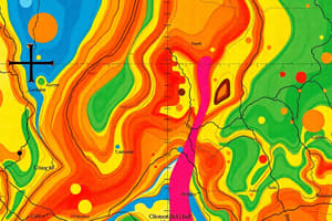
- Isopleth maps (contour maps) show lines of equal values
- Dot density maps use dots to represent occurrences, with locations randomized
- Map elements include title, legend, scale, north arrow, and data sources
Geocoding
- Geocoding assigns georeferenced locations to address coordinate values
- Address event table contains the addresses to be geocoded
- Address reference theme is a dataset with street network data
- Geocoding matches an address in an event table to the reference dataset
- It calculates a georeferenced location if a match is found
- Geocoding may be affected by variations in street names, data entry errors, missing information, or place names.
Lab 0: Plot US State Population Density
- Select a single state using Select by Attribute and Export Features
- Crop the raster to the state extent using Clip Raster
- Set symbology and create a new map layout
- Add map elements like legend, scale, north arrow, and data sources
Studying That Suits You
Use AI to generate personalized quizzes and flashcards to suit your learning preferences.