Podcast
Questions and Answers
What is the main topic covered in the first virtual class for the GE 105 Cartography course?
What is the main topic covered in the first virtual class for the GE 105 Cartography course?
- Map scale, coordinate systems, and projections (correct)
- GPS technology
- Geographic landmarks
- Map legends and symbols
Why is scale crucial in map creation?
Why is scale crucial in map creation?
- To distort real-world features
- To represent real-world features accurately (correct)
- To hide landmarks on maps
- To make maps visually appealing
What does map scale educate map users about?
What does map scale educate map users about?
- Landmarks, distances, and features (correct)
- Historical events
- Rare artifacts
- Weather patterns
Which coordinate system is based on latitude, longitude, and height?
Which coordinate system is based on latitude, longitude, and height?
What do map projections distort?
What do map projections distort?
Which projection preserves area properties well?
Which projection preserves area properties well?
What coordinate systems are used in the Philippine land survey?
What coordinate systems are used in the Philippine land survey?
Which system was introduced in 1965 to unify coordinate systems for cadastral surveys in the Philippines?
Which system was introduced in 1965 to unify coordinate systems for cadastral surveys in the Philippines?
What is the significance of PRS92 in the Philippines?
What is the significance of PRS92 in the Philippines?
What is the purpose of Geographic Information Systems (GIS)?
What is the purpose of Geographic Information Systems (GIS)?
Which component of GIS includes functions and tools?
Which component of GIS includes functions and tools?
What classification levels are discussed regarding map data in the text?
What classification levels are discussed regarding map data in the text?
Flashcards are hidden until you start studying
Study Notes
- The meeting is the first virtual class for the GE 105 Cartography course.
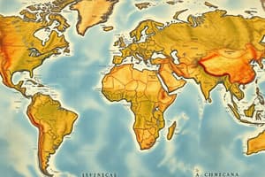
- The lecture covers scale, coordinate systems, and projections.
- Map scale is the ratio between distances on the map and the earth.
- Map scale helps represent real-world features accurately on maps.
- Scale is crucial for updating maps with new developments and changes.
- Scale educates map users about landmarks, distances, and features.
- Map scale guides travelers in estimating travel time and distances.
- Scales need to be constantly updated to reflect changes in landmarks.
- Creating scales for maps can be time-consuming and expensive.
- Scale disadvantages include consuming time, requiring research, and constant updates.
- Map scale ensures landmarks are accurately represented on maps.
- Map projections are methods to convert the Earth's round surface onto a flat map.
- Coordinate systems define positions on Earth's surface using reference points and measurements.
- Coordinate systems include global Cartesian, geographic, and projected coordinates.
- Geographic coordinates are based on latitude, longitude, and height.
- Projected coordinates transform spherical Earth into a flat map using units of measure.
- Map projections distort properties like area, shape, and distance.
- Projections can be conic, cylindrical, or planar, each suited for specific areas.
- The Lambert Equal Area Conic Projection preserves area properties well.
- The Universal Transverse Mercator Projection divides the world into zones for accurate mapping.
- The Lambert Azimuthal Equal Area Projection preserves area and direction properties.
- The Philippine land survey uses coordinate systems like LPCS, PPCS, and PRS92.
- The Local Plane Coordinate System offers accurate calculations within specific zones.
- State Plane Coordinate Systems are designed for regions to minimize errors within zones.- The Philippines uses the State Plane Coordinate System, derived from the US system, which was introduced in 1965 to unify coordinate systems for cadastral surveys.
- Before 1965, cadastral surveys in the Philippines used LPCS, which caused issues in connecting survey outputs from different municipalities.
- In 1965, the Philippines introduced the Philippine Datum of 1911 for the Philippine Plane Coordinate System, based on Clark's F spheroid of 1866 parameters and the transverse Mercator projection.
- In 1992, the PRS92 was established as a national network of control points marked by survey monuments using GPS technology, becoming the standard reference system for surveying and mapping activities in the Philippines.
- The implementation agencies for these systems include NAMRIA and DNR, which establish different levels of control points for surveying.
- The Philippine Datum of 1911 and PRS92 use the transverse Mercator projection divided into zones with specific parameters for each zone.
- Geographic coordinate values in the Philippine Transverse Mercator Projection correspond to central meridians for each zone, with specific areas of coverage.
- Provinces in the Philippines are assigned to map projection zones based on their geographic locations.
- The text then delves into the four levels of map data classification: nominal, ordinal, interval, and ratio, explaining each level in detail with examples.
- It further discusses Geographic Information Systems (GIS) and how GIS combines geographic and information systems to organize, store, and communicate geographic information effectively.
- GIS is crucial for decision-making as it helps in finding patterns in data, integrating data from various sources, and providing accurate and timely decisions to solve real-world problems.- In GIS, patterns are used to determine if an occurrence is due to its special location or proximity to a certain feature, such as floodwater in Dubai near the Saturn Mining Area being slower.
- GIS components include hardware (computer system), software (functions and tools), data (core of GIS), people (classified into general users, viewers, and specialists), and methods (procedures for data analysis).
- GIS software examples include QGS, ArcGIS, MapInfo, and MapWindow, ranging from simple packages to industrial-level software.
- Data in GIS can be geographic or tabular, with attribute data describing spatial characteristics.
- GIS users range from technical specialists to everyday users who utilize GIS for their work.
- GIS methods involve capturing, storing, manipulating, analyzing, managing, presenting, and disseminating geographic data.
- Applications of GIS span various fields like political science (election analysis), real estate (land prices analysis), business (demographic analysis), healthcare (epidemiology), education, urban planning, environmental science, and more.
Studying That Suits You
Use AI to generate personalized quizzes and flashcards to suit your learning preferences.