Podcast
Questions and Answers
Asia is the smallest continent in terms of land area and population.
Asia is the smallest continent in terms of land area and population.
False (B)
China and India together account for roughly 2.7 billion people.
China and India together account for roughly 2.7 billion people.
True (A)
The physical geography of Asia features uniform landscapes throughout the continent.
The physical geography of Asia features uniform landscapes throughout the continent.
False (B)
Asia is bounded by the Arctic Ocean in the south.
Asia is bounded by the Arctic Ocean in the south.
Asia has a total of 49 sovereign states.
Asia has a total of 49 sovereign states.
The Ural Mountains separate Asia from South America.
The Ural Mountains separate Asia from South America.
The Isthmus of Suez connects Asia with North America.
The Isthmus of Suez connects Asia with North America.
The Pacific Ocean is located to the west of Asia.
The Pacific Ocean is located to the west of Asia.
East Asia includes the countries of China, Japan, and Mongolia.
East Asia includes the countries of China, Japan, and Mongolia.
North Asia is largely comprised of the deserts in Central Asia.
North Asia is largely comprised of the deserts in Central Asia.
South Asia sustains around one-third of the world's population.
South Asia sustains around one-third of the world's population.
The Himalayas are the highest mountain range in the world.
The Himalayas are the highest mountain range in the world.
Mount Tirich Mir is the highest peak in the Karakoram Range.
Mount Tirich Mir is the highest peak in the Karakoram Range.
The Deccan Plateau is located entirely in northern India.
The Deccan Plateau is located entirely in northern India.
The Tien Shan mountain system is located in Northern Asia.
The Tien Shan mountain system is located in Northern Asia.
Lake Baikal is located in the Northern Lowlands of Asia.
Lake Baikal is located in the Northern Lowlands of Asia.
The Arabian Plateau gently slopes eastward towards the Persian Gulf.
The Arabian Plateau gently slopes eastward towards the Persian Gulf.
The Zagros mountain range stretches across parts of Qatar.
The Zagros mountain range stretches across parts of Qatar.
The Yunnan Plateau has an average elevation of 2,000 metres.
The Yunnan Plateau has an average elevation of 2,000 metres.
The Gobi Desert receives an average of 20 inches of rainfall each year.
The Gobi Desert receives an average of 20 inches of rainfall each year.
The four closely located peaks over 8,000 metres in the Karakoram Range include K2.
The four closely located peaks over 8,000 metres in the Karakoram Range include K2.
The Taklamakan Desert is composed primarily of rocky terrain.
The Taklamakan Desert is composed primarily of rocky terrain.
The Altay Mountain range is located in South-East Asia.
The Altay Mountain range is located in South-East Asia.
The Pamir Knot is a pivotal mountain intersection in Asia.
The Pamir Knot is a pivotal mountain intersection in Asia.
The Tigris-Euphrates Valley is formed by the Tigris and Euphrates rivers.
The Tigris-Euphrates Valley is formed by the Tigris and Euphrates rivers.
The Caspian Sea is the smallest lake on the planet by surface area.
The Caspian Sea is the smallest lake on the planet by surface area.
The Southern Plateaus include the Deccan Plateau.
The Southern Plateaus include the Deccan Plateau.
The Tsaidam Basin is a notable mountain range in Central Asia.
The Tsaidam Basin is a notable mountain range in Central Asia.
The Indus Valley is located solely in Pakistan.
The Indus Valley is located solely in Pakistan.
The Shar Desert is the largest desert in Asia.
The Shar Desert is the largest desert in Asia.
K2 is located in the Tibetan region of Asia.
K2 is located in the Tibetan region of Asia.
The highest point in the Zagros mountain range is Mount Dena.
The highest point in the Zagros mountain range is Mount Dena.
The Thar Desert receives the majority of its rain during the winter months.
The Thar Desert receives the majority of its rain during the winter months.
The Malay Archipelago consists of over 24,000 islands.
The Malay Archipelago consists of over 24,000 islands.
Lake Baikal is recognized as the deepest freshwater lake on Earth.
Lake Baikal is recognized as the deepest freshwater lake on Earth.
The Irrawaddy River is located exclusively in China.
The Irrawaddy River is located exclusively in China.
The Shan Plateau is a part of the Indo-Malayan mountain system.
The Shan Plateau is a part of the Indo-Malayan mountain system.
Study Notes
Overview of Asia
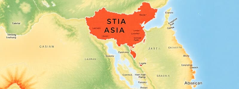
- Asia is the largest continent by land area and population, covering 30% of the world's land and home to 60% of its population.
- Key populous countries include China (1.4 billion) and India (1.3 billion).
- Asia features diverse physical geography shaped by tectonic activities, comprising mountains, river plains, jungles, and modern cities.
Geographic Extent
- Spans from 10°S to 80°N latitude and 25°E to 170°W longitude.
- North-south distance: 8,560 km; east-west distance: 9,600 km.
- Bounded by various bodies of water: Arctic Ocean (north), Pacific Ocean (east), Indian Ocean (south), Middle Eastern seas (south-west), and Europe (west).
- Separated from North America by the Bering Strait and from Australia by straits linking the Indian and Pacific Oceans.
- The Isthmus of Suez connects Asia to Africa, with the Suez Canal marking the border.
Countries and Regions
- Comprises 49 sovereign states, six states with limited recognition, and six dependent territories.
Regional Divisions
- East Asia: Includes China, Mongolia, North and South Korea, Japan, Taiwan; covers about 28% of Asia.
- North Asia: Encompasses Siberia and the Asia-Pacific region of Russia.
- Central Asia: Extends from the Caspian Sea to western China, including former Soviet republics.
- South-East Asia: Contains countries like Indonesia, Thailand, and Vietnam.
- South Asia: Comprises Afghanistan, India, Pakistan, and others; the most densely populated region.
- West Asia: Comprises countries like Saudi Arabia, Iraq, and Turkey.
Physical Regions
- Northern Lowlands: World's largest continuous plain, spanning from Ural Mountains to Bering Sea, characterized by the Siberian Plain and Turan Plain, housing Lake Baikal.
- Central Highlands: Key mountain ranges converge at the Pamir Knot, including the Himalayas (highest), Hindu Kush, Karakoram, Kunlun, and Tien Shan.
- Southern Plateaus: Features the Deccan, Arabian, Shan, and Yunnan plateaus, primarily composed of hard crystalline rocks.
- Great River Basins: Fertile areas formed by major rivers like Tigris, Euphrates, Indus, and Ganga.
- Island Groups: Home to the Malay Archipelago and significant islands such as the Andaman and Nicobar Islands.
Mountains and Plateaus
- Himalayas: Home to the world’s highest peaks, including Mount Everest (8,848 m).
- Karakoram Range: Contains K2 (8,611 m), the second highest peak globally.
- Hindu Kush: Mount Tirich Mir stands at 7,690 m, marking the highest in this range.
- Tibetan Plateau: Known as the “roof of the world,” surrounded by multiple mountain ranges.
Deserts
- Arabian Desert: Largest in Asia, covering 2.33 million km².
- Gobi Desert: Second largest, spanning 1.295 million km² between China and Mongolia.
- Taklamakan Desert: China’s largest sand desert, covering 337,000 km².
- Thar Desert: Asia’s only subtropical desert, lies mainly in Rajasthan, India.
Water Bodies
- Caspian Sea: Largest lake globally, characterized by salty water.
- Lake Baikal: World’s deepest and oldest freshwater lake at 5,315 feet.
- Aral Sea: Rapidly shrinking due to pollution and mismanagement.
Cultural Diversity
- Asia is characterized by its rich cultural diversity, with a wide range of languages, traditions, and ethnic groups that reflect its vast geographical and historical complexity.
Studying That Suits You
Use AI to generate personalized quizzes and flashcards to suit your learning preferences.
Description
This quiz explores the geographical and geopolitical aspects of East Asia, covering key regions such as China, Mongolia, North Korea, South Korea, Japan, Taiwan, and the broader context of North and Central Asia. Understanding these areas is crucial for comprehending the dynamics of this significant region in the world. Test your knowledge on the geography, culture, and politics of East Asia and its neighboring regions.


