Podcast
Questions and Answers
Which two rivers are major rivers of the Himalayas?
Which two rivers are major rivers of the Himalayas?
- Indus and Brahmaputra (correct)
- Brahmaputra and Ganges
- Nile and Amazon
- Indus and Ganges (correct)
The Indus River rises in Pakistan.
The Indus River rises in Pakistan.
False (B)
What is the world's largest drainage basin?
What is the world's largest drainage basin?
Amazon River Basin
The Indus River has several tributaries, including the Zaskar, Nubra, Shyok, and _____ .
The Indus River has several tributaries, including the Zaskar, Nubra, Shyok, and _____ .
What type of geographical features do Himalayan rivers create in their floodplains?
What type of geographical features do Himalayan rivers create in their floodplains?
The Himalayan rivers are primarily known for their deposition features.
The Himalayan rivers are primarily known for their deposition features.
Name one important tributary of the Indus River.
Name one important tributary of the Indus River.
Match the following rivers with their characteristics:
Match the following rivers with their characteristics:
Where does the Ganga emerge from the mountains?
Where does the Ganga emerge from the mountains?
The Sundarban Delta is the smallest delta in the world.
The Sundarban Delta is the smallest delta in the world.
What is the primary tree that gives the Sundarban Delta its name?
What is the primary tree that gives the Sundarban Delta its name?
The Ganga bifurcates at __________, leading to the Bhagirathi-Hooghly river.
The Ganga bifurcates at __________, leading to the Bhagirathi-Hooghly river.
Match the following rivers with their tributaries:
Match the following rivers with their tributaries:
Which river joins the Ganga in Bangladesh?
Which river joins the Ganga in Bangladesh?
The length of the Ganga is less than 2000 km.
The length of the Ganga is less than 2000 km.
What is the primary ecosystem where the Sundari tree is found?
What is the primary ecosystem where the Sundari tree is found?
Which river system flows into the Indus near Mithankot?
Which river system flows into the Indus near Mithankot?
The Indus river flows through India and Pakistan.
The Indus river flows through India and Pakistan.
What is the total length of the Indus river?
What is the total length of the Indus river?
The Indus river eventually reaches the __________ Sea.
The Indus river eventually reaches the __________ Sea.
What percentage of the total water carried by the Indus river system can India use according to the Indus Water Treaty?
What percentage of the total water carried by the Indus river system can India use according to the Indus Water Treaty?
Name one of the headwaters of the Ganga river.
Name one of the headwaters of the Ganga river.
Match the following rivers with their origin:
Match the following rivers with their origin:
The flow of many Peninsular rivers is seasonal, as it is dependent on __________.
The flow of many Peninsular rivers is seasonal, as it is dependent on __________.
Which of the following rivers does NOT rise in the Nepal Himalaya?
Which of the following rivers does NOT rise in the Nepal Himalaya?
Ambala is located on the water divide between the Indus and the Ganga river systems.
Ambala is located on the water divide between the Indus and the Ganga river systems.
What are the two main objectives of the Namami Gange Programme?
What are the two main objectives of the Namami Gange Programme?
The Brahmaputra river takes a 'U' turn after reaching _____ before entering India.
The Brahmaputra river takes a 'U' turn after reaching _____ before entering India.
What is the approximate fall in slope from Ambala to the Sunderban?
What is the approximate fall in slope from Ambala to the Sunderban?
The rivers that rise from the Nepali Himalaya are known for their rich water capacity.
The rivers that rise from the Nepali Himalaya are known for their rich water capacity.
Name one river that is joined with the Brahmaputra in Assam.
Name one river that is joined with the Brahmaputra in Assam.
What is the name of the world's largest riverine island formed by the Brahmaputra?
What is the name of the world's largest riverine island formed by the Brahmaputra?
The Narmada River has long tributaries that join the main stream at right angles.
The Narmada River has long tributaries that join the main stream at right angles.
Name the scheme undertaken by the government of Madhya Pradesh for the conservation of the Narmada River.
Name the scheme undertaken by the government of Madhya Pradesh for the conservation of the Narmada River.
The Ganga has tributaries on its right and left bank, while the _______ is known as the Tsang Po in Tibet.
The Ganga has tributaries on its right and left bank, while the _______ is known as the Tsang Po in Tibet.
What type of channel does the Brahmaputra have in Assam?
What type of channel does the Brahmaputra have in Assam?
The Narmada River basin covers parts of Madhya Pradesh and Maharashtra only.
The Narmada River basin covers parts of Madhya Pradesh and Maharashtra only.
Which two geographical features serve as the main water divide in Peninsular India?
Which two geographical features serve as the main water divide in Peninsular India?
In which state is the Wular lake located?
In which state is the Wular lake located?
Where does the river Narmada have its source?
Where does the river Narmada have its source?
Sambhar is a freshwater lake in India.
Sambhar is a freshwater lake in India.
Which is the longest river of Peninsular India?
Which is the longest river of Peninsular India?
What is meant by a water divide? Give an example.
What is meant by a water divide? Give an example.
The largest river basin in India is the ______.
The largest river basin in India is the ______.
Which two Peninsular rivers flow through troughs?
Which two Peninsular rivers flow through troughs?
Match the headstreams of the Ganga with their respective origins:
Match the headstreams of the Ganga with their respective origins:
Flashcards
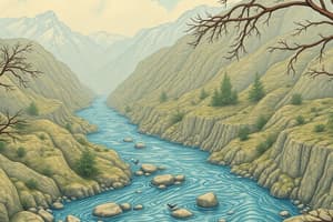
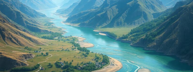
Himalayan Rivers
Himalayan Rivers
Major rivers originating north of the Himalayas, flowing through gorges and having long courses to the sea.
Indus River System
Indus River System
The Indus River and its tributaries, originating in Tibet and flowing into India.
Himalayan River Tributaries
Himalayan River Tributaries
Smaller rivers that join the major Himalayan rivers (e.g., Zaskar, Nubra, Shyok, Hunza).
River Gorge
River Gorge
Signup and view all the flashcards
River Basin
River Basin
Signup and view all the flashcards
Amazon River Basin
Amazon River Basin
Signup and view all the flashcards
River System
River System
Signup and view all the flashcards
River Erosion
River Erosion
Signup and view all the flashcards
Ganga River Source
Ganga River Source
Signup and view all the flashcards
Ganga's Tributaries
Ganga's Tributaries
Signup and view all the flashcards
Ganga's Length
Ganga's Length
Signup and view all the flashcards
Ganga-Brahmaputra Confluence
Ganga-Brahmaputra Confluence
Signup and view all the flashcards
Sundarban Delta
Sundarban Delta
Signup and view all the flashcards
Devaprayag
Devaprayag
Signup and view all the flashcards
Yamuna River Origin
Yamuna River Origin
Signup and view all the flashcards
Ganga Delta Location
Ganga Delta Location
Signup and view all the flashcards
Ganga River tributaries
Ganga River tributaries
Signup and view all the flashcards
Ganga River's drainage pattern
Ganga River's drainage pattern
Signup and view all the flashcards
Brahmaputra River source
Brahmaputra River source
Signup and view all the flashcards
Brahmaputra River course
Brahmaputra River course
Signup and view all the flashcards
Ganga River's slope
Ganga River's slope
Signup and view all the flashcards
Brahmaputra tributaries
Brahmaputra tributaries
Signup and view all the flashcards
Ganga River plains extent
Ganga River plains extent
Signup and view all the flashcards
Namami Gange Programme
Namami Gange Programme
Signup and view all the flashcards
Indus River's Course
Indus River's Course
Signup and view all the flashcards
Indus River Length
Indus River Length
Signup and view all the flashcards
Indus Basin Location
Indus Basin Location
Signup and view all the flashcards
Peninsular Rivers
Peninsular Rivers
Signup and view all the flashcards
Indus Water Treaty
Indus Water Treaty
Signup and view all the flashcards
Ganga River Headwaters
Ganga River Headwaters
Signup and view all the flashcards
Seasonal River Flow
Seasonal River Flow
Signup and view all the flashcards
Ganga River Flow
Ganga River Flow
Signup and view all the flashcards
Brahmaputra River in Tibet
Brahmaputra River in Tibet
Signup and view all the flashcards
Brahmaputra Braided Channel
Brahmaputra Braided Channel
Signup and view all the flashcards
Narmada River Conservation
Narmada River Conservation
Signup and view all the flashcards
Narmada Tributaries
Narmada Tributaries
Signup and view all the flashcards
Tapi River Basin
Tapi River Basin
Signup and view all the flashcards
Peninsular Water Divide
Peninsular Water Divide
Signup and view all the flashcards
Coastal River Characteristics
Coastal River Characteristics
Signup and view all the flashcards
River Pollution
River Pollution
Signup and view all the flashcards
Wular Lake Location
Wular Lake Location
Signup and view all the flashcards
Narmada River Source
Narmada River Source
Signup and view all the flashcards
Sambhar Lake Type
Sambhar Lake Type
Signup and view all the flashcards
Longest Peninsular River
Longest Peninsular River
Signup and view all the flashcards
River flowing through rift valley
River flowing through rift valley
Signup and view all the flashcards
Water Divide
Water Divide
Signup and view all the flashcards
River Basin in India
River Basin in India
Signup and view all the flashcards
Study Notes
Drainage Systems in India
- Drainage describes the river system of an area
- Small streams converge into larger rivers, draining into a larger body of water (lake, sea, ocean)
- Drainage basin: area drained by a single river system
- Water divide: elevated area separating two drainage basins (mountains, uplands)
Major Groups of Indian Rivers
-
Himalayan rivers: perennial (water year-round), originate in the Himalayas, receive water from rain and melting snow, long courses
-
Peninsular rivers: seasonal (flow dependent on rainfall), shorter courses, originate in the central highlands, flow towards the west or Bay of Bengal
Himalayan Rivers
-
Indus River System:
- Originates in Tibet, enters India in Ladakh, flows through Kashmir, Baltistan, Gilgit and Attock.
- Major tributaries: Zaskar, Nubra, Shyok, Hunza, Satluj, Ravi, Chenab, Jhelum
- Flows through Pakistan eventually reaching Arabian Sea.
-
Ganga River System:
- Originates in the Gangotri Glacier, joined by Alaknanda;
- Large tributaries: Yamuna, Ghaghara, Gandak, Kosi, Chambal, Betwa, Son.
- Flows east into the Bay of Bengal (forming the Sunderban Delta).
-
Brahmaputra River System:
- Originates in Tibet (Tsang Po), enters India as Dihang, joins the Ganga and flows to the Bay of Bengal.
- Major tributaries: Dihang, Lohit, others
- Similar Characteristics as other Himalayan rivers
Peninsular Rivers
- Seasonal flow; originate in Western Ghats; flow towards the Bay of Bengal.
- Noted Rivers: Narmada, Tapi
- Often shorter courses and shallower than Himalayan rivers
- Notably, the Narmada flows west into the Arabian Sea
- Other Rivers: Godavari, Krishna, Kaveri.
River Basins
-
Regions drained by major rivers; often impacted by seasonal rainfall patterns.
-
Indus Basin: stretches across parts of India and Pakistan, largest in India.
-
Ganga Basin: large and spans across India, important for agriculture.
-
Brahmaputra basin: extensive regions including parts of India and neighboring countries.
River Pollution
- Domestic, industrial, and agricultural activities can affect water quality in rivers.
- Important to understand the importance of water for livelihood, agriculture, etc. leading to concerns over pollution.
Lakes
- Natural lakes; formed by glaciers, tectonic activity, human action
- Important as tourist attractions, sources of water etc.
- Specific examples include Wular, Dal, Chilika and Sambhar.
Studying That Suits You
Use AI to generate personalized quizzes and flashcards to suit your learning preferences.