Podcast
Questions and Answers
What are the two major groups of drainage systems in India?
What are the two major groups of drainage systems in India?
The two major groups are the Himalayan rivers and the Peninsular rivers.
How is a drainage basin defined in relation to a river?
How is a drainage basin defined in relation to a river?
A drainage basin is the area drained by a single river.
What distinguishes Himalayan rivers from Peninsular rivers in terms of water supply?
What distinguishes Himalayan rivers from Peninsular rivers in terms of water supply?
Himalayan rivers are perennial, receiving water from both rain and melted snow.
What role do elevated areas play in defining drainage basins?
What role do elevated areas play in defining drainage basins?
What geographical features primarily control the drainage systems of India?
What geographical features primarily control the drainage systems of India?
In what ways do Himalayan and Peninsular rivers differ?
In what ways do Himalayan and Peninsular rivers differ?
What is the significance of snowmelt in the flow of Himalayan rivers?
What is the significance of snowmelt in the flow of Himalayan rivers?
What was the primary objective of the National River Conservation Plan (NRCP) when it was implemented in 1995?
What was the primary objective of the National River Conservation Plan (NRCP) when it was implemented in 1995?
How do lakes contribute to flood prevention during heavy rains?
How do lakes contribute to flood prevention during heavy rains?
Explain the impact of urbanization and industrialization on rivers according to the provided content.
Explain the impact of urbanization and industrialization on rivers according to the provided content.
What role do rivers play in the economy of India, as highlighted in the text?
What role do rivers play in the economy of India, as highlighted in the text?
Discuss one way lakes affect the climate of their surrounding environments.
Discuss one way lakes affect the climate of their surrounding environments.
What are the states that share the Krishna Basin?
What are the states that share the Krishna Basin?
How long does the Krishna River flow before reaching the Bay of Bengal?
How long does the Krishna River flow before reaching the Bay of Bengal?
What are some tributaries of the Krishna River mentioned in the content?
What are some tributaries of the Krishna River mentioned in the content?
From which mountain range does the Kaveri River originate?
From which mountain range does the Kaveri River originate?
What is the total length of the Kaveri River?
What is the total length of the Kaveri River?
Which states are drained by the Kaveri Basin?
Which states are drained by the Kaveri Basin?
What type of lakes are formed as a result of glaciers and ice sheets?
What type of lakes are formed as a result of glaciers and ice sheets?
What geographical features form lagoons in coastal areas?
What geographical features form lagoons in coastal areas?
What distinguishes seasonal lakes in inland drainage regions?
What distinguishes seasonal lakes in inland drainage regions?
What is the name of the second biggest waterfall in India, associated with the Kaveri River?
What is the name of the second biggest waterfall in India, associated with the Kaveri River?
What is the significance of Devaprayag in the context of the Ganga river?
What is the significance of Devaprayag in the context of the Ganga river?
How does the flow direction of the Bhagirathi-Hooghly differ from that of the mainstream Ganga?
How does the flow direction of the Bhagirathi-Hooghly differ from that of the mainstream Ganga?
What are the names of the major tributaries that join the Ganga from the Himalayas?
What are the names of the major tributaries that join the Ganga from the Himalayas?
What is the geographical significance of the Sundarban Delta?
What is the geographical significance of the Sundarban Delta?
Where does the Yamuna river originate?
Where does the Yamuna river originate?
What is the estimated length of the Ganga river?
What is the estimated length of the Ganga river?
What role do the Himalayas play in the tributaries of the Ganga?
What role do the Himalayas play in the tributaries of the Ganga?
How is the Meghna river formed, and what is its significance?
How is the Meghna river formed, and what is its significance?
What tree is the Sundarban Delta named after, and why does it thrive in that region?
What tree is the Sundarban Delta named after, and why does it thrive in that region?
What is the significance of the Sambhar Lake in Rajasthan?
What is the significance of the Sambhar Lake in Rajasthan?
Identify the largest freshwater lake in India and its origin.
Identify the largest freshwater lake in India and its origin.
How do the majority of freshwater lakes in India originate?
How do the majority of freshwater lakes in India originate?
List two notable rivers that flow towards the east in India.
List two notable rivers that flow towards the east in India.
What percentage of the world's water is freshwater?
What percentage of the world's water is freshwater?
What role do rivers play in the formation of artificial lakes?
What role do rivers play in the formation of artificial lakes?
Mention one tourist activity associated with lakes in Kashmir.
Mention one tourist activity associated with lakes in Kashmir.
What major initiative was launched to address river pollution in India?
What major initiative was launched to address river pollution in India?
What percentage of freshwater globally is trapped as ice?
What percentage of freshwater globally is trapped as ice?
Name two other significant lakes in India apart from Wular Lake.
Name two other significant lakes in India apart from Wular Lake.
Flashcards
Drainage System
Drainage System
The entire network of rivers in a specific area, including smaller tributaries flowing into the main river.
Drainage Basin
Drainage Basin
A large area of land where all the water drains into a single river or a body of water.
Water Divide
Water Divide
A high point of land that separates two different drainage basins, directing water flow to different rivers.
Perennial Rivers
Perennial Rivers
Signup and view all the flashcards
River Source
River Source
Signup and view all the flashcards
River Mouth
River Mouth
Signup and view all the flashcards
Catchment Area
Catchment Area
Signup and view all the flashcards
Ganga River
Ganga River
Signup and view all the flashcards
Yamuna River
Yamuna River
Signup and view all the flashcards
Devaprayag
Devaprayag
Signup and view all the flashcards
Haridwar
Haridwar
Signup and view all the flashcards
Bhagirathi-Hooghly River
Bhagirathi-Hooghly River
Signup and view all the flashcards
Meghna River
Meghna River
Signup and view all the flashcards
Sundarban Delta
Sundarban Delta
Signup and view all the flashcards
Upper Ganga River
Upper Ganga River
Signup and view all the flashcards
Lower Ganga River
Lower Ganga River
Signup and view all the flashcards
National River Conservation Plan (NRCP)
National River Conservation Plan (NRCP)
Signup and view all the flashcards
How do lakes regulate river flow?
How do lakes regulate river flow?
Signup and view all the flashcards
Why are cities located on riverbanks?
Why are cities located on riverbanks?
Signup and view all the flashcards
How are rivers important for India's economy?
How are rivers important for India's economy?
Signup and view all the flashcards
Challenges faced by rivers in India.
Challenges faced by rivers in India.
Signup and view all the flashcards
Artificial Lake
Artificial Lake
Signup and view all the flashcards
Natural Lake
Natural Lake
Signup and view all the flashcards
Largest Freshwater Lake in India
Largest Freshwater Lake in India
Signup and view all the flashcards
Saltwater Lake
Saltwater Lake
Signup and view all the flashcards
Glacial Lakes
Glacial Lakes
Signup and view all the flashcards
Hydroelectric Power from Waterfalls
Hydroelectric Power from Waterfalls
Signup and view all the flashcards
Ganga Action Plan (GAP)
Ganga Action Plan (GAP)
Signup and view all the flashcards
Dal Lake
Dal Lake
Signup and view all the flashcards
Closed Lakes
Closed Lakes
Signup and view all the flashcards
Where does the Krishna River originate?
Where does the Krishna River originate?
Signup and view all the flashcards
Which states share the Krishna River's drainage basin?
Which states share the Krishna River's drainage basin?
Signup and view all the flashcards
What are some tributaries of the Krishna River?
What are some tributaries of the Krishna River?
Signup and view all the flashcards
Where does the Kaveri River begin and end?
Where does the Kaveri River begin and end?
Signup and view all the flashcards
Which states are covered by the Kaveri River's drainage basin?
Which states are covered by the Kaveri River's drainage basin?
Signup and view all the flashcards
Name some tributaries of the Kaveri River.
Name some tributaries of the Kaveri River.
Signup and view all the flashcards
What significant waterfall is created by the Kaveri River?
What significant waterfall is created by the Kaveri River?
Signup and view all the flashcards
Why are lakes important for tourism?
Why are lakes important for tourism?
Signup and view all the flashcards
What are some ways lakes are useful to humans?
What are some ways lakes are useful to humans?
Signup and view all the flashcards
How can lakes be formed?
How can lakes be formed?
Signup and view all the flashcards
Study Notes
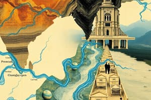
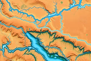
Drainage Systems in India
- Drainage describes the river system of an area
- Streams flow into larger rivers, which flow into larger bodies like lakes or oceans
- The area drained by a river system is a drainage basin
- Elevated areas, like mountains, separate drainage basins, forming water divides
Drainage Systems in India (Continued)
- Indian drainage systems are mainly influenced by the subcontinent's relief.
- Two main groups:
- Himalayan rivers: These are perennial, meaning they flow year-round. They get water from rain and snowmelt. Examples include Indus and Brahmaputra
- Peninsular rivers: These are seasonal, flowing mostly during the rainy season or depending on rainfall. Examples are Mahanadi, Godavari, Krishna, and Kaveri.
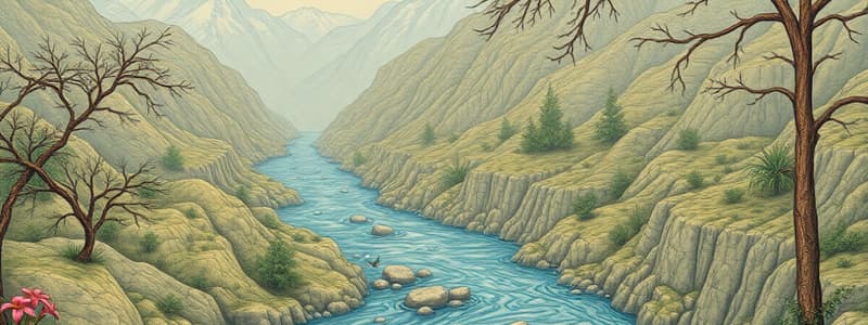
Himalayan Rivers
- Major Himalayan rivers include Indus, Ganga, and Brahmaputra
- These rivers have large tributaries
- Indus originates in Tibet, flows west, enters India (Ladakh), cuts through mountains as a gorge, and joins with tributaries in Pakistan to reach the Arabian Sea
- Ganga originates in the Himalayas, with the Bhagirathi and Alaknanda joining to form the Ganga. Major tributaries include the Yamuna, Ghaghara, Gandak, and Kosi. Flows to the Bay of Bengal
- Brahmaputra runs through Tibet, then enters India, where it has a U-turn and is joined by other tributaries, before merging into the Ganga and flowing to the Bay of Bengal.
Peninsular Rivers
- Most Peninsular rivers originate in the Western Ghats and flow eastwards to the Bay of Bengal
- Rivers like Mahanadi, Godavari, Krishna, and Kaveri are major examples
- Narmada and Tapi are west flowing, originating in the highlands and flowing to the Arabian Sea.
River Systems and Basins
- Drainage basins are the areas of land drained by a river and its tributaries
- The Indus, Ganga, and Brahmaputra river systems are large and important for India
- The Indus Water Treaty (1960) regulates water use from the Indus River System.
Lakes in India
- Lakes can be natural (glacial, wind-formed, or river-formed) or created by humans (dams).
- The Himalayas are home to many freshwater lakes, including Wular, Dal, and Nainital
- Some lakes (like Sambhar) are located in arid regions and are seasonal or saline
- Lakes play a significant role in tourism, water resources, and moderating local climates.
National River Conservation Plan (NRCP)
- The NRCP project was initiated to improve water quality by managing pollution.
- Untreated sewage and industrial waste affect the quality and self-cleaning capabilities of rivers.
- River pollution impacts human health and well-being and the economy.
Studying That Suits You
Use AI to generate personalized quizzes and flashcards to suit your learning preferences.