Podcast
Questions and Answers
What is the main focus of Physical Geography?
What is the main focus of Physical Geography?
- The study of population and urbanization
- The relationship between people and the environment
- The natural environment, including climate and landforms (correct)
- The acquisition of data about the earth's surface
What type of map displays specific data or themes, such as climate or population density?
What type of map displays specific data or themes, such as climate or population density?
- Cartograms
- GIS Maps
- Thematic Maps (correct)
- Topographic Maps
What is the term for the process of people moving from rural areas to cities?
What is the term for the process of people moving from rural areas to cities?
- GIS
- Remote Sensing
- Migration
- Urbanization (correct)
What is the main difference between climate and weather?
What is the main difference between climate and weather?
What is the term for the natural elevations of the earth's surface?
What is the term for the natural elevations of the earth's surface?
What is the term for the movement of people from one place to another?
What is the term for the movement of people from one place to another?
What is the term for a computer-based tool for analyzing and displaying geographic data?
What is the term for a computer-based tool for analyzing and displaying geographic data?
What is the term for the network of satellites that provide location information and navigation data?
What is the term for the network of satellites that provide location information and navigation data?
Flashcards are hidden until you start studying
Study Notes
Branches of Geography
- Physical Geography: studies the natural environment, including climate, landforms, water, soil, and vegetation.
- Human Geography: examines the relationship between people and the environment, including population, culture, economy, and urbanization.
Types of Maps
- Topographic Maps: show the relief and features of an area, such as mountains, valleys, and bodies of water.
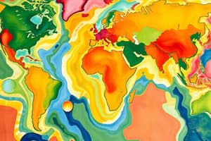
- Thematic Maps: display specific data or themes, such as climate, population density, or economic activity.
- Cartograms: distort the shape and size of features to represent a particular theme or data.
Geographic Features
- Mountains: natural elevations of the earth's surface, formed by tectonic activity or volcanic activity.
- Plains: flat or gently sloping areas of land, often formed by erosion or deposition.
- Bodies of Water: oceans, lakes, rivers, and wetlands that cover over 70% of the earth's surface.
Climate and Weather
- Climate: long-term atmospheric conditions, including temperature, precipitation, and wind patterns.
- Weather: short-term atmospheric conditions, including temperature, humidity, cloudiness, and precipitation.
Human Settlement and Migration
- Urbanization: the process of people moving from rural areas to cities, leading to the growth and development of urban areas.
- Migration: the movement of people from one place to another, often in search of better living conditions, economic opportunities, or political freedom.
Geographic Tools and Techniques
- GIS (Geographic Information System): a computer-based tool for analyzing and displaying geographic data.
- Remote Sensing: the acquisition of data about the earth's surface through the use of sensors and cameras.
- GPS (Global Positioning System): a network of satellites that provide location information and navigation data.
Branches of Geography
- Physical Geography focuses on the natural environment, encompassing climate, landforms, water, soil, and vegetation.
- Human Geography examines the relationship between people and the environment, including population, culture, economy, and urbanization.
Types of Maps
- Topographic Maps display the relief and features of an area, showcasing mountains, valleys, and bodies of water.
- Thematic Maps display specific data or themes, such as climate, population density, or economic activity.
- Cartograms distort the shape and size of features to represent a particular theme or data.
Geographic Features
- Mountains are natural elevations of the earth's surface, formed by tectonic activity or volcanic activity.
- Plains are flat or gently sloping areas of land, often formed by erosion or deposition.
- Bodies of Water encompass oceans, lakes, rivers, and wetlands, covering over 70% of the earth's surface.
Climate and Weather
- Climate refers to long-term atmospheric conditions, including temperature, precipitation, and wind patterns.
- Weather refers to short-term atmospheric conditions, including temperature, humidity, cloudiness, and precipitation.
Human Settlement and Migration
- Urbanization is the process of people moving from rural areas to cities, leading to the growth and development of urban areas.
- Migration involves the movement of people from one place to another, often in search of better living conditions, economic opportunities, or political freedom.
Geographic Tools and Techniques
- GIS (Geographic Information System) is a computer-based tool for analyzing and displaying geographic data.
- Remote Sensing involves the acquisition of data about the earth's surface through the use of sensors and cameras.
- GPS (Global Positioning System) is a network of satellites that provide location information and navigation data.
Studying That Suits You
Use AI to generate personalized quizzes and flashcards to suit your learning preferences.