Podcast
Questions and Answers
Which of the following best describes the relationship between porosity and permeability in the context of infiltration?
Which of the following best describes the relationship between porosity and permeability in the context of infiltration?
- High porosity always guarantees high permeability, as more voids inherently allow easier water passage.
- Porosity and permeability are synonymous; a soil with high porosity will always exhibit high permeability.
- Porosity determines the maximum water storage, while permeability measures the ease of water flow through the soil. (correct)
- Permeability is the percentage of soil volume occupied by voids, directly dictating the infiltration rate.
During a period of prolonged rainfall, which scenario would most likely lead to saturation overland flow (SOF)?
During a period of prolonged rainfall, which scenario would most likely lead to saturation overland flow (SOF)?
- Rainfall infiltrating rapidly through a highly permeable soil layer.
- A high-intensity rainfall event on dry soil with substantial infiltration capacity.
- Rainfall occurring on soil that is already saturated, with the water table at the surface. (correct)
- A low-intensity rainfall event on a slope with sparse vegetation.
How does dense vegetation cover primarily influence infiltration and throughflow processes in a drainage basin?
How does dense vegetation cover primarily influence infiltration and throughflow processes in a drainage basin?
- It slows down rainfall impact, aiding infiltration, while vegetation roots reduce throughflow by absorbing water. (correct)
- It increases throughflow and decreases infiltration by compacting the soil.
- It reduces infiltration due to interception and enhances throughflow by channeling water along root systems.
- It increases both infiltration and throughflow by creating more macropores in the soil.
Which of the following scenarios would most likely result in Infiltration Excess Overland Flow (IEF)?
Which of the following scenarios would most likely result in Infiltration Excess Overland Flow (IEF)?
In which climatic region would you expect to find ephemeral channels, and why?
In which climatic region would you expect to find ephemeral channels, and why?
How does climate primarily influence the balance between input and output in a drainage basin system?
How does climate primarily influence the balance between input and output in a drainage basin system?
What impact does the deforestation of a drainage basin have on infiltration and overland flow?
What impact does the deforestation of a drainage basin have on infiltration and overland flow?
How does urbanization typically affect the components of a hydrograph?
How does urbanization typically affect the components of a hydrograph?
What role does baseflow play in maintaining streamflow during dry periods?
What role does baseflow play in maintaining streamflow during dry periods?
What is the most significant impact of constructing dams on downstream river channels?
What is the most significant impact of constructing dams on downstream river channels?
How does soil texture (proportion of constituent grains) influence infiltration capacity and subsurface flows within a drainage basin?
How does soil texture (proportion of constituent grains) influence infiltration capacity and subsurface flows within a drainage basin?
Which of the following best illustrates the impact of relief (differences in height) on water movement and storage in a drainage basin?
Which of the following best illustrates the impact of relief (differences in height) on water movement and storage in a drainage basin?
What is a primary positive impact of fluvial floods on agricultural lands?
What is a primary positive impact of fluvial floods on agricultural lands?
Which of the following factors typically increases the vulnerability of urban populations to the negative impacts of fluvial floods?
Which of the following factors typically increases the vulnerability of urban populations to the negative impacts of fluvial floods?
What is the main advantage of using satellite images in flood prediction and forecasting?
What is the main advantage of using satellite images in flood prediction and forecasting?
Why are levees built along river banks effective for flood management, and what is one of their major limitations?
Why are levees built along river banks effective for flood management, and what is one of their major limitations?
How does channelization aim to reduce flood risk, and what is a potential environmental consequence of this strategy?
How does channelization aim to reduce flood risk, and what is a potential environmental consequence of this strategy?
What is the fundamental principle behind floodplain regulation and hazard zoning as a flood management strategy?
What is the fundamental principle behind floodplain regulation and hazard zoning as a flood management strategy?
What is the purpose of implementing 'sponge city' strategies, and how do they function?
What is the purpose of implementing 'sponge city' strategies, and how do they function?
In what ways do afforestation and vegetation play a role in managing flood risk?
In what ways do afforestation and vegetation play a role in managing flood risk?
What is the significance of 'recurrence interval' in flood management planning?
What is the significance of 'recurrence interval' in flood management planning?
Excessive rainfall and unexpected excessive rainfall due to atmospheric-oceanic processes can cause flooding in the humid tropics. Which of the following atmospheric-oceanic processes can cause fluvial floods?
Excessive rainfall and unexpected excessive rainfall due to atmospheric-oceanic processes can cause flooding in the humid tropics. Which of the following atmospheric-oceanic processes can cause fluvial floods?
Rock and soil conditions affect drainage basins. Which one of the following conditions will most likely cause flooding?
Rock and soil conditions affect drainage basins. Which one of the following conditions will most likely cause flooding?
The shape of a drainage basin influences the possibility of an extreme flood peak. Which basin shape is more likely to have a possibility of an extreme flood peak?
The shape of a drainage basin influences the possibility of an extreme flood peak. Which basin shape is more likely to have a possibility of an extreme flood peak?
Changes in land use can lead to flooding in areas which were not previously threatened or increase magnitude and frequency of flood events. Which choice shows an increased magnitude and frequency of flood events?
Changes in land use can lead to flooding in areas which were not previously threatened or increase magnitude and frequency of flood events. Which choice shows an increased magnitude and frequency of flood events?
Fluvial floods bring about positive impacts, which can promote agricultural productivity. Which of the choices below explains what helps agriculture?
Fluvial floods bring about positive impacts, which can promote agricultural productivity. Which of the choices below explains what helps agriculture?
Some negative social impacts of fluvial floods can affect human health and overall wellbeing. Which of the following consequences is an indirect health impact?
Some negative social impacts of fluvial floods can affect human health and overall wellbeing. Which of the following consequences is an indirect health impact?
Why are some people more vulnerable to effects of floods depending on their socio-economic status??
Why are some people more vulnerable to effects of floods depending on their socio-economic status??
In implementing flood management strategies, what does risk mapping entail, and why is it important?
In implementing flood management strategies, what does risk mapping entail, and why is it important?
When using satellite images in flood management, what are their limitations?
When using satellite images in flood management, what are their limitations?
What happens when channel designs are inaccurate when built through channelization, and what are its effects?
What happens when channel designs are inaccurate when built through channelization, and what are its effects?
What is a potential limitation of flood warning and evacuation systems as a soft engineering strategy?
What is a potential limitation of flood warning and evacuation systems as a soft engineering strategy?
What is a key function of crisis-relief in response to fluvial floods?
What is a key function of crisis-relief in response to fluvial floods?
Flashcards
Input Precipitation & Snow melt
Input Precipitation & Snow melt
Main water input into a drainage basin, varying in form, quantity, intensity, & duration.
Water Storages
Water Storages
Temporary holding of water within a drainage basin system.
Pathways (Flows)
Pathways (Flows)
Ways water moves through a drainage basin from one storage to another.
Interception storage
Interception storage
Signup and view all the flashcards
Biological water storage
Biological water storage
Signup and view all the flashcards
Infiltration
Infiltration
Signup and view all the flashcards
Porosity
Porosity
Signup and view all the flashcards
Permeability
Permeability
Signup and view all the flashcards
Infiltration rate
Infiltration rate
Signup and view all the flashcards
Infiltration capacity
Infiltration capacity
Signup and view all the flashcards
Soil moisture storage
Soil moisture storage
Signup and view all the flashcards
Hygroscopic water
Hygroscopic water
Signup and view all the flashcards
Capillary water
Capillary water
Signup and view all the flashcards
Throughflow
Throughflow
Signup and view all the flashcards
Percolation
Percolation
Signup and view all the flashcards
Groundwater storage
Groundwater storage
Signup and view all the flashcards
Water table
Water table
Signup and view all the flashcards
Baseflow
Baseflow
Signup and view all the flashcards
Overland flow
Overland flow
Signup and view all the flashcards
Infiltration Excess Overland Flow (IEF)
Infiltration Excess Overland Flow (IEF)
Signup and view all the flashcards
Saturation Overland Flow (SOF)
Saturation Overland Flow (SOF)
Signup and view all the flashcards
Return flow
Return flow
Signup and view all the flashcards
Channel storage
Channel storage
Signup and view all the flashcards
Ephemeral channels
Ephemeral channels
Signup and view all the flashcards
Intermittent channels
Intermittent channels
Signup and view all the flashcards
Perennial channels
Perennial channels
Signup and view all the flashcards
Evapotranspiration
Evapotranspiration
Signup and view all the flashcards
Evaporation
Evaporation
Signup and view all the flashcards
Transpiration
Transpiration
Signup and view all the flashcards
River discharge
River discharge
Signup and view all the flashcards
Influence of climate
Influence of climate
Signup and view all the flashcards
Soil condition
Soil condition
Signup and view all the flashcards
Geology - Rock type
Geology - Rock type
Signup and view all the flashcards
Relief
Relief
Signup and view all the flashcards
Anthropogenic activities
Anthropogenic activities
Signup and view all the flashcards
Hydrographs
Hydrographs
Signup and view all the flashcards
Fluvial floods
Fluvial floods
Signup and view all the flashcards
Bankfull discharge
Bankfull discharge
Signup and view all the flashcards
Risk mapping
Risk mapping
Signup and view all the flashcards
Hard engineering strategies
Hard engineering strategies
Signup and view all the flashcards
Study Notes
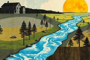
- The basin hydrological cycle includes water entering the system as precipitation and snowmelt (input) and leaving as discharge or evapotranspiration (output).
Input: Precipitation & Snow Melt
- Precipitation is the primary input of water into a drainage basin.
- Precipitation varies in type, quantity, intensity, and duration, depending on the climate.
- Tropical drainage basins receive input from precipitation, with humid tropics receiving more frequent input than arid tropics.
- Areas with sub-zero temperatures and high altitudes receive precipitation in the form of snow.
Water Storages
- Water storages are vital for temporarily holding water, influencing the drainage basin system.
- Locations of water storage include: interception storage, biological water storage, soil moisture storage, groundwater storage, and channel storage.
Pathways (Flows)
- Pathways are the routes water takes through the drainage basin from one storage to another.
- Pathways include: infiltration, throughflow, percolation, baseflow, overland flow, and channel flow.
Interception Storage
- Interception is when precipitation is caught and stored by vegetation instead of falling directly onto the ground.
- Interception storage is the amount of water stored on the vegetation's wetted surface.
- Water stored through interception may not reach the ground unless the vegetation's capacity is exceeded.
- Factors affecting interception include type and density of vegetation and seasonal changes , with dense vegetation leading to greater interception.
Biological Water Storage
- Rain intercepted by vegetation may evaporate from plant leaves, be taken in via root uptake, and stored.
- Plants store water for photosynthesis and growth then lose it to the atmosphere through transpiration.
Infiltration
- Infiltration is the downward entry of water into the soil's surface, drawn in by gravity and capillary action.
- Porosity, the percentage of soil volume occupied by voids, determines the maximum amount of water that can be stored.
- Permeability measures the ease with which water passes through soil; interconnected pores lead to high permeability.
- The more permeable the soil, the faster the infiltration rate.
- The infiltration rate is the rate at which water enters the soil, measured by the amount of water passing through a given unit of soil within a certain time frame.
- The infiltration rate is initially high but decreases over time due to soil saturation, fine sediment blocking soil pores, and clay swelling.
Infiltration Capacity (Storage)
- Infiltration capacity is the maximum rate at which water can be absorbed at a steady rate
- Rainfall intensity affects infiltration; high intensity leads to faster saturation and less infiltration.
- High vegetation cover slows down rainfall and aids infiltration.
- A humus layer can hold rainwater, slowing down infiltration.
Soil Moisture Storage
- Soil moisture storage is the amount of water held in the soil at any time.
- It is contributed by sub-surface flow processes like infiltration, percolation, throughflow, and baseflow.
- Soil moisture storage forms an unsaturated zone that acts as a storage reservoir.
- Water is stored in soil as hygroscopic water (thin films adhering to soil particles) and capillary water (in micro pores).
Throughflow
- Throughflow involves lateral movement of water within the soil layer.
- Water moves sideways to fill pores and transports water from areas of higher to lower saturation as soil becomes more compact and less permeable with depth
- Throughflow moves relatively slowly due to high friction, flowing underground until it returns to the surface.
Percolation
- Percolation is the downward vertical movement of water through joints and pores in soil and underlying rocks due to gravity
- Percolation is slower than infiltration and throughflow, occurring at greater depths.
- The downward movement of water from the unsaturated zone to the saturated zone creates or replenishes groundwater storage.
- Percolation slows down as it gets deeper because the layers of soil and rock get more compact resulting in pore spaces reduced.
- Volume of pore spaces and frequency of joints affect percolation; more spaces mean soil can hold more water, and more cracks allow water to pass through easily.
| Infiltration | Percolation | |
|---|---|---|
| Direction Travelling | Enters from the surface of soil | Continues to move down soil & rock layers |
| Flow of Water | Surface to unsaturated zone | Saturated zone to unsaturated zone |
| Factors Affecting | Rainfall intensity and vegetation cover | Volume of pore spaces and frequency of joints |
Groundwater Storage
- Groundwater storage is water beneath the ground surface in soil pore spaces within bedrock and regolith.
- All pore spaces fully filled with groundwater at greater depths in rock to form zone of saturation.
- Water table is the imaginary line marking the surface of the saturated zone, dividing it from the unsaturated zone.
Baseflow/Groundwater Flow
- Stored groundwater slowly feeds water into stream channels via baseflow.
- Baseflow comes from water that has infiltrated and percolated deep into the sub-surface.
- It occurs when the water table lies above the bed of the stream channel.
- Baseflow ensures sustained water flow within stream channels between periods of precipitation.
- It moves laterally and slowly (slowest amongst all flows).
Overland Flow/Surface Runoff
- Overland flow is rainwater or meltwater that travels over the land surface from higher to lower elevations towards stream channels.
- It is a lateral flow on the surface that occurs during precipitation events.
Infiltration Excess Overland Flow (IEF)
- IEF occurs when rainfall intensity exceeds infiltration capacity.
- Precipitation hits ground that is either impervious or has lower infiltration capacity
- Infiltration occurs at capacity rate and excess water accumulates on the ground surface.
- It occurs quickly during or shortly after a rainfall event.
- The volume of water decreases downslope, and the flow enters the channel, contributing to the river.
- IEF is likely to occur with reduced infiltration capacity, low vegetation cover, and increased rainfall intensity.
- In arid climates, high amounts of overland flow can lead to flash floods
Saturation Overland Flow (SOF)
- SOF occurs when precipitation continues to fall on already saturated soil where infiltration cannot take place.
- It takes place with high antecedent soil moisture or prolonged rainfall duration.
- Two components of SOF are return flow (throughflow emerges from ground) and direct precipitation onto saturated areas.
| IEF | SOF | |
|---|---|---|
| Ground/Soil Conditions | Precipitation intensity exceeds capacity | High soil infiltration capacity but the soil is saturated, with the water table at the surface |
| Precipitation Characteristics | Intense but short-lived rainfall | Prolonged rainfall |
| Time Taken for Occurrence | Less time; begins soon after a storm | More time; begins only after soil is saturated |
| Location | Widespread over drainage basins | Localised areas (foot of slope/slope concavities) |
Channel Storage
- Channel storage is water stored in a river, as surface storage.
- It's part of precipitation retained temporarily at the ground surface or depression storage.
- Regional climate may influence Channel storage Ephemeral channels: Channels are dry most of the time and occupied only after a rainstorm Intermittent channels: Channels are seasonally occupied by flowing water Perennial channels: Channels are always occupied by flowing water
Output: Evapotranspiration & River Discharge
- Outputs include evapotranspiration and river discharge.
Evapotranspiration
- Evapotranspiration is the sum of evaporation and plant transpiration from the earth’s land surface to the atmosphere.
- Evaporation is a subsequent loss of water from sources, depending on solar radiation and air temperature.
- Transpiration is the subsequent loss of water from roots, released as vapor through stomata in plant leaves, dependent on density of vegetation.
River Discharge
- River discharge is the volume of water flowing through a river channel.
Factors Affecting Drainage Basin Systems
- Climate influences drainage basin systems by determining the balance between input and output.
- The atmospheric system provides insolation and precipitation; it can further influence water storages and pathways of flows.
- The drainage basin water balance is in water surplus in humid tropics but water deficit in arid tropics.
- Climate largely determines the amount of precipitation (input) into the drainage basin.
- Positive balance: Water surplus (humid tropics), Negative balance: Water deficit (arid tropics)
Tropical Rainforest Climates (Af)
- Net water surplus with high precipitation throughout the year that exceeds potential evapotranspiration.
Arid Climates (B-Type)
- Net water deficit.
- Similar or higher potential evapotranspiration levels but receive very little precipitation.
Tropical monsoon climates (Am)/savannah climates (Aw)
- Seasonal changes in water balance over the year due to distinct wet and dry seasons
Tropical Rainforest Climates (Af)
- High soil moisture, constant replenishment of groundwater storage, prolonging heavy rainfall and increasing rates of SOF & IEF.
- Areas of soil moisture surplus as they receives more infiltration than it gives in vapor losses to evapotranspiration
- Constant replenishment of groundwater storage ensures that water table is sufficiently high allowing base flows of water to channel storage
- Likely to have prolonged heavy rainfall frequently resulting in greater SOF
- Likely to have intense rainfall event resulting in greater IEF
- Dense vegetation cover leads to greater interception
- Perennial channels – channels always occupied with water
Arid Climates (BSh/BWh)
- Little to no precipitation, decrease infiltration, and experiencing soil moisture deficits leading to lower water table heights and reduction in baseflow & channel storage.
- soil moisture storage gets lower meaning soil moisture deficit
- Incoming precipitation will only infiltrate into soil by several centimetres before it is absorbed by soil, taken up by plants or evaporated
- lesser groundwater storage (water table height decreases)
- Water table in arid tropics well below surface, preventing base flows & replenishment of channel storage
- Ephemeral channels: Dry most of the time and only occupied during storms
Tropical Monsoon Climates (Am)/Tropical Savannah Climates (Aw)
- Seasonal changes impact soil moisture storages.
- During wet seasons soil moisture levels are higher as rainfall level exceeds potential evapotranspiration level & soil recharged with moisture.
- Encourages flow of groundwater to channel storage via baseflows (channel storage & flows greater)
- Overtime, soil will become saturated & further infiltration is hindered resulting in greater SOF
- During dry seasons potential evapotranspiration rate likely to surpass rainfall levels and groundwater storage decreases.
- channel flows are fed by baseflows during particular times of year resulting in Intermittent channels: Channel flows fed by baseflows during particular times of year
Rainfall Intensity
- Impacts the extent of infiltration into soil layers.
- Most of precipitation would not infiltrate into soil layers (Rainfall intensity > Infiltration capacity) resulting in increasing IEF, inputs enter river as stream flow more quickly
- Heavy raindrops compact soil surface pores resulting in Soil’s infiltration capacity lower & infiltration lower, encouraging IEF
- Evident in arid tropics due to intense rainfall from shifting ITCZ.
- Rainfall duration contrasted to prolonged rainfall event, greater soil moisture storage & increased subsurface flows, entering river more slowly.
- When sub-surface water storage becomes saturated, subsequent rainfall is unable to infiltrate into ground & hence flows over surface as SOF .
Influence of Vegetation Amount & Density
- Increase interception storage, and infiltration capacity & infiltration.
- Reduces throughflow by taking in water through roots
Humid Tropics (Af/Am Climates)
- Vegetation consists of tall evergreen rainforest trees & dense vegetation.
- Higher interception storage as Interception by canopy is more substantial and higher infiltration & subsurface flows.
- Reduced throughflow due to vegetation taking in water through roots
Arid Tropics (B Type Climates)
- Direct precipitation leads to compaction due to raindrop effect resulting in infiltration being reduced and increasing channel storage.
Humid Tropics with Distinct Wet and Dry Seasons (Am/Aw Climates)
- Are tropical forests which are deciduous (Leaves shed during dry seasons, grow during wet seasons )
- Experience Seasonal variations in output by Little transpiration in dry seasons & higher transpiration in wet seasons and seasonal variations in interception storage.
Geology Influences Pathways & Water Storages
- Geology influences the pathways and water storages of drainage basin water through influencing permeability & porosity.
- Affect permeability & porosity of ground
- Hence create spatial variations in pathways & water storages at a more local scale
Soil Conditions
- Influenced by proportion of constituent grains and how they are aggregated which determine permeability & porosity of soil
- Soil with higher amounts of clay reduces both porosity & permeability of soil and coarser soil increases porosity & permeability of soil.
- Finer Soil texture: Less porous but relatively impermeable
- Coarse soil texture result in Soils with large & well-connected pores promoting infiltration & subsequent subsurface flows
Soil Structure
- Soil particles held together by organic matter promotes subsequent subsurface flows & storages while Platy/compacted soil particles reduces subsequent subsurface flows & storages.
Rock Type
- Influences amount of overland flows & subsequent percolation of water to groundwater storage
- Sedimentary rock types has well-developed joint systems Allows and Encourages rapid infiltration & subsequent percolation of water while Dense & massive rocks decreases porosity & permeability
- Igneous and metamorphic rock types impede infiltration and results in a Greater of overland flows
- Sedimentary rock typesEncourages rapid infiltration & subsequent percolation of water Rocks such as Karst landscapes May be non-porous but highly permeable allowing ease of flow and speed
Relief Influences Pathways & Water Storages
- Relief (differences in height) may encourage local variations in pathways & water storages
- Steeper relief results in reduced subsurface flows & water storages + encourages overland flows while Gentle slopes encourage subsequent subsurface flows & water storages
- Steep-sided upland valleys, Water is likely to reach river more quickly through time reduction for water to infiltrate
- Gentle slopes, results in an increased time for water to infiltrate as water flows down slope more slowly
Anthropogenic Activities Influence Pathways & Water Storages
- Anthropogenic activities seek to alter physical environment & natural land surfaces which will then affect pathways & storages
Deforestation
- Causes higher evaporation rates, exposed surface increases raindrop impact, and exposed surface increases raindrop impact in event of rain .
- Lack of interception leads to direct infiltration & contribution of water table , as exposed surface increases raindrop impact in event of rain impacting soil
Urbanisation
- Concretisation of land leads to impervious surface, Infiltration rates decreases > reduction in subsurface pathways & storages
Agricultural Land Use
- Infiltration hindered & infiltration capacity diminished by soil compaction which Reduces permeability – lower infiltration rates & higher surface runoff
Construction of Dams
- With-holds water behind dam, Reduces channel flow downstream & drainage basin hydrological systems\
Groundwater Extraction
- Leads to diminishing of groundwater storages & lowering of water table and Reduces baseflows leads to natural flow patterns altered due to diminishment of groundwater storage
Interpreting Hydrographs
- Hydrographs graph discharge over time, indicating the relationship between rising/falling limbs in relevance to flood events stemming from increased surface and precipitation from reduced infiltration
Influencing Factors
- Valley side steepness - Steeper, resulting in Lesser time to infiltrate → Infiltration is reduced
- Vegetation - Removal of trees → Lesser infiltration results in being most similar to influence of urbanisation
- Soil type
Fluvial Floods
- Flooding is the temporal condition of partial or complete inundation of normally dry land areas.
- River/fluvial floods: Occurs when a river’s discharge exceeds bankfull discharge, causing the river to overflow and inundate its surrounding area that is usually dry.
Climatic Characteristics
- High rainfall intensity, excessive rainfall, and prolonged heavy rainfall causing excess discharge to the river and resulting in floods (influenced by monsoon winds/tropical cyclones) Basin Characteristics
- Dry, plate soil, Vegetated/Deforested land, Impervious (concretised surfaces), Areas below dams, Small basins and Low lying coastal regions
- Close proximity to river banks (within flood fringe/hazard area)
Natural Factors
- Nature of precipitation input is the main and immediate cause as an Unexpected excessive rainfall can Occur due to atmospheric-oceanic processes
- Monsoon climates - Wet season leading to excessive rainfall > higher overland flow processes > River overflows bankfull discharge resulting in floods
- Ice or snowmelt results in potential seasonal flooding
- Can be Combined with rainfall to cause widespread flooding during spring thaws
Flood Intensifying Conditions - Basin Characteristics
- Affects how water is stored, and tends to be drainage basin specific
- Affects water & how water is stored
Rock/Soil Conditions
- Dry platey soils are limited in infiltration capacity & often made imperious by raindrop effect
- Doesn’t allow liquid to pass through and only Results in floods if groundwater storage is fully saturated
- Soils - in relation to storms are Dry platey soil
- soils due to a rainfall event stemming from incursion of ITCZ will cause quickflow processes (overland flow & rapid throughflow) to be generated
- soils which Are Permeable/saturated from previous rainfall event/prolonged rainfall event
Topography (Relief)
- Low-lying parts of active flood plains & deltas can flood easily as they lie closest to channel & have poor drainage, as well as Steep slopes which promotes rapid runoff
- For example the Low-lying plains - causes Floods caused by monsoons regularly cover 20-30% of flat delta
Basin Size
- Small basins which responds more quickly to rainfall events due to small area of land and Large rivers tend to flood on seasonal basis as build-up tends to be slow
- Circular basins - have increase for possible flood peak
Human Factors
- Changes in land-use (can be closely linked to deforestation and urbanisation)
- Determines nature & intensity of flooding with Removal of vegetation eliminating potential for evaporation-transpiration & interception, and deforested landscapes increasing flood runoff
- Poor agricultural practices from Changes soil structure & permeability leading to overland flow & increased erosion of sediment into rivers
- Urbanisation- which can Replace vegetation & soil cover with large area of impermeable surfaces on streets & roofs
Negative & Positive Impacts of Fluvial Floods
- Renewing soil fertility supports agricultural productivity as a result of Deposit fresh layers of nutrient-rich alluvium on floodplains with maintaining soil fertility by flushing salts , bringing about benefits and with agricultural growth
- Rejuvenation of river ecosystems as floodwaters Introduces nutrients into river channels & floodplains, which Supports growth of healthy fisheries
- Replenishing of groundwater storage- important source of water and via recharge is essential
Negative Environmental Impacts
- Riverbank erosion & reduction in water quality as a result of high & fast-moving floodwaters that exceed riverbanks and Wildlife loss & habitat destruction, Wildlife loss encompasses Drowning, disease proliferation & habitat destruction
Negative Social Impacts
- Impacts on human health & wellbeing such as mortality from drowning & injuries from Direct & Indirect health impact caused High mortality rates due to Rapidly rising waters and from Diseases from Vector- & Water-borne diseases
Negative Economic Impacts
- Results in economic losses from property damage and inundation of agricultural lands which causes massive erosion which undermines foundation of buildings with Physical stresses on buildings increased when waters contain debris
- Businesses face disruptions – leading to long-term economic losses
Vulnerability
- Exposure and the concentration of human activity are impacted as a result of Natural factors such as being located in lower-elevations and concentration of human activity
- Vulnerability to flooding differs via Proximity, Elevation and Level of economic development
Variations in Effects of Fluvial Floods among Different Groups of People
- Socioeconomic status ( poverty leads to greater flood risk) and gender (reduced mobility amongst women undermines their ability to effective evacuate) cause more damage from flood impact
- Also affected by age with Older people having less mobility & pre-existing chronic health conditions and systemic racism in certain societies
Management of Fluvial Floods
- Consists of Prediction/Forecasting, Mitigation, and Response plans put into pre-crisis and short/long-term events
- Management types that are employed Seek to change the natural environment & hydrological cycle, using a number of strategies & measures
- Seeks to Reduce risk, Manage effects or Provide aid after flood
Prediction & Forecasting
- Predicting how discharge within a drainage changes over the years and describes flood hazard, magnitude & frequency (with magnitude meaning the size of the event)
- Flood recurrence interval, derived by a field study of the area & satellite images helps plan a map/model to assess variables that affect flooding
- Consists of satellite based monitoring and prediction ability for areas to evacuate, forecast data and the development of a risk mapping to translate info for planning
Mitigation
- Seeks to prevent occurrence of flooding or lower flood risk (Employed before flood event) using techniques such as hard (construction along river channels/coasts, regulating river flow) and soft (evacuation and hazard zoning or river-basin measures)
Floodplain Regulation and Control
- Controls to limit use of flood-prone areas & relocate developments Engineering Structures - such as Levees & Dams and channelisation - are used to encourage safety
Nature-Based Solutions
- (also water & land-use control measures) uses Ecological principles and aims to Shape & manage environment to minimize damage, and may be integrated into urban environments through sponge-city mitigation
Response & Recovery
- Plan depends on both local post-disaster emergency plans & any assistance that may be rendered by foreign aid sources such as NGOs and crisis/rehabilitation efforts which need government support to sustain said efforts
Studying That Suits You
Use AI to generate personalized quizzes and flashcards to suit your learning preferences.