Podcast
Questions and Answers
Which process describes water changing from a gaseous state to a liquid state in the hydrological cycle?
Which process describes water changing from a gaseous state to a liquid state in the hydrological cycle?
- Infiltration
- Evaporation
- Precipitation
- Condensation (correct)
What is the primary input into a drainage basin system?
What is the primary input into a drainage basin system?
- Surface Runoff
- Transpiration
- Evaporation
- Precipitation (correct)
Which term describes the movement of water through the upper soil layers towards a river?
Which term describes the movement of water through the upper soil layers towards a river?
- Throughflow (correct)
- Channel Flow
- Surface Runoff
- Infiltration
What is a potential effect of deforestation on the hydrological cycle?
What is a potential effect of deforestation on the hydrological cycle?
How might mining activities impact the hydrological cycle?
How might mining activities impact the hydrological cycle?
What is the role of vegetation in the hydrological cycle?
What is the role of vegetation in the hydrological cycle?
What is the effect of urbanization on surface runoff, in the hydrological cycle?
What is the effect of urbanization on surface runoff, in the hydrological cycle?
What process involves water moving downwards into the soil?
What process involves water moving downwards into the soil?
Which of the following best describes the rising limb of a hydrograph in an urban area compared to a rural area after a heavy rainfall?
Which of the following best describes the rising limb of a hydrograph in an urban area compared to a rural area after a heavy rainfall?
What is the primary reason for the higher peak discharge in an urban hydrograph compared to a rural hydrograph?
What is the primary reason for the higher peak discharge in an urban hydrograph compared to a rural hydrograph?
Which of the following best describes the lag time in an urban hydrograph compared to that of a rural hydrograph?
Which of the following best describes the lag time in an urban hydrograph compared to that of a rural hydrograph?
What contributes to the faster return to base flow in an urban hydrograph after a storm?
What contributes to the faster return to base flow in an urban hydrograph after a storm?
The recessional limb of an urban hydrograph is characteristically:
The recessional limb of an urban hydrograph is characteristically:
What is the influence of vegetation on a rural hydrograph?
What is the influence of vegetation on a rural hydrograph?
What is the baseflow discharge of the River Valency before the storm?
What is the baseflow discharge of the River Valency before the storm?
What is the typical lag time mentioned in the text concerning the River Valency?
What is the typical lag time mentioned in the text concerning the River Valency?
What is the main contributing factor to the steep rising limb of the River Valency’s hydrograph?
What is the main contributing factor to the steep rising limb of the River Valency’s hydrograph?
What is the primary erosion process that forms a plunge pool at the base of a waterfall?
What is the primary erosion process that forms a plunge pool at the base of a waterfall?
What causes the overhang of hard rock above the plunge pool in a waterfall?
What causes the overhang of hard rock above the plunge pool in a waterfall?
Which river feature is formed by erosion on the outer bend and deposition on the inner bend?
Which river feature is formed by erosion on the outer bend and deposition on the inner bend?
What is the main force behind the cutting off of a meander to form an oxbow lake?
What is the main force behind the cutting off of a meander to form an oxbow lake?
What type of weathering contributes to the widening of a V-shaped valley?
What type of weathering contributes to the widening of a V-shaped valley?
What is the direct result of the rocks that have fallen into the river in the formation of a V-shaped valley?
What is the direct result of the rocks that have fallen into the river in the formation of a V-shaped valley?
Flashcards
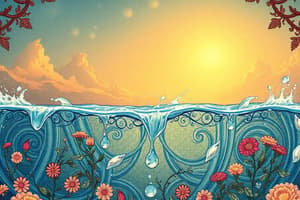
Hydrological Cycle
Hydrological Cycle
The continuous movement of water between the Earth's surface and the atmosphere through evaporation, condensation, precipitation, and runoff.
Evaporation
Evaporation
The process where liquid water changes into water vapor and rises into the atmosphere.
Condensation
Condensation
The process where water vapor in the atmosphere cools and condenses into liquid water, forming clouds.
Precipitation
Precipitation
Signup and view all the flashcards
Surface Runoff
Surface Runoff
Signup and view all the flashcards
Channel Flow
Channel Flow
Signup and view all the flashcards
Drainage Basin
Drainage Basin
Signup and view all the flashcards
Infiltration
Infiltration
Signup and view all the flashcards
Rising Limb Steepness
Rising Limb Steepness
Signup and view all the flashcards
Peak Discharge
Peak Discharge
Signup and view all the flashcards
Lag Time
Lag Time
Signup and view all the flashcards
Recessional Limb Steepness
Recessional Limb Steepness
Signup and view all the flashcards
Base Flow
Base Flow
Signup and view all the flashcards
Throughflow
Throughflow
Signup and view all the flashcards
Transpiration
Transpiration
Signup and view all the flashcards
Hydraulic Action
Hydraulic Action
Signup and view all the flashcards
Abrasion
Abrasion
Signup and view all the flashcards
Plunge Pool
Plunge Pool
Signup and view all the flashcards
Meander
Meander
Signup and view all the flashcards
Oxbow Lake
Oxbow Lake
Signup and view all the flashcards
V-Shaped Valley
V-Shaped Valley
Signup and view all the flashcards
Study Notes
Hydrological Cycle
- Water continuously cycles, a closed system.
- Evaporation (liquid to gas) from bodies of water (e.g., seas, lakes) adds moisture to the atmosphere.
- Rising water vapor cools, condenses (gas to liquid), and forms clouds.
- Precipitation (e.g., rain, snow) returns water to the surface,
- Water may flow across land as surface runoff or channel flow in streams/rivers.
- Some water is intercepted by vegetation before reaching the ground.
- Water eventually returns to the sea/lakes, completing the cycle.
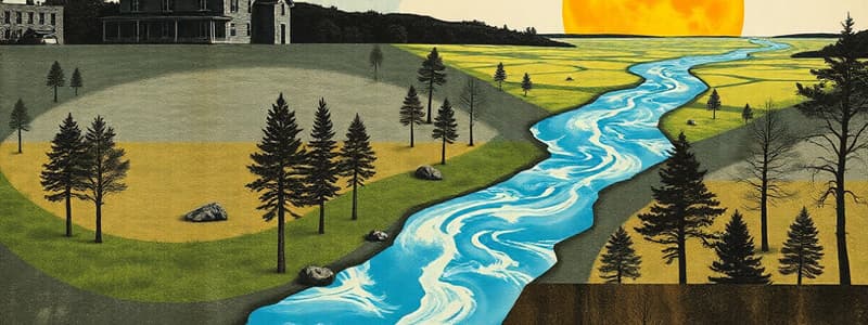
Drainage Basin
- A drainage basin is an open system with inputs, storage, transfers, and outputs.
- Inputs: Precipitation (rain, snow).
- Storage: Lakes, rivers, vegetation interception.
- Transfers: Surface runoff, channel flow, infiltration, throughflow.
- Outputs: Evaporation, surface runoff into seas/oceans.
Human Impact on the Hydrological Cycle
- Mining reduces storage capacity of lakes/rivers by causing silting.
- Reduced vegetation increases surface runoff.
- Irrigation reduces river flow and lowers water tables, increasing evaporation.
- Deforestation increases surface runoff and extreme river flows.
- Urbanization increases impermeable surfaces, accelerating surface runoff and leading to higher river levels.
Urban vs. Rural Hydrographs
- Urban Area:
- Steeper rising limb due to less interception and faster runoff.
- Higher peak discharge due to impermeable surfaces.
- Short lag time due to accelerated runoff.
- Steeper recessional limb due to quicker runoff.
- Rural Area:
- Gentler rising limb due to vegetation interception and slower runoff.
- Lower peak discharge due to absorption and slower movement.
River Valency Storm Hydrograph (16th August)
-
Discharge Changes:
- Baseflow around 2 cumecs.
- Slow rise in discharge initially (07:00-09:00).
- 5-hour lag time.
- Steep rising limb, peak discharge 100 cumecs at 18:00.
- Rapid falling limb to baseflow between 18:00-22:00.
-
Reasons for Changes:
- Initial slow rise due to early rainfall and vegetation interception
- Soil storage exceeded leads to steeper rise; impermeable surfaces cause rapid runoff.
- Steep catchment leads to rapid overland flow.
- Falling limb results from lack of further rainfall.
Waterfall Formation
- Hard rock overlies soft rock.
- Hydraulic action & abrasion erode soft rock.
- Plunge pool forms.
- Continued erosion undercuts overhang of hard rock which collapses.
- Waterfall retreats upstream over time.
Meander Formation
- Winding curves/bends in middle/lower course rivers.
- Hydraulic action/abrasion erode outer bends.
- Faster flow on outer bend, slower on inner bend.
- Deposition on inner bend & erosion on outer bend.
- Meanders migrate downstream.
Oxbow Lake Formation
- Erosion (hydraulic action/abrasion) continues on outer meander bends and deposition on inner bends
- Flood event creates a new, straighter channel.
- Original meander is cut off forming an oxbow lake.
V-Shaped Valley Formation
- Rivers in mountainous areas erode vertically quickly due to high flow velocity.
- Hydraulic action and abrasion erode river channel.
- Freeze-thaw weathering impacts valley sides.
- Eroded material transported by river deepens channel, widening valley in V-shape.
Studying That Suits You
Use AI to generate personalized quizzes and flashcards to suit your learning preferences.