Podcast
Questions and Answers
Which ancient Indian text describes the six seasons?
Which ancient Indian text describes the six seasons?
- Bhagavad Gita
- Meghdootam
- Rigveda (correct)
- Mahabharata
What geographic concept did Brahmagupta contribute to through his works?
What geographic concept did Brahmagupta contribute to through his works?
- Geographical mapping of India
- Tectonic plate movements
- Climate change theories
- Earth's gravitational force (correct)
Which geographic thinker is associated with the work 'Khandakhandya'?
Which geographic thinker is associated with the work 'Khandakhandya'?
- Kalidasa
- Varahamihira
- Brahmagupta (correct)
- Aryabhata
Which historical traveler described the climate of Malwa?
Which historical traveler described the climate of Malwa?
In which ancient text are 21 rivers described?
In which ancient text are 21 rivers described?
Which of the following works is NOT associated with Kalidasa?
Which of the following works is NOT associated with Kalidasa?
Which of these descriptions relates to the mountains mentioned in the Mahabharata?
Which of these descriptions relates to the mountains mentioned in the Mahabharata?
What does 'Sapta Saindhav' refer to in ancient texts?
What does 'Sapta Saindhav' refer to in ancient texts?
Which scholar is known for the detailed description of lunar and solar eclipses?
Which scholar is known for the detailed description of lunar and solar eclipses?
What significant aspect did Aryabhatta contribute to astronomy?
What significant aspect did Aryabhatta contribute to astronomy?
What was the contribution of Bhaskaracharya-II in geographic measurements?
What was the contribution of Bhaskaracharya-II in geographic measurements?
Which region constitutes 28% of India's total area according to the Census Commission of 1951?
Which region constitutes 28% of India's total area according to the Census Commission of 1951?
Which geological feature formed the northern boundary of the Indian subcontinent?
Which geological feature formed the northern boundary of the Indian subcontinent?
The Himalayas were formed as a result of the collision between which two tectonic plates?
The Himalayas were formed as a result of the collision between which two tectonic plates?
What percentage of India's total area is categorized as plain in the 1951 Census Commission data?
What percentage of India's total area is categorized as plain in the 1951 Census Commission data?
Which of the following works is attributed to Ritusanharam?
Which of the following works is attributed to Ritusanharam?
What is the average width of the alluvial plain mentioned?
What is the average width of the alluvial plain mentioned?
Which of the following rivers is NOT mentioned as originating from the Himalayas?
Which of the following rivers is NOT mentioned as originating from the Himalayas?
What is the depth of the alluvial plain approximately?
What is the depth of the alluvial plain approximately?
Which part is characterized by high porosity, leading rivers to flow underground?
Which part is characterized by high porosity, leading rivers to flow underground?
What is the general characteristic of the Bangar region compared to the Khadar region?
What is the general characteristic of the Bangar region compared to the Khadar region?
What is the suitability of the Terai region for human habitation?
What is the suitability of the Terai region for human habitation?
What is the approximate area covered by the alluvial plain?
What is the approximate area covered by the alluvial plain?
Which of the following features is NOT characteristic of the Bhabar region?
Which of the following features is NOT characteristic of the Bhabar region?
What is the primary reason the plain of Punjab is considered not very fertile?
What is the primary reason the plain of Punjab is considered not very fertile?
Which railway line passes through the central part of the region mentioned?
Which railway line passes through the central part of the region mentioned?
What are 'Walsans' characterized as in this region?
What are 'Walsans' characterized as in this region?
Which doab is situated between the Ravi and Chenab rivers?
Which doab is situated between the Ravi and Chenab rivers?
Which of the following lakes is associated with salt production?
Which of the following lakes is associated with salt production?
The rainfall in the semi-mountainous plain of Punjab is approximately how much?
The rainfall in the semi-mountainous plain of Punjab is approximately how much?
Which of the following is true about the flat and flowing basins referred to in the content?
Which of the following is true about the flat and flowing basins referred to in the content?
What geographical feature demarcates the semi-mountainous plain in Punjab?
What geographical feature demarcates the semi-mountainous plain in Punjab?
What is the primary geographical feature that forms the eastern boundary of the Rajasthan Plain?
What is the primary geographical feature that forms the eastern boundary of the Rajasthan Plain?
Which of the following statements about the Rajasthan Plain is incorrect?
Which of the following statements about the Rajasthan Plain is incorrect?
What distinguishes the Rajasthan Bangar region within the Rajasthan Plain?
What distinguishes the Rajasthan Bangar region within the Rajasthan Plain?
Which river mentioned is associated with the Luni basin in the Rajasthan Plain?
Which river mentioned is associated with the Luni basin in the Rajasthan Plain?
What type of landscape features can be found on the pediplain of the Rajasthan Plain?
What type of landscape features can be found on the pediplain of the Rajasthan Plain?
During which geological period was the Rajasthan Plain influenced by the sea?
During which geological period was the Rajasthan Plain influenced by the sea?
What is the approximate length of the Rajasthan Plain from the Aravalli Hills to the Indo-Pak border?
What is the approximate length of the Rajasthan Plain from the Aravalli Hills to the Indo-Pak border?
What is the primary reason for the high relative humidity in most parts of this region?
What is the primary reason for the high relative humidity in most parts of this region?
In which direction does the slope of the Rajasthan Plain primarily go?
In which direction does the slope of the Rajasthan Plain primarily go?
During which period does the region generally experience rainfall caused by 'Kaal Vaishakhi'?
During which period does the region generally experience rainfall caused by 'Kaal Vaishakhi'?
What type of forest is found in the deltaic region of this area?
What type of forest is found in the deltaic region of this area?
Which crops are primarily cultivated in this region?
Which crops are primarily cultivated in this region?
What geographical feature contributes to the rainfall in coastal areas during winter?
What geographical feature contributes to the rainfall in coastal areas during winter?
What is the approximate width of the Brahmaputra Plain?
What is the approximate width of the Brahmaputra Plain?
Which part of the Brahmaputra Plain is prone to natural disasters such as floods and landslides?
Which part of the Brahmaputra Plain is prone to natural disasters such as floods and landslides?
What type of forest is primarily found in the northern part of this region?
What type of forest is primarily found in the northern part of this region?
Flashcards
Ancient Indian Geography Sources
Ancient Indian Geography Sources
Information about ancient Indian geography comes from literary texts, archaeological remains, and descriptions by travelers.
Satpura Mountains
Satpura Mountains
Ancient Indian texts, like the Mahabharata, refer to the Satpura range as 'Vadarya Parvat'.
Ancient Indian Rivers
Ancient Indian Rivers
The Rigveda's 'Nadi Sukta' and other texts describe 21 rivers, like those mentioned in the Markandeya Purana as 'Sapta Saindhav'.
Ancient Indian Seasons
Ancient Indian Seasons
Signup and view all the flashcards
Brahmagupta's Contributions
Brahmagupta's Contributions
Signup and view all the flashcards
Indian Astronomical Knowledge
Indian Astronomical Knowledge
Signup and view all the flashcards
Evidence of Cultural Exchange
Evidence of Cultural Exchange
Signup and view all the flashcards
Kalidasa's Geographical Descriptions
Kalidasa's Geographical Descriptions
Signup and view all the flashcards
Indian Physiographic Regions
Indian Physiographic Regions
Signup and view all the flashcards
Himalayan Mountain Region
Himalayan Mountain Region
Signup and view all the flashcards
Northern Mountainous Region division
Northern Mountainous Region division
Signup and view all the flashcards
Plate Tectonics
Plate Tectonics
Signup and view all the flashcards
Solar and Lunar Eclipses
Solar and Lunar Eclipses
Signup and view all the flashcards
Aryabhatta's findings
Aryabhatta's findings
Signup and view all the flashcards
Bhaskaracharya's contribution
Bhaskaracharya's contribution
Signup and view all the flashcards
Varahamihira's work
Varahamihira's work
Signup and view all the flashcards
Alluvial Plain
Alluvial Plain
Signup and view all the flashcards
Bhabar Region
Bhabar Region
Signup and view all the flashcards
Terai Region
Terai Region
Signup and view all the flashcards
Bangar Plain
Bangar Plain
Signup and view all the flashcards
Khadar Plain
Khadar Plain
Signup and view all the flashcards
Width of the Plain
Width of the Plain
Signup and view all the flashcards
Plain's Formation
Plain's Formation
Signup and view all the flashcards
Geographical Features
Geographical Features
Signup and view all the flashcards
Rajasthan Plain Location
Rajasthan Plain Location
Signup and view all the flashcards
Rajasthan Plain Eastern Boundary
Rajasthan Plain Eastern Boundary
Signup and view all the flashcards
Rajasthan Plain Area
Rajasthan Plain Area
Signup and view all the flashcards
Rajasthan Plain Slope
Rajasthan Plain Slope
Signup and view all the flashcards
Rajasthan Plain Average Height
Rajasthan Plain Average Height
Signup and view all the flashcards
Rajasthan Plain Semi-arid Region
Rajasthan Plain Semi-arid Region
Signup and view all the flashcards
Rajasthan Plain's Rivers
Rajasthan Plain's Rivers
Signup and view all the flashcards
Rajsthan Plain's Division
Rajsthan Plain's Division
Signup and view all the flashcards
Sambhar Lake
Sambhar Lake
Signup and view all the flashcards
Punjab Plains Division
Punjab Plains Division
Signup and view all the flashcards
Semi-mountainous plain location
Semi-mountainous plain location
Signup and view all the flashcards
Chos Rivers
Chos Rivers
Signup and view all the flashcards
Sindhu Sagar Doab
Sindhu Sagar Doab
Signup and view all the flashcards
Railway Lines (Punjab)
Railway Lines (Punjab)
Signup and view all the flashcards
Walsans and Pyala
Walsans and Pyala
Signup and view all the flashcards
Punjab Plains Fertile?
Punjab Plains Fertile?
Signup and view all the flashcards
Assam Plain Climate
Assam Plain Climate
Signup and view all the flashcards
Assam Plain Rainfall
Assam Plain Rainfall
Signup and view all the flashcards
Assam Plain Vegetation
Assam Plain Vegetation
Signup and view all the flashcards
Upper Brahmaputra Plain Location
Upper Brahmaputra Plain Location
Signup and view all the flashcards
Upper Brahmaputra Plain Rainfall
Upper Brahmaputra Plain Rainfall
Signup and view all the flashcards
Upper Brahmaputra Plain Vegetation
Upper Brahmaputra Plain Vegetation
Signup and view all the flashcards
Brahmaputra Plain Size
Brahmaputra Plain Size
Signup and view all the flashcards
Brahmaputra Plain Environmental Challenges
Brahmaputra Plain Environmental Challenges
Signup and view all the flashcards
Study Notes
Physiographic Division of India
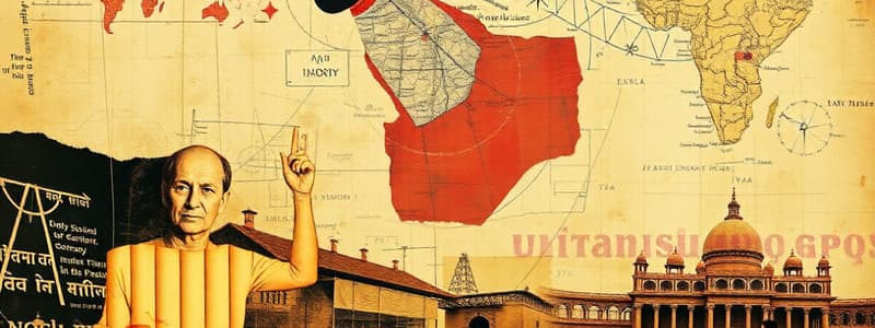
- Ancient Indian geographical concepts have a long history, continuously flourishing.
- Inter-regional travels, literary descriptions, and archaeological discoveries are sources of geographical knowledge.
Sources of Geographical Knowledge
- Harappan Civilization: Contemporary details from excavations of Harappa, Mohenjodaro, and Lothal. Evidence of river reliance for development, and knowledge of natural disasters (granaries).
- Vedic Period: Geographical details from Vedic texts (Vedas, Brahmanas, Aranyakas, Upanishads). Information on the origin of the universe (Rigveda) and agricultural activities (Shatapath Brahman).
- Ramayana and Mahabharata Periods: Geographical information on mountains, rivers, plateaus, and pilgrimages.
- Buddha Period: Religious journeys and literature providing geographical information, including Pali literature.
- Purana Period: Descriptions of India as presented in Vishnu Purana.
- Historical Journeys: Geographic information from Greek geographers (Hecataeus, Herodotus) and Chinese travelers' writings. Descriptions of climates.
Major Indian Geographic Thinkers
- Brahmagupta: Works like Brahmasphuta Siddhanta and Khandakhadyaka. Details on the Earth's attraction force (gravity) and solutions to geometrical and algebraic problems (Khandakhadyaka). Also addressed astronomy in Brahmasphuta Siddhanta.
- Kalidasa: Works such as Meghadutam and Ritusanhar. Descriptions of clouds and the beauty of Amarkantak.
- Varahamihir: Works like Panchsiddhantika and Brihatsamhita. Detailed descriptions of solar and lunar eclipses.
- Aryabhata: Works like Surya Siddhanta and Aryabhattiyam. Explained the Earth's round shape and its rotation.
- Bhaskaracharya II: Works like Siddhanta Shiromani and Karan Kautoohal. Detailed information about planetary motions.
Hills of Purvanchal
- Formed due to the collision of the Eurasian and Indian plates.
- Folded mountains formed in geosynclines.
- The initial phase involved the accumulation of sediments within the geosyncline.
- This process led to the gradual subsidence of the geosyncline.
- The accumulating pressure resulted in the folding of sediments which formed the Himalayan range.
Physiographic Region of Himalayas
- The Himalayas form the northern boundary of the Indian subcontinent.
- Its formation is related to the collision of two tectonic plates, the Indian and Eurasian plates.
- It spans from the Indus River Gorge in the west to the Brahmaputra River Gorge in the east.
- It is divided into three major parts: Trans-Himalayan, Himalayan, and Shivalik regions.
Physiographic Region of India
- India can be categorized into five major physical regions, based on geological structures, processes, and stages of development.
- These regions represent a combination of mountains, plateaus, and plains.
- According to the 1951 Census Commission, 11% of the total area is mountainous, 18% hilly, 28% plateau and 43% plain.
Studying That Suits You
Use AI to generate personalized quizzes and flashcards to suit your learning preferences.


